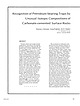
 | | Journal (article/letter/editorial) | | sandstone of Permian age over the Davenport oil field, Oklahoma. The 5C 1 3 pdb ranges from - 5 . 1 to —11.3/mil...was relatively rapid. At the Cement oil field, Oklahoma, similar relations in surface rocks occur, but...the southeastern part of the Anadarko basin of Oklahoma (Donovan, 1974). There, the rock cements display...contour map of main part of Davenport oil field, Oklahoma. Contoured on top of Pennsylvanian Prue Sand....interstitial cements in surface rocks, Davenport field, Oklahoma. X's and numbers represent sample locations and |  | | Report (issue) | | Intrusive and extrusive alkaline rocks of the Lincoln County porphyry belt by Theodore J. Armbrustmacher...fold belt Lincoln fold belt Vaughn trend Buckles and northeast-trending faults Roosevelt County fault Alamosa........................ Pre-Permian rocks of Lincoln County....................... Pre-Permian rocks of...Armbrustmacher........................................ Lincoln County porphyry belt............................................................... Limestone and dolomite.............................................. |  | | Report (volume) | | center of the booming White Oaks gold district, Lincoln County, N. Mex. Gold was probably the first metallic...metallic commodity to be commercially mined in the Lincoln County porphyry belt and has the highest production...Intrusive and Extrusive Alkaline Rocks of the Lincoln County Porphyry Belt, by Theodore J. Armbrustmacher.................................... .. Roosevelt County Fault. ................................................... . Pre-Permian Paleozoic Rocks of Lincoln County ................................. . Pre-Permian |  | | Report (issue) | | some light- and darkgray, orange-weathering silty dolomite and orange- to brownweathering sandstone beds...medium-gray, yellowish-gray-weathering, thinbedded dolomite interbedded with light- to dark-gray aphanitic...was called the Crystal Pass Member of the Sultan Dolomite in the Goodsprings district by Hewett (193D and...Shale (MDp). The yellowish-gray slope-forming dolomite, known as the "yellow bed" is 10 to 100 m thick...exceed 480 m. An isolated block of limestone, dolomite, sandy limestone, and sandstone in Kane Springs |  | | Report (volume) | | .Prof. E. H. Barbour, University of Nebraska, Lincoln. Nevada...........Dr. W. S. Tangier Smith, Berkeley... Prof. G. D. Hubbard, Oberlin College, Oberlb Oklahoma........Prof. D. W. Ohern, Norman. Oregon........See Bauxite and Hallpysite. Asbestos. Tallapoosa County, with corundum deposits near Dudleyville; not found...commercial quantity or quality. Asphalt. Colbert County, small quantity has been shipped from near Leighton;...following localities: Bibb County, Pratts Ferry; Calhoun County, near Tampa; Clay County, T. 20, Pv. 7 E.; Jefferson |  | | Report (issue) | | and culvert immediately north of the current county road, where it crosses secondary-stream alluvium...may make this a viable resource. Oil and Gas Lincoln County contains 38 oil and gas fields and active exploration...exploration continues, but not yet in Lincoln County, township 21 north and range 117 west (T21N, R117W)...example, 95 permits to drill for hydrocarbons in Lincoln County were granted between 1 January 2011 and 15...Green 2000). The first reported earthquake in Lincoln County occurred near Bedford on 31 March 1915. From |  | | Report (volume) | | ............................................. Oklahoma.................................................Mineral resources of Oklahoma and statistics of production from 1901 to 1914: Oklahoma Geol. Survey Bull...Nebraska____.Prof. E. H. Barbour, University of Nebraska, Lincoln. Nevada_____Dr. W. S. Tangier Smith, Lodi, Cal...See Bauxite and Halloysite. Asbestos. Tallapoosa County, with corundum deposits near Dudleyville; not found...commercial quantity or quality. Asphalt. Colbert County, small quantity has been shipped from near Leighton; |  | | Journal (article/letter/editorial) | | Houston, Texas 77036 ROBERT 0. FAY Oklahoma Geological Survey Norman, Oklahoma 73019 Downloaded by [The Aga...713 15th Street NW Ardmore, Oklahoma 73401 OKLAHOMA Figure 1. Oklahoma counties. Mineral Locality...known for its gypsum crystals and barite roses, Oklahoma also boasts a variety of other species, including...unaware of the variety of minerals available from Oklahoma and think primarily of the prolific gypsum crystals...hundred years, extends into the northeast corner of Oklahoma and has produced notable specimens. Unfortunately |  | | Report (issue) | | Structure of the Seaman Range and Fox Mountain, Lincoln and Nye Counties, Nevada U.S. GEOLOGICAL SURVEY...Structure of the Seaman Range and Fox Mountain, Lincoln and Nye Counties, Nevada By DONLON O. HURTUBISE...structure of the Seaman Range and Fox Mountain, Lincoln and Nye Counties, Nevada / by Donlon O. Hurtubise...Seaman Range. 4. Geology Nevada Fox Mountain (Nye County). I. du Bray, E.A. II. Title, ill. Series. IV....Springs Dolomite B5 Silurian Laketown Dolomite B5 Devonian B8 Sevy Dolomite B8 Simonson Dolomite B9 Guilmette |  | | Report (volume) | | properties of the Woodford Shale, Anadarko Basin, Oklahoma-Loading, subsidence, and forebulge development...Chief Mining District, eastern Chief Range, Lincoln County, Nevada, by Peter D. Rowley, Lawrence W. Snee...EXPLANATION Sandstone and shale Shale limestone Dolomite Arkose Crystalline rocks :?:~~;~/; ~~:::lline~o:~~i•nJ...veins, then a succession of siderite, dolomite, and ferroan dolomite (table 1). Most of the mineral fillings...Feldspathic arenite Quartz, siderite, dolomite, ferroan dolomite; clay, hematite 5-7? na na Incremental |  | | Map | | recognized a Guadalupe Mountains district in Otero County, but there is no evidence of mineral deposits in...in the Old Placers (Santa Fe County) and Burro Mountains (Grant County) districts. The first mining...de Abalos in the Fra Cristobal Mountains, Sierra County on March 26, 1685 (Northrop, 1996), but there is...In 2014, 226 active mines nd e 0 Roosevelt Lincoln Socorro ra Value in dollars (Billions) 3.0 ...claims must be recorded with the BLM as well as the county courthouse. A mining plan must be filed and approved |  | | Map | | byproduct of copper, zinc, or lead production. County District Estimated production (Troy ounces) Gold...Pinos Altos Santa Rita* Steeple Rock Hidalgo Lincoln Granite Gap* Kimball Lordsburg* McGhee Peak* Noga...USBM Minerals Yearbooks Bernalillo County dera Group. Catron County 3. Mogollon 362,225 (365,000) 4...1910 Ag, Cu, Pb (W) D,A Cibola County 5. Zuni Mountains Colfax County 6. Cimmaroncito (100) monzonite...Creek derived from the lode deposits. Dona Ana County 8. Black Mountain (600) Ag, Cu (Ba) M, E Veins |  | | Report (issue) | | STATES GEOLOGICAL SURVEY Washington County CO UJ -J Lincoln County o. CO .0 '* o o o 9a. a o> IE...as 8,500 feet in thickness in southeastern Lincoln County (Tschanz and Pampeyan, 1961) whereas rocks...total about 6,700 feet in thickness in Washington County (Cook, 1960) probably covered the entire area of...Meadow Valley Wash drainage area and in Washington County, Utah. Physical properties of many of the stratlgraphic...Precanbrian quartzite, sericitic shale, limestone, and dolomite, similar to the Grand Canyon (Unkar Group) and |  | | Report (issue) | | Geology of the Fort Hill Quadrangle Lincoln County Wyoming I GEOLOGICAL SURVEY PROFESSIONAL PAPER 594-M...594-M - Geology of the Fort Hill Quadrangle Lincoln County Wyoming By STEVEN S. ORIEL SHORTER CONTRIBUTIONS...GEOLOGY GEOLOGY OF THE FORT HILL QUADRANGLE, LINCOLN COUNTY, WYOMING By STEVEN ABSTRACT The Fort Hill... M3 GEOLOGY OF THE FORT HILL QUADRANGLE, LINCOLN COUNTY, WYOMING the office, by inspection of stereoscopic...quadrangle lies in the northeastern part of Lincoln County, western Wyoming, astride the western margin |  | | Report (issue) | | on Amsden Creek in T. 57 N., R. 87 W., Sheridan County, Wyo ------------------------------------------------Geologic...of shale, sandstone, and dolomite Amsden Formation Upper shale and dolomite member shale Sacajawea...Formation Upper Amsden Amsden Formation member Dolomite Amsden Formation Upper carbonate zone Amsden...Amsden Formation Upper sequence of clay, shale, dolomite, limestone. sandstone Siltstone Tensleep Sandstone...varicolored thin-bedded siltstone and silty A9 dolomite beds of the Bull Ridge from poorly bedded bright |  | | Journal (article/letter/editorial) | | .... Blackwelder,Eliot. Origin of the Bighorn Dolomite of Wyoming. Reviewby R. C. M. ........... Bliss...Review by V. O. T. Buttram, Frank. Glass Sands of Oklahoma. Review by W. B. W. . Cady, Gilbert H. Coal Resources...... Geology and Geography of a Portion of Lincoln County, Wyoming. By Alfred Reginald Schultz. Review...T. T. Q. .......... Geology of East Central Oklahoma. By L. C. Snider. Review by W. B. W. ...........Harvey Pirie. Review by T. T. Q ... Glass Sands of Oklahoma. By Frank Buttram. Review by W. B. W. 822 206 |  | | Report (volume) | | Proceedings, vol. 13, pp. 1-46. Davenport, Iowa. Delaware County Institute of Science: Proceedings, vol. 7, no....Science: Proceedings, vol. 6, pt. 3. Columbus, Ohio. Oklahoma Geological Survey: Bulletin, nos. 13, 17, 18,...Virginia Geological Survey: County Reports, Kanawha County; Preston County; Map of... coal, oil, etc....16. Ancient auriferous gravel channels of Sierra County, California: Am. Inst. Min. Eng., Bull., no. 91...deposits of the San Juan district, San Luis Obispo County, California: California Acad. Sci., Proc., 4th |  | | Book | | Mexico New York North Carolina North Dakota Ohio Oklahoma Oregon Peru1Sylvania Rhode Island South Dakota...University of Nebraska ..., 113 Nebraska Hall 5 Lincoln, Nebraska, 68508 LCo-n..S'iv-Vif)/o..,.._ Nevada...Columbus 10, Ohio Oklahoma Geological Survey The University of Oklahoma / 5 3 D Norman, Oklahoma -; 3 u (.,...northeast part of the Coosa Coal Field, St. Clair County, Alabama, by H. E. Rothrock. 1949. 69 B. 50 Well...and G. L. Richardson. 91 1940. district, Franklin County, Alabama, by E . F. Burchard and H. D. Pallister |  | | Report (issue) | | Geologic map of the Pahroc Spring SE Quadrangle, Lincoln County, Nevada by W C Swadley and Peter D. Rowley... Geologic Map of the Pahroc Spring SE Quadrangle, Lincoln County, Nevada UAT/75 V . Pji»cr«f(?J tc \ fcw...cobbles of ash-flow tuff, lava flows, limestone, dolomite, and quartzite; large cobbles and sparse boulders...cobbles, and boulders of ash-flow tuff, lava flows, dolomite, limestone, and quartzite that are commonly less...subrounded ash-flow tuff, lava flows, limestone, dolomite, and quartzite pebbles, cobbles, and sparse boulders |  | | Report (issue) | | GEOLOGIC MAP OF THE BRISTOL WELL QUADRANGLE, LINCOLN COUNTY, NEVADA By W.R. Page 1 and E.B. Ekren 2 Prepared...from the Eureka Quartzite (Oe) and Ely Springs Dolomite (Oes). Fan surfaces consist of abundant carbonate...West Range Limestone overlies highly fractured dolomite and quartzite of the Guilmette Formation. Many...extremely diverse sequence composed mostly of dolomite but containing abundant quartzite and clean orthoquartzitic...brownish-gray dolomite and 20 percent dark-gray limestone. There are numerous Amphipora beds in the dolomite and |  | | Journal (article/letter/editorial) | | and Cenozoic Rocks in the Pahranagat Range, Lincoln County, Nevada Abstract: A maximum composite thickness...miogeosynclinal facies being composed primarily of dolomite, limestone, and orthoquartzite with only 10 per...Springs Dolomite Ordovician-Silurian boundary Silurian rocks General statement Laketown Dolomite Silurian-Devonian... . Devonian lormations General statement Scvy Dolomite Simonson Formation Guilmcitc Formation West Range...the Pahranagat Range anc surrounding area, Lincoln County, Nevada 903 Plate Facing 1. Photogeologic map |  | | Report (issue) | | strata in southeastern Kansas and northeastern Oklahoma; 40 samples. Set 6.--Meade Peak Phosphatic Shale...the "saline facies" of the Paradox Basin, Grand County, Utah; 21 core samples. Set 5 consists of 40 samples...areas in southeastern Kansas and northeastern Oklahoma are only those from which samples were collected...entire sequence of black siltstone, phosphorite, dolomite, and limestone from the Meade Peak Phosphatic...opening at Raymond Canyon in Sublette Ridge, Lincoln County, Wyo. The strata in this part of the Western |  | | Report (volume) | | Creek Limestone. The Garrard, named for Garrard County, Ky., is chiefly limy siltstone and minor mudstone...named for Galloway Creek in north-central Madison County, Ky. The type section (measured section 1, p. D20)...outcrops near the village of Paint Lick in Garrard County, was said to be the lower, more massive part of...43), Mapping of the Garrard Siltstone in Garrard County and near Paint Lick shows no extensive divisions...section of the Galloway Creek Limestone, Madison County, Ky. D8 CONTRIBUTIONS TO STRATIGRAPHY FIGURE |  | | Report (volume) | | Association of Petroleum Geologists, Inc., Tulsa, Oklahoma, 1970. Proper establishment requires publication...Highway 49 (Skyway Road) near town of Abel, Cleburne County. Absaroka Supergroup/Volcanic Supergroup U ABRK03...volcanic field, Yellowstone National Park, Park County, Wyo. Academy Church Shale Member (Springer Formation)...Formation) ACMC01 1. Lower Pennsylvanian (Morrowan) 2. Oklahoma (SC) 3. Straka, J. J., II, 1972, Am. Assoc. Petroleum...W1/2NW1/4NE1/4SE1/4 sec. 1, T. 3 s., R. 2 E., Carter County. Adams Formation ADMS01 1. Holocene 2. Alaska (SE) |  | | Report (issue) | | GEOLOGIC MAP OF THE DEADMAN SPRING NE QUADRANGLE, LINCOLN COUNTY, NEVADA by W. C. Swadley1 , Willliam R. Page1...sparse boulders commonly less than 0.6m across of dolomite, limestone, ash-flow tuff, lava, and quartzite...commonly less than 0.5 m across, of limestone, dolomite, ash-flow-tuff, and lava. Gravel is generally...boulders commonly less than 1 m across, of limestone, dolomite, ash-flow tuff, lava, and quartzite. Sand component...large as 2 m, of ash-flow tuff, lava, limestone, dolomite, and quartzite. Unit forms poorly exposed, eroded |
|


