 | | Journal (article/letter/editorial) | | Montanuniversität Leoben September 10th - 13th Leoben Nachtrag - Addendum Excursion Montan University of Leoben, P...ULTRAMAFIC MASSIF EXCURSION GUIDE ÖMG CONFERENCE LEOBEN 2015, AUSTRIA by Oskar A.R. Thalhammer & Heinrich Mali...Montanuniversität Leoben, Austria Abstract The Kraubath Ultramafic Massif, located ca. 30 km SW of Leoben, represents...situated in the Mur valley, approximately 30 km SW of Leoben. It represents the largest ultramafic massif within...discovered (Fig. 2). Fig. 2 Arial relief image (GIS Styria) of part of the Gulsen mountain, W oft he Mur valley |  | | Journal (article/letter/editorial) | | Montanuniversität Leoben September 10th - 13th Leoben Nachtrag - Addendum Excursion Montan University of Leoben, P...ULTRAMAFIC MASSIF EXCURSION GUIDE ÖMG CONFERENCE LEOBEN 2015, AUSTRIA by Oskar A.R. Thalhammer & Heinrich Mali...Montanuniversität Leoben, Austria Abstract The Kraubath Ultramafic Massif, located ca. 30 km SW of Leoben, represents...situated in the Mur valley, approximately 30 km SW of Leoben. It represents the largest ultramafic massif within...discovered (Fig. 2). Fig. 2 Arial relief image (GIS Styria) of part of the Gulsen mountain, W oft he Mur valley |  | | Journal (article/letter/editorial) | | MINES AND MINERALS OF AUSTRIA By P H I L I P M O R R I L L East Derby, N . H., 0 3 0 4 1 ( P A R T III)...(Geodes). General-Tourmaline (yellow and black). VII STYRIA (Steiermark) Alt/Ausee. In N W corner of province...Zaratite with Millerite and Chromite; Enstatite (Bronzite). Sommergraben, Kraubat. Magnesite; Talc; Pyrite;...Fohnsdorf. Lignite containing Orpiment and Realgar. Leoben. Iron Ms. Pyrrhotite; Goethite; Halloysite; Variscite;...16 Miles Do not scale. Uooer Austria Altaussee tsch# Lower Austria Yugoslav! VII STYR1A ROCKS AND |  | | Journal (article/letter/editorial) | | of Geological Sciences, University of Leoben, Leoben, Austria With 7 Figures Received June 17, 1998;...(Kempirsai, Kazakhstan) and the Eastern Alps (Kraubath, Austria). Copper- and (Ir, Rh, Pt)-rich thiospinel (general...(Urals, Kazakhstan) and Kraubath (Eastern Alps, Austria), and are compared with relevant literature data...abundance) pargasitic amphibole, forsterite, diopside, enstatite, sodium phlogopite, and uvarovite, besides Ni-Co...minerals (PGM). The ultrama®c massif of Kraubath (Austria) is part of the Speik Complex of the Austroalpine |  | | Book | | metasomatic origin of enstatite in ultrabasic bodies Carswell et al. have proposed that enstatite, anthophyllite...total in excess of 6kb. Regarding the origin of enstatite Carswell et al. stated: "One interesting and perhaps...finding of the study was the undoubted presence of enstatite, a zonal mineral. Enstatitization therefore occurred...mechanism accounting for the development of the enstatite rich, ultrabasic masses which occur in some parts...monticellite; and the purely magnesian silicates enstatite, anthophyllite, and forsterite. We find in fact |  | | Book (volume) | | (6) The Chromite Ore Deposit of Kraubath in Upper Styria 6. Tin-Stone as a Primary Segregation in Granitic...Deposits of North America Marc[uette Iron Ore District in the State of Michigan 7. African Iron Ore Deposits... The Manganese Deposits of Southern Bukowina, Austria ' 3. The Manganese-Zinc Deposits of New Jersey...The Gold Deposits of Zell, in the Ziller Valley, Austria 1. 2. 471 471 472 474 475 Gold-bearing Quartz-Diorite...Iron and Manganese Ores 1. The Iron Ores of the District of Elbingerode, in the Harz 2. The Iron Ore Deposits |  | Amstutz, G. C., Goresy, A. El, Frenzel, G., Kluth, C., Moh, G., Wauschkuhn, A., Zimmermann, R.A. - Eds. (1982) Ore Genesis. Springer Berlin, Heidelberg. doi:10.1007/978-3-642-68344-2 | Book | | Alteration and Mineralization in the Tri-State District of Missouri, Kansas, and Oklahoma, U.S.A. R.D...Myrthengraben Gypsum Deposit, Semmering, Lower Austria W. Tufar (With 13 Figures) . . . . . . . . . ....Emphasis on the Bavarian Pfahl of the Altrandsberg District) H.-W. Biiltemann and R. Hofmann (With 9 Figures)...Hydrothermal Ore Formation, Ticapampa-Aija Mining District, Cordillera Negra, Department of Ancash, Peru...deposits of the Blind River-Elliot Lake area (Algoma district), Ontario, are widely cited as classic examples |  | Amstutz, G. C., Goresy, A. EI, Frenzel, G., Kluth, C., Moh, G., Wauschkuhn, A., Zimmermann, R.A. - Eds. (1982) Ore Genesis - The State of the Art - A Volume in Honour of Professor Paul Ramdohr on the Occasion of His 90th Birthday With Special Reference to His Main Scientific Interests - Special Publication of the Society for Geology Applied to Mineral Deposits No. 2. Springer Berlin Heidelberg. | Book | | Alteration and Mineralization in the Tri-State District of Missouri, Kansas, and Oklahoma, U.S.A. R.D...Myrthengraben Gypsum Deposit, Semmering, Lower Austria W. Tufar (With 13 Figures) . . . . . . . . . ....Emphasis on the Bavarian Pfahl of the Altrandsberg District) H.-W. Biiltemann and R. Hofmann (With 9 Figures)...Hydrothermal Ore Formation, Ticapampa-Aija Mining District, Cordillera Negra, Department of Ancash, Peru...deposits of the Blind River-Elliot Lake area (Algoma district), Ontario, are widely cited as classic examples |  | | Journal (article/letter/editorial) | | Remarks on the Pal~eolithic Implements of the District, and on the Origin of the Chalk Escarpment." By...over his maps and sections of the Christiania district,we shoald think of him rather as an admirable...classified the Silurian rocks of the Christiania district, and pointed out their relations to the corresponding...some of which were derived from the Christiania district. Now, in recent times science has rebuilt the...ores occur in nature. His sojourn in Germany and Austria gave him the opportunity of making the acquaintance |
|

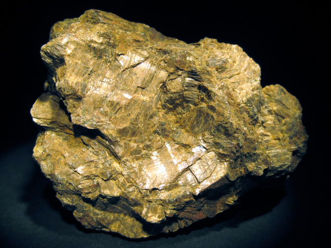


Sommergraben, Sankt Stefan ob Leoben, Leoben District, Styria, Austria