 | | Report (issue) |
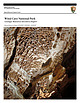
| National Park Service U.S. Department of the Interior Natural Resource Program Center Wind Cave National...THE COVER: On the Candlelight Tour Route in Wind Cave boxwork protrudes from the ceiling in the Council...Austin, inside photo by Even Blackstock Wind Cave National Park Geologic Resources Inventory Report Natural...80225 March 2009 U.S. Department of the Interior National Park Service Natural Resource Program Center Denver...and applicability to a broad readership in the National Park Service and to others in the management of |
 | | Report (volume) |
| § J| f Geology of the Jewel Cave SW Quadrangle Custer County, South Dakota *s>o v> Os g EH O M 3 ...1063-G ^Geology of the Jewel Cave SW Quadrangle Custer County, South Dakota By .WILLIAM A. BRADDOCK...Geologic map and section of the Jewel Cave SW quadrangle, South Dakota. 21. Lithology of the Minnelusa..._.__-55. Deformed gypsum beds__-----__-__--__________________ 56. Contorted gypsum beds-----------_--_----------_------...BLACK HILLS GEOLOGY OF THE JEWEL CAVE SW QUADRANGLE CUSTER COUNTY, SOUTH DAKOTA By WILLIAM A. BRADDOCK ABSTRACT |
 | | Journal (issue) |
| the Geology and Resources of the Black Hills of Dakota with Atlas, Washington. 1879-1880, quarto, pp....Preliminary Report of Ex plorations in Nebraska and Dakota. in the Years 1855-56-57. Washington. I 875. Oc...Black Hills, and adjacent pans of the Nebraska and Dakota regions was originally as an appendix to the Humphrey...topographic and geographic features from Kansas in the south to the Canadian border on the north. The map extends...com PO Box 455 • Poncha Springs, Colorado 81242 USA Phone: 719-539-4113 • Fax 719-539-4542 SUMMER 2002 |
 | | Journal (article/letter/editorial) |
| a rockfall in Paleozoic sandstone. Hot Springs National Park: 101 Reserve Street, Hot Springs, 71901;...Pennsylvanian Pounds Sandstone. Cave-In-Rock: 1 New State Park Road, Cave-in-Rock, 62919; http://www.dnr...gov/Parks/Pages/CaveInRock. aspx. This massive 55-foot-wide cave along the banks of the Ohio River was carved out...and is exposed near the cave entrance. Garden of the Gods: Shawnee National Forest, Herod; http://www...seafloor. Collecting is not allowed. Indiana Dunes National Lakeshore: 1100 North Mineral Springs Road, Porter |
 | | Report (issue) |
| Denver, Colorado 9 ^University of South Dakota Vermillion, South Dakota INTRODUCTION This bibliography...references on geology of the Black Hills in South Dakota and Wyoming. For purposes of this report, the... the area does not include the Bad Lands of South Dakota nor the bulk of the Powder River Basin in Wyoming...included in the bibliography. References for South Dakota are more complete than those for Wyoming. Both...potential and geology of the Black Hills National Forest, South Dakota and Wyoming, with a section on Salable |
 | | Book |
| logyoO0000grie &N ROADSIDE % JEOLOGY of South Dakota John Paul Gries Mountain Press Publishing...Gries, John Paul, 1911- Roadside geology of South Dakota / John Paul Gries. p. cm. Includes bibliographical...(pbk. : alk. paper) 1. Geology—South Dakota—Guidebooks. 2. South Dakota— Guidebooks. I. Title. QE163.G68...interpreting the details of the surface geology of South Dakota. My model is Nathaniel Horatio Darton, geologist...depth to groundwater in the western half of South Dakota. Even in this day of gadgetry, field studies |
 | | Report (issue) |
| Localization ofUraniu Deposits, Southern Black Hills, South Dakota and Wyon1ing GEOLOGICAL SURVEY Prepared on...of Uranium Deposits, Southern Black Hills, South Dakota and Wyoming By GARLAND B. GOTT, DON E. WOLCOTT...anhydrite-bearing strata of the subsurface in Custer County, S. Dak.·-------------------------------------------------·...Gettys Canyon, SE %. sec. 16, T. 3 S., R. 1 E., Custer County, S. Dak ___________________________________...LOCALIZATION OF URANIUM DEPOSITS, SOUTHERN BLACK HILLS, SOUTH DAKOTA AND WYOMING By GARLAND B. GOTTJ DoN E. |
 | | Report (issue) |
| SURVEY Locatable Mineral Reports for Colorado, South Dakota, and Wyoming provided to the U.S. Forest Service............ 2 Arapaho and Roosevelt National Forests Pawnee National Grassland Mike Cervi Land Exchange..................................... 3 Gunnison National Forest Crested Butte Mountain Resort Land Exchange...Exchange Offer ...... . . ............ 10 Pike National Forest County of El Paso (Black Forest) Land Exchange...Exchange Offer .................. 124 Roosevelt National Forest Fossey/Paul Land Exchange Offer ........... |
 | | Journal (article/letter/editorial) |
| Hills of South Dakota THOMAS J . C A M P B E L L and WILLARD L . ROBERTS Museum of Geology South Dakota...Dakota School of Mines and Technology Rapid City, South Dakota 57701 more comprehensive description of the...occurrences as the Black Hills area of western South Dakota. These occurrences are quite diverse, ranging...the recently added South Dakota room in the Museum of Geology at the South Dakota School of Mines and...Thomas Campbell is a graduate student at the South Dakota School of Mines and Technology. His major in |
 | | Journal (issue) |
| SUCCESS SELENIUM, CUSTER & The Battle of Little Bighorn EASTER GEM STORIES CAVES NATIONAL PARKS + OF THE...2022 16 CAVES OF THE NATIONAL PARKS 50 FOR WANT OF A MINERAL: SELENIUM, CUSTER & THE BATTLE OF LITTLE...many adventures and one of my favorites was to a cave that was not open to the public. We would crawl...make our way through the extensive cave system. It was a legit cave with a stream, cliffs, stalactites...stalactites and stalagmites. We’d eat lunch in the cave, spend time without any light, etc. We were messy at the |
 | | Report (volume) |
| Edgemont NE Quadrangle Fall River and Custer Counties, South Dakota GEOLOGICAL SURVEY BULLETIN Prepared...Edgemont NE Quadrangle Fall River and Custer Counties, South Dakota By GARLAND B. GOTT and ROBERT W. SCHNABEL...basal part of the Pall River formation__________ Gypsum deposits__________________________________________...section of the Edgemont NE quadrangle, Fall River and Custer Counties, S. Dak. 13. Exploded block diagram. 14...Intraformational fold---__--_-_-----__----------------_136 25. Gypsum beds__-____,.__-_-_-_____---__---_----___-_-_-138 |
 | | Report (volume) |
| Hot Springs Quadrangle Fall River and Custer Counties, South Dakota 7 ' -. ... . . . ..-.._ r^ O OQ...Hot Springs Quadrangle Fall River and Custer Counties, South Dakota By DON E. WOLCOTT GEOLOGY AND URANIUM...QUADRANGLE, FALL RIVER AND GUSTER COUNTIES, SOUTH DAKOTA By DON E. WOLCOTT ABSTRACT The Hot Springs...flank of the Black Hills in parts of Fall River and Custer Counties, S. Dak. Exposed sedimentary rocks, about...structures attributed to the removal of anhydrite and gypsum by solution from the Minnelusa Formation are present |
 | | Report (volume) |
| the Cascade Springs Quadrangle Fall River County South Dakota GEOLOGICAL SURVEY BULLETIN Prepared on...the Cascade Springs Quadrangle Fall River County South Dakota By EDWIN V. POST GEOLOGY AND URANIUM DEPOSITS...Prospecting-_________-____----_-_-_----_-__--_--_-___-_-__ Gypsum._________..__________________________________ Limestone...the Cascade Springs quadrangle, Fall River County, South Dakota. 30. Isometric panel diagram of the Fall... Cascade Springs quadrangle, Fall River County, South Dakota, showing abrupt changes in lithology and |
 | | Journal (article/letter/editorial) |
| KARSTIC GYPSUM PROBLEMS AT WASTEWATER STABILIZATION SITES IN THE BLACK HILLS OF SOUTH J)AJ(OTA Arden...Departmeni ofGeology and Geological Engineering. South DakotaSchool ofMines and Technology. Rapid City...conditions have developed in the Black Hills of South Dakota. The evaporite karst has caused severe engineeringproblems...proposed lagoon/ wetlands facility for Whitewood. South Dakota, The Spearfishsewage lagoons were buill in 1972on...tabled after controversy. and shale with interbedded gypsum. Its environment of deposition is believed to have |
 | | Book (edition) |
| EDITION SOUTH DAKOTA MINNESOTA KANSAS • INDIANA • • MISSOURI ILLINOIS • NORTH DAKOTA • OHIO...includes SOUTH DAKOTA • MICHIGAN • ILLINOIS • IOWA WISCONSIN • OHIO • KANSAS • NORTH DAKOTA NEBRASKA...Jasper 25 Golden Barite - 13 Black Agates The Custer Area Tepee Canyon Agate Page 8 12 Ardmore Agate...Minnesota 32 Wisconsin 39 Nebraska 40 North Dakota 43 Indiana . 45 Ohio 46 Michigan 50 Missouri...you are a tourist in the IMack Hills of Soutli Dakota, the highest mountain region east of the Rockies |
 | | Report (issue) |
| STATE OF SOUTH DAKOTA Nils Boe, Governor MINERALOGY OF THE BLACK HILLS by WILLARD LINCOLN ROBERTS...Associate in Mineralogy Museum of Geology, South Dakota School of Mines and Technology and GEORGE RAPP...Department of Geology and Geological Engineering, South Dakota School of Mines and Technology With the Editorial...Mineralogy South Dakota School of Mines and Technology BULLETIN NUMBER 18 of the South Dakota School of...of Mines and Technology Rapid City, South Dakota PUBLICATIONS STAFF F. L. Partlo J. T. Thomas President |
 | | Journal (issue) |
| was found in the Hell Creek Formation in North Dakota, a heavily studied formation containing a variety...Montana and stretches into portions of North and South Dakota and into parts of Wyoming ("The virtual fossil‖)...It has been a good life. The Black Hills of South Dakota (and some in Wyoming) (Fig. 1) have enough Blue...back in 1965. As a student at the University of South Dakota I was on a field trip designed to collect mammals;...secured from local rock shops (I found the shops in Custer and Hermosa to be very helpful), the U. S. Forest |
 | | Book |
| THE | UNDERGROUND ATLAS A Gazetteer of the World’ Cave Regions JOHN MIDDLETON & TONY WALTHAM ISBNO-31e-O1101-b...book which gives a comprehensive study of all the cave regions of the world. The authors’ special combination...photographs. This is a book that will fascinate cave lovers, spelunkers and speleologists everywhere...Berger, Grenoble, France; and back: Quashies River Cave, Jamaica. (continued on back flap) SAN MATEO... The Underground Atlas A gazetteer of the world’s cave regions by JOHN MIDDLETON & TONY WALTHAM St. |
 | | Book |
| 551.4 Gr Graf, Mike. Cave story an underground adventure tBr2 5 19S OCT i»^ "M J-3. j^N Qa ...enthusiasm and knowledge, and letting me stay alone in a cave for the beingalone experience. Paul Bernard not...critique Cave Story and get it to the final version it is in now. Without any of the above. Cave Story would...educational books including The Weather Report, National Parks He World's Best Places. is currently...Chapters 37 Chapter 7 40 Appendix 44 National Park Caves 44 Cave Surveying and Mapping 44 Longest Caves |
 | | Report (issue) |
| .................................... 12 NCKRI National Seed Grants................................................................................. 23 Cave and Karst Studies at NMT..........................Lab......................................... 24 Cave and Karst Research Fellowships for NMT Undergraduates............... 27 National Park Service - NCKRI Liaison Program.............. 28 Cave and Karst Resources............................. 29 Timpanogos National Monument Resource Stewardship Strategy............ |
 | Martin, James E., Sawyer, J. Foster, Fahrenbach, Mark D., Tomhave, Dennis W., Schulz, Layne D. (2004) Geologic Map of South Dakota, South Dakota Geological Survey. | Map |
| General Map 10 South Dakota Geological Survey o o o o 103 104 o 101 102 N O R T H D K...meltwater streams which flowed into Glacial Lake Dakota. Thickness up to 30 ft (9 m). Outwash, undifferentiated...Contains prominent oxidized joints and fractures with gypsum or calcite. Typically overlain by up to 25 ft (8...prominent oxidized joints and fractures with calcite or gypsum. Typically overlain by up to 45 ft (14 m) of loess...250-350 ft (76-107 m). Gypsum Spring Formation (Middle Jurassic) - Massive white gypsum and minor maroon siltstone |
 | | Report (volume) |
| Geology of the Fanny Peak Quadrangle Wyoming-South Dakota GEOLOGICAL SURVEY BULLETIN Prepared on behalf... Geology of the Fanny Peak Quadrangle ( Wyoming-South Dakota By DONALD A. BROBST and JACK B. EPSTEIN GEOLOGY...Jurassic Series.--------.---------------------------Gypsum Spring Formation..______._.._-__..___..____.__...sections of the Fanny Peak quadrangle, Wyoming-South Dakota. 26. Diagram of the major physiographic and...structural features of the Newcastle area, Wyoming-South Dakota. FIGURE 66. Structure contour map of the Black |
 | | Book (edition) |
| chapters entitled Gypsum Caves, Krubera (Voronja) Cave, and Ukranian Giant Gypsum Caves. Copyright ©...Burlington, MA 01803, USA 525 B Street, Suite 1900, San Diego, California 92101-4495, USA 84 Theobald’s Road...to Darkness Crustacea 1 Databases Castleguard Cave, Canada Adaptation to Low Food 10 Frédéric Hervant...Boris Sket Diversity Patterns in the Tropics 166 Cave Dwellers in the Middle East 85 Paul Goldberg and...Susan W. Murray and Thomas H. Kunz Contamination of Cave Waters by Heavy Metals 127 Beetles Dorothy J. |
 | | Book (edition) |
| COVER -- Pairburn agates from South Dakota. Photo courtesy South Dakota School of Mines Museum. > 1...includes 1 SOUTH DAKOTA • MICHIGAN • ILLINOIS • IOWA WISCONSIN • OHIO • KANSAS • NORTH DAKOTA NEBRASKA...2 KANSAS Foreword 4 How To Use This Book SOUTH DAKOTA 6 New Finds ................ Fairburn Type...AGATE BEDS 11 OELRICHS AGATE BED .. 12 THE CUSTER AREA ......... Tepee Canyon Agate ... Garnets ...RED RIVER VALLEY .... 32 NORTH DAKOTA .. 30 WESTERN NORTH DAKOTA Badlands and Buttes........... Gems |
 | | Report (volume) |
| Geology of the Dewey Quadrangle Wyoming-South Dakota GEOLOGICAL SURVEY BULLETIN Prepared on behalf...1063-B Geology of the Dewey Quadrangle Wyoming-South Dakota By DONALD A. BROBST GEOLOGY OF URANIUM DEPOSITS...section of Wicker-Baldwin urainum prospect, Weston County, Wyo______________________________ In pocket FIGURE...Creek shale in sec. 21, T. 41 N., R. 60 W., Weston County, Wyo_ 46 TABLE Page TABLE 1. Stratigraphy of the...HILLS GEOLOGY OF THE DEWEY QUADRANGLE WYOMING-SOUTH DAKOTA By DONALD A. BROBST ABSTRACT The Dewey quadrangle |


