 | | Report (issue) | | Selected Mining Districts of Utah by Carl L. Ege Headframe of Centennial Eureka mine, Tintic mining district...MISCELLANEOUS PUBLICATION 05-5 UTAH GEOLOGICAL SURVEY a division of 2005 Utah Department of Natural Resources...Resources STATE OF UTAH Jon Huntsman, Jr., Governor DEPARTMENT OF NATURAL RESOURCES Michael Styler, Executive...Executive Director UTAH GEOLOGICAL SURVEY Richard G. Allis, Director PUBLICATIONS contact Natural Resources...toll-free: 1-888-UTAH MAP website: http://mapstore.utah.gov email: geostore@utah.gov THE UTAH GEOLOGICAL SURVEY |  | Stein, H.J., Bankey, Viki, Cunningham, C.G., Zimbelman, D.R., Brickey, D.W., Shubat, M.A., Campbell, D.L., , (1989) Tooele 1 x 2 Quadrangle, Northwest Utah; a CUSMAP preassessment study. Open-File Report Vol. 1989 (89-467) US Geological Survey doi:10.3133/ofr89467 | Report (issue) | | THE INTERIOR GEOLOGICAL SURVEY Tooele I°x2° Quadrangle, Northwest Utah A CUSMAP Preassessment Study by...Mel H. Podwysocki2 Prepared in cooperation with Utah Geological and Mineral Survey Open-File Report...preliminary and has not been reviewed for conformity with U.S. Geological Survey editorial standards and stratigraphic......................... CURRENT STATUS OF MAJOR MINING DISTRICTS......................... 28 28 37 39............... Gold Hill (Clifton)......................................... Recent Mining Activity References |  | | Report (issue) | | resource areas in the Basin and Range Province of Utah by George Wong Open-File Report 83-722 This...preliminary and has not been reviewed for conformity with U.S. Geological Survey editorial standards and stratigraphic...Refereaces cited Appendix A - 2 7 Table Table 1. District descriptions Preliminary map of the resource...resource areas in the Basin and Range Province of Utah By George Wong The purpose of this map is to identify...Range Province. These areas include past or present mining and prospecting activity as well as areas of potential |  | | Report (volume) | | Placer Gold Deposits of Utah___________ IIT 9 r 3 GEOLOGICAL SURVEY BULLETIN 1357 Placer Gold...Gold Deposits of Utah By MAUREEN G. JOHNSON GEOLOGICAL SURVEY BULLETIN 1357 A catalog of location...72-600159 For sale by the Superintendent of Documents, U.S. Government Printing Office Washington, D.C. 20402........................... History of placer mining in Utah..................................... Purpose...study................................... Garfield County. ............................................. |  | | Report (issue) | | Mountains Wilderness Study Area, Juab and Tooele Counties, Utah U.S. GEOLOGICAL SURVEY BULLETIN 1745-C ...Mountains Wilderness Study Area, Juab and Tooele Counties, Utah By CONSTANCE J. NUTT, DAVID R. ZIMBELMAN...and JOSEPH S. DUVAL U.S. Geological Survey BRIAN J. HANNIGAN U.S. Bureau of Mines U.S. GEOLOGICAL SURVEY...AREAS NORTHWESTERN UTAH DEPARTMENT OF THE INTERIOR MANUEL LUJAN, JR., Secretary U.S. GEOLOGICAL SURVEY...purposes only and does not imply endorsement by the U.S. Government. UNITED STATES GOVERNMENT PRINTING OFFICE: |  | | Journal (article/letter/editorial) | | GEOLOGIST .JUNE, 1918 ON GOLD HILL AND VICINITY, COUNTY, WESTERN UTAH. No. 4 TOOELE J. F. KEMP AND PAUL...passedwestwardthrough Dugway, Fish Spring Camp and Clifton, Utah, and so on across the stateline to the headwatersof...Nevada. While at Clifton, Mr. O'lcottmade a short trip to the north and visited Gold Hill and the neighboringCane...interest, and as all came from a portion of the county regardingwhich records were few, a short contributionwas...preparedand publishedregarding them? Clifton and Gold Hill are two early mining campsformerly scenesof activity |  | | Report (issue) | | limestone or dolomite. It is a useful ore guide in many mining districts UNITED STATES GOVERNMENT PRINTING OFFICE...printing 1978 For sale by the Branch of Distribution, U.S. Geological Survey, 1200 South Eads Street, Arlington........... Characteristics of jasperoid in major mining districts of the United States ..................................................... Tri-State district, Oklahoma, Kansas, and Missouri .................... Clifton-Morenci district, Arizona .............................. Bisbee (Warren) district, Arizona |  | | Report (issue) | | CALITI ES OF UTAH by Kenneth C. Bullock UTAH GEOLOGICAL AND MINERAL SURVEY a division of the UTAH DEPARTMENT...LOCALITIES OF UTAH by Kenneth C. Bullock Nature displays her most common mineral, quartz, in this beautiful.... . . . . . 1 Chapter I. Mining Districts of Counties and the State of Utah. . . . . . . . . . . . .... . . . . . . . . . . . . . . . . . . . . . . 1 County Listings. . . . . . . . . . . . . . . . . . . .... . . . . . . . . . . . 1 Chapter II. Mining Districts of Utah . . . . . . . . . . . . . . . . . . . |  | | Report (issue) | | Characterization of the Bbnneville Region, Utah and Kevadt U.S. GEOLOGICAL StJ&VEY Pi*0£ESSIO&AL PAPER 1370-G...WASTECHARACTERIZATION OF THE BONNEVILLE REGION, UTAH AND NEVADA Looking north of Blue Lake Springs...southwestern margin of the Great Salt Lake Desert, Tooele County, Utah. Springs at and near Blue Lake Springs discharge...Waste Characterization of the Bonneville Region, Utah and Nevada Edited by M.S. BEDINGER, K.A. SARGENT...HYDROLOGY FOR ISOLATION OF HIGH-LEVEL RADIOACTIVE WASTE U.S. GEOLOGICAL SURVEY PROFESSIONAL PAPER 1370-G |  | | Report (issue) | | Geologic Map of Utah C.J. Nutt1 and Steve Ludington2 Open-File Report 03-486 Version 1.0 2003 U.S. Department...Department of the Interior Gail A. Norton, Secretary U.S. Geological Survey Charles G. Groat, Director Any use...endorsement by the U.S. Government. 1 U.S. Geological Survey, Denver, CO 80225 U.S. Geological Survey...about intrusive rocks in Utah that can be linked to the Digital Geologic Map of Utah (Hintze et al., 2000)...000-scale Geologic Map of Utah (Hintze, 1980), can be obtained from the Utah Geological Survey (Map 179DM) |  | | Report (issue) | | Professional Paper Ill THE ORE ~DEPOSITS OF UTAH BY B. S. BUTLER, G. F. LOUGHLIN, V. C. HEIKES...81 83 84 84 85 87 87 87 87 THE ORE DEPOSITS OF UTAH. By B. S. BuTLER. PART !._:_GENERAL FEATURES. INTRODUCTION...INTRODUCTION. reports are those on the Mercur district, by J. E. Spurr and S. F. Emmons; the Bingham... began district, by J. M. Boutwell, Arthur Keith, and field work on the ore deposits of Utah in the S...S. F. Emmons; the Park City district, by J. M. FIELD .WORK AND AUTHORSHIP. summer of 1908 by making |  | | Report (issue) | | U.S. DEPARTMENT OF THE INTERIOR U.S. GEOLOGICAL SURVEY PRELIMINARY GEOLOGIC MAP OF THE STOCKTON 7 1/2-MINUTE...1/2-MINUTE. QUADRANGLE, TOOELE COUNTY, UTAH By Edwin W. Tooker1 and RJ. Roberts2 Open-File Report 92-385...preliminary and has not been reviewed for conformity with U.S. Geological Survey editorial standards or with the...purposes only and does not imply endorsement by the U.S. Government 1 Menlo Park, California 2 Consultant............. 13 Eagle Hill rhyolite porphyry ..................... . . .13 Quartz monzonite. ......... |  | | Report (issue) | | Oxidized Zinc Deposits of the United States Part 2. Utah By ALLEN V. HEYL GEOLOGICAL SURVEY BULLETIN ...detailed study of the supergene zinc deposits of Utah UNITED STATES GOVERNMENT PRINTING OFFICE, WASHINGTON...Director For sale by the Superintendent of Documents, U.S. Government Printin~ Office Washin~ton 25, D.C. ...___________ ____ __ ________ ____ Silver Islet district ___________________ ~_____________________ Cache...district____ __ ____________ _________ __ __ ____ ______ Tooele County________________________________________________ |  | | Report (issue) | | Director Professional Paper 177 THE GOLD HILL MINING DISTRICT U'TAH BY T. B. NOLAN UNItED STATES GOVERNMI£NT...sedimentary rocks in eastern Nevada and western Utah __________ _ Carboniferous system____ __ __ _ _...rocks ___ _ General features ____________________ _ Quartz monzonite__ _ VII 1 1 1 1 2 3 3 4 4 4 4 6 7...__________________ _ Fifth cycle and faults related to the quartz monzonite intrusion ___________ _ Progressive variation..._________ _ Northwestern block_ _ ___ _____________ _ Quartz monzonite block_ _________ _ Igneous metamorphism |  | | Report (issue) | | of Base- and Precious-Metal Mining Districts in the Oquirrh Mountains, Utah by Edwin W. looker1 Open-File...preliminary and has not been reviewed for conformity with U.S. Geological Survey editorial standards or with the...imply endorsement by the U.S. Government U.S. DEPARTMENT OF THE INTERIOR U.S. GEOLOGICAL SURVEY Menlo.... ......... 5 Geologic Setting of North-Central Utah .......................... 7 Oquirrh Mountains Nappes...Structural and Stratigraphic Characteristics of Mining Districts in the Oquirrh Mountains ........... |  | | Report (issue) | | Stansbury Mountains Wilderness Study Area, Tooele County, Utah U.S. GEOLOGICAL SURVEY BULLETIN 1745-B :"...AND MAPS OF THE U.S. GEOLOGICAL SURVEY Instructions on ordering publications of the U.S. Geological Survey...catalog "New Publications of the U.S. Geological Survey." Prices of available U.S. Geological Survey publications...Availability List" Publications that are listed in various U.S. Geological Survey catalogs (see back inside cover)...released to the open files are given in the listing "U.S. Geological Survey Open-File Reports," updated monthly |  | | Book | | OF UTAH'S MINING INDUSTRY By Utah Mining Association 918 Kearns Building Salt Lake City, Utah MILES P...material was available to give Utah citizens an account of their mining industry. Most of the available...segments of mining activity. We have attempted in the following pages to discuss mining in all phases...picture of the mineral deposits and of the mining activity in Utah as time and effort permit. In the writing...the person interested in, but unacquainted with mining, mineral processing, and mineral economics, could |  | | Book (edition) | | beautifully hasn't thrilled to the sight of mounted in gold or or silver, some lovely gem, against lying...every blood red glow, every touch of green, blue, gold or royal purple. Gem stones have been the treasures...gem stones mon dull are as hard or harder than quartz, a com- mineral everywhere present as dust which...Hardness Scale 6. Orthoclase 1. Talc 2. Gypsum 7. Quartz Topaz Corundum 10. Diamond 3. Colcite 8. 4...Your will scratch orthoclase feldspar but not quartz. In making hardness appears to be a scratch paper |  | | Report (issue) | | Geology of the Oquirrh Mountains, Utah by Edwin W. Tooker Open-File Report OF 99-571 1999 This report...preliminary and has not been reviewed for conformity with U.S. Geological Survey editorial standards or with the...imply endorsement by the U.S. Government U.S. DEPARTMENT OF THE INTERIOR U.S. GEOLOGICAL SURVEY Menlo...Acknowledgments Geologic setting of north-central Utah 11 13 15 17 Precambrian basement terrane and the...70 Bingham mining district area 70 Middle Canyon-Soldier Creek areas 71 Lion Hill and Porphyry |  | | Report (volume) | | ............ r ............................. 45 Gold................................................................................................. Quartz..................................................elongated rhombic crystal faces, from Nugget mine, Gilpin County, Colo.-................... II. A, Wedge-shaped...from Hoosier mine, Nederland, Colo.; B, Cuboid ferberite crystals from Georgia A. mine, Nederland. Colo...Nugget mine, Gilpin County, Colo.............................. IV. A, Hiibnerite from Birdie mine, Butte | 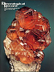 | | Journal (issue) | | DC Peter G. Embrey London, England Richard C. Erd U.S. Geological Survey Menlo Park, CA Steven R. Morehead...85740 602-297-6709 Subscriptions • Individuals (U.S.): $36 for one year; $69 for two years. (Firstclass...circulation manager for rates.) • Individuals (outside the U.S.): $39 for one year, $75 for two years. (Airmail... Famous mineral localities: the Gold Hill mine, Tooele County, Utah ................................... S. Wise The Wagon Wheel Gap fluorspar mine, Mineral County, Colorado ............................. |  | | Report (volume) | | OTIS SMITH^ DIRECTOR BULLETIN 507 BY JAMES M. HILL WITH A GEOLOGIC INTRODUCTION BY WALDEMAR LINDGREN........................... 5 5 Distribution of mining districts........................................part)...............'............................... Utah.............................................................. PART II. Catalogue of mining districts, by J. M. Hill........................ Acknowledgments............................... Classification of mining districts..................................... | | Long, Keith R., DeYoung,, John H., Ludington, Stephen (1998) Database of significant deposits of gold, silver, copper, lead, and zinc in the United States. Open-File Report Vol. 1998 (98-206) US Geological Survey doi:10.3133/ofr98206ab | Report (issue) | | of the East Shasta copper-zinc district, Shasta County, California: U.S. Geological Survey Professional...1972, Geology and mineral deposits of Esmeralda County, Nevada: Nevada Bureau of Mines and Geology Bulletin...1940, Reconnaissance of gold mining districts in the Black Hills, South Dakota: U.S. Bureau of Mines Bulletin...Wilderness Study Area (AZ-020-024), Mohave County, Arizona: U.S. Bureau of Mines Mineral Land Assessment...Plumas County, California; Venture 63: San Francisco, Calif., American Exploration and Mining Co., unpaginated |  | | Report (issue) | | U.S. DEPARTMENT OF THE INTERIOR U.S. GEOLOGICAL SURVEY PRELIMINARY GEOLOGIC MAP OF THE LOWE PEAK 7 1/2-MINUTE...1/2-MINUTE QUADRANGLE, TOOELE, UTAH, AND SALT LAKE COUNTIES, UTAH Compiled by Edwin W. Tooker 1 Open-File...preliminary and have not been reviewed for conformity with U.S. Geological Survey editorial standards or with the...purposes only and does not imply endorsement by the U.S. Government. 1992 1 Menlo Park, CA 94025 TABLE...Peak 7 1/2-minute quadrangle, Tooele, Salt Lake, and Utah Counties, Utah Figure 1. Location of the Lowe |  | | Journal (article/letter/editorial) | | JANUARY-FEBRUARY,1967 SILVER-BEARING BLACK MINING D. F. HEWETT CALCITE DISTRICTS AND A. IN .... Tybo district, Nye County,Nevada ................................... Pioche, Lincoln County, Nevada................................ Ophir district, Tooele County,Utah .................................. San...San Franciscodistrict,Beaver County,Utah ........................... Tombstonedistrict, CochiseCounty............................. Lake Valley, Sierra County,New Mexico ............................. Review |
|


U.S. Mine, Gold Hill, Gold Hill Mining District, Tooele County, Utah, USA