 | | Report (issue) | | Mineral Deposits of the Osgood Mountains Quadrangle Humboldt County, Nevada GEOLOGICAL SURVEY PROFESSIONAL...Mineral Deposits of the Osgood Mountains Quadrangle Humboldt County, Nevada I By PRESTON E. HOTZ and...mineral deposits of the Osgood Mountains quadrangle, Humboldt County, Nevada, by Preston E. Hotz and...of the Osgood Mountains quadrangle, Humboldt County, Nevada. 1963. (Card 2) 1. Geology-Nevada-Humboldt...resources-Nevada-Humboldt Co. I. Willden, Charles Ronald, 1929joint author. II. Title: Osgood Mountains quadrangle |  | | Report (issue) | | MANAGEMENT'S WINNEMUCCA DISTRICT AND SURPRISE RESOURCE AREA, NORTHWEST NEVADA AND NORTHEAST CALIFORNIA... MS 176, Mackay School of Mines, University of Nevada, Reno, Reno, NV 89557-0047 CONTENTS Introduction........................................ Northern Nevada Rift ............................................assessment of BLMadministered lands in northwest Nevada and northeast California. The project area is composed...(RAs), totalling 13.5 million acres, in northwest Nevada and northeast California (figs. 1, 2). The SonomaGerlach |  | Peters, S.G., Nash, J.T., John, D.A., Spanski, G.T., King, H.D., Connors, K.A., Moring, B.C., Doebrich, J.L., McGuire, D.J., Albino, G.V., Dunn, V.C., Theodore, T.G., Ludington, S.D. (1996) Metallic mineral resources in the U.S. Bureau of Land Management's Winnemucca District and Surprise Resource Area, northwest Nevada and northeast California. Open-File Report Vol. 1996 (96-712) US Geological Survey doi:10.3133/ofr96712 | Report (issue) | | Management's Winnemucca District and Surprise Resource Area, northwest Nevada and northeast California...Ludington3 Open-File Report 96-712 1996 1 Reno, Nevada 89557 2 Denver, Colorado 80228 3 Menlo Park, California...Canada 7 U.S. Bureau of Land Management, Winnemucca, Nevada 89445 This report is preliminary and has not been............................................. 18 Humboldt River porphyry tracL............................epithermal deposits (Comstock epithermal vein, quartz-sericite-adularia) (models 25c and 25d of Cox and |  | Madden-McGuire, Dawn J., Smith, S.M., Botinelly, Theodore, Silberman, M.L., Detra, D.E. (1990) Physical characteristics of alluvium and geochemistry of pebbles and cobbles from the alluvium in drill core above the Rabbit Creek gold deposits, Getchell mining district, Humboldt County, Nevada. Open-File Report Vol. 1990 (90-32) US Geological Survey doi:10.3133/ofr9032 | Report (issue) | | Rabbit Creek gold deposit, Getchell mining district, Humboldt County, Nevada Dawn J. Madden-McGuire1 ...Silberman1 , and David E. Detra1 and Santa Fe Pacific Mining, Inc.2 Open-File Report 90-32 1 U.S. Geological...gold deposit and other gold deposits along the Getchell gold belt ................................. Figure............... Figure 5.--Relative abundances of quartz, feldspar, calcite, and montmorillonite in the...from deposits of alluvial fans in western Fresno County, California ............................ Table |  | | Journal (article/letter/editorial) | | the Getchell Carlin-Type Gold Deposit, North-Central Nevada JEAN S. CLINE† University of Nevada, Las...454010, Las Vegas, Nevada 89154-4010 Abstract Pregold mineralization at the Getchell Carlin-type gold...gold deposit includes quartz and base metal vein mineralization associated with intrusion of a Cretaceous...and marcasite encompassed by jasperoid and drusy quartz, and local late fluorite, orpiment, and galkhaite...open space-filling realgar and calcite, with minor quartz, stibnite, and framboidal pyrite. Realgar conforms |  | | Report (issue) | | of the Arizona Geological society, society for Mining, Metallurgy and Exploration Inc., and the U. s...We also want to thank collectively, all of the mining companies and staff who graciously allowed us to...ALONG THE 1-80 CORRIDOR, RENO TO BATTLE MOUNTAIN, NEVADA R. Cuffney, R. Atkinson and R. Buffa Revised 1990...north-south ranges of central and northeastern Nevada (Fig. I). These belts, or their extensions, contain...vast majority of precious metal deposits found in Nevada to date. Our trip begins in the Walker Lane mineral |  | | Report (issue) | | MINERALS OF NEVADA MINERALS OF NEVADA Peer Hen By CASTOR oan eGORY.C.oFER DOCK NEVADA AND BUREAU... UNIVERSITY Reno & Las Vegas OF NEVADA PRESS GEOLOGY Nevada Bureau of Mines and Geology Special...University of Nevada Press, Reno, Nevada 89557 USA Copyright © 2004 by University of Nevada Press Photographs...otherwise noted Map of Mining Districts and significant mineral occurrences of Nevada by Nevada Bureau of Mines...Cataloging-in-Publication Data Castor, Stephen B, Minerals of Nevada / Stephen B. Castor and Gregory C. Ferdock.— Ist | | | Report (issue) | | MINERALS OF NEVADA MINERALS OF NEVADA STEPHEN B. CASTOR and G R EGOR Y C . F E R D OC K l NEVADA BUREAU...association with the UNIVERSITY OF NEVADA PRESS Reno & Las Vegas Nevada Bureau of Mines and Geology Special...University of Nevada Press, Reno, Nevada 89557 USA Copyright© 2004 by Uni versity of Nevada Press Photographs...Districts and si gnificant minernl occurrences of Nevada by Nevada Bureau of Mines and Geology All rights reserved...-Publ ication Dat,i Castor, Stephen B. Minerals of Nevada/ Stephen B. Castor and Gregory C. Ferdock.- rst |  | | Journal (article/letter/editorial) | | Geology Vol. 98, 2003, pp. 1189–1211 Lead in the Getchell-Turquoise Ridge Carlin-Type Gold Deposits from...Igneous and Sedimentary Rock Sources in Northern Nevada: Implications for Fluid and Metal Sources* R. M...J. S. CLINE, University of Nevada, 4505 Maryland Parkway, Las Vegas, Nevada 89104 C. MARK FANNING, Research...(SHRIMP) in the Getchell and Turquoise Ridge Carlin-type gold deposits (Osgood Mountains) require contribution...Carlin trend in northeast Nevada. Petrologically similar rocks host the Getchell and Turquoise Ridge deposits |  | | Report (volume) | | Geochemical Exploration Near the Getchell Mine Humboldt County, Nevada GEOLOGICAL SURVEY BULLETIN 1198-A... Geochemical Exploration Near the Getchell Mine Humboldt County, Nevada By R. L. ERICKSON, A. P. MARRANZINO..._______ Getchell ore body________-_. North workings.______--____. Area north of Getchell mine. _. Hansen...geochemical map of the northern part of the Getchell mine area. 2. Geologic and geochemical map of a part...42 E., Humboldt County, Nev. Page FIGURE 1. Index map of central part of the Osgood Mountains, Humboldt |  | | Report (issue) | | in the Osgood Mountains and Surrounding Areas, and a Stop at the Golconda Thrust Fault, Humboldt County...County, North-Central Nevada by Dawn J. Madden-McGuire1 Open-File Report 90-72 1 U.S. Geological Survey......... Osgood Mountain Quartzite, Soldiers Pass, southern Osgood Mountains .......... Osgood Mountain...Mountain Quartzite at barite mine ........................... Preble Formation on south side of Emigrant Canyon.................. Golconda tungsten and manganese mine ............................ Preble Formation on |  | | Report (volume) | | North Fork of the Little Humboldt River W.. .mess St Area Humboldt County, Nevada U.S. GEOLOGICAL SURVEY...Fork of the Little Humboldt River Wilderness Study Area, Humboldt County, Nevada By JOCELYN A. PETERSON...RESOURCES OF WILDERNESS STUDY AREAS: LITTLE HUMBOLDT RIVER REGION, NEVADA DEPARTMENT OF THE INTERIOR DONALD...Fork of the Little Humboldt River Wilderness study area, Humboldt County, Nevada (U.S. Geological Survey...and mineral resources Nevada Little Humboldt River Wilderness. 2 Little Humboldt River Wilderness (Nev |  | | Journal (article/letter/editorial) | | Identification of quartz and carbonate minerals across northern Nevada using ASTER thermal infrared emissivity... Denver Federal Center, Denver, Colorado 80225, USA ABSTRACT ASTER (Advanced Spaceborne Thermal Emission...imagery over a 389 km × 387 km area in northern Nevada (38.5°–42°N, 114°–118.5°W) was analyzed to evaluate...and cost-effective identification and mapping of quartz and carbonate minerals at regional to local scales...materials, many of which are composed primarily of quartz and carbonate minerals. This area is also endowed |  | | Journal (article/letter/editorial) | | Carlin-Type Mineralization in the Getchell and Twin Creeks Deposits, Nevada John A. Groff PII: DOI: Reference:...Carlin-Type Mineralization in the Getchell and Twin Creeks Deposits, Nevada, Ore Geology Reviews (2018), doi:...Carlin-Type Mineralization in the Getchell and Twin Creeks Deposits, Nevada John A. Groff Department of Earth...Environmental Sciences, New Mexico Institute of Mining and Technology, 801 Leroy Place, Socorro, New Mexico...ibnite mineralization in the Getchell and Twin Creeks deposits, Nevada was undertaken to determine the |  | | Report (issue) | | wu OUTLINE OF NEVADA MINING HISTORY— Joseph V: Tingley a RobertC.Horton _ Francis C. Lincoln 3 . ...Publication of this new edition of “Outline of Nevada Mining History” was made — possible with the assistance...eh aa nearly 48 million acres of public land in Nevada. Most of the minerals, _ _ geothermal energy, and...ahij 4 = Wh A a ‘ a a y 4 Pte Es in Nevada comes from publicland. First edition, first printing...Leshendok, U.S. Bureau of Land Management Eric Moody, Nevada Historical Society é Jon Price, National Research |  | | Journal (article/letter/editorial) | | Fracture-Controlled Fluid Flow in Carlintype Gold Deposits, Nevada John A. Groff PII: DOI: Reference: S0169-1368(19)30820-0...Fracture-Controlled Fluid Flow in Carlintype Gold Deposits, Nevada, Ore Geology Reviews (2019), doi: https://doi.org/10...Fracture-Controlled Fluid Flow in Carlin-type Gold Deposits, Nevada John A. Groff Department of Earth and Environmental...Environmental Sciences, New Mexico Institute of Mining and Technology, 801 Leroy, Socorro, New Mexico 87801...flow distal to Eocene igneous rocks (e.g., the Getchell trend) was evaluated using fluid inclusion microthermometry |  | | Journal (article/letter/editorial) | | Tungstenand Gold Mineralizationnear the Getchell Mine, Humboldt County, Nevada* MILES L. SILBERMAN,BYRONR. BERGER...rocks in the OsgoodMountains of eastern Humboldt County, Nevada. Within the metamorphicaureole surroundingthe...rocks is the Getchell fault, along which the disseminatedgold ore bodiesof the Getchell mine are localized... Introduction THE Getchellgold depositin Humboldt County is one of a group of disseminatedgold deposits•of...distributionof heavymineralsand gold within the stock. Nevada. Other ore depositsof this type include Geologic |  | | Report (issue) | | ASSOCIATED WITH DISSEMINATED GOLD AND SILVER DEPOSITS IN NEVADA AND IDAHO M. Dennis Krohn U.S. Geological Survey...ASSOCIATED WITH DISSEMINATED GOLD AND SILVER DEPOSITS IN NEVADA AND IDAHO M. Dennis Krohn U.S. Geological Survey...in northern Nevada and southern Idaho. Samples from the open-pit mines at Pinson, Nevada, and Delamar...weathered surface samples from a prospect at Preble, Nevada. Eight characteristics of the disseminated deposits...been mapped at Goldfield, Nevada. [Rowan et al, 1974]; at Cuprite, Nevada. [Abrams et al, 1977], at Tintic | 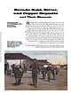 | | Journal (article/letter/editorial) | | has been an important industry in the economy of Nevada, the Silver State, since territorial times (1861)...area and created the state (1864). There are 526 mining districts in the state, 60 of which produce nonmetallic...ores (Tingley 1998). Three major mining booms have occurred in Nevada: 1860-1880 (Comstock and other silver...precious-metal mining with the development of low-grade, large-tonnage mines. I n 1997 Nevada ranked first...percent, respectively, of total U.S. production. Nevada also produced 148 million pounds of copper, 4 percent |  | | Journal (article/letter/editorial) | | 31 December 2014 NEVADA MINERAL STEVEN PULLMAN 1755 Circle Drive NW Reno, Nevada 89509 RICHARD THOMSSEN...THOMSSEN P.O. Box 1656 Carson City, Nevada 89702 Map showing Nevada counties, by William W.Besse. N evada...minerals new to the state being identified every year. Nevada is one of the few western states without a published...Clark County. Walt Lombard0 specimen, Jeff Scovil photo. Churchill County Chalk Mountain District Chalk...Chalk Mountain mine: calcite, cerussite, chlorargyrite, descloizite, galena, hemimorphite, leadhillite, |  | | Report (issue) | | in the Cortez District Nevada Gold Geochemical Anomaly in the Cortez District Nevada By R. L. Erickson...20242 Gold geochemical anomaly in the Cortez district, Nevada By R. L Erickson, G. H. Van Sickle, H. M....3.4 ounces per ton. The samples are from narrow quartz veins, calcite veins, and shear zones in partially...field study. Abstract An area in the Cortez district, Nevada, previously established to be anomalous in...anomalous also in mercury and gold. Samples from narrow quartz veins, calcite veins, and shear zones in partially |  | Hall, C. M., Kesler, Stephen E., Simon, Grigore, Fortuna, John (2000) Overlapping Cretaceous and Eocene Alteration, Twin Creeks
Carlin-Type Deposit, Nevada. Economic Geology, 95 (8) 1739-1752 doi:10.2113/gsecongeo.95.8.1739 | Journal (article/letter/editorial) | | Eocene Alteration, Twin Creeks Carlin-Type Deposit, Nevada C. M. HALL, STEPHEN E. KESLER,† GRIGORE SIMON,*...previous studies of the nearby Getchell district, particularly the Osgood stock, which has a date of 98...98 to 92 Ma. Our results suggest that the Osgood stock is part of a more protracted Cretaceous igneous-hydrothermal...largest gold producers in Nevada. It is on the eastern flank of the Osgood Mountains, just west of the Pinson...Preble, and Getchell deposits. The Twin Creeks operation consists of two separate mining areas. Chimney |  | Arehart, G. B., Chakurian, A. M., Tretbar, D. R., Christensen, J. N., McInnes, B. A., Donelick, R. A. (2003) Evaluation of Radioisotope Dating of Carlin-Type Deposits in the Great Basin,Western North America, and Implications for Deposit Genesis. Economic Geology, 98 (2) 235-248 doi:10.2113/gsecongeo.98.2.235 | Journal (article/letter/editorial) | | of Geological Sciences, University of Nevada, Reno, Reno, Nevada 89557 J. N. CHRISTENSEN, Lawrence Berkeley...events and those from galkhaite. Galkhaite from Getchell indicates a mineralization age of ~39 Ma and that...Barrick Goldstrike Mines, Inc., P.O. Box 29, Elko, Nevada 89803. 0361-0128/01/3326/235-14 $6.00 deposits...portions of some of these deposits, such as at Getchell and Mercur, have been 235 236 AREHART ET AL...techniques. 114° 42° JC Carlin-type deposits in Nevada GT CT Elko C Reno AB BM 39° Great Basin |  | Doebrich, Jeff L., Albino, G.V., Barker, C.E., Duffield, W.A., Dunn, V.C., Hanna, W.F., McFarlan, J.P., McGuire, D.J., Miller, M.S., Peters, S.G., Plouff, Donald, Raines, G.L., Sawatasky, D.L., Spanski, G.T. (1994) Resource assessment of the Bureau of Land Management's Winnemucca District and Surprise Resource Area, Northwest Nevada and Northeast California. Open-File Report Vol. 1994 (94-712) US Geological Survey doi:10.3133/ofr94712 | Report (issue) | | MANAGEMENT'S WINNEMUCCA DISTRICT AND SURPRISE RESOURCE AREA, NORTHWEST NEVADA AND NORTHEAST CALIFORNIA...Field Office, Mackay School of Mines, University of Nevada, Reno, NV 89557-0047 2U.S. Geological Survey, Unit...Winnemucca District and Surprise Resource Area, an area covering 13.5 million acres in northwest Nevada and...impact of mine dewatering on drainage basin groundwater resources (for example, the Humboldt River drainage...part of their Resource Management Plan for the District/Resource Area or for other planning units such |  | | Report (issue) | | SURVEY CIRCULAR 1062 .r • San jose tin~silver mine at Oruro, Bolivia, where high-grade ores are hosted...hosted by a volcanic complex consisting of quartz latite domes in coeval lavas and breccias of Miocene...on Mineral and Energy Resources, held in Reno, Nevada, February 11-14, 1991 U.S. GEOLOGICAL SURVEY CIRCULAR...-Soviet research on mineral deposits in the Noril'sk district is underway. Seventh Annual V.E. McKelvey Forum...mineral resources. Once again, we have selected Reno, Nevada, as the site for the Forum, as the city represents |
|


Getchell Section 5 pit, Getchell Mine, Adam Peak, Potosi Mining District, Osgood Mountains, Humboldt County, Nevada, USA