Boquillas (Del Carmen) Mine (Puerto Rico Mine), Boquillas Del Carmen, Mun. de Ocampo, Coahuila, Mexico
This page is currently not sponsored. Click here to sponsor this page.

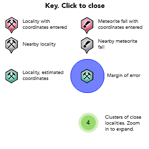
Key
Lock Map
| Location is approximate, estimate based on other nearby localities. | |
|---|---|
| Latitude & Longitude: | 27° North , 102° West (est.) |
| Margin of Error: | ~142km |
| Locality type: | Mine |
Described by Maxwell (1968) as a lead, silver and zinc mine 5 miles SE of Boquillas (now Boquillas Del Carmen) village (Mexico) started in the 1890s. The ore was smelted in a small furnace on the bank of the Rio Grande (Rio Bravo) near Boquillas until 1914. The ore was later carried into Texas (now the Big Bend National Park) by an aerial tramway 4 miles north of the river where it was loaded into mule or burro-drawn wagons for the haul to Marathon. The wagons used an old road that passed between the McKinney Hills and the Sierra Del Carmen and joined what is now the National Park road 15 miles south of Persimmon Gap. This activity ended about 1919. The mine was operated by Juan Sada.
An information panel (see locality photos) along the tramway in Big Bend National Park describes the tramway as originating at the "Puerto Rico Mine" and continuing for 6 miles, terminating at Ernest Valley and delivering up to 7 tons of ore per hour. The ground haul to Marathon was 85 miles.
Sadly neither reference gives a mineral list and this mine seems to otherwise reside in obscurity. A mineral shop in Study Butte, Texas had fluorite for sale supposedly from there. Before the Boquillas crossing was opened again (it was closed after 9/11), residents on the Mexican side would leave fluorite for sale on the American side, but of course they did not come with labels! The fluorite may originate in Melchor Múzquiz, however, SE of Boquillas Del Carmen, where it is abundant (http://www.mindat.org/loc-27248.html). If anyone goes over there please see what you can find out and add it to this page.
The towers for the tramway have collapsed but the cables still lie along the ground in the park.
No minerals currently recorded for this locality.
This page contains all mineral locality references listed on mindat.org. This does not claim to be a complete list. If you know of more minerals from this site, please register so you can add to our database. This locality information is for reference purposes only. You should never attempt to
visit any sites listed in mindat.org without first ensuring that you have the permission of the land and/or mineral rights holders
for access and that you are aware of all safety precautions necessary.
References
Sort by Year (asc) | by Year (desc) | by Author (A-Z) | by Author (Z-A)
Maxwell, Ross A. (1968), The Big Bend of the Rio Grande, A guide to the Rocks, Geologic History, and Settlers of the Area of Big Bend National Park. Bureau of Economic Geology/The University of Texas at Austin Guidebook 7: 41-43.


Boquillas (Del Carmen) Mine, Boquillas Del Carmen, Mun. de Ocampo, Coahuila, Mexico