|
USA | |
|
| (2005) Mineral Resources Data System (MRDS), US Geological Survey. |
- Blue Wing Mining District
| Gobla, Michael J. (2012) Montana Mineral Locality Index. Rocks & Minerals, 87 (3) 208-240 doi:10.1080/00357529.2012.676825 |
|
| Ref: Montana Bureau of Mines and Gology Special Publication 75, 1977 |
- Tendoy Range Mining District
| (2005) Mineral Resources Data System (MRDS), US Geological Survey. |
|
| Ref: Montana Bureau of Mines and Gology Special Publication 75, 1977 |
|
| (2005) Mineral Resources Data System (MRDS), US Geological Survey. |
- Utopia Mining District (Birch Creek Mining District)
| (2005) Mineral Resources Data System (MRDS), US Geological Survey. |
|
| Anita Moore-Nall and David R. Lageson (2015) Elevated REE in Ore Minerals of the Pryor Mountain Mining District, South Central Montana. 2015 Mining and Mineral Symposium, Montana Bureau of Mines and Geology pp47-49. |
|
| Gobla, Michael J. (2012) Montana Mineral Locality Index. Rocks & Minerals, 87 (3) 208-240 doi:10.1080/00357529.2012.676825 |
|
| Rocks and Minerals V.74 No.3 p.190,191 |
|
| www.christuckerminerals.com |
|
| (2005) Mineral Resources Data System (MRDS), US Geological Survey. |
|
| (2005) Mineral Resources Data System (MRDS), US Geological Survey. |
|
| (2005) Mineral Resources Data System (MRDS), US Geological Survey. |
- Philipsburg Mining District (Flint Creek Mining District)
| Jensen, M., Nikischer, T. (2012) Some notes on the mineralogy of the Black Pine Mine, Granite County, Montana. Mineral News: 28(6): 1-10. |
|
| Am Min 39:208-214 |
- Colorado Mining District (Prickly Pear Mining District; Corbin Mining District)
| (2005) Mineral Resources Data System (MRDS), US Geological Survey. |
|
| (2005) Mineral Resources Data System (MRDS), US Geological Survey. |
|
| (2005) Mineral Resources Data System (MRDS), US Geological Survey. |
- Whitehall Mining District (Cardwell Mining District)
| Gnanou, Hamadou (2018) Mineralogy and sulfur isotope geochemistry of the Apex and Bonanza prospects at the Golden Sunlight mine, Montana. Montana Tech of The University of Montana. 78pp. |
|
| Gnanou, Hamadou (2018) Mineralogy and sulfur isotope geochemistry of the Apex and Bonanza prospects at the Golden Sunlight mine, Montana. Montana Tech of The University of Montana. 78pp. |
|
| (2005) Mineral Resources Data System (MRDS), US Geological Survey. |
|
| Barrick Gold Corporation |
|
| Gnanou, Hamadou (2018) Mineralogy and sulfur isotope geochemistry of the Apex and Bonanza prospects at the Golden Sunlight mine, Montana. Montana Tech of The University of Montana. 78pp. |
|
| Winchell, Alexander Newton (1914) Mining districts of the Dillon quadrangle, Montana, and adjacent areas. Bulletin Vol. 574. US Geological Survey doi:10.3133/b574 |
|
| (2005) Mineral Resources Data System (MRDS), US Geological Survey. |
|
| (2005) Mineral Resources Data System (MRDS), US Geological Survey. |
|
| (2005) Mineral Resources Data System (MRDS), US Geological Survey. |
|
| USGS Bull 139 |
|
| Gobla, Michael J. (2012) Montana Mineral Locality Index. Rocks & Minerals, 87 (3) 208-240 doi:10.1080/00357529.2012.676825 |
- Eight Mile Mining District
| (2005) Mineral Resources Data System (MRDS), US Geological Survey. |
|
| Gobla, Michael J. (2012) Montana Mineral Locality Index. Rocks & Minerals, 87 (3) 208-240 doi:10.1080/00357529.2012.676825
Chris Tucker and John Betts specimens. |
|
| Gobla, Michael J. (2012) Montana Mineral Locality Index. Rocks & Minerals, 87 (3) 208-240 doi:10.1080/00357529.2012.676825
Chris Tucker and John Betts specimens. |
|
| |
|
| Anaconda Mining Company Collection |
|
| The Mineralogy of The Butte District, Montana
Guilbert and Zeihen 1964 |
|
| Singer, D.A., Berger, V.I., Moring, B.C. (2008) Porphyry copper deposits of the world: Database and grade and tonnage models, 2008. Open-File Report 2008-1155 |
|
| J Lorengo collection |
|
| Christopher H. Gammons (2016) Origin of Bright Yellow Coatings of Secondary Cadmium Sulfi de (Greenockite) on the Walls of the Orphan Boy Mine, Butte, MT. in MBMG Open-File Report 685 p69 |
|
| Jenkins, Robert E. II, Lorengo, Jerry A. (2002) Butte, Montana: Minerals, Mines and History. The Mineralogical Record, 33 (1) 5-69 |
|
| Winchell, Alexander Newton (1914) Mining districts of the Dillon quadrangle, Montana, and adjacent areas. Bulletin Vol. 574. US Geological Survey doi:10.3133/b574 |
|
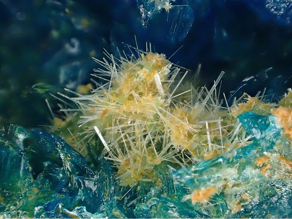
| Chris Tucker specimen |
|
| Gobla, Michael J. (2012) Montana Mineral Locality Index. Rocks & Minerals, 87 (3) 208-240 doi:10.1080/00357529.2012.676825
Chris Tucker and John Betts specimens. |
|
| Gobla, Michael J. (2012) Montana Mineral Locality Index. Rocks & Minerals, 87 (3) 208-240 doi:10.1080/00357529.2012.676825
Chris Tucker and John Betts specimens. |


Butte Mining District, Silver Bow County, Montana, USA