| Locality type: | Quarry |
| Classification |
|---|
|
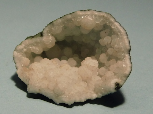
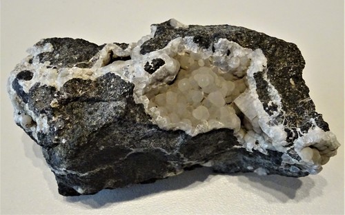
| Species: | 'Thomsonite Subgroup' (not an IMA approved species) |
| Confirmation |
|---|
|
| Validity: | Believed Valid |
| Associated Minerals Based on Photo Data: |
|---|
|
| Stilbite Subgroup | ⓘ3 photos of Thomsonite Subgroup associated with Stilbite Subgroup at this locality. |
| Apophyllite Group | ⓘ2 photos of Thomsonite Subgroup associated with Apophyllite Group at this locality. |
| Calcite | ⓘ1 photo of Thomsonite Subgroup associated with Calcite at this locality. |
| Data |
|---|
|
| Mineral Data: | Click here to view Thomsonite Subgroup data |
| Locality Data: | Click here to view Strond Quarry, Ánirnar, Borðoy, Norðoyar Region, Faroe Islands |
| Photo Gallery | View Gallery (3 photos) |
| Data Identifiers |
|---|
|
| Mindat Occurrence Record ID: | 512827 |
| Long-form Identifier: | 1:3:512827:3 |
| GUID (UUID V4): | 7613f549-b291-4ebb-b718-4796d27abb4e |
| Nearest other occurrences of Thomsonite Subgroup |
|---|
|
|
| 3.9km (2.4 miles) | ⓘHvannasundsvegur Quarry, Depil, Borðoy, Norðoyar Region, Faroe Islands |
| 8.5km (5.3 miles) | ⓘThe Northern Isles Tunnel, Leirvik, Eysturoy, Eysturoy Region, Faroe Islands |
| 8.9km (5.6 miles) | ⓘLeirvik, Eysturoy, Eysturoy Region, Faroe Islands |
| 12.7km (7.9 miles) | ⓘSyðrugøta, Eysturoy, Eysturoy Region, Faroe Islands |
| 14.2km (8.8 miles) | ⓘGøtueiđi, Eysturoy, Eysturoy Region, Faroe Islands |
| 16.3km (10.1 miles) | ⓘHustoft Quarry, Lamba, Eysturoy, Eysturoy Region, Faroe Islands |
| 16.3km (10.1 miles) | ⓘSkáli Roadcuts, Skála, Eysturoy, Eysturoy Region, Faroe Islands |
| 18.5km (11.5 miles) | ⓘFunningur Roadcut, Funningsfjørđur, Eysturoy, Eysturoy Region, Faroe Islands |
| 19.5km (12.1 miles) | ⓘEidi II Hydropower Tunnel, Selatrað, Eysturoy, Eysturoy Region, Faroe Islands |
| 19.9km (12.4 miles) | ⓘSelatrađ Quarry, Morskranes, Eysturoy, Eysturoy Region, Faroe Islands |
| References |
|---|
|
|


Strond Quarry, Ánirnar, Borðoy, Norðoyar Region, Faroe Islands