| Locality type: | Quarry |
| Classification |
|---|
|
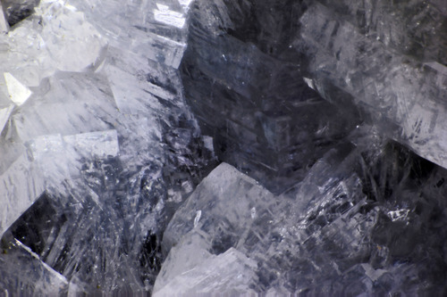
| Species: | Mordenite |
| Formula: | (Na2,Ca,K2)4(Al8Si40)O96 · 28H2O |
| Confirmation |
|---|
|
| Validity: | Believed Valid |
| Associated Minerals Based on Photo Data: |
|---|
|
| Heulandite Subgroup | ⓘ3 photos of Mordenite associated with Heulandite Subgroup at this locality. |
| Smectite Group | ⓘ1 photo of Mordenite associated with Smectite Group at this locality. |
| Data |
|---|
|
| Mineral Data: | Click here to view Mordenite data |
| Locality Data: | Click here to view Baird Creek Quarry, Wolf Point, Cowlitz County, Washington, USA |
| Photo Gallery | View Gallery (3 photos) |
| Data Identifiers |
|---|
|
| Mindat Occurrence Record ID: | 648259 |
| Long-form Identifier: | 1:3:648259:6 |
| GUID (UUID V4): | 0cce4979-fe2d-4c14-b194-08c87c2d4a66 |
| Nearest other occurrences of Mordenite |
|---|
|
|
| 1.7km (1.0 miles) | ⓘ200 / 237 Road Quarry, Wolf Point, Cowlitz County, Washington, USA |
| 29.6km (18.4 miles) | ⓘRoadcuts, Kalama area, Cowlitz County, Washington, USA |
| 30.7km (19.1 miles) | ⓘNeer Road, Goble, Columbia County, Oregon, USA |
| 35.1km (21.8 miles) | ⓘWoodland, Clark County, Washington, USA |
| 38.2km (23.7 miles) | ⓘRiffe Lake, Kosmos, Lewis County, Washington, USA |
| 39.3km (24.4 miles) | ⓘMossyrock Dam, Morton, Morton Mining District, Lewis County, Washington, USA |
| 39.4km (24.5 miles) | ⓘBig Tree Creek, Yacolt, Clark County, Washington, USA |
| 51.5km (32.0 miles) | ⓘClinton Knob, Ryderwood, Lewis County, Washington, USA |
| 55.5km (34.5 miles) | ⓘQuartz Creek Roadcut, Lewis River, Skamania County, Washington, USA |
| 65.0km (40.4 miles) | ⓘPoison Creek, Lewis River, Skamania County, Washington, USA |
| References |
|---|
|
|
| Reference Search (possible matching items) |
|---|
 | | Journal (issue) | | .......... VANCOUVER, WASHINGTON May 6, 2000 9:30 am to 6:30 pm Clark County P. U. D. Building 1200...1200 Fort Vancouver Way Vancouver, Washington Rudy will be back meeting with us, so bring your new zeolites...please plan to join us. Mill . Vancouver Way Washington Interstate Bridge Columbia River Oregon 2...SCOLECITE AND MESOLITE AT THE BAIRD CREEK QUARRY, WOLF POINT, COWLITZ COUNTY, WASHINGTON by Rudy W. Tschcmich...flow exposed in a quarry at the headwaters of Baird Creek, southeast of Wolf Point in the Mount Saint |  | | Journal (issue) | | . May 12,2001 . VANCOUVER, WASHINGTON 9:30 am to 6:30 pm Clark County P. U. D. Building 1200 }'ort...sympositun has been moved from Tacoma to Kelso. Washington and will remain there for at ieast the next three...the end of the meetings when we met in Raymond, Washington and stayed overnight. This tradition was carrier...informally by a pay-your-own dinner at the Old County Buffet by those who wish to attend. Any one wanting...discussed. A case deYoted to the Micro Minerals of Washington Pass will be considered. VV orking demonstrations |
|


Baird Creek Quarry, Wolf Point, Cowlitz County, Washington, USA