 | | Report (issue) |
| GEORGIA STATE DIVISION OF CONSERVATION DEPARTMENT OF MINES, MINING AND GEOLOGY GARLAND PEYTON, Director...Bulletin No. 61 GEOLOGY OF THE STONE MOUNTAIN-LITHONIA DISTRICT, GEORGIA By Leo Anthony Herrmann ATLANTA...4 LETTER OF TRANSMITTAL Department of Mines, Mining and Geology Atlanta, April 15, 1954 To His Excellency...herewith Georgia Geological Survey Bulletin No. 61, "Geology of the Stone MountainLithonia District, Georgia"...__________ . __________________ _ Location of the District .. _________ ·------------------------- __ _ Physiography |
 | | Journal (article/letter/editorial) |
| GEORGIA Downloaded by [University of Calgary] at 09:55 07 August 2017 MINERAL LOCALITY INDEX JENNINGS...JENNINGS B. GORDON, JR. P . O . Box 6214 Rome, Georgia 30162 Although perhaps best known for its gold, rutUe...rutUe, and staurolite (the state mineral), Georgia has, in fact, almost two hundred mineral species. ...have been reported and verified from the state of Georgia. The index has been compiled from the literature...be either a report on the economic geology of Georgia or a field guide for lapidaries, it excludes commercial |
 | | Report (edition) |
| ANNOTATED BIBLIOGRAPHY OF GEORGIA GEOLOGY FROM 1960 THROUGH 1964 by Howard Ross Cramer Emory University...Atlanta, Georgia STATE OF GEORGIA DEPARTMENT OF NATURAL RESOURCES Joe D. Tanner, Commissioner GEORGIA GEOLOGIC...1972) BULLETIN 84 ANNOTATED BIBLIOGRAPHY OF GEORGIA GEOLOGY FROM 1960 THROUGH 1964 by Howard Ross...Ross Cramer, Emory University, Atlanta, Georgia INTRODUCTION This bibliography is a continuation of, and...bibliography of Georgia geology through 1959, published by the Georgia Department of Mines, Mining and Geology |
 | | Report (edition) |
| GEOLOGICAL SURVEY OF OF GEORGIA GEORGIA GEORGIA DEPARTMENT OF MINES , MINING AND GEOLOGY OF MICHIGAN...ANNOTATED BIBLIOGRAPHY 101 OF A3 0 84 о .8 пo n GEORGIA GEOLOGY FROM 1960 THROUGH 1964 by Howard Ross...Geophysical studies Hydrology Economic geology Mining directory Environmental studies Engineering studies...as new subjects are published GEORGIA DEPARTMENT OF MINES , MINING AND GEOLOGY Jesse H. Auvil, Jr....Bulletin Number 84 ANNOTATED BIBLIOGRAPHY OF GEORGIA GEOLOGY FROM 1960 THROUGH 1964 by Howard Ross |
 | | Report (issue) |
| GEORGIA STATE DIVISION OF CONSERVATION DEPARTMENT OF MINES, MINING AND GEOLOGY A. S. FURCRON, Director...Governor of Georgia and Commissioner Ex-Officio State Division of Conservation Atlanta, Georgia Dear Governor...herewith Bulletin 80 of the Department of Mines, Mining and Geology entitled, "PaleozoicPrecambrian Appalachian...report contains a number of articles prepared by Georgia geologists and by some geologists working outside...Structure of an Area in the Vicinity of Adairsville, Georgia, by K. Spalvins -·-------·--------------·----- |
 | | Report (issue) |
| COVER PHOTO : Gold nugget from Dukes Creek, White County, weight 5 oz., 12 dwt., approx. 2x. BACK COVER...crystal from Graves Mountain, approx. 1.5x. Lower left - Goethite from Pulaski County, approx. lx. Right...Geophysical studies Hydrology Economic geology Mining directory Environmental studies Engineering studies... MINERALS OF GEORGIA: THEIR PROPERTIES AND OCCURRENCES by Robert B. Cook STATE OF GEORGIA DEPARTMENT OF........................................... 143 Muscovite ............................................. |
 | | Report (issue) |
| STATE GEORGIA DIVISION OF CONSERVATION DEPARTMENT OF MINES, MINING AND GEOLOGY A. S. Furcron, Director...Bulletin Number 79 ANNOTATED BIBLIOGRAPHY OF GEORGIA GEOLOGY THROUGH 1959 by Howard Ross Cramer, Arthur...University, Atlanta, Georgia ATLANTA 1967 LETTER OF TRANSMITTAL Department of Mines, Mining and Geology September...Governor of Georgia and Commissioner Ex-Officio State Division of Conservation Atlanta, Georgia 30334 Dear...Department of Mines, Mining and Geology entitled, "Annotated Bibliography of Georgia Geology Through 1959 |
 | | Report (issue) |
| GEORGIA STATE DIVISION OF CONSERVATION DEPARTMENT OF MINES, MINING AND GEOLOGY GARLAND PEYTON, Director...ARCHAEOLOGY OF GEORGIA (NUMBER II) ATLANTA 1953 LETTER OF TRANSMITTAL Department of Mines, Mining and Geology...Conservation Sir: I have the honor to submit herewith Georgia Geological Survey Bulletin No. 60, "Short Contributions...to the Geology, Geography, and Archaeology of Georgia". This report is published in response to many...earth science work in the University System of Georgia, Emory University, the State Geological Survey |
 | | Report (issue) |
| Uranium occurrences in non-seaimtntary rocks of Georgia ............. 12 Table 4 Uranium occurrences in...Uranium occurrences in non-sedimentary rocks of Georgia.......................................15 Figure...Mountains, Vermont. During the Jurassic, the1 White Mountain plutonic series of New England apparently was...deposit occurs as a thin seam in graphitic Cleburne County. The property is, about 11.2 SINE phyllite which...Average from Rock Springs Church, 1.6 km east of Stone 1969; Ui radioactivity is 5 to 7 times background |
 | | Report (volume) |
| STATES COMPILED BY SAMUEL SANFORD AND RALPH W. STONE WASHINGTON GOVERNMENT PRINTING OFFICE 1914 USEFUL...STATES. Compiled by SAMUEL SANFORD and RALPH W. STONE. INTRODUCTION. By EDWARD W. PARKEH. The final...it helpful to refer to Survey Bulletin 507, "The mining districts of the western United States," and to...abundant, it may have been completely exhausted by mining or quarrying. Deposits of minerals of wide distribution...because they occur in sufficient quantity to warrant mining for their usual products but because they furnish |
 | | Journal (article/letter/editorial) |
| post-metamorphic cooling of gneisses in the Inner Piedmont of Georgia, southern Appalachians O. van Breemen 1 and R.D...(Canada) 2 Department of Geoloyv. University of Georgia, Athens, GA 30602 (U.S.A.) Received April 4, 1983...cm in width) collected in quarries within the Georgia Inner Piedmont of the southern Appalachians indicate...with Rb-Sr and 4°Ar/39Ar mineral ages from this quarry, the 315 _+17 Ma isochron age is interpreted to...a contiguous suite from another Inner Piedmont quarry confirms a Paleozoic age for regional metamorphism |
 | | Report (issue) |
| BIBLIOGRAPHY OF GEORGIA GEOLOGY 1965 through 1970 by Howard Ross Cramer STATE OF GEORGIA DEPARTMENT OF...Director ATLANTA 1976 ANNOTATED BIBLIOGRAPHY OF GEORGIA GEOLOGY FROM 1965 through 1970. by Howard Ross...Bibliography of Georgia Geology through 1959 and the Annotated Bibliography of Georgia Geology, supplement...These were published as Bulletins 79 and 84 of the Georgia Geological Surve-y, This bibliography contains...Each article was read, annotated, and indexed by county, subject, and geological age where appliGable. |
 | | Report (volume) |
| STATES**-^ COMPILED BY FRANK C. SCHRADER, RALPH W. STONE AND SAMUEL SANFORD A revision of Bulletin 585 .......................................... 102 District of Columbia ................................................................................. Georgia..................................................STATES. Compiled by FRANK C. SCHRADER, EALPH W. STONE, and SAMUEL SANFORD. INTRODUCTION. The volumes...has led to the publication 1 Sanford, Samuel, and Stone, R. W., Useful minerals of the United States: U |
 | | Report (issue) |
| the GEORGIA DEPARTMENT OF MINES, MINING, AND GEOLOGY and STATE HIGHWAY DEPARTMENT OF GEORGIA CONTENTS...Atlanta water system ...................... 4 DeKalb County system ..................... 4 East Point water...Status of water table in Atlanta area........... 7 Wells..................................... 7 Effect of...water levels in pumped wells.................................. 7 Yield of wells ................................ 8 Depth of wells. ............................ 8 Spacing of wells ......................... |
 | | Book (volume) |
| Location Guide for Rock Hounds in the United States GEORGIA Georgia’s nearly 59,000 square miles makes it the...highest elevation in the state at 4,784 feet. 145 Georgia Beginning in the northwest, where the Lookout...mountains loom over rich agricultural valleys, Georgia easily divides into five major physiographic provinces...The first real Gold Rush in America occurred in Georgia following two simultaneous discoveries of Gold... some Ruby-red Corundum, Spodumene and Topaz. Georgia has been actively prospected for gold since colonial |
 | | Journal (article/letter/editorial) |
| left). Calcite, 5.5 cm high, Elmwood mine, Smith County. Terry Huizing specimen, Jeff Scovil photo. Figure...(above). Fluorite, 13.1 cm wide, Elmwood mine, Smith County. Francis Benjamin specimen, Jeff Scovil photo....Smith County. Terry Huizing specimen and photo. Figure 4 (right). Cumberland mine, Smith County. Travis... minerals, and mineral resources of the state. Mining has been an important part of Tennessee industry...not seem to filter down to the collector. Major mining districts that are mineralogically simple occur |
 | | Report (volume) |
| Argillite__________________________________________ Muscovite schist___________________________________ Qua..._ _ _ _ __ _________ __ __ __ __ ______ Kings Mountain belt _ _ __ __ __ ____ __ _________ __ ___ _____...Cherryville Quartz Monzonite_______________________ Muscovite pegmatite_______________________________ Unnamed...Whiteside Granite_________________________________ Muscovite-perthite pegmatite_______________________ Rocks...ages-Continued Age of specific rock units-Continued Muscovite-perthite pegmatite_______________________________ |
 | | Report (volume) |
| Massive Sulfide District 12 Coker Creek Gold District 13 Sweetwater Barite District and Other Locations...14 Central Tennessee Zinc-Lead-Barite-Fluorite District Iron 16 Manganese 16 Uranium 17 Aluminum 17 Industrial...to the central Blue Ridge at the North Carolina-Georgia border 10 5-7. Maps showing: 5. Major faults of...Tennessee district 15 9-11. Maps showing: 9. Industrial mineral localities, geologic units, and mining areas...10. Oil and gas fields and selected oil or gas wells or drill holes in the Chattanooga 1°X2° quadrangle |
 | | Journal (article/letter/editorial) |
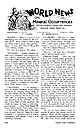
| senopyrite in Darien (Fairfield Co.), Levesque, Cross County, Arkansas. The Conn., for over a year. A few weeks...are chunks of galena and widely in the farming district south of quartz, and finally a solid vein of rich...material." — note from Thomas H. Webb, Linville, N.C. GEORGIA — "I am enclosing a specimen which I found here...A H O — "This specimen was found in Twin Falls County about 10 miles south of Hagerman, Idaho. These...and I visited a fairly new limestone quarry in eastern DeKalb County, 111. There were a few small fossils |
 | | Report (issue) |
| Alabama, University, Ala. Department of :ty.lines, Mining and Geology State Division of Conservation Atlanta...Jr ___________________________ _ Relationship of mining to other economic sectors, by Albert E. Schreck...Ocoee Series ________________ --- _---Grandfather Mountain Formation and Mount Rogers Volcanic Group ___...Manmade features _____________________ _ Strip mining ______________________ _ Subsidence ________________________...commodities-Continued Construction materials-Continued Crushed stone, by Robert G. Stansfield, George E. Fish, Jr., and |
 | | Report (volume) |
| MINERAL RESOURCES OF THE QUAKERTOWN-DOYLESTOWN DISTRICT PENNSYLVANIA AND NEW JERSEY BY F. BASCOM, E....system. _____-_--______--_--_---_-----_------__ Mountain wash_ ______-__________--_---_-__--.-__--__Alluvium...section of the rocks of the Quakertown-Doylestown district._ ___-___-_____-_-----_______-_---__-___________...Well-bedded shales of the Lockatong formation in quarry on Delaware River 1 mile west of Lumberville, Doylestown...resembling a pothole formed in hard diabase on Spring Mountain, Quakertown quadrangle._________ FIGURE 1. Index |
 | | Book (volume) |
| ..........................................122 Georgia .................................................rights, so remember you were told. If in doubt, a county map will tell you who the legal owner is. Good...gemmy qualities for cutting and polishing. AUTAUGA COUNTY PRATTVILLE, N. 6 mi., and just E of the Birmingham...were well known to prehistoric Indians.) BARBOUR COUNTY BAKER HILL, SE 1 mi. : 1 in a deep ravine, as a...deep red to variegated⎯ocher. BIBB COUNTY GENERAL AREA: c county gravel pits along the Cahaba R.⎯gemmy |
 | | Journal (article/letter/editorial) |
| areas: 1. southern New York Bedford pegmatite district—we can add here the small xenotime- or beryl-bearing...Cranberry Creek (Mayfield), Overlook, Corinth, and Wells; 3. east central Adirondack pegmatites at Crown...pegmatite in New York is at Bedford in Westchester County. Its complex zoning and mineralogy are approached...by the pegmatite at Batchellerville in Saratoga County. The McLear pegmatite in the St. Lawrence Lowlands... the mining started in 1875 on Kinkel’s farm, at the Kinkel quarry, followed by Hobby’s quarry, or Hobbey’s |
 | | Book (edition) |
| YEAR 1687"—DAVID T. DAY, CHIEF OF THE DIVISION OF MINING STATISTICS AND TECHNOLOGY WASHINGTON GOVERNMENT...and consump tion, or better and cheaper means of mining, extraction, and convey ance to market, may in...by Prof. John G. Smock, and that for the Eocky Mountain region by Mr. C. Whitman Cross. To these gentlemen...correspondence has been carried on with geologists, mining engineers, and other local authorities, and various...mmed at Broken Arrow aud Trout creek, in Sc. Clair county. The strata in this field are more faulted und |


