 | | Report (edition) | | GEOLOGICAL SURVEY 2045 MORSE RD., BLDG. C- 1 COLUMBUS, OHIO 43229-6693 (614) 265-6576 (614) 447-1918 (FAX)...L. Fox, MS, Seismologist Michael C. Hansen, PhD, Ohio Seismic Nelwork (OhioSeis) Coordinator An Equal... Minerals of Ohio by Ernest H. Carlson Bulletin 69 Second Edition STATE OF OHIO DEPARTMENT OF NATURAL...Inc., Auglaize quarry (formerly Stoneco, Inc.}, near Junction, Pau lding County, Ohio. Specimen is 3...citation: Carlson, E.H., 2015, Mineral s of Ohio (2d ed.): Columbus, Ohio Department of Natural Resources, Division | 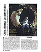 | | Journal (article/letter/editorial) | | that bring together important locality data for Ohio minerals. It is a contri bution to the national...the Findlay Arch (northwestern Ohio) and Serpent Mound (southwestern Ohio) districts (Carlson 1990); thisvone...fossil wood, Michael J. Kirwan Reservoir at mouth of Silver Creek near Edinburg, Portage County. Figure...septarium, Copperas Mountain near Spargursville, Ross County. Ernest Carlson photo. Figure 3. Map showing mineral...in a northerly trending belt that runs from the Ohio River to Lake Erie (Monroeville and Spargursville |  | | Journal (article/letter/editorial) | | OHIO MINERAL L CALITY INDEX Findlay rch and Serpent Mound Districts Although best known for Itsfluorite^apdcelestite...tite, northern Ohio also offers an array of other minerals, including superb calcite, strontianite, barite...Department of Geology Kent State University Kent, Ohio 44242 OHIO C A N BOAST O F several classic mineral localities...be found in museums around the world. Interest in Ohio minerals developed in the early 1800s with the discovery...famous Green (Strontian) Island site in Ottawa County (Douglass, 1820, 1821). Although Ohio's minerals |  | | Journal (article/letter/editorial) | | andIsotopicStudiesof the Findlay Arch District, Northwestern Ohio ElINEST H. CAP&SON Departmentof Geology,KentStateUniversity...Trenton Limestone and the Cambrian Knox Dolospreadin quarry exposures of carbonaterocksin mite (Stieglitz,1975;...m/km (lessthan 0.4ø) alongthe to determine if the Ohio sulfides are allied to ores of flanksof the arch...I I 200 KILOME'I•RS I FIG. 1. Tectonicmap of Ohio and adjoiningregionswith structurecontourson the...sphalerite/ sures 200 kin, east to west, and 175 kin, north to galenaratiosare 100 or higher,galenais alsoa |  | | Journal (article/letter/editorial) | | limestone has been quarried near Rockwood, Franklin Co., Ala. ARIZONA—Small purple amethyst xls with red...Red Cloud mine (about 30 miles N . of Yuma), Yuma Co., Ariz., have been received from Earl U. Mayer, 1733...are still to be found at the Saddle Mt, Maricopa Co., Ariz., location. The best of these compare favorably...the mountain, for 3 miles. The gravel road is a county road, usually fair except after heavy rains. At...of novaculite pebbles (gravel). Of course, both north and south coastal plains and streams thereto, have |  | | Report (issue) | | .......................................... 18 Calcite .................................................The most common minerals in these sediments are calcite, clay minerals, dolomite, glauconite, goethite...of geodes from Big Walnut Creek, Putnam County; and many quarry operators for granting us permission to...Indians knew of and used Wyandotte Cave in Crawford County (4).2 Ball (1941, p. 39) summarized the various...The Indians found that Wyandotte Cave, Crawford County, Ind., contained two desirable products, a jaspery |  | | Book (volume) | | Loudsville in White Co. and the other on the Bear Cr. near Dahlonega in Lumpkin Co. Not only was placer...4½ carats picked up near Morrow Station in Clayton Co. in 1887. Since then, many fine diamonds have been...northeastward through Dahlonega Co. and Rabum Co., and the McDuffie County Belt extending through portions...Sphalerite. BALDWIN COUNTY MILLEDGEVILLE, at state farmjasper. BANKS COUNTY COMMERCE, along Hwy. 59...Jackson-Banks Co. lineBeryl. MAYSVILLE, area gravels along adjoining Co. linerock crystal. BARROW COUNTY WINDER |  | | Report (issue) | | BEDROCK GEOLOGY AND MINERAL RESOURCES OF PUTNAM COUNTY, INDIANA Special Report 26 -- Special State... Bedrock Geology and Mineral Resources of Putnam County Indiana By JOHN R. HILL, MICHAEL C. MOORE, and...Page Map of Putnam County showing physiographic units .2 Map of Putnam County showing general distribution... .2 Map of Putnam County showing drainage network . . . . Map of Putnam County showing bedrock topography...topography .3 .4 7 Map of Putnam County showing unconsolidated deposits Map of Indiana showing the eastern |  | | Journal (article/letter/editorial) | | TERRY E . HUIZING 5341 Thrasher Drive Cincinnati, Ohio 45247 T H E M I N E R A L S O F I N D I A N A are...The most abundant minerals in these rocks are calcite, clay minerals, dolomite, glauconite, goethite...inclusions with pyrrhotite and other iron sulfides in calcite, barite, dolomite, and quartz in geodes. Other...RICHARD E . RUSSELL 7843 Montreal Court Cincinnati, Ohio 45211 but not described in this locality index...left): Calcite, twinned on {0221}, 4 cm across; Meshberger Stone, Inc. quarry, Bartholomew County. Richard |  | | Journal (issue) | | MOTORS CANTON, 5'2"x7" CORPORATION OHIO, U. S. A. AND OUR QUARRY BANK BOOK IS AT STAKE/ ei —UNLESS...for Producers and Manufacturers of Sand Gravel, Stone, Cement, Gypsum, Lime and Other Non-Metallic Minerals...FEATURE No. 9 CONTENTS Tenth Annual Crushed Stone Convention Reflects New Viewpoint In Industry. ...Cincinnati from January 17 Proervess In the Crushed Stone Tidus, A. T. Goldbeck, Director, Bureau ooo soc...National Crushed Stone Association, explains where future progress in the crushed stone industry will be |  | | Journal (article/letter/editorial) | | occurrences. These localities have been listed by county; and, strictly for convenience, the list has been...None theless, with the aid of a good state or county map, plus local inquiries, the list could be helpful...Wayne County International Salt C o . mine—Detroit Alpena County National G y p s u m C o . quarry (formerly...(formerly the Huron-Portland Ce ment Co. quarry)—Alpena barite, calcite, chalcopyrite (r), dolomite, marcasite...pyrite, sphalerite, strontianite (r) Paxton quarry—Paxton calcite, chalcopyrite, dolomite, marcasite, pyrite |  | | Book (volume) | | circumference by navigable waters, primarily the Ohio and Mississippi rivers. The highest elevations are...Wisconsin glaciation, the bluffs and detritus of the Ohio and Mississippi rivers, and in the southern Fluorspar...grading to 600 to 800 feet thick in the north. ALEXANDER COUNTY FAYVILLE, area stream gravels⎯agate, jasper...⎯agate, jasper; d RR siding of Clay⎯agate. CALHOUN COUNTY AREA, shores of the Mississippi R., in the Warsaw...crystals). CRAWFORD COUNTY PALESTINE, area deposits⎯Siderite. EDWARDS COUNTY AREA, T. 1 S, R. 10 E |  | | Book (volume) | | circumference by navigable waters, primarily the Ohio and Mississippi rivers. The highest elevations are...Wisconsin glaciation, the bluffs and detritus of the Ohio and Mississippi rivers, and in the southern Fluorspar...grading to 600 to 800 feet thick in the north. ALEXANDER COUNTY FAYVILLE, area stream gravels⎯agate, jasper...⎯agate, jasper; d RR siding of Clay⎯agate. CALHOUN COUNTY AREA, shores of the Mississippi R., in the Warsaw...crystals). CRAWFORD COUNTY PALESTINE, area deposits⎯Siderite. EDWARDS COUNTY AREA, T. 1 S, R. 10 E |  | | Report (issue) | | kiln was I mile northwest of Stinesville in Monroe County. The Lime Industry of Indiana By CURTIS H. AULT...lime kiln near Milltown , Crawford County, used by J. B. Speed & Co. from 1887 to about 1915 / 10 6 ... Modern rotary kilns at the Marblehead Lime Co. plant at Buffington near Gary / 11 7 Generalized columnar...Lithofacies (Wabash Formation) exposed in the Erie Stone Co. quarry at Huntington / 16 9 Abandoned vertical...used by the France Stone Co. , Logansport , from about 1900 to 1943 / 18 10 Abandoned quarry near Rabbitville |  | | Report (issue) | | ENVIRONMENTAL GEOLOGIC FACTORS AS AIDS TO PLANNING IN CASS COUNTY, INDIANA Special Report 22 State of Indiana Department...Environmental Geologic Factors as Aids to Planning in Cass County, Indiana By JOHN R. HILL ENVIRONMENTAL STUDY 16...formations on outcrop and beneath glacial drift in Cass County . . . . . . . . . . . . . . . . . . . . . . . ...Generalized bedrock stratigraphic column for Cass County . . . . . . . . . .3 3 Well log of bedrock units...topography of Cass County .7 7 Map showing distribution of unconsolidated deposits in Cass County .8 8 Map |  | | Journal (article/letter/editorial) | | Rosemeyer histori cal photo. May/June: Barite on calcite, Stoneham, Colorado; Brian Lees specimen, John...Westmoreland, New Hampshire; Resur rection Mining Co. specimen, Ronald E . Bentley photo. September/October:...and photo. November/December: Calcite, France Stone Co., Custar, Ohio; Neal Pfaff specimen, Terry E ...Minerals in Keweenawan Basalt, South Range Quarry, Douglas County, Wisconsin, W. S. Cordua, 412-415 Anatase...Colorado, 133, 143, 200-222; New Hampshire, 290, 334; Ohio, 512-540 Bartsch, J., see Collections and Displays |  | | Journal (article/letter/editorial) | | is considered to be a replaoement mineral after calcite or aragonite and the abundance of Sr in “secondary”...GARRELS, THOMPSON and SIEVER (1960) show that calcite and magnesite mixtures are unstable with respect...in addition to dolomite, primary and secondary calcite, authigenic and detrital clay minerals, minerals...dolomite were assembled from various localities in North America, Europe and Africa. Relying largely on petrographic...secondary origin, i.e. replaoing pre-existing calcite, and (2) the so-called “primary” dolostones which |  | | Report (issue) | | percent) of samples from the Russellville Stone Co. quarry, Putnam County, Ind -----------------32 7. Chemical...percent) of samples from the Ohio and Indiana Stone Co. quarry, Putnam County, Ind---------------------...samples from the Manhattan Crushed Stone Co. quarry, Putnam County, Ind ----------------- 34 9. Chemical...percent) of samples from the State Farm quarry, Putnam County, Ind ----------------------------- 35 10...percent) of samples from the Dunn Limestone Co. quarry, Owen County, Ind ------------- 36 11. Chemical and |  | | Journal (article/letter/editorial) | | ANNUAL ORIGIN IN CELESTITE CRYSTALS FROM CLAY CENTER, OHIO, AND IN OTHER MINERALS1 EnwrN Roolton, lJ. S. GeologicolSuraey...dolomite in the vicinity of CIay Center, Ottawa County, Ohio, (lat.41o 34'N.; long.83o 22'W.) are found in...fluorescent fluorite. Other associated minerals include calcite, aragonite, dolomite, strontianite, pyrite, marcasite...crystals from similar occurrencesto the north in Monroe County, Michigan, are associatedwith free sulfur...blade from the southeastwall of the Basic,Inc., quarry at Clay Center, about 15 m below top of bedrock |  | | Book | | whose thirty years of lapidary production of gem stone jewelry may be found in hundreds of West Coast collections...and Petrified Wood 131 Characteristics of Agates; Opal, Queen of the Gems; Petrified Wood; Commonly Occurring...Hampshire New Jersey New Mexico New York North Carolina North Dakota Ohio Oklahoma Oregon Pennsylvania Rhode...neanderthalensis ( men of the Old Stone Age) and Homo sapiens (men of the New Stone Age, our direct ancestors...Lake Rudolf area of Africa's Kenya found shaped stone implements radiologically dated from 2,160,000 years |  | | Report (issue) | | Central Clark County region ...................................... . Southern Harrison County region ......of samples from Bloomington Crushed Stone Co. quarry, Monroe County, Ind. . . . . . . . . . . . . . . ...samples from abandoned quarry of the Bloomington Crushed Stone Co., Monroe County, Ind. . . . . . . . ...percent) of samples from the Stinesville quarry section, Monroe County, Ind.... Chemical and spectrographic...percent) of samples from abandoned quarry of the France Stone Co., Owen County, Ind. . . . . . . . . . . . |  | | Book | | invertebrate animals, and plants—including petrified wood. Jay Ellis Ransom, geologist and author of The Rock-hunter’s...nWM@OLA-CARNEGIE PUBLIY Nature Collection a (ony BRARY CO FOSSILS IN AMERICA a Be sansa? ee eee eae...cessor. Not infrequently, when looking for gem stone or mineral float in the sedimentary detritus of...maps used by mining geologists, prospectors, gem-stone hunters, and rock collectors are based on outcrops...fossil-hunting localities, organized by state, county, township, section, or other landmark, together |  | | Book | | commercial ores and secondary minerals by state, county, township, and geologic range. For easy identification...cities, and many of today’s prosperous western county seats began as mining-boom camps. trating sand...Whether you such as those listed alphabetically by county, township, and range in Part II of this book. Where...maps. Yet, were you to risk a ruptured oil pan, a stone-bruised tire, or becoming stranded in deep sand...however small or short-lived, served as a stepping stone bridging a hostile frontier, helping to erase America’s |  | | Report (issue) | | Crushed Stone Resources of the Blue River Group (Mississippian) of Indiana BULLETIN 52 SCIENTIFIC AND...Head PAT GERTH, Sales and Records Clerk Crushed Stone Resources of the Blue River Group (Mississippian)...mine dust 45 Dimension limestone 46 Filter stone 51 Flux stone 52 Glass 52 Lime 53 Mineral wool 58 Neutralization...Literature cited 61 Appendix 1. Producers of crushed stone from the Blue River Group in Indiana 71 Appendix...with Ste. Genevieve limestone from the Mountain Quarry 49 Illustrations Figure 7 Tombstone carved from |  | | Journal (article/letter/editorial) | | SOCIETY OF AMERICA M ID D LE DEVONIAN BONE BEDS OF OHIO BY JOHN W . WELLS CONTENTS Abstract....................... Middle Devonian limestones of central Ohio and their bone beds.............................................................................. Ohio bone beds........................................................................................ Ohio bone bed localities...............................central Ohio............... 276 Outcrop of Middle Devonian limestone formations in central Ohio....... |
|


