 | | Journal (article/letter/editorial) | | Postcard view of the Waukon iron mine, Allamakee County, cia. 1912. John Taylor collection. ARTHUR E ...HAROLD L. PRlOR P.O. Box 111 Columbus Junction, Iowa 52738 halprior@ louisacomm.net When we began this...too, could be cited with many other localities. Iowa contains the type locality for one mineral, iowaite...December 2014 Figure 2. Map of Iowa showing the counties. Courtesy Iowa Geological Survey. ACKNOWLEDGMENTS...is courtesy of the Iowa Geological Survey. Localities by County Allamakee County Lansing, Lansing lead |  | | Journal (article/letter/editorial) | | Figure 1. The state of Iowa map; prepared by William Besse. IOW AITE Sioux County, Iowa BRUCE CAIRNCROSS ...1,000–1,500 feet below the surface in Sioux County, Iowa (Kohls and Rodda 1967); approximately thirty-five...of Johannesburg. Volume 93, May/June 2018 271 Iowa has 74 valid species (Mindat.org; accessed March...geodes from the Keokuk area in Lee County (Wherry 1918; Smith 1997; Huizing 2017). The Keokuk geode is also...also the official state rock for Iowa. Pint’s quarry in Black Hawk County has produced collectible, attractive |  | | Report (issue) | | I s { IOWA ft 7 ■■• A * i . ;» \ P* A 7-. ■ «*"V ' r * < •+ ' 1 ’ T, / • k’-/ 5...i S' s I . " * • * «r- ‘ ; ' Geologist, Iowa Geological Survey ' .*4** =»*' I Paul*J. Horick...Jithill * v'v* l* Iowa Geolo^ica^Survey Educational Series 2 V . - -■' ( J Iowa Geological Survey...Educational Series 2 THE MINERALS OF IOWA by Paul J. Horick Geologist Iowa Geological Survey edited by Otto...STATE OF IOWA 1974 Library of Congress Catalog Card Number: 74-620075 Available from the Iowa Geological |  | | Journal (article/letter/editorial) | | KEOKUK GEODE AREA OF IOWA AND MISSOURI By MURRAY KANE Route 2, Murray, Iowa I hope readers of R&M would...like some up-to-date information on the Keokuk geode area of Iowa and Missouri which I have recently visited...didn't visit the Illinois side. I'll describe the Iowa area first. We found geodes up the Skunk River as...west as Oakland Mills. At Denmark (in northern Lee County) I asked a filling station attendant if he knew...geodes were mostly calcite with some galena and gypsum. They are so flat that it is hard to tell a geode |  | | Journal (article/letter/editorial) | | once-in-a-lifetime opportunity,” exclaimed a collector from the Keokuk area who was working beside me splitting geodes...discusses the types of Keokuk geodes and their various inclusions found at two Lewis County, Missouri, sites...0 0 0 0 0 0 0 0 0 0 0 0 0 0 0 General History Keokuk geodes are so named because they are found in exposures...Formation that occur in a 70-mile radius around Keokuk, Iowa (Sinotte 1969). The geodes are understood to...debated. Sinotte presented his theory in The Fabulous Keokuk Geodes (1969), the most comprehensive study of | 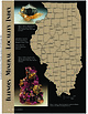 | | Journal (article/letter/editorial) | | Sphalerite and calcite, 5 cm across, Denton mine, Hardin County. Ross Lillie specimen. +!.+!+%% 34!2+ +./8 ...chalcopyrite, and sphalerite, 12.7 cm high, Hardin County. Marv Rausch specimen. 3(%,"9 -!#/50). /5 ....and barite, 6 cm high, Minerva No. 1 mine, Hardin County. Ross Lillie specimen. Figure 5 (above right).... Barite, 12.9 cm across, Denton mine, Hardin County. Ross Lillie specimen. Figure 6 (right). Fluorite...Fluorite, 1.9 cm on edge, Minerva No. 1 mine, Hardin County. Harris Precht specimen, Terry Huizing photo. Arthur |  | | Journal (article/letter/editorial) | | location a~ included at the end of each entry. Adair County Chariton River (40-04-05N 92-4 I -23W). septarian...septarian concretions about 2 miles north of the Macon county line. CALCITE crystals enclosing bundles of acicular...hematite, quartz (Broadhead 1873b, 1877). Audrain County Mexico, in fire clay pits and spoil piles: PYRITE...University Library] at 19:58 29 October 2014 Barton County McKarrow’s coal bank (37-37N 94-28W), 2.5 miles...PICKERINGITE, pyrite, siderite (Broadhead 1873b). Bates County Panther Creek, northwest of Rockville in coal deposits: |  | | Journal (article/letter/editorial) | | Figure 2. Keokuk geode (7 inches in longest dimension) from Mississippian strata in southeastern Iowa. The...(This photograph,used as the cover illustration on Iowa Geology [1994], was supplied by B. F. Glenister...courtesy Patricia Lohmann, the artist who designs the Iowa Geological Survey bulletins; photograph by Tim Kemmis)...Minerals recorded from geodes of the three-state Keokuk area. Minerals whose names have no symbol after...were collected by the author and his wife in Lee County, Iowa, in 1947, plus observations of definitive |  | | Report (chapter) | | shelf carbonates: Burlington and Keokuk Formations (Mississippian), Iowa and Illinois David C. Harris and...shelf carbonates: Burlington and Keokuk Formations (Mississippian), Iowa and Illinois David C. Harris &...Mississippian (Osagean) Burlington and Keokuk Formations in Iowa and Illinois has revealed a complex diagenetic...three generations of dolomite in the Burlington and Keokuk limestones. Petrographic and geochemical characteristics...III was derived mainly from precursor Burlington--Keokuk dolomites through replacement or pressure solution |  | | Journal (article/letter/editorial) | | still great without them. ROLLIN D. SALISBURY. Iowa Geological Survey. Vol. I. First Annual Report,...paper by Mr. Keyes, on the Geological Formations of Iowa, is a summary of present knowledge of the various...and the Cretaceous. Investigations in northwestern Iowa have brought to light the presence of undoubted...with sandstone and gravel, in a deep well at Hull, Iowa. The discovery by Culver and Hobbs of eruptive rock...given to the terranes includmany subdivisions. Keokuk and Burlington, in place of William's term the |  | | Journal (article/letter/editorial) | | the best known locality is in the region about Keokuk, Iowa; and almost every museum and large collection...of this region are found at cenain levels in the Keokuk limestone of the Mississippian series, that is...Mississippi River and its tributaries near Keokuk and at many places in Iowa, Illinois, Missouri and Indiana. The...often afford excellent places for collecting. The Keokuk limestone occurs typically in thick horizontal...geodes are calcite, aragonite, galena, sphalerite, gypsum, barite, ankerite, magnetite, chalcopyrite, pyrite |  | | Book | | eOQ000wolf 560.172 W855£ WOLF FV FOSSILS OF IOWA : FIELD TO PALEOZOIC DEPOSITS GUIDE 12.45 BK 560...560.172 PeUIDE TO PALEOZOIC DEPOSITS FOSSILS OF IOWA: FELD WOLF, ROBE 3000 ‘St. Louis Community College...collector specializing in Paleozoic fossils from Iowa and parts of Minnesota and Nebraska, including invertebrates...Society of Iowa. © 1983 Robert Charles Wolf. All rights reserved Composed and printed by The Iowa State University...University Press, Ames, Iowa 50010 No part of this book may be reproduced in any form—by photostat |  | | Journal (article/letter/editorial) | | road cut along old IN-37, near Harrodsburg, Monroe County, Indiana. Note the semispherical opening, lower...Kentucky, and the Warsaw Formation in Illinois, Iowa, and Missouri. Geodes occur primarily in limestones...commercial geode mine at St. Francisville, Clark County, Missouri. This specimen appeared on the dust jacket...quartz geode, from a locality near Revere, Clark County, Missouri. Cincinnati Museum Center specimen (No...from Sheffler’s geode mine, near Alexandria, Clark County, Missouri. Fred and Sue Keitel specimen, Terry |  | | Book (volume) | | Dahlonega Co. and Rabum Co., and the McDuffie County Belt extending through portions of McDuffie, Warren...Sphalerite. BALDWIN COUNTY MILLEDGEVILLE, at state farmjasper. BANKS COUNTY COMMERCE, along Hwy. 59...along adjoining Co. linerock crystal. BARROW COUNTY WINDER, along rd. to Jefferson and 1½ mi. inside...Guide for Rock Hounds in the United States BARTOW COUNTY AREA, Saltpeter Cave, as floatjasper. CARTERSVILLE:...agate, (banded, various colors), jasper. BIBB COUNTY MACON: at Holton Quarry, 7½ mi. NWagate; N |  | | Journal (article/letter/editorial) | | 00:11 06 November 2014 Eagle Mine, Cilman, Eagle County, Colorado W orld production of zinc is enormous...associated with blue fluorite, galena, and water-clear gypsum have been found in recent years in the Dolomite...of the BalmatEdwards district in Saint Lawrence County (Smith and Figure 1. A fine example of jet-black...in the zinc ores of the Franklin mines, Sussex County, New Jersey (Palache, 1937).Although approximately...Morgantown (twins to 2 cm) in Berks County; the Thomasville quarry, York County (bright green crystals to 4 cm); |  | | Journal (article/letter/editorial) | | confirmation of my guess as to the rock I found in Marion County, Florida. "I say it's jasper, flint and agate....From Idaho wilderness area near Stanley in Blaine County, Idaho. Some of these come in very large xls."...that were found in the Warsaw formation, Hancock County, Illinois. These were found in geodes embedded...location to collecting." IOWA — From an old quarry north of Keokuk (Lee Co.), Iowa, we have 2 rough and one...were sent in by Carl E. Krasuski, 1412 Iowa St.,, Burlington, Iowa. "This oolitic limestone is hard to find |  | | Journal (issue) | | eruptive rocks from the CCVF cover an area of Park County. approximately 8500 sq. mi. including most of the...field trip headed south from Hartsel on CO 9 and County 53 Rd and noted the Antero Formation of Oligocene...Hollister in 1867: This Park has salt springs, beds of gypsum, coal shales, veins of chalcedony, carnelian, and...further south to the club peridot claim located near County Rd. 53, The gemmy olivine comes from a rock unit..., L. A., Geology and Mineral Resources of Park County, Colorado: Colorado Geological Survey, Resource | 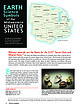 | | Journal (article/letter/editorial) | | symbol to promote outstanding aspects of their county or state. Many of these Earth science symbols will...from the Crater of Diamonds, Murfreesboro, Pike County, Arkansas; largest diamond 4.95 carats. Matilda...company, Hardin County, Illinois; 9.6 cm tall. Ross Lillie specimen, Jeff Scovil photo. IOWA State Rock:...Figure 4. A Keokuk quartz geode with sphalerite, from the Warsaw Formation, Keokuk, Iowa; 15 × 13-cm...such as this one from Middle Fork Creek, Estill County, Kentucky; 19.3 cm tall. Barbara and Gary Hansen |  | | Report (issue) | | . . . . . . . . . . . . . . . . . . . Nebraska-Iowa region, by Marvin P. Carlson......................Geological Survey and Water Resources J. W. Koenig Iowa Geological Survey M. C. Parker 1 2 PALEOTECTONIC...from large-scale geologic maps, such as State or County geologic maps. The outcrop patterns are necessarily...Northern Anthracite basin of Pennsylvania to Huron County (fig. 4) in north-central Ohio. The western side...State, undifferentiated Ordovician rocks. In Polk County, Ga., the Rockmart Slate of Ordovician age underlies |  | Lasemi, Zakaria, Norby, Rodney D., Devera, Joseph A., Fouke, Bruce W., Leetaru, Hannes E., Denny, F. Brett (1999) Middle Mississippian carbonates and siliciclastics in Western Illinois. Guidebook Series 31. Illinois State Geological Survey | Report (issue) | | from 5 Geophysical log 1 2 7 8 1) Genevieve County, Missouri Ste. 6 2 3 4 shoaling-upward cycles...Measured section of the Rock Creek outcrop in Monroe County, Illinois Location map of Casper Stolle Quarry...section for the Hickman Creek outcrop in St. Clair County, Illinois Location map of Alby Quarry (Stop 6)...western and southwestern Illinois, southeastern Iowa, and eastern Missouri. Rocks equivalent in age to...Road section, NE NE SW Sec. 13, T6N, R11W, Jersey County, Illinois, Elsah 7.5-minute quadrangle. (B) An |  | | Journal (article/letter/editorial) | | isotopes in the sulfate evaporites from southeastern Iowa, U.S.A." Indications of postdepositional change...aDepartment of Geological and Atmospheric Sciences, Iowa State University, Ames, IA 50011, U.S.A. bHarding...isotopes in the sulfate evaporites from southeastern Iowa. U.S.A.: Indications of postdepositional change...meters below the surface across much of southeastern Iowa. In addition, Mesozoic (Jurassic?) evaporites have...have been mined from thick beds in northcentral Iowa. This study reports stable isotope analyses performed | | | Report (issue) | | Eastern Interior basin to the west and the central Iowa basin to the northwest, indicating that these basins...---.1_ _.-- --- ~ CH .. L' _____ ------~' IOWA DO ' l _ __ _ I: ' ' ,... ANCESTRAL I ...Saverton Shale in lllinois and its equivalents in Iowa which probably had a source to the north (Collinson...beginning of interval A time. Only in southeastern Iowa and in the Ouachita Mountains area of Arkansas does...B eventually covered all the State. Southeastern Iowa also was emergent prior to deposition of interval |  | | Journal (issue) | | MINERALS How to Become A LAPIDARIST WHAT ARE KEOKUK GEODES? Discover their Hidden Treasures ROCK&GEM... 2 VOL. 52 NO. 05 • MAY 2022 14 WHAT IS A KEOKUK GEODE? 52 THE ROLE OF ROCKS AND MINERALS IN PLANT...ON THE COVER Large pink calcite crystals in this Keokuk geode are highly desired by collectors. Photo by...editor, I met Richard Gross and featured one of his Keokuk geodes in our Parting Shot. He and I reminisced...Keokuks would be just the ticket. I’ve never been to Keokuk for the formal festival that Richard describes |  | | Book (edition) | | NORTH DAKOTA • OHIO • MICHIGAN • NEBRASKA • IOWA WISCONSIN Digitized by the Internet Archive in... includes SOUTH DAKOTA • MICHIGAN • ILLINOIS • IOWA WISCONSIN • OHIO • KANSAS • NORTH DAKOTA NEBRASKA...46 Michigan 50 Missouri 53 j- Kansas 5Q Iowa 60 - Illinois Minerals of Illinois 69 72... June Zeitner holds a fine Targe agate from the Iowa gravel deposits. ally — sented here. many who... and in the Northwestern South Dakota Harding County in the northwestern corner of the state has several |  | | Journal (article/letter/editorial) | | 1906 NOTES ON THE GEOLOGICAL SECTION OF IOWA SAMUEL CALVIN Iowa City, Ia. The columnar section is not...Wisconsin is equally certain. The 25 feet exposed in Iowa is only a small part of the thickness of this formation...contact with the Algonkian quartzites is not seen in Iowa; a thickness of fully 700 feet of this formation...or Potsdam series, in the geological reports of Iowa and Wisconsin. The special formation name, St. Croix...XIV, No. 7 571 572 SAMUEL CALVIN SECTION OF IOWA NOTES ON THE GEOLOGICAL 573 nesian of Owen into |
|


