 | | Book |
| known in 1887 as the Yale Farm, about two miles northeast of the town of Litchfield, where a mass of white...a few such specimens have been found after 1960 (see the Amity-Edenville entry for Edenite and Spine!)...Mount Malosa, Chilwa alkaline province, Zomba district. "Illite" is the name of a series of incompletely...to 2 cm which are pseudomorphs after bastnasite--see photo in Guastoni, Pezzotta and Zorzi (2008). ILMENITE...euhedral, pale tan to white rnicrocline crystals-see photos in Dupuis and David (2013). ffighway 5 extension |
 | | Journal (article/letter/editorial) |
| Another 60 miles south, the writer studied a district near the southern end of the Taconic Range but...proposed. Dale (1893, p. 324-325) thought he could see a general synclinal structure in the Rensselaer graywacke...undisturbed. Loc. 2. Small rise 1240', % mile northeast of the northeast corner of Babcock Lake (Grafton quadrangle)...graywacke layers strike northeast as does the slate in the lowland northeast of the scarp. This involves...fault is assumed to cut across this plate on the northeast side, it requires a vertical component of several |
 | | Report (issue) |
| varies from 8 to 12 feet. Perfumo Canyon has a northeast-southwest direction where the iron-ore bed crosses...strike of the bed. Perhaps several 'hundred feet northeast of the ore bed lies the contact of the Franciscan...Mother Lode district, in the western foothills of the Sierra Nevada. About 50 or 60 miles northeast is the...ores are known in Calaveras County, 1£ miles northeast of Valley Springs, half a mile north of Esmeralda...much fractured and brecciated along the canyon slope above the limestone, and in some of these fractures |
 | | Report (issue) |
| Ore Deposits of the· Kokomo-Tenmile District, Colorado By M. H. BERGENDAHL and A. H. KOSCHMANN . I...osquito fault ____________________________ _ Northeast-trending faults ___________________ _ Northwest-trending...Page PLATE 1. Geologic map of Kokomo-Tenmile district------------------------------------------------------...pocket FIGURE 1. Index map of Kokomo-Tenmile district ___________________________________________________________..._ 14. Map of Kokomo-Tenmile district showing areas of garnet and epidote alteration ________________________ |
 | | Report (issue) |
| THE COPPER DEPOSITS OF THE CLIFTON-MORENCI DISTRICT, ARIZONA BY w-ALDEMAR LINDGREN WASHINGTON GOVERNMENT.... _..................................... 10!1 Epidote . . . . . . . . . . . . . . . . . . . . . . . ..._. __ . . . . . . • • . 176 177 177 177 177 Epidote ......... _..... ____ ............ _..•..... _..... _. __ ... _.. _.......... _. __ ... __ West slope of Modoc Mountain _.... ____ . __ .. ____ ... _...................... __ •. _ 303 IX. METCALF DISTRICT - - - - --.- - - - - -- - - - - •. -.---- •• - |
 | | Report (issue) |
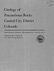
| Geology of Precambrian Rocks Central City District Colorado GEOLOGICAL SURVEY PROFESSIONAL PAPER 474-C...Commission Geology of Precambrian Rocks Central City District Colorado By P. K. SIMS and D. J. GABLE SHORTER...1918Geology of Precambrian rocks, Central City district, Colorado, by P. K. Sims and D. J. Gable. Washington...1918Geology of Precambrian rocks, Central City district, Colorado. 1964. (Card2) 1. Geology, Stratigraphic...Central City district, Gilpin County, Colorado. 2. Geologic sections of the Central City district, Gilpin |
 | | Journal (article/letter/editorial) |
| are also preserved in places along the southeast slope of the Blue Eidge and at several points in the vicinity...the central core of igneous rocks. The southeast slope merges into the Piedmont Plateau, along which, in...Keith’s description of one of the varieties follows: 2 See a reprint of annual reports and other papers on the...Madison counties, more than 100 miles to the northeast, and to similar syenites of Norway. In 1913, Watson...of the hypersthene syenite occurring on the west slope of the Blue Ridge farther southwest in Roa noke |
 | | Report (issue) |
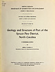
| Geology and Structure of Part of the Spruce Pine District, North Carolina A PROGRESS REPORT BY JOHN M....Geology and Structure of Part of the Spruce Pine District, North Carolina A PROGRESS REPORT By M. PARKER..."Geology and Structure of Part of the Spruce Pine District, North Carolina."' This Bulletin is another in...covers a part of the most important pegmatite district in the United States, It is believed that the...Introduction Location of district History Summary of investigations in the district Scope of present report |
 | | Report (issue) |
| No. 61 GEOLOGY OF THE STONE MOUNTAIN-LITHONIA DISTRICT, GEORGIA By Leo Anthony Herrmann ATLANTA 1 9...No. 61, "Geology of the Stone MountainLithonia District, Georgia". This report was prepared by Dr. Leo...__________ . __________________ _ Location of the District .. _________ ·------------------------- __ _ Physiography...and Structure of the Stone Mountain- Lithonia District, Georgia ____________________________________...Lineation map of the Stone Mountain- Lithonia District, Georgia --------------------------------------------------In |
 | | Report (volume) |
| _________--____-_---_-------___-_--------_----_______ Ajo district.-_--_.____---------______--_-_--__---_______ Oatman...____________________________________________________ 11 Austria._____________________________________________________...______--__-__---_____----_____-__-___-___________ Bonanza district._________________________________________ Breckenridge...region___________________________________________ Spanish Peaks district.____________________________________ Summitville...________________________________________ Edwardsburg district._____________________________________ 11 11 12 |
 | | Report (issue) |
| GEOLOGY -AND ORE DEPOSITS OF THE MAGDALENA MINING DISTRICT, NEW MEXICO BY G. F. LOUGHLIN AND A. H. KOSCHMANN...fault----~------Grand Ledge fault______________ East Slope fault_ _ _ __ __ __ __ _ _ _ _ _ Waldo ·fault_ ________________...____________ __ ______________ Minerals of the Magdalena district, by S. G. Lasky and G. F. Loughlin_______ _______...deposits-Continued. Minerals of the Magdalena district-Continued. Copper minerals-Continued. Oxidized...________________ _ Garnet _______________________________ _ Epidote ________________ -'·· _________ ~ __ _ Serpentine |
 | | Report (issue) |
| Geology and Ore Deposits of the Zimapan Mining District, State of Hidalgo Mexico By FRANK S. SIMONS and...______________________________ Minerals of the Zimapan mining district Hypogene ore minerals. _______________ Silver...trails in the Zimapan district. 2. Geologic map and sections, Zimapdn district. 3. Longitudinal projection...stopes, Lomo de Toro mine. 7. Formations in Zimapan district. 8. Views of Tertiary El Morro fanglomerate and...Index map showing location of Zimapdn . mining district, State of Hidalgo, Mexico. _ 2. Columnar stratigraphic |
 | | Report (issue) |
| in City District, Sugene Mountains, Pershing County, Nevada ^ ABSTRACT The ^111 City district is situated... arshlng County, Mavada. For 25 /ears this district has been one of the leading domestic producers...granodiorite and hornblende andesite. In the tungsten district the sedimentary rocks have been metamorphosed... and all mining and milling operations in the district are con* ducted by this company* The geology of... INTRODUCTIGH Location The Mill City tungsten district is situated on the east flank of the Eugene Mountains |
 | | Report (issue) |
| SURVEY Some copper deposits in the Old Hat aiining district, PI IP a County, Arizona P. Peterson S. C. Creasey...ii Some coprer deposits in the Old Hat mining district, Piira County, Arizona. Introduction Trom August...Interior, studied a part of the Old Hat mining district, in the Santa Otalina Vonntains, Arizona. The...north-northeast of Tucson, in T. 11 S, , R 16 E., Gila and Salt River meridian, in the northeast corner...Geesmpn rr»ine is the only active mine in the district at the present tirr>e. It is operating with a |
 | | Book |
| detailed review of th e Minerals of California series, see I. Campbell, 1966, pp. 13-19.) For over 100 years...of the diverse character of the state’s eleven (See Map 1-1). mineral species, plus 5 species found...than one form, polymorph with A primary mineral see different forms that are due to more than one ...mineral zoisite or epidote. mineral formed later than the rock enclosing it; see pri- mary mineral...by partially developed faces; see anhedral, euhedral. supergene A see syngenetic tactite mineral |
| | Book |
| detailed review of the .Minerals of California series, see I. Campbell, 1966, pp. 13-19.) For over 100 years...character of the state's eleven geomorphic provinces (See Map 1-1). From the lake-bed deposits of the Basin...formed at the same time as the rock enclosing it; see secondary mineral. pseudomorph A mineral with an...zoisite or epidote. secondary mineral A mineral farmed, later than the rock enclosing it; see primary mineral...subhedral Characterized by partially developed faces; see anhedral, euhedral. supergene A mineral deposit or |
 | | Journal (article/letter/editorial) |
| BULL. GEOL. SOC. AM., VOL. 49 I2Q-W 120!.I o' LEG EN D GEOLOGIC MAP CHELAN DISTRICT, WASHINGTON alluvium...l20°oo' 120 (o’ GEOLOGIC M A P OF C H E L A N DISTRICT, W A S H I N G T O N C o r b a l e y C a n y...Plate ' Facing page 1. Geologic Map of Chelan District, Washington.....................................distribution, but small size, suggests that in this district the roof of the batholith was not far above the...flo w bands M atrix of contact breccia, south slope of Chelan B utte. ROCK SU RFA CES ALONG B O R D |
 | | Journal (article/letter/editorial) |
| international boundary at a point about 1J miles northeast of Richford. The area includes a large part of... Often amygdaloidal. In places large knots of epidote occur. STRATIGRAPHY conformably underlie the...Lower Cambrian hyolithid was found on the western slope of Bald Hill in Westford Township, Milton quadrangle...of the southern end of Brome Lake and 15 miles northeast of Pinnacle Mountain (Fig. 1). The schist is typically...coarse-textured, with the larger grains of magnetite, epidote, and actinolite barely visible to the naked eye |
 | | Report (volume) |
| die out to the southeast. Many minor east- and northeast-striking faults connect the main faults. Most...Springs-Ralston shear zone the eastern part of a narrow northeast-trending shear zone that extends about 150 miles...area of Precambrian rocks, where they occur, in northeast-trending bodies several hundred feet wide, interlayered...the area of Precambrian rocks, where it forms a northeast-trending layer that lies between the quartzite...minerals are opaque minerals, zircon, apatite, epidote, and sphene. TABLE 2. Modes (volume percent) of |
 | | Report (volume) |
| district_-_____-_-___-__ In pocket. 2. Geologic map of the Hyder district ____________________ In pocket. 3. Generalized...international boundary, was much public interest in the district aroused. To meet the call for information as to...geologist, in 1920 spent a month in field work in the district and prepared a report of his observations, which...no definite prediction as to the future of the district could be made. Enough information was obtained...southeastern Alaska, was assigned to study the district. The results of Mr. Buddington's studies, as well |
 | | Report (issue) |
| .......... Bedding-plane faults of the Eureka district Interpretation of original conditions along the...deposits................ Deposits of the Sylvanite district......................... ' Types of deposits....structural features............ Deposits of the Eureka district .............................. Types of deposits......................................... Eureka district...................'.........................,...................................... Sylvanite district.............................................. |
 | | Journal (article/letter/editorial) |
| acquired a large amount of information concerning the district across the central part of the range from Sacramento...the two narrow belts of Jura-Trias, on the west slope of the range, are the Mariposa beds; the JuraTrias...free quartz, as in the rocks of the Gopher Ridge. (See Jackson geologic folio.) The amphibolitic schists...is so obscured by secondary minerals (uralite, epidote, chlorite, zoisite and calcite) that it is little...foothills of Eldorado, Amador, and Calaveras counties (see Placerville and Jackson folios) there is a narrow |
 | | Journal (article/letter/editorial) |
| consist of two well-defined parts. There is a northeast-southwest ridge, about six miles in length, extending...of steps to its southern extremity. The eastern slope of this ridge above the foothills is quite The western...the central part of the western slope of the ridge. The northwest slope of this peak is gentle; the west...much steeper; while the northeast slope meets the northern half of the western slope of the ridge forming...graphite in fine scales. In the middle of the northeast slope this Schist is destitute of fibrolite and pseudomorphs |
 | | Report (volume) |
| Geology and ore deposits of the Shafter mining district, Presidio County, Tex., by Clyde P. Ross _______...mineralization caused widespread deposition of epidote and chlorite, accompanied locally by garnet, magnetite...Creek came from mineralized areas of the Alma district, west of the area. In these valleys also glaciation...large increase in gold production from the Alma district has greatly stimulated interest in territory immediately... * Muilenburg, G. A., Geology of the Tarryall district, Park, County, Colo.: Colorado Geol. Survey Bull |
 | | Report (issue) |
| from references to the geographic term ''Mining District," especially in the pre-1920 literature. Widespread...new silicate minerals ( Agrell, Brown, and McKie Am. Mineral. 50, : p. 278). Hand in hand with the...imagine what Professor Blake might think if he could see the trends in commercial minerals that have developed...are making California 's mineral empire " as we see it in this current volume and as it was portrayed... which was mined by aboriginal tribes in the northeast corner of San Bernardino County in prehistoric |


