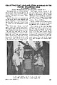
 | | Journal (article/letter/editorial) | | COLLECTING ZINC, LEAD AND OTHER MINERALS IN THE PICHER, OKLAHOMA AREA By GARDINER E. GREGORY Director: The...states. We enjoyed excellent collecting in the Picher, Oklahoma ar~a. . My wI~e Anne and 1 were accompanied...trailer, and the Romalewski' s tented out. The Picher area contains a zinc-lead deposit, which also extends...drilling near Commerce, Oklahoma. By 1916 large scale operations existed in the Picher Field. The decline or...meteoric rise of the Picher Field. The largest mining company in the area is the Eagle-Picher Corporation, who |  | | Journal (article/letter/editorial) | | figure 2 (leftI: Galena. Crawford mine, Pirher, Oklahoma, Tri-State district; 6' 2 cm across; Harvard Mineralogical...of the 1970s. The last remaining operator, Eagle-Picher Indus tries, closed the Bear Hole mine in February...of the Crescent Formation, Robertson Pit, Mason County, Washington" (January/February 1988). From 1961...open Figure 10: Shullsburg mine and mill, Eagle-Picher Co., Shullsburg, Wisconsin, Upper Mississippi Valley...after calcite), hydrozincite, hernimorphite, goslarite, and the clay minerals sauconite and zincian montmorillonite |  | | Journal (issue) | | The Tri-State Mining District Missouri-Kansas-Oklahoma by Denise Bicknell Wendell E. Wilson 2017 The...Tucson USA Visit us at these international shows: Houston Ste. Marie Denver Munich USA France USA Germany...and Riverpark Inn Rhodochrosite, Sweet Home Mine, USA, 10 cm Photo: Malte Sickinger MARCUS BUDIL Monaco... The Tri-State Mining District Missouri-Kansas-Oklahoma Denise Bicknell 16711 East Whimbrel Circle Conroe...settled Tri-State area of Missouri, Kansas, and Oklahoma suspected the world of wealth that lay just beneath |  | | Journal (article/letter/editorial) | | Houston, Texas 77036 ROBERT 0. FAY Oklahoma Geological Survey Norman, Oklahoma 73019 Downloaded by [The Aga...713 15th Street NW Ardmore, Oklahoma 73401 OKLAHOMA Figure 1. Oklahoma counties. Mineral Locality...known for its gypsum crystals and barite roses, Oklahoma also boasts a variety of other species, including...unaware of the variety of minerals available from Oklahoma and think primarily of the prolific gypsum crystals...hundred years, extends into the northeast corner of Oklahoma and has produced notable specimens. Unfortunately |  | | Report (issue) | | Geology and Ore Deposits of the Picher Field Oklahoma and Kansas GEOLOGICAL SURVEY PROFESSIONAL PAPER... 588 Geology and Ore Deposits of the Picher Field Oklahoma and Kansas By EDWIN T. McKNIGHT and RICHARD...towns and mine workings in the main part of the Picher field. Geologic map of the Wyandotte quadrangle. Isopach...bed and approximate west limit of L bed in the Picher field. Sections and correlation of the Moccasin Bend...and dolomitized areas in part of the Picher zinc-lead field, Oklahoma and Kansas: 5. Northwest sheet. 6 |  | | Journal (article/letter/editorial) | | the world. These are the Tri-State district of Oklahoma, Kansas, and Missouri and the world-class Viburnum...from southwestern Missouri through Kansas into Oklahoma (fig. l), was one of the primary zinc-producing...titled “Minerals of the Vanadinite Mine, Mohave County, Arizona.” 400 ROCKS 81 MINERALS rized in Lasnianis...Mining did not start in Kansas until 1877 and in Oklahoma until 1891. In 1853 lead mining began at Granby...the Granby Mining and Smelting Company. In Jasper County, a large lead deposit was discovered by J. B. Sargent |
|


