 | | Journal (article/letter/editorial) | | 55.2012.1.4 Paleovolcanic reconstruction in the Tokaj Mountains Tibor Zelenka Pál Gyarmati Institute...Institute of Hungary, Budapest János Kiss Eötvös Loránd Geophysical Institute of Hungary, Budapest The...The Tokaj Mts, situated in the northeastern part of the inner arc of the Carpathians, forms a part of...prospective occurrences of the mineral resources of the Tokaj Mts: andesite, dacite, welded zeolitic tuff, K-metasomatite...Miskolc-Egyetemváros, Hungary, e-mail: tibor.zelenka@gmail.com P. Gyarmati: H-1143 Budapest, Stefánia út 14, Hungary J. |  | | Journal (volume) | | Elemér Pál-Molnár University of Szeged, Szeged, Hungary E-mail: palm@geo.u-szeged.hu Guest Editor Máté...Szeged, Hungary E-mail: csato.szilvia@geo.u-szeged.hu Editorial Address H-6722 Szeged, Hungary 2 Egyetem...Geochemistry and Petrology, University of Szeged, Szeged, Hungary © Department of Mineralogy, Geochemistry and Petrology...of Szeged On the cover: Kollerite, Pécs-Vasas, Hungary. Width of the picture: 5 mm. Collection and photo:...Sciences in the Carpathians Conference Miskolc, Hungary, May 13-14, 2021 ABSTRACTS Edited by Máté Zs | 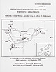 | | Report (volume) | | 65 Epithermal Mineralization of the Tokaj Mtns., Northeast Hungary: Shallow Levels of Low-Sulfidation...Mineralization of the Matra Mountains, Northeast Hungary iGaiter, F Moinar,,.J. Poldessy, 1 zZelenka, J... oh tee seareae 203 The Banska Stiavnica Ore District: Relationship between Metallogenetic Processes...several mining districts in the Oas-Gutai Mtns., Tokaj Mtns., B6érzsény Mins. etc.). All of these deposits...on three regions: the Tokaj Mins. and the Matra Mtns. in northeastern Hungary and the Central Slovakia |  | | Book (volume) | | in-plane (ν1) and out-of-plane (ν2) vibrations of calcite- and dolomite-group carbonates (Ca,Mn,Mg,Fe) (CO3)...CaCO3. The figures correspond to the areas of calcite (1), rhodochrosite (2), siderite (3), magnesite...distribution densities for samples of Fe-bearing calcite with the formulae (a) Ca0.92Fe0.08(CO3) and (b)...abbreviations are used in this chapter: Mt. mountain Co. county IR infrared D density Dmeas measured density Dcalc... Pegmatite Field, Andrembesoa Commune, Betafo District, Vakinankaratra Region, Antananarivo Province |
|


