 | | Report (issue) | | POTENTIAL OF CARBONATE ROCKS IN THE SAN BERNARDINO NATIONAL FOREST, CALIFORNIA SUMMARY PAMPHLET TO ACCOMPANY...Government. 1 U.S. Geological Survey, Menlo Park, California, 2 U.S. Geological Survey, Tucson, Arizona, and...Cement Corporation, Lucerne Valley, California. 1995 ABSTRACT Outcrops of limestone and(or) dolomite...marble are present throughout the San Bernardino National Forest, California. Where possible, these Precambrian...the Nopah Formation, the Sultan Limestone, the Monte Cristo Limestone, and the Bird Spring Formation. |  | | Report (volume) | | specimens. Some mineral aggregates, as clay, granite, limestone, sand, and sandstone, are included, because they...H. Purdue, Nashville, Tenn. California........Mr. William H. Storms, San Francisco. Prof. A. F. Rogers...Henry Landes, Seattle. West Virginia... .Dr. I. C. White, Morgantown. Wisconsin.........Prof. W. 0. Hotchkiss...See Bauxite and Hallpysite. Asbestos. Tallapoosa County, with corundum deposits near Dudleyville; not found...commercial quantity or quality. Asphalt. Colbert County, small quantity has been shipped from near Leighton; |  | | Report (volume) | | ............................................ California....................................................................................... 102 District of Columbia ....................................Some mineral aggregates, such as clay, granite, limestone, sand, and sandstone, are included because they...mineralogic reports, especially from those of Arkansas, California, Colorado, New Mexico, Oregon, South Dakota,...Bulletin, 1912. Eakle, A. S., Minerals of California: California State Min. Bur. Bull. 67, 1914. George | 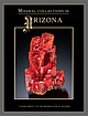 | | Journal (issue) | | Vanadinite 3.4 cm, from the North Geronimo mine, La Paz County, Arizona. Dick Morris collection; Jeff Scovil photo...graders at the Copper Creek Elementary School in Oro Valley, spearheaded a campaign in 2014 to propose exactly...to my Representative, Mark Finchem (R-District 11, Oro Valley), asking him to be the primary sponsor...cm, from the Defiance mine near Gleeson, Cochise County, Arizona. Ken Donn photo. 6 Supplement to The...Candee Gold, 2.3 cm, from the Breckenridge district, Summit County, Colorado. Ken Donn photo. Wulfenite (hot-pink) |  | | Report (issue) | | is shown in PI. III. The Butte, Mont., copper district is the greatest silver-producing camp of the entire... Although similar disseminations of glance and pyrite in altered granite alongside of and between the...milling ores used is increasing each year. The California ores, like those of Ducktown, Tenn., are basic...at Ducktown, Tenn., and at the mines of Shasta County, Cal., while the smelting ores of Butte are well-known...been made to treat such ores, particularly in the San Pedro mines in New Mexico, success has not been attained |  | | Report (volume) | | Creek Formation and the Upper Mississippian White Knob Limestone. The Mackay mineralized area includes polymetallic...Mountain Section, Geological Society of America, Sun Valley, Idaho (Link and Hackett, 1988), and on December...Hill and Warm Springs mining districts, Blaine County, Idaho: Idaho Bureau of Mines and Geology Pamphlet...Deposits in the Lake Creek Mineralized Area, Blaine County, South-Central Idaho By Bradford R. Burton and...Mineral Deposits in the Washington Basin Area, Custer County, South-Central Idaho By J. Brian Mahoney H. Mineral |  | | Report (issue) | | I°x2° quadrangle and ore deposits of the Atlanta district, Idaho .................... Snee, L.W. , and Kunk...Link, P.K., Lake Creek mineralized area, Blaine County, Idaho ...................... Doyle, M.A., Geology...Geology and ore deposits of Garfield Canyon, Blaine County, Idaho ...................... Mahoney, J.B., Geology...mineral deposits of the Washington Basin area, Custer County, Idaho ................ Mahoney, J.B., and Horn...Geology and mineral deposits of the Vienna mining district, Blaine and Camas Counties, Idaho .... 1 3 17 |  | | Report (issue) | | section on Paleontology, by Joseph Lintz, Jr. CC. California, Oregon, and Washington, by Richard B. Saul,...·-------------------------------------------------------CC. California, Oregon, and Washington, by Richard B. Saul,...from Lee County in the southeast corner of the State northwestward to southeastern Kossuth County in north-central...of Mississippian rock units are found along the valley of the Mississippi River from southeastern Iowa...of formations farther south in the Mississippi Valley that are thicker and more uniform in lithology |  | | Report (issue) | | and Geophysics, Boise State University Craig M. White ....................................... Director...South-Central Idaho: A Field Guide to the Lost River, White Knob, Pioneer, Boulder, and Smoky Mountains 5 Paul...Stratigaphy and Structure of the Milligen Formation, Sun Valley Area, Idaho 1.53 Robert J. W. Turner and Bruce...Carrietown Counties, Idaho Silver-Lead-Zinc District, Blaine and Camas Robert S. Darling Vii 193...Fart A. Glacial Deposits of the Big Wood River Valley 203 Suzanne Pearce, Gunnar Schlieder, and Edward |  | | Report (issue) | | 10- - 14 32 ** . 11 39 12 42 % White Knob Limestone 13 ----- 42 *. 14 Age and paleontology...mining district I5~ - -- Copper Basin mining district --- 16 Little Wood River mining district - -... Tables Table 1. Chemical analyses of White Knob Limestone from near Mackay -- 5- 2. . . 45 ...Dolomite, Grand View Dolomite, and Three Forks 5 (Limestone, all of Devonian age, are the oldest rocks exposed...widespread; they are represented by the White Knob Limestone in the ! 12 |eastern part of the quadrangle |  | | Book (edition) | | criticising the manuscript. Thanks are due to Dr. David White of the Geological Survey, for criticising the data...anthracite region 10. Structure section in Tazewell County, east of Richlands, southwest 8. 9. 12. 13. ...house and tipple, bituminous coal mine, Spring Valley, 111 Northern Interior coal field Composite section...showing distribution of oil fields 103 Map of California oil fields and pipe lines North-south section...structure of western field of Los 104 Angeles district 106 Section of Spindle Top oil field near Beaumont |  | | Journal (article/letter/editorial) | | Two Point claim, Pikes Peak batholith, Teller County. The Collector’s Edge specimen, Jeff Scovil photo...Park 6. Devils Head 7. South Platte pegmatite district 8. Mount Antero 9. Ruby Mountain 10. Calumet iron...locality 15. Otero County barite occurrences 16. Royal Gorge (Eight Mile Park) pegmatite district 318 ROCKS...ROCKS & MINERALS 17. Micanite-Guffey pegmatite district 18. Devils Hole pegmatite 19. Grape Creek cordierite-gahnite...Mountain kimberlite 23. Crystal Mountain pegmatite district 24. Genessee Park calc-silicate locality 25. North |  | | Journal (issue) | | reduce maintenance to a Fifth Machinery St., San Company Francisco 7, Calif. ATLAS COPCO SSOR...Jersey COlfax 1-6800 930 Brittan Avenue San Carlos, California LYtell 1-0375 Biggest “EUC” Rear-Dumps...heavy off-highway service in construction, mine, quarry and industrial tons For work under large loading...EDITORIAL AND EXECUTIVE 500 Howard Street San Francisco 5, California EXbrook 7-1881 Field OFFICES G. eorge...United Kingdom Operations Murray Hill 3-9294 District BUYERS J-/26 Denny York City Office 370 Lexington |  | | Journal (article/letter/editorial) | | same mining district, great ir- regularity. Experienceat Tintic, Utah, in an arid district revealed the...very little of the oxidized ores; whereas in limestone, a kilometer or two distant, it had not been...eruptivecamein contactwith pure carbonateof lime, white crystallinemarble would be alone produced. It has...would garnet zones be developedand that where the limestone was pure, crystalline marble would alone result...three cases--thefirst by the writer for the zonesat San Josdin the State of Tamaulipas, Mexico, the secondby |  | | Report (volume) | | Obradovich, J. D. 1 1965, Age of marine Pleistocene of California: Am. Aasoc. Petroleum Geologists, v. 49 1 no...7 1 p. 1087 1 for the Pleistocene of southern California. ll Geoloaical Society of London, 1964 1 The...Names and definitions of the geological units of California: U.S. Geol. Survey Bull. 826. 4. Wilmarth, M...74, Ph miles east of Dutchtown, Cape Girardeau County, Mo. Type section cut by northtrending fault with...stream in NEIA sec. 33, T. 16 N., R. 14 E, Wayne County. Named after village of Abington, about 3 miles |  | | Report (volume) | | commodities 78 ~anganese 78 Semiprecious gemstones 78 Limestone 79 Iron 79 Graphite in metamorphic rocks 79 Pegmatite...Boulder-Pioneer Wilderness Study Area, and the White Cloud-Boulder Roadless Area. The U.S. Geological...Mountains; and the southwestern tract covers the White Knob Mountains, Copper Basin, and the eastern part...sedimentary quartzite, argillaceous quartzite, local limestone and sandstone, and minor interbedded volcanic...deposited at this time ranged from dominantly limestone in the east, through clastic rocks, to dominantly |  | | Report (issue) | | mine in the Alder Creek mining district, is situated in the White Knob Range, about six miles by road...road southwest of Mackay, in southeastern Ouster County, Idaho. Mackay is the terminus of a branch of the...stock, which has been intruded into the Brazer limestone, of Mississippian age. Near the Empire mine the...in the adjacent limestone.- Tongues and dikes of granite porphyry transect the limestone, and several large...large blocks of limestone are wholly included within the granite porphyry." Irregular masses of garnet-diopside |  | | Report (volume) | | ............................................ California......................................................... California, northern counties....................................... California, southern counties...districts............... Map of northern counties of California, showing location of mining districts.......................... Map of southern counties of California, showing location of mining districts..........offices of the Survey at Denver, Salt Lake City, and San Francisco (Messrs. Chester Naramore, V. C. Heikes |  | | Report (volume) | | Buffalo, N. Y. California Academy of Sciences: Proceedings, 4th ser., vol. 1, pp. 1-6. San Francisco, Cal...Cal. California Journal of Technology, vols. 8-10. Berkeley, Cal. California Physical Geography Club:...Club: Bulletin, vol. 1. Oakland, Cal. California State Mining Bureau: Report of Board of Trustees for 1902...1904, and 1906; Bulletins, nos. 21-49. San Francisco, Cal. California, University of, Department of Geology:...10,11, 12, pp. 1-94. Davenport, Iowa. Delaware County Institute of Science: Proceedings, vol. 1, nos |  | | Journal (article/letter/editorial) | | order of number of occurrences,are: chalcopyrite, pyrite, pyrrhotite,sphalerite,galena,arsenopyrite,bornire...closelyassociated sulphidestherefore are pyrrhotite, pyrite, chalcopyrite,and sphalerite. Becauseof its normal...a long list of sulphides,includingparticularly pyrite, chalcopyrite,pyrrhotite,sphalerite,arsenopyrite...Russia (xoo) .................. Alamo District, Lower California ,.• • ,.• 0 x x x x x x x x x... Sweden (7o) ................... x Boundary District, B.C. (53) ........... x x Brittania, B.C. (H3) |  | | Report (issue) | | to the four provincial series of the Mississippi Valley area: the Kinderhook, Osage, Meramec, and Chester...from large-scale geologic maps, such as State or County geologic maps. The outcrop patterns are necessarily...Basin and Range province of Nevada, southern California, southern Arizona, and southern New Mexico, isopachs...represent a single homogeneous unit of sandy limestone or interbedded layers of sandstone and carbonate...Berkeley, Los Angeles, London, University of California Press, v. 99, 141 p ., 21 pls. McKee, E. D. |  | | Report (volume) | | crystalline rocks Maine 1. Rocks from Aroostook 'County 2. Miscellaneous rocks5 v New Hampshire 5 Vermont...rocks New Jersey Pennsylvania Maryland and the District of Columbia 1. Peridotite and pyroxenite 2. Gabbro...Carolina Georgia Kentucky 1.. Elliott County dike 2. Crittenden County dike Tennessee Missouri Arkansas Oklahoma...1. Marquette region, Michigan 2. Crystal Falls district, Michigan 5 3. Keweenaw Point, Michigan 4. Menominee...region 6. Pigeon Point, Minnesota 5 7. Mesabi district, Minnesota 8. Miscellaneous rocks from Minnesota |  | | Journal (article/letter/editorial) | | ldobservation. GENERAL CHARACTERISTICS OF LIMESTONE CONTACTS. Distribution.--Contacts of limestones...Adirondacks,the highlandsof New Jersey, and the Piedmont district. The metamorphosedsedimentary rocks here are mostly...igneouscornactsare most comtnonlydevelopedin the limestone. AssociatedOres.--Many of the ore depositswhich...C. Harder, "The Iron Ores of the Iron Springs District, Utah," U.S. G. S., Bull. 338, I9o8. * E. C. Harder...Harder, "Iron Ores of Western and Central California," U.S. G. S., Bull. 430; F. L. Ransome,U.S. G. S |  | | Book (edition) | | in . 247 Limestone Definition and origin Chalk Lithographic stone Hydraulic limestone Lime Uses Dolomite...lead-zinc ores of the Mississippi Silesia localities Valley. CHAPTER XXIV Metalliferous Deposits Formed Near...Washington Sumatra — The base-metal veins — The San Juan Colorado — General features — Telluride —Silverton...telluride of region, district district district district district district Nevada. CHAPTER XXV...Al—Interior types —Paragenesis — Gold-quartz veins the California and Victoria the Sierra type— Principal characteristics |  | | Journal (article/letter/editorial) | | porphyryinclosingthe ore shoots; (3) engulfed blocks of limestone determined thelociof metamorphism; (4) thegarnetrockis...thegarnetrockis bothof granite-porphyry and limestone derivation;and (5) the magmaclearlysupplied greatquantities...the principal settlement in theAlderCreekmining district,is situatedin east-central Idaho. The copperdeposits...geolo• and topographyof the Alder Creek district, Idaho. of White Knob, a great mass of marble 9,600 feet...which headsagainstWhite Knob and flowsthroughthe centralportion of the district (see Fig. 8o). The rock |
|


