| Classification |
|---|
|
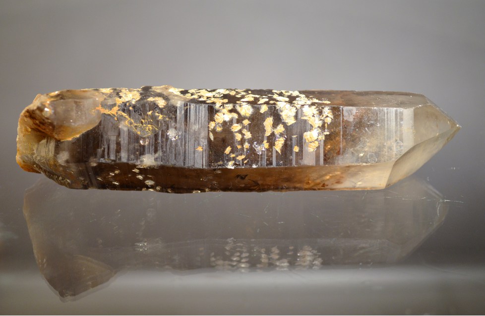
| Species: | Quartz |
| Formula: | SiO2 |
| Confirmation |
|---|
|
| Validity: | Confirmed |
| Confirmation Methods: | Visually Identified |
| Data |
|---|
|
| Mineral Data: | Click here to view Quartz data |
| Locality Data: | Click here to view Devils Playground (Devil's Playground), Bovine Mountains, Box Elder County, Utah, USA |
| Data Identifiers |
|---|
|
| Mindat Occurrence Record ID: | 1009598 |
| Long-form Identifier: | 1:3:1009598:2 |
| GUID (UUID V4): | 52487470-ecf3-46f8-8b48-b28bc616b5d2 |
| Nearest other occurrences of Quartz |
|---|
|
|
| 5.9km (3.7 miles) | ⓘTactite Occurrence (MRDS - 10088333), Rosebud Mining District, Grouse Creek Mts (Grouse Creek Range), Box Elder County, Utah, USA |
| 7.9km (4.9 miles) | ⓘSilver Riddle Mines, Rosebud Mining District, Grouse Creek Mts (Grouse Creek Range), Box Elder County, Utah, USA |
| 8.2km (5.1 miles) | ⓘCompressor Mine, Rosebud Mining District, Grouse Creek Mts (Grouse Creek Range), Box Elder County, Utah, USA |
| 8.2km (5.1 miles) | ⓘA & W Mine, Rosebud Mining District, Grouse Creek Mts (Grouse Creek Range), Box Elder County, Utah, USA |
| 8.3km (5.2 miles) | ⓘMagnitude Mine (Frank Edison Mine), Rosebud Mining District, Grouse Creek Mts (Grouse Creek Range), Box Elder County, Utah, USA |
| 8.5km (5.3 miles) | ⓘRocky Pass Mine (Emigrant Pass Mines), Rosebud Mining District, Grouse Creek Mts (Grouse Creek Range), Box Elder County, Utah, USA |
| 16.9km (10.5 miles) | ⓘRocky Pass Chalcedony Occurrence, Grouse Creek Mts (Grouse Creek Range), Box Elder County, Utah, USA |
| 18.9km (11.8 miles) | ⓘRed Butte Mine, Red Butte Mining District, Box Elder County, Utah, USA |
| 23.4km (14.5 miles) | ⓘUtahlite claim, Utahlite Hill, Box Elder County, Utah, USA |
| 24.1km (15.0 miles) | ⓘWest Utahlite Hill Variscite Occurrence, Box Elder County, Utah, USA |
| References |
|---|
|
|


Devils Playground, Bovine Mountains, Box Elder County, Utah, USA