 | | Journal (article/letter/editorial) | | SHERWOOD 106A East 25th, P. 0. Box 436 Oak Grove, Missouri 64075-0436 Downloaded by [Brown University Library]...Louis, Missouri 63129-2704 Figure 1. Counties in Missouri. N o comprehensive list of Missouri mineral...found in Missouri; two of these, fletcherite and starkeyite, were first described from Missouri mines....location a~ included at the end of each entry. Adair County Chariton River (40-04-05N 92-4 I -23W). septarian...septarian concretions about 2 miles north of the Macon county line. CALCITE crystals enclosing bundles of acicular |  | | Report (volume) | | GEOLOGICAL SURVEY OF MISSOURI. ARTHUR WINSLOW, STATE GEOLOGIST. VOL. II . A REPORT 0:N THE IRON...IRON ORES OF MISSOURI FROM FIELD WORK PROSECUTED DURING THE YEARS T891 and 1892. W i th 6 2 Illu s trat...Polk County. LETTER OF TRANSMITTAL. 0FFICI~ OF THE GEOLOGICAL SURVEY,} JEFFERSON CITY, MISSOURI, December...transmit, herewith, a Report upon the Iron Ores of Missouri, by Mr. Frank L. Nason, assistant geologist. Dnring... the two important iron mines of southeastern Missouri, the Iron IIIOuntain and Pilot Knob deposits, | 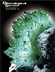 | | Journal (issue) | | . . subject to prior sale. Prices on request. Wayne and Dona Leicht, 332 Forest Avenue No. 8, Laguna...R. Kampf Natural History Museum of Los Angeles County Arthur Roe Tucson, AZ Abraham Rosenzweig University.................351 by R. M. Coveney, Jr., A. V. Allen, J. C. Blankenship and W. B. Simmons Fluorapatite...Fluorapatite from the King Lithia mine, Custer County, South Dakota .. 361 by M. L. Wilson, J. B. Paces and A....characterized by a network of quartz and relatively soft limonite. The upper zones were much higher before the land |  | | Book (edition) | | mmed at Broken Arrow aud Trout creek, in Sc. Clair county. The strata in this field are more faulted und...prong of Canoe creek, in St. Clair county, to Ha\sop creek, in Bibb county, a distance of 60 miles. Down to...to Helena, in Shelby county, the field has an average width of 5 or 6 miles. Below that point the width...miles being in the latitud" of Blocton, in Bibb county. The south ern end of this field has a greater...Jefferson county; Helena, Montevallo, and Brierfield, Shelby county; and at Blocion. Bibb county. The Warrior |  | | Journal (article/letter/editorial) | | locale is yielding basal xls of calcite coated with limonite which fl. strong red (SW) equal to Franklin, N...interesting. INDIANA—In the glacial drift around Fort Wayne (Allen Co.), Ind., many minerals have been found by...by Ora R. Kuhlman, 4125 Warsaw St., Fort Wayne 5, Ind. One specimen found was a large piece of black slate...Mr. Smith. MINNESOTA—"I found an agate in Itasca County, Minn., which weighed exactly one pound. It is...more items, Mr. Conley. MISSISSIPPI—Dark brown limonite pipes, 6" long and IV2" in diam. have been found |  | | Book (volume) | | Dahlonega Co. and Rabum Co., and the McDuffie County Belt extending through portions of McDuffie, Warren...Sphalerite. BALDWIN COUNTY MILLEDGEVILLE, at state farmjasper. BANKS COUNTY COMMERCE, along Hwy. 59...along adjoining Co. linerock crystal. BARROW COUNTY WINDER, along rd. to Jefferson and 1½ mi. inside...Guide for Rock Hounds in the United States BARTOW COUNTY AREA, Saltpeter Cave, as floatjasper. CARTERSVILLE:...barite pitsBarite, Geodes, Goethite, Hematite, Limonite, Iron minerals; area mines, as important producersBarite |  | | Book (volume) | | 600 to 800 feet thick in the north. ALEXANDER COUNTY FAYVILLE, area stream gravels⎯agate, jasper, rare...⎯agate, jasper; d RR siding of Clay⎯agate. CALHOUN COUNTY AREA, shores of the Mississippi R., in the Warsaw...crystals). CRAWFORD COUNTY PALESTINE, area deposits⎯Siderite. EDWARDS COUNTY AREA, T. 1 S, R. 10 E...E, regional deposits⎯Siderite. FULTON COUNTY FARMINGTON, W 6 mi. on Rte. 116 to the Rapatee No. 5 strip...mine⎯pyritized gastropods (Pennsylvanian age). GRUNDY COUNTY AREA: c Regional rd. and RR cuts and banks of Mason |  | | Book (volume) | | 600 to 800 feet thick in the north. ALEXANDER COUNTY FAYVILLE, area stream gravels⎯agate, jasper, rare...⎯agate, jasper; d RR siding of Clay⎯agate. CALHOUN COUNTY AREA, shores of the Mississippi R., in the Warsaw...crystals). CRAWFORD COUNTY PALESTINE, area deposits⎯Siderite. EDWARDS COUNTY AREA, T. 1 S, R. 10 E...E, regional deposits⎯Siderite. FULTON COUNTY FARMINGTON, W 6 mi. on Rte. 116 to the Rapatee No. 5 strip...mine⎯pyritized gastropods (Pennsylvanian age). GRUNDY COUNTY AREA: c Regional rd. and RR cuts and banks of Mason |  | | Report (issue) | | Processing Plant at Martins Creek, Pennsylvania, by Allen R. Krueger 91 The Role of Applied Geology in Producing...Dr. Arthur A. Socolow, Moderator Mr. George E. Allen Mr. James R. Coxey Dr. James R. Dunn Mr. Frank...vania, and Virginia; the latter from Illinois, Missouri, and Arkansas (Murphy, I960). In the Southeast...) dune sands (Lex ington County) and Pleistocene marine sands (Marion County) in South Carolina; is extracted...representing samples from Jeff Davis, Toombs and Wayne Counties (Figures 3 and 4) ; and from the Dorchester |  | | Book (volume) | | BRULE COUNTY AREA: in the Oacoma zone of the Pierre Fm. On Elm Cr. Near its jct. with the Missouri River...rosette up to 5 or 6 inches. CAMPBELL COUNTY MOUND CITY, W to the Missouri R., regional hillsides, ridges,...gravels, etc.petrified wood, wood opal. CORSON COUNTY LITTLE EAGLE: area ridges, slopes, stream beds...Guide for Rock Hounds in the United States CUSTER COUNTY AREA: The November Mine, 1.2 mi. SE of the Needles...of rd. a few yds., outcropRose Quartz. DOUGLAS COUNTY CORSICA, S on US 281 to Armour, area rd. cuts, |  | | Book (volume) | | chalcedony, jasper and gem petrified wood. BUFFALO COUNTY KEARNEY, area gravel bars and pits along the Platte...townagate, chalcedony, jasper, petrified wood. CASS COUNTY WEEPING WATER, SE, on rd. to Nehawka, in the Snyderville...chalcedony, jasper, fossils. CHERRY COUNTY VALENTINE, in the Sandhills county along the Niobrara R. and Minnechaduza...gem qualityagatized and opalized wood. DAWES COUNTY CHADRON, in N part of Co. and as far W as Crawford...woods, etc. DAWSON COUNTY GOTHENBURG, in sand pitspetrified palm wood. DEUEL COUNTY CHAPPELL, all regional |  | | Report (volume) | | Ark. Geol. Survey County Min. Rept.; Ann. Rept. -Arkansas Geological Survey, County Mining Report; Annual...Water Res. County Rept. -Maryland Department of Geology, Mines, and Water Resources, County Report. Md...Md. Geol. Survey County Rept. -Maryland Geological Survey, County Report. Meddel. om Gr¢nland- Meddelelser...Survey, Bulletin. Mo. Bur. Geology and Mines Bull. -Missouri Bureau of Geology and Mines, Bulletin. Rolla.... Mo. Geol. Survey and Water Res. -Missouri Geological Survey and Water Resources. Rolla. Mo. Univ., School |  | | Report (issue) | | BUTTE HIGH-ALUMINA CLAY DEPOSIT LANE COUNTY, OREGON By Victor T. Allen, John S. ·Loofbourow, Jr., and Robert...deposit, Lane County, Ore1oa--------Sections of Hobart Butte high-alumina clay deposit, Lane County, Ore1oa----Index...BUTI'E HIGH-ALUMINA CLAY DEPOSIT LANE COUNTY, _OREGON Victor T. Allen, JohnS. Loofbourow, Jr., ud Robert...is mainly in Lane County, Oreg., although a small part is located in Douglas County. The Hobart Butte...W. It is near the summit of Hobart Butte, Lane County, Oreg., in the Calapooya Mountains, about 1, 500 |  | | Book | | jJUl 2 2 1998 ALLEN COUNTY PUBLIC LIBRARY FORT WAYNE, INDIANA 46802 You may return this book to any...branch, or bookmobile of the Allen County Public Library DEMCO ALLEN COUNTY PUBLIC LIBRARY 549 Sch9m...Publishing Co., Inc. New York Fort Wayne, IN 46801-2270 Allen County Public Liofary 900 Webster Street...Borax 0 Boron, California/USA Na2[B405(0H)4]-8 H20 0 Boron, California/USA fr?1 71 Id V\ /"W > Streak...calcite, colemamte, kernite, ulexite. Found in: Nevada/USA; Tibet/China; Kashmir/Pakistan/ India; Kazakhstan/USSR; |  | | Journal (article/letter/editorial) | | mining in Alabama in the Cragford district of Clay County, the workings which entered the unoxidized zone...Palmer, Alaska. ARIZONA—From a locality in Mohave County in N . W . Arizona, we have an interesting specimen...glauberite xls mailed you last June from Imperial County near Bertam Siding on the Southern Pacific R.R...grayish xls. The locality is in S/W Winneshiek County of N / E Iowa. KANSAS—"In the southeast corner...corner of Kansas and extending over into Missouri and Oklahoma, we have the famous TriState lead and zinc mines |  | | Journal (article/letter/editorial) | | about 35 miles northwest of Flagstaff, in Coconino County, a pineforested volcanic area. The elevation is...in California recently I visited the Los Angeles County Museum in Los Angeles to see the famous collection...in Los Angeles can walk across the lawn to the County Museum for another thrill—the display of some of...Leadville (Lake Co.). Colo., almost at the end of Lake County, I found a specimen of small radiating chrysocolla...of Culloden, and one mile S. of the Monroe-Lamar County line. The cordierite occurs in knots and irregularshaped |  | | Journal (article/letter/editorial) | | FORMATION OF HIGH ALUMINA CLAY.* VICTOR THE T. ALLEN. ABSTRACT. In the West, where volcanic materials...these localities. IONE CLAY DEPOSIT, AMADOR COUNTY, CALIFORNIA. A notableexampleof a sedimentaryclay...alteredrhyolitictuffs. In 1929 restudyof the Ione formationby Allen a restricted the Ione formation to the lower two...Fourteenth Ann. Rep., pt. II: 462-465, 1894. s Allen, Victor T.: The Ione formation of California. Univ...CASTLE ROCK, WASHINGTON. Near CastleRock, Cowlitz County,V•Tashington, 60 miles north of Portland, Oregon |  | | Report (issue) | | (CaBSiO4OH) vesicle filling from a basaltic Houghton County lava flow. Small specks of native copper occur... Grand Rapids, 1971-1976 CHARLES G. YOUNGLOVE, Allen Park, 1972-1978 JOAN L. WoLFE, Belmont, 1973-1976...exceptionally fine, twinned analcite crystals from Houghton County ························-··-······-··-········...····· 41 2. Ankerite on siderite from Alpena County ···-··············-··················· 46 3....crystals of barite with stalactitic limonite from Negaunee in Marquette County ............................ |  | | Book | | Co. Hematite CALERA, Shelby Co. Wavkllite CLAY COUNTY, Sec. 24. T. 19 S R., 7 E. STATUARY, Coosa Co...Co., (W. border of* Marble Crystalline TALLADEGA COUNTY Marble, (crystalline) VALLEY HEAD, DeKalb Co. Hematite...Feldspar HISSOP, Coosa Co., (near) Beryl JACKSON COUNTY Hematite KENNEDYS, Clay Co., (near) Magnetite MILLERVILLE...DELANEY, Madison Co. Quartz, (clear crystals) GARLAND COUNTY Quartz Crystals HOT SPRINGS, Garland Co. Malachite...Malachite HOT SPRINGS DISTRICT Quartz Xls LAWRENCE COUNTY Pearls LITTLE ROCK Quartz Crystals MAGNET COVE, |  | | Journal (article/letter/editorial) | | left). Calcite, 5.5 cm high, Elmwood mine, Smith County. Terry Huizing specimen, Jeff Scovil photo. Figure...(above). Fluorite, 13.1 cm wide, Elmwood mine, Smith County. Francis Benjamin specimen, Jeff Scovil photo....Smith County. Terry Huizing specimen and photo. Figure 4 (right). Cumberland mine, Smith County. Travis...earths to make saltpeter, at Nicojack Cave in Marion County, then nitromagnesite at the same location (Shepard...Sevier County (Coskren and Lauf 2000). The following index is arranged alphabetically by county. It is |  | | Report (issue) | | GRAVEL RESOURCES IN EASTERN JOHNSON COUNTY AND WESTERN SHELBY COUNTY, INDIANA SCIENTIFIC AND TECHNICAL...WHALEY, Geophysicist CLARENCE HASKINS, Driller WAYNE COX, Assistant Driller JOHN R, HELMS, Geophysical...Head HENRY H. GRAY, Head Stratigrapher WILLIAM J. WAYNE, Head Glacial Geologist ANN M. BURGER, Geologist...Geologist JAMES T. CAZEE, Geological Assistant ALLEN PRUETT, Geological Assistant JAMES F. THRASHER,...Gravel Resources in Eastern Johnson County and Western Shelby County, Indiana By DONALD D. CARR DEPARTMENT |  | | Report (volume) | | Bull.; County Rpt.-Maryland Department of Geology, Mines and Water Resources Bulletin; County Report...Bulletin. Jackson, Miss. Mo. Bot. Garden Annals-Missouri Botanical Garden Annals. Fulton, Mo. Mo. Geol...Geol. Survey and Water Res. Inf. Circ.; Rpt. Inv.-Missouri Geological Survey and Water Resources Information...Univ., Sch. Mines and Metallurgy Bull. Tech. Ser.-Missouri University, School of Mines and Metallurgy Bulletin...Technical Series. Rolla, Mo. Mo. Univ. Studies-Missouri University Studies. Columbia, Mo. Mont. Acad. |  | | Journal (issue) | | MINERAL COLLECTING SITES IN VIRGINLA D. Allen Penick, Jr. and Palmer C. Sweet Seven m i n d localities...AMHERST COUNTY The amethyst site is located 4.35 miles southeast of Amherst, Amherst County, about 1...BERYL MZNE AMELIA COUNTY The Beryl mine is located 3.8 miles east of.Amelia* Amelia County, off the southwest...CRYSTAL LOCALITY BATH COUNTY - The ChestnutRidge site is located in Bath County on the easternslopeof...was fomd at the mim Richard Seaver of Cumberland County, Virginia. This gem is currengy on display at the |  | | Report (issue) | | 2 Mesaverde Group and Mesaverde Formation-Con. Allen Ridge Formation _______________ - ______ ---Pine...__________________________________________ _ 7. Allen Ridge Formation at Pine Tree Gulch ____________...__ _ 8. Outcrop of an unnamed marine member of Allen Ridge Formation ______________ _ 9. Pine Ridge Sandstone...name), Haystack Mountains )formation (new name), Allen Ridge Formation, Pine Ridge Sandstone, and Almond...oldest to youngest: Haystack Mountains Formation, Allen Ridge Formation, Pine Ridge Sandstone, and Almond |  | | Journal (article/letter/editorial) | | Marble Peak in the Santa Catalina Mountains, in Pima County, Arizona. A note from him reads: "I have done some...good crystal specimens of epidote which occurs in limonite as well as in calcite. Some of the epidote crystals...taken from the Cherokee district placers in Butte County, California. Mineral Information Service, July...found at Mulberry, Polk Co., Fla., by Mrs. Rena Allen, formerly of Daytona Beach, Fla., but when this...% inch in size. A short note received from Mrs. Allen, just before leaving Florida, reads: "You will be |
|


