 | | Report (issue) | | Selected Mining Districts of Utah by Carl L. Ege Headframe of Centennial Eureka mine, Tintic mining district...MISCELLANEOUS PUBLICATION 05-5 UTAH GEOLOGICAL SURVEY a division of 2005 Utah Department of Natural Resources...Resources STATE OF UTAH Jon Huntsman, Jr., Governor DEPARTMENT OF NATURAL RESOURCES Michael Styler, Executive...Executive Director UTAH GEOLOGICAL SURVEY Richard G. Allis, Director PUBLICATIONS contact Natural Resources...toll-free: 1-888-UTAH MAP website: http://mapstore.utah.gov email: geostore@utah.gov THE UTAH GEOLOGICAL SURVEY | 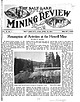 | | Journal (volume) | | RE HE SALT LAKE עתנו ESTABLISHED APRIL SE DY. VOL . 18. No. 1 . pood SALT LAKE CITY, UTAH , APRIL...Howell Mine BY WILL C. HIGGINS The Howell Mining Company, of Salt Lake City, is making preliminary arrangements...property in the South Fork The property of the Howell Mining Com of Big Cottonwood canyon, about twentyfive...to the discovery of the property of the Howell Mining Company, of the great ils sure that gives such...-roots. The discovery of the Howell reads al district has been not most like a romance . ed for its |  | | Report (issue) | | DIRECTOR ECONOMIC GEOLOGY OF THE BINGHAM MINING DISTRICT, UTAH By JOHN MASON BODTWELL WITH A SECTION...DIRECTOR ECONOMIC GEOLOGY OF THE BINGHAM MINING ^DISTRICT, UTAH By JOHN MASON BOUTWELL WITH A SECTION.......... 25 PART I. AREAL GEOLOGY OF THE BINGHAM DISTRICT, BY ARTHUR KEITH. Geography.............................................................. Bingham quartzite........................................66 PART II. ECONOMIC GEOLOGY OF THE BINGHAM MINING DISTRICT, UTAH, HY JOHN MASON BOUTWELL. Introduction |  | | Report (issue) | | Is EIN Mining Industry of IDAHO FOR THE YEAR 1928 UUUGEQEONGRGOUUEEEOOUOONGOUUOOGOQEOOOQOUVONOQO...EcIUUUGGMOUAN THIRTIETH ANNUAL REPORT OF THE Mining Industry of IDAHO FOR THE YEAR 1928 STEWART INSPECTOR...Sem OWNERSHIP STS VIS OF TIMBER ON UNPATENTED MINING 2 cere ee Ra ye pe a a RLECTRICIEY ON THE COURT...BBAR GIAKBS COUINT Yee cele ewe ds IBDN BEWAH. COUNTY 1M nook oe 0d ee a 0 ee ae ee ie yee IBUINGTRUAINE...ee BONNER (COUNTY. Ci. 0 ee es et ee BONUNB VAMGIEES (COUNTY 2.5 kool ee BOUNDARY: COUNTY. cis -t:50 |  | | Report (issue) | | TWENTY- NINTH ANNUAL REPORT OF THE Mining Industry of IDAHO FOR THE YEAR’ 1927 STEWART INSPECTOR...MINES ° TWENTY- NINTH ANNUAL REPORT OF THE Mining Industry of IDAHO FOR THE YEAR 1927 STEWART INSPECTOR...IBANINOCK COUNTY i xcec2 oh cccen eke tee ceca ksee see oe coe ee Beeroeeree BEAR SIGAKE: COUNTY: cn 625...625 Se a, oe ee BENE WAH COUNTY: coristoc a cers ows thea ts eared eee econ ee STN GET A\Miig, CO WINIEXS...WINIEXS se oe no EN ce IS POE ee BiATNE COUNTY 64 ee 2 Br Pe 0s ee SOE eee ee ek ek IBOISEL. COUNDY” 35.06 |  | | Book | | WITH MINING ENGINEERS By Formerly editor T. A. of the RICKARD 'Engineering and Mining Journal'...Journal', 'The Mining Magazine', and the 'Mining and Scientific Press'; now contributing editor of the 'Engineering...'Engineering and Mining Journal-Press'. SAN FRANCISCO MINING AND SCIENTIFIC PRESS 1922 CONTENTS Page...of the mining profession, together with editorial appreciations written by me in the 'Mining and Scientific...interview, of which I am the 'Engineering and Mining Journal-Press', The publication of this series |  | | Report (volume) | | 27-36. Minneapolis, Minn. American Institute of Mining Engineers: Transactions, vols. 30-35; Bimonthly...Canada. Canadian Mining Institute: Journal, vols. 4-7. Ottawa, Canada. Canadian Mining Review: vols. 20-24... 42-46. Colorado Springs, Colo. . . . Colorado Mining Bureau: Bulletins, nos. 4 and 5; Report State Bureau...Proceedings, vols. 8 and 9. Davenport, Iowa. Delaware County Institute of Science: Proceedings, vol. 1, no....vols. 17-21. Chapelhill, N. C. Engineering and Mining Journal: vols. 71-80. New York, N. Y. Engineering |  | | Report (volume) | | 1903. Minneapolis, Minn. American Institute of Mining Engineers: Transactions, vol. 33, 1903, and advance...2d ser., vol. 8,-1902. Ottawa, Canada. Canadian Mining Review, vol. 22, 1903. Ottawa, Canada. Canadian...and 2,1903. Chapelhill, N.' C. Engineering and Mining Journal, vols. 75 and 76, 1903. New York, N. Y...volume] 1903. Indianapolis, Ind. Institution of Mining Engineers: Transactions, vol. 22, pts. 5-6; vol...1903. Newcastle-uponTyne, England. . International Mining Congress: Proceedings 5th Annual Session, 1903 |  | | Report (volume) | | viii-ix. The physical geology of the Grand Canon district, by Clarence E. Button, pp. 47-166, pis. x-xxxvi...unnumbered map. Contributions to the history of Lake Bonneville, by G. K. Gilbert, pp. 167-200, pis....Abstract of report on geology and mining industry of Leadville, Lake County, Colorado, by S. F. Emmons, pp...of'the geology of the Comstock lode and the Wash oe district, by George F. Becker, pp. 291-330, pis. xlvi-xlvii...Marsh, pp. 45-88. " The copper-bearing rocks of Lake Superior, by Roland Dner Irving, pp. 89-188, pis |  | | Report (volume) | | ............................................... Utah...................................................ethnologic and archjBologic subjects are included in the group "Ethnology and Archaeology." All geographic entries...by Dr. Hayclen's exploring expedition of 1871, in Utah and Wyoming Territories, with descriptions of a...embracing portions of Montana, Idaho, Wyoming, and Utah, being a report of progress of the explorations... C. Peale, M. D., [on explorations in Colorado, Utah, and Wyoming], pp. 97-187, 1 leaf containing fig |  | | Report (issue) | | the Bear Trap Canyon Instant Study Area, Madison County, Montana By Darrell M. Pinckney, William F. Hanna........................................ 3 Ennis Lake block............................................................... 10 Lower Hot Springs Mining District................................... 11 Minor...of U.S. Geological Survey sample sites, Madison County, Montana............ In pocket 2. Regional gravity...and mineral zoning of the lower Hot Springs mining district......................................... 14 |  | | Report (issue) | | meridian 76° 30', from Tompkins County, New York, to Bradford County, Pennsylvania, by H. S. Williams...33 pp. B 16. Higher Devonian faunas of Ontario County, New York, by J. M. Clarke. 1885. 86 pp., 3 pls...and other points in the Tertiaries of Colorado and Utah, by S. H. Scudder. 1892. 35 pp., 3 pls. B 97. Mesozoic...the fauna of the Hamilton formation of the Cayuga Lake section in central New York, by H. F. Cleland. 1903...Aspen district Leadville region Salida Canyon Pikes Peak quadrangle Perry Park Larimer County Summary |  | | Report (volume) | | subsequent reports cited. The use of a wellknown group name in parentheses following the age designation...belonging to . the group mentioned, but that its fossils indicate correlation with that group. 4 LEXICON...1931. Tenn., August 1929. Tex., September 1930. Utah, December 1932. Vt., September 1935. Va., April... 5 in., inch or inches. Circ., Circular. Co., County or Company. Indus., Industrial. Inst., Institute...Metallurgical, Metallurgy, or tions. Metals. dist., district. Mg., Mining. div., division. mi., mile or miles. dol |  | | Book | | regarding internal and external communications by the mining industry. The fact that our technological society...ahead. But is the world's population ready? Is the mining industries public image high enough to assure adequate...appears today to be a sobering lack of general mining awareness by the public. Few people realize that...taken to discern the public's attitude towards mining. A typical response might be "My lifestyle is unaffected...slightly affected by mining production." John Q. Public might well answer that 4 mining did not affect his |  | | Report (volume) | | the route from the Missouri Eiver to the Great Salt Lake, and in the vicinity of the latter place, by the... E. (Stansbury's Expl. and Surv. Vail. Gt. Salt Lake Utah, App. E., pp. 407-414, Pis. 1-4.) OWEN (D....limestone in the Marcellus shale of the Hamilton Group, in the eastern and central parts of the State of...Indiana; with some analogous forms from the Hamilton Group proper. (13th Eep. N. Y. State Cab. Nat. Hist.,...of new fossil remains collected in Nebraska and Utah, by the exploring expeditions under the command |  | | Report (issue) | | found within the Valdez Group, but a small number lie within the Orca Group and the McHugh Complex. In...(Pickthorn, 1982), and McKinley Peak (Haney, 1982) mining areas, but nowhere has there been a compilation...listed first Gold Mining District or Region gives the name of the gold mining district, however, if a locality...locality lies outside of a recognized district a regional name was used (i.e. "Port Dick"). Quad lists...lithologic unit, that is, the Valdez Group, Kodiak Formation, Orca Group, or McHugh Complex, is given. The |  | | Report (volume) | | 1885. 1885. 1888. 1889. 1889. 1890. MONOGRAPHS. I. Lake Bonneville, by Grove Earl Gilbert. 1890. 4°. xx...$1.50. II. Tertiary History of the Grand Canon District, with atlas, by Clarence E. Dutton, Capt. U. S...III. Geology of th« Comstook Lode and the Washoe District, with atlas by George F. Becker. 1882. 4°. xv...of 21 sheets folio. Price $11.00. IY. Comstock Mining and Miners, by Eliot Lord. 1883. 4°. xiv, 451 pp... ADVERTISEMENT. V. The Copper-Bearing Rocks of Lake Superior, by Roland Duer Irving. 1883. 4°. xvi, |  | | Book (edition) | | )':2/*:"'°'"<^c r^ NORFOLK wales/// /FRIENDLY .>::;i-' \group ^.ra,4.5^^/,.^' \ 21 15 . f -4ni^ / /'-...continental lands. The Caspian and Aral, which are salt seas, — ; lie in a depression of the continent...2900 Colorado, 6800 Connecticut, 500 Delaware, 60 District of Columbia, 150 Florida, 100 Georgia, 600 Idaho...350 South Dakota, 2200 Tennessee, 900 Texas, 1700 Utah, 6100 Vermont, 1000 Virginia, 950 Washington, 1700...sierra is, in Spanish, the name of a ridge, or group of direction, : ridges, of serrated or irregular |  | | Report (issue) | | Reclamation. 72 Geology of the Flaming Gorge Area Utah-Colorado-Wyoming By WALLACE R. HANSEN GEOLOGICAL...Wallace R 1920- Geology of the Flaming Gorge area, Utah-Colorado-Wyoming. Washington, U.S. Govt. Print....Vyoming-Sweetwater Co. I. Title. II. Title: Flaming Gorge area, Utah-Colorado-,Vyoming. (Series) For sale by the Superintendent...Quartzite (middle Precambrian) ___ _ Uinta Mountain Group (younger Precambrian)_ Paleozoic rocks _______________...Creek Quartzite _________ _ In the Uinta Mountain Group ________ _ In the Carmel and Frontier Formations |  | | Report (volume) | | Geologist, Vols. I-XXIV. American Institute of Mining Engineers: Transactions, Vols. I-XXIX. American...Trask (1850-55), Keports Nos. 1-4. California State Mining Bureau: Annual Keports, Nos. 1-13. : Bulletins... First Report of Progress, 1891. The Paleozoic Group, 1893. Bulletins, Nos. 1-3A, 4A, 5A, 6A, 7. Hamilton...(F.), Report on the Geological Survey of Miami County, Kans., 1865. ' Kansas University Geological Survey:...Report on Geology of'Mercer County. Report on Geology of Lincoln County. Report or Geology of Henry, |  | | Book | | Areas (CCOP) CCOP Technical Secretariat Offshore Mining Organization Building 110/2 Sathorn Nua Road, Bangkok...rock. (6) Stanniferous veins other than those of Group 5. (7) Lodes of the Cornish type. (8) Replacement...Komotivi, Rhodesia (P) Manono, Zaire, Zoned Bernic Lake, Canada (P) (Note- The cassiterite in pegmatites...groups Group 1. Group 2. Group 4. Group Group Group Group 3. 5 6. 7. Group 8. Group 9. ... Group 10. Group Group Group 11. 12. 13. Disseminations, other than those in placers, that are not |  | | Report (issue) | | Illinois.. Lower-Upper Middle Devonian Traverse group of Lower Peninsula, Michigan . » . 121 = 123 ...Hollow beds, Lambton County, Ontario............. Middle Middle Devonian—Clark County, Indiana, etc., Falls...and Nevada. . Lower Upper Devonian (Frasnian) of Lake Manitoba and Maccene Devonian of South America...(New Providence, Fern Glen, St. Joe, Burlington and Lake Valley) of Kentucky, . 209 . 210 oil 212 213...Nebraska, Missouri, Oklahoma, Texas, peel Colorado, Utah, and New Mexico. 0... ce cs0s- ee csee see eens |  | Wells, D.E., Pittman, T.L., Brew, D.A., Douglass, S.L. (1986) Map and description of the mineral deposits in the Juneau, Taku River, Atlin, and part of the Skagway quadrangles, Alaska. Open-File Report Vol. 1986 (85-717) US Geological Survey doi:10.3133/ofr85717 | Report (issue) | | pertaining to mines, prospects, mineral occurrences, and mining claims in the Atlin, Juneau, Taku River, and part...at each site is centered on the major workings, group of workings, prospect, or a claim block. Where prospects...separate claim groups are recorded, the size of each group is listed. Several individual sites shown on the...overlap. For this reason the name and size of a given group may be listed for more than one site. Additional...KARDEX listing maintained by the Alaska Division of Mining (ADM) Office, 794 University Avenue, Fairbanks |  | | Journal (article/letter/editorial) | | geologists had studied the ranges of northern Nevada and Utah, while Powell’s previous work had been in the Grand...of the Colorado and the plateau region of eastern Utah. The nomenclature and correlations of the two explorations...trips in Nevada and north ern, central, and western Utah in previous years, I was able during the summer...which flow north and west and empty into Great Salt lake. In contrast with the southern slope the strata...the depression of Kamas valley and the irregular group of hills formed of intrusive andesite and extrusive |  | Zou, Hao, Pirajno, Franco, Zhang, Qiang, Tessalina, Svetlana, Ware, Bryant, Li, Xin‐yu, Liu, Hang, Li, Yang, Jiang, Xiu‐wei, Wei, Shao‐yi (2020) New evidence from the Wuliji'Oboo fluorite deposit for the role of the paleo‐Pacific Plate and Mongol–Okhotsk suture in creating extensive fluorite mineralization in the Great Xing'an Range, NE China. Geological Journal, 55 (5). 3654-3678 doi:10.1002/gj.3601 | Journal (article/letter/editorial) | | that are located in the south‐east area of the mining area are a brecciated felsic unit, most likely...sericite (Figure 5h,i) constituting south‐east of the mining area (Figure 1c). the remaining 10%. The fluorite...mineralization in the mining area and WS2, WS3, and WS10) from the eastern drill cores of the mining dis- thus...methods used were the ICP‐MS method zone of the mining district. Six samples of massive or banded fluorite...element analyses produced results with of the mining district (Figure 2b). Ten fluorite samples (WLG‐1~10) |
|


