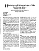
 | | Journal (article/letter/editorial) | | and Mineralogy of the Indiana Mine Ontonagon County, Michigan Ninth in a series of articles on the mines...(Indiana Copper Company) mine dump in Ontonagon County, Michigan. The individual crystals, which range from...and 38 (Lake Mine Junction) in northern Ontonagon County. The property consists of 1,280 acres in secs....37 W., Greenland Township. The 2-square-mile property is owned by the state of Michigan and is traversed...Tom Rosemeyer is a native of Upper Michigan and a graduate of Michigan Technological University in Houghton |  | | Journal (article/letter/editorial) | | COPPER-BEARING FISSURE VEINS Keweenaw County, Michigan Downloaded by [University of Delaware] at 05:05...mine 12. Copper Falls mine 13. Clark mine 14. Point prospect 15. Mendota mine 16. Gull Rock fissure and...leading to ore bins. On the left are ore cars of the Keweenaw Central Railroad being loaded with chunks of mass...known as the Michigan Copper Country, is located on the scenic, rugged, and isolated Keweenaw Peninsula...into Lake Superior at the western end of Upper Michigan. The native copper mines that comprised the district |  | | Journal (article/letter/editorial) | | bottom of Lake Superior near Eagle Harbor, Keweenaw County, Michigan. The near-shore find, now called the Laker...9,000–15,000 feet, and form the “spine” of the Keweenaw Peninsula. Interbedded with the basalt flows are...and Lankton 2006). In the central portion of the Keweenaw Peninsula the strike of the PLV changes from northeast...Tom Rosemeyer, a native of Upper Michigan, is a graduate of Michigan Technological University. He now... Figure 2 (upper left). A floater group of sharp tenorite-coated dodecahedral copper crystals that range |  | | Journal (article/letter/editorial) | | favorite site for collecting microcrystals in the Keweenaw. The crystals occur in small vugs in prehnitequartz...langite, malachite, and posnjakite. Point Prospect The Point prospect, located about 6 miles southeast of...Copper Country (Rosemeyer and Carlson 2000). The prospect exposed a near-vertical fissure vein that strikes...the vein was intensely worked through 1996. Point prospect copper crystals exhibit a limited variety of...represented. The most intriguing aspect of Point prospect copper crystals is their size. Enormous copper |  | | Book | | Mineralogy of Michigan by E. W. Heinrich updated and revised • by George W. Robinson M By E W~ Hellnr]ch...Museum Michigan Technological University Houghton, Michigan 49931 2004 © MINERALOGY OF MICHIGAN 3 FOREWORD...FOREWORD Michigan has a long and varied geologic history that includes repeated episodes of volcanism...before the first Europeans set foot here. When Michigan became a state in 1837, one of the first actions...and we continue to learn more about them today. Michigan minerals helped to build the state and nation |  | | Journal (article/letter/editorial) | | February 2015 Figure 2. A generalized map of the Michigan copper district showing the location of new finds...are arranged geographically, starting with Keweenaw Point and continuing in a southwestern direction...end of the district. Keweenaw Point, Keweenaw County The waters off Keweenaw Point have drawn much attention...since the publication of the first “News from the Keweenaw” article that described the occurrence of yellow...To date, he has discovered two areas between Keweenaw Point and Manitou Island where datolite occurs in |  | | Journal (article/letter/editorial) | | o t- avv of Point PrOlitleEt - K EWEENAW I - COUNTY, -~ __ -- ---K--- MICHIGAN Tom Rosemcyer...decaie in the Upper tip of the Keweenaw Peninsula Peninsula. in northern Michigan. The vein History outcrop...outcrop, known locally as Point prospect, is located approximately 6 miles southeast The fissure vein that...(ltfi). A close-up view of the flssure vein at Point pmpect showing copper crystals in the siUcilled...two best large copper groups recovered from Point prospect. hj?: John Rascona holds an 11.4-cm group that |  | | Journal (article/letter/editorial) | | Iuyw I , < h,,,rl,rp,, ,,I I r,,,,l>,l\ T HE MICHIGAN COPPER DISTRICT stretches in a southwest-northeast...White Pine mine in Ontonagon County to Copper Harbor in Keweenaw County. Copper mineralization occurs...the scientific world. From 1844 through 1995 the Michigan copper district produced a reported 14,595,357...to the worldclass native-copper deposits of the Keweenaw Peninsula and the sediment-hosted stratiform copper...more than 160 miles, forming the “spine” of the Keweenaw Peninsula. The intercalated sedimentary beds were |  | | Journal (article/letter/editorial) | | News from the Keweenaw Downloaded by [Florida State University] at 18:43 12 November 2014 Part 3—Recent...the Sunset Bay Campground, located near Fivemile Point. The gravel bars along the shoreline shift with...years have passed since the last “News from the Keweenaw”; this article updates new finds to the spring...Tom Rosemeyer is a native of Upper Michigan and a graduate of Michigan Technological University in Houghton...construction in the Keweenaw. However, extensive logging operations, primarily in Keweenaw County, have increased |  | | Journal (article/letter/editorial) | | Cruzeiro mine, Minas Gerais, Brazil. Los Angeles County Museum of Natural History specimen, Harold and... near Badger Creek, north of Coaldale, Fremont County, Colorado. Dave Bunk specimen, Jeff Scovil photo...manganoan, Argentine vein, Idarado mine, San Miguel County, Colorado. Dave Bunk specimen, Ed Raines photo...MINERALS Analcime, Michigan, 225 Anatase, Bahia, Brazil, 3.5 Andalusite, Michigan, 96 Anhydrite, Bahia...Antigorite, Michigan, 95 Antlerite, Utah, 244 Apatite, Bahia, Brazil, 38; Madagascar, 256; Michigan, 96; Ohio |  | | Journal (article/letter/editorial) | | Copper-bearing Amygdaloidal Lode Houghton and Keweenaw Counties, Michigan TOM ROSEMEYER PO Box 369, 506 Pine Street...the secondmost-productive lode discovered in the Michigan copper district. In the heyday of mining it became...the A. E. Seaman Mineral Museum on the campus of Michigan Technological University will let you relive the...Tom Rosemeyer is a native of Upper Michigan and a graduate of Michigan Technological University in Houghton...researches the mineralogy and mining history of the Michigan copper district and the San Juan Mountains, Colorado |  | | Journal (article/letter/editorial) | | 57647 Caledonia Street Calumet, Michigan 49913 datolite@charter.net Keweenaw Figure 1. A delicate group...Copper Country Figure 2. Generalized map of the Michigan copper district showing the location of the new...Mineral Finds in Michigan’s Copper Country T he Michigan Copper Country, also known as the Lake Superior...scenic Keweenaw Peninsula, which juts out into Lake Superior at the western end of Upper Michigan. The...Tom Rosemeyer, a native of Upper Michigan, is a graduate of Michigan Technological University in Houghton |  | | Journal (article/letter/editorial) | | in celebrating the rich mineral heritage of the Keweenaw Peninsula’s datolite by diving into this article...Dyl II, Director A. E. Seumnii Mineral Museum Michigan Technological University 170 ROCKS 81MINERALS... 8. Capemine 9. Clatkmine 10. starmine 11. Keweenaw Point Historical information and Collecting History...Roseineyer is a native of Upper Michigan arid a graduate of Michigan Technological Universip in Hoirghton...the Datolite mine) and at other localities on Keweenaw Point. He also described the first reported occurrence |  | | Journal (article/letter/editorial) | | additional money from investors. Hays was back in the Keweenaw in March 1845 with a crew of miners, equipment...courtesy Michigan Technological University Archives and Copper Country Historical Collections, Michigan Technological...suspend operations after June 1870. Up to this point the Cliff mine had produced 36 million pounds of...1992). In 1923 the mines were acquired by the Keweenaw Copper Company and later by the Calumet and Hecla...Phoenix properties. From 1913 through 1917 the Keweenaw Copper Company leased the mine and produced a |  | | Journal (issue) | | two of us can work inside. Hard to tell at this point the size of the pocket, but there seems to be no...museum quality.” (Szenics, 1967) Spruce Peak, King County, Washington, 1977 Beautiful pyrite and quartz specimens...because they were doubly terminated and showed no point of attachment. In all, approximately 10,000 kilograms...“floater” with deep smoky color and no visible point of attachment. The longest crystal found, though...and FLECK, G. (1980) The Grey Horse mine, Pinal County, Arizona. Mineralogical Record, 11 (4), 231–232 |  | | Journal (article/letter/editorial) | | John A. Jaszczak photo. rom the bowels of a Keweenaw copper mine to the icy depths of Lake Superior...steep 2,000-foot-deep mine shaft in the dead of a Keweenaw winter with only mud and ice for footholds while...and Sciences Michigan Technological University Tom Rosemeyer is a native of Upper Michigan and a graduate...graduate of Michigan Technological University in Houghton. Since retiring from the mining industry, he has...MINERALS Part 2: Southern Keweenaw, Houghton, and Ontonagon Counties, Michigan Tenth in a series of articles |  | | Book (edition) | | FOURTHEDITION V e a o_ of li rizo TI RAYMOND W. GRANT RONALD B. GIBBS HARVEY W. JONG JAN C. RASMUSSEN...Co\·er photo: \\ 7 ulfenite, Rowley Mine, Maricopa County, 4 cm high specimen, Evan and Melissa Jones Collection... Data Names: Grant, Raymond \X'.,author. Title: Mineralogy of Arizona/ Raymond W. Grant [and 4 others]...Williams, and Bideaux Grant Anthony, Williams, and Bideaux J. W. Anthony et al. Grant Grant et al. 43 1 5 26...Sidney Williams, and Richard Bideaux, with Raymond Grant added on the third edition. The first edition was |  | | Book (edition) | | abbreviations: Rep. (republic), prov. (province), co. (county), munic. (municipio), pref. (prefecture), dept...always included in text, except in the cases of the USA, UK, and the provinces Ontario and Quebec in Canada...Uintah County. Utah. and m (2.B. acanthite group). Monoclinic, C2/m, a,b,c Rio Blanco County. Colorado...Juster vitreous to Hot Springco., Arkansas, in the Point of Rock quarry, pearly. Clea,·age {001} perfect...Plat., Malawi, G 10 17 River Formation in Uintah County, Utah. Deer et al., v. 2A,483, 1997. Aenigmatite |  | | Book (edition) | | mine, Si/County, Arizona. Smithsonian Institution. Fornzer!y in...Sidney A. Williams Richard A. Bideaux Raymond W Grant PHOTOGRAPHY EDITOR Wendell E. Wilson Published...photographs has been generously funded by a special grant from the Phelps Dodge Corporation. • CONTENTS...The Bisbee District, Cochise County 64 The Tombstone District, Cochise County 70 The Mammoth-St. Anthony...Anthony Mine, Tiger, Pinal County 78 Uranium and Vanadium Deposits 80 Monument Valley 81 - • Vll The Cameron |  | | Report (issue) | | INDEX OF MINING PROPERTIES IN COCHISE COUNTY., ARIZONA by Stanton B. Keith Geologist Bulletin 187...Employer. INDEX OF MINING PROPERTIES IN COCHISE COUNTY, ARIZONA by Stanton B. Keith Geologist Bulletin... 10. Index Map to Mining Districts in Cochise County and Explanation of Geologic Symbols. . • • California...geologic framework and mineral resources of Cochise County have been released. Because the bulletin was reprinted...Society, held its 29th field conference in Cochise County, November 9-11, 1978. Road logs and technical papers |  | | Report (issue) | | ........... Petaca mining district, Rio Arriba County .................................................25 25 25 Page Other occurrences, Rio Arriba County ....................................................................... 26 Red River belt, Taos County .................................................(Fibbs—Nogle, Steve's) prospect .................................... 34 Bear Canyon prospect ..................................... 34 Hercules (Bueno Vista) prospect ............................................. | | | Book (edition) | | mine, Silver district, Trigo Mountains, La Paz County, Arizona. Smithsonian Institution. Formerly in...Sidney A. Williams Richard A. Bideaux Raymond W. Grant PHOTOGRAPHY EDITOR Wendell E. Wilson Published...photographs has been generously funded by a special grant from the Phelps Dodge Corporation. (ngs * Prien’...Bisbee District, Cochise County 64 70 The Tombstone District, Cochise County The Mammoth-St. Anthony Mine...Mine, Tiger, Pinal County Uranium and Vanadium Deposits 80 Monument Valley 81 63 78 il S: The Cameron |  | | Book | | are reported by county of occurrence. Map 1-2 shows the county boundaries and county names. When possible...given in the following notation: Section (Sec.), Township (T.), Range (R.), and Meridian (M.D.M. Mount Diablo...117° 1O'. The arrangement of sections within a township is illustrated by Figure 1-1. *M. Fleischer's...,o Map 1-2. Outline map of California showing county boundaries. __ _) 4 MINERALS OF CALIFORNIA...Diagram showing arrangement o f sections within a township. T able 1-1. List of Chemical Elements, Including |  | | Report (issue) | | been found in the mining the nugget Jim, Placer County, California, in 1871 by a small girl in who town...The bibliography has been updated and expanded. County lists published by Collins (1) pp. 40-64, in Murdoch...rhyolite locality in Alameda County and the lawsonite type locality Marin County, which have been completely...color" from Cherokee Flat, Butte County); and to borax ("Lake County, in large crystals in the clay of...the total entry!). No hint acid. Clear Lake, Lake County" foreshadows the subsequent discovery of immense | | | Book | | species are reported by 1-2 shows the county boundaries and county names. When possible, locations of mines...given in the following notation: Section (Sec.), Township (T.), Range (R.), and Meridian (M.D.M. — Mount...arrangement of sections within a township is illustrated by Figure 1-1. county of occurrence. Map *M. Fleischer’s...Map 1-2. Outline map of California showing county boundaries. 4 MINERALS OF CALIFORNIA R5W i...Diagram showing arrangement of sections within a township. Table 1-1. List of Chemical Elements, Including |
|


