 | | Report (issue) |
| WASHINGTON . GEOLOGICAL SURVEY. HENRY LANDES, STA TE GEOLOGIST. VOLUME I. ANNUAL REPORT FOR 1901... . . . . . . . . . . . . . . . . . . . Stevens County..................... ... . . . . . . . . . . ....Northport District. .... . ........ . .. ... . . . .. . . . ............ . Myers Fa.Us District . . . .... . . . . . . . . . . . . . . . . Fla.t C1·eek District . . . . . . . . . . . . . . . . . . . . . . .... . . . . . . . . . . . . . . . . . Colville District . . . . . . . . . . . . . . . . . . . . . . . . |
 | | Report (issue) |
| WASHINGTON GEOLOGICAL SURVEY HENRY LANDES, State Geologist BULLETIN No. 5 PART I Geology and Ore Deposits...Creek Mining District PART II Geology and Ore Deposits of the OrovilleNighthawk Mining District By JOSEPH...Creek Mining District, and Part II, Geology and Ore Deposits of the Oroville-Nighthawk Mining District...GEOLOGY AND ORE DEPOSITS OF THE MYERS CREEK MINING DISTRICT. Paoe I NTRODUCTION . . . . . . . . . . • ... . . . . . . . . . . . . . . . 40 Minerals of district. . . . . . . . . . . . . . . . . . . . . . . |
 | | Book (edition) |
| MINES AND MINERALS OF WASHINGTON. SECOND ANNUAL REPORT GEORGE A. BETHUNE, STATE GEOLOGIST. OLYMPIA...Report of the State G<3ologist for the State of Washington, George A. Bethune, First State Geologist, 1891...Pacific Northwest Collection of the University of Washington Library and we are most grateful to the library...Geology and F.arth Resources Division of the Washington State Department of Natural Resources for their...American Trading Company, P.O. Box 1312, Bellevue, 'Washington, 98009 · To H<>n. ELISHA P. FERRY, Govern(lr |
 | | Report (issue) |
| GEOLOGY AND EARTH RESOURCES DIVISION OLYMPIA, WASHiNGTON 98504 METAL MINES OF WASHINGTONPRELIMINARY REPORT...DERKEY NANCY L. JOSEPH and RAYMOND LASMANIS WASHINGTON DIVISION OF GEOLOGY AND EARTH RESOURCES OPEN...Earth Resources standards and nomenclature. 1, WASHINGTON STATE DEPARTMENT OF Natural Resources Brian...DERKEY NANCY L. JOSEPH and RAYMOND LASMANIS WASHINGTON DIVISION OF GEOLOGY AND EARTH RESOURCES OPEN...standards and nomenclature. • CONTENTS Page Page County and site name Kelly Camp Kettle Key East Knob |
 | | Report (issue) |
| RECONNAISSANCE OF THE CONCONULLY AND RUBY MINING DISTRICTS, WASHINGTON. By EDWARD L. JONES, Jr. INTRODUCTION...examination of the Conconully and Ruby mining districts, in Okanogan County, Wash., made during two weeks in...impossible. The districts are included in the Okanogan and Chopaka quadrangles, which have been topographically... Francis A. Thomson, of the State College of Washington, who has furnished a preliminary report on the...incorporated in this paper. Data on the Arlington mine were kindly supplied by Mr. H. S. Stoolfire, of |
 | | Book (edition) |
| annual report upon the Mines and Minerals of Washington. Yours very truly, GEO. A... BETHUNE, ~ First...and House of Rep1·esentatives of the State of Washington: G~NTLEMEN- Herewitb find my annual report, as...as the first ~tate geologist of the State of Washington. In submitting this report for your consideration...the Barlow-Catlin, or Washington block, in the city of T acoma, P ierce county. I forthwith prepared...inspected, and now report upon every mining district, every mine of promise 01· prospective worth, every |
 | | Report (Issue volume) |
| State of Washington ARTHUR B. LANGLIE, Governor Department of Conservation and Development W. A. GALBRAITH...GLOVER, Supervisor Bulletin No. 37 INVENTORY OF WASHINGTON MINERALS PART II METALLIC MINERALS By MARSHALL...Volume 2 - MAPS STATE PRINTING PLANT. OLYMPIA, WASHINGTON lll!UI For sale by Department of Conservation...volumes-text and maps) $4.50. INVENTORY OF WASHINGTON MINERALS PART II METALLIC MINERALS Volume 1...Bulletin 33, "Nonmetallic Mineral Resources of Washington," published in 1936. Since then the catalogue |
 | | Book |
| Bart Cannon 1975 CORD ILLERAN Mercer Island, Washington Lilli liliiiLt' 111? KLi-KlLLLIlrVlIlI Copyright...Island, Washington 98040 COVER ILLUSTRATION: Amethyst scepter heads growing upon milky quartz stems.... Denny Mountain area of King County. Specimen from the collection of Cary A. Maykut and Lewis Landers...publications dealing with the various aspects of Washington State's diverse mineral wealth exist, but none..."Minerals of Washington" represents an attempt to begin such a cata logue. "Minerals of Washington" shall |
 | | Report (issue) |
| 192 B1tlletin No. 23, Washington Geologicat Survey MOUNTAIN BOY These workings·which are credited with... workings are located near one another on the Mountain Boy claim, about half a mile outhwest of tlle...which prevails over a large portion of Castle Mountain and the ridges projecting from it. '' Only two...1·esllltcd from gutting the small irregular ore-bearing quartz lenses that occur along the planes of schistosity...rocks. Undergrouncl ilevclopm ent shows that these quartz lenses vary in width from half au inch to 18 inches |
 | | Book |
| PUBLISHED BY Western Mineral Exchange Seattle, Washington 1941 t Copyright 1941 WESTERN MINERAL EXCHANGE...volume is dedicated is four-fold: (1) To locate by mine, deposit, or community those mineralized areas of...Co. Hematite CALERA, Shelby Co. Wavkllite CLAY COUNTY, Sec. 24. T. 19 S R., 7 E. STATUARY, Coosa Co...Co., (W. border of* Marble Crystalline TALLADEGA COUNTY Marble, (crystalline) VALLEY HEAD, DeKalb Co. Hematite...VILLAGE SPRINGS, Blount Co. Hematite WOODS COPPER MINE, Cloaburne Co. Sphalerite ARIZONA COVEI.I.ITE |
 | | Report (issue) |
| WASHINGTON . GEOLOGICAL SURVEY. HENRY LANDES, STA TE GEOLOGIST. VOLUME I. ANNUAL REPORT FOR 1901...McBRIDE, Governor of Washington. C. w. Secretary. MAYNA.R D, Treasurer of Washington. F. P. GRAVES,...President of the University of Washington. E. A. BRYAN, President of the Washington Agrtoultural College and...University of Washington. State Geologist. SOLON SHEDD, • Geologist. Professor of Geology, Washington Agrioultural...Soienoe. w. s. THYNG, . Professor of Mining Engineering, Washington Agrtoultural College and School of |
 | | Report (volume) |
| COMPILED BY SAMUEL SANFORD AND RALPH W. STONE WASHINGTON GOVERNMENT PRINTING OFFICE 1914 USEFUL MINERALS...it helpful to refer to Survey Bulletin 507, "The mining districts of the western United States," and to...exhausted by mining or quarrying. Deposits of minerals of wide distribution, such as quartz and calcite...because they occur in sufficient quantity to warrant mining for their usual products but because they furnish...STATES. Tennessee........Mr. George H. Ashley, Washington, D. C. Texas............Dr. William B. Phillips |
 | | Report (volume) |
| INDIAN RESERVATION WASHINGTON BT J. T. PARDEE SCHOOL OF OHIO STATE UNIVERSITY. WASHINGTON GOVERNMENT PRINTING................................... 50 History of mining............................................................................ 54 Condition of the mining industry.................................................................. 56 Nespelem (Moses) district............................................. ............................... 58 Production and mining conditions. ................................. 59 |
 | | Report (volume) |
| PARALLEL GEORGE OTIS SMITH AND FRANK C. CALKINS WASHINGTON GOVERNMENT PRINTING OFFICE 1904 Trri-o^)...divisions of the region..--.........-.--.-.--.-.-.. Okanogan Valley .................:.. ................................................................. Okanogan Mountains ........................................ Columbia and lower Okanogan valleys........................ Upper Okanogan Valley ..._.........---...-----.-.------.....-----.-.-.-...---Mount Baker district ................................... ..... Preliminary |
 | | Report (volume) |
| AND SAMUEL SANFORD A revision of Bulletin 585 WASHINGTON GOVERNMENT FEINTING OFFICE 1917 CONTENTS........................................... 102 District of Columbia ................................................................................ Washington................................................to refer to Geological Survey Bulletin 507, "The mining districts of the western United States," and to...exhausted by mining or quarrying. Deposits of minerals that are widely distributed, such as quartz and calcite |
 | | Journal (article/letter/editorial) |
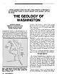
| grandeur, and even the climate. THE GEOLOGY OF WASHINGTON RAYMOND LASMANIS D e p a r t m e n t of Natural...Geology and Earth R e s o u r c e s Olympia, Washington 98504 W A S H I N G T O N S T A T E IS A D V...features of the adjacent regions all ter minate in Washington. The state's uniqueness is further enhanced by...by two major geologic conditions. First, Washington is impacted by crus tal tectonics as the oceanic...figures 1 and 2.) Second, the Columbia Basin in Washington and adjacent Oregon was subjected to one of the |
 | | Journal (article/letter/editorial) |
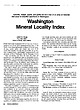
| Autunite, realgar, quartz, and pyrite are but a few of an array of that occur in beautiful specimens...specimens in Washington. minerals Washington Mineral Locality Index L A N N Y R. R E A M P.O. Box 2043 C o e...spectacular specimens of several miner als (e.g., quartz, pyrite, and realgar) and some of the world's best...okanoganite-(Y), and zektzerite, all from Washington Pass in Okanogan County —which are known only from the state;...Mackinaw mine in Snohomish County, ferritungstite from Germania mine near Fruitland in Stevens County, and |
 | | Book (edition) |
| popular ond little known oreos of OREGON e WASHINGTON BRITISH COLUMBIA • IDAHO BY H. C. DAKE Editor...Localities Beaches Map of Oregon Beaches JACKSON COUNTY A Mineral Mecca Mop of Josephine and Jackson Counties...Counties General Ge::ilogy Fine Zeolites Gold Mining Region The Applegate Gem Rhodonite Area Copper Nuggets...Eagle Point Locality ~hodonite Table Rock Mountain JOSEPHINE COUNTY Josephinite Oregonite Althouse Creek CENTRAL...Plume Mines Ochoc::i D;ggings Post District Antelope Locality County Quarry Brown's Ranch Crystal Hills |
 | | Report (volume) |
| RESULTS OF SPIRIT LEVELING IN THE STATE OF WASHINGTON 1896 TO 1910, INCLUSIVE R. B. MARSHALL, CHIEF...COOPERATION WITH THE STATE DURING 1909 AND 1910 WASHINGTON : GOVERNMENT PRINTING OFFICE 1911 CONTENTS...Chopaka, Nespelem, Okanogan, Osoyoos, and Republic quadrangles (Douglas, Ferry, and Okanogan counties).......Slate Pass, and Stehekin quadrangles (Chelan, Okanogan, and Whatcom counties)............................................ Portland quadrangle (Clarke county)................................... Index .... |
 | | Report (issue) |
| WASHINGTON GEOLOGICAL SURVEY HENRY LANDES, State Geologist BULLETIN No. 23 THE METAL MINES OF WASHINGTON...herewith a report entitled "Tl1e lVfetal lVIines 0£ Washington," by Ernest N. Patty, with the recommendation... . . . . . . . . . . . History of metal mining in Washington . . . . . . . . . . . . . . . . . . . ....of stocks and roof pendants. . . . . . . . . . . Quartz-silver-lead-copper velns . . . . . . . . . . ....Fissure veins In andesile and quartz latite. . . . . . Breccialed zones in quartz latite and associated volcanics |
 | | Report (volume) |
| OTIS SMITH, DIBECTOR BULLETIN 557 STATE OF WASHINGTON 1896 TO 1913, INCLUSIVE R. B. MARSHALL, CHIEF...WITH THE STATE HENRY LANDES, STATE GEOLOGIST WASHINGTON GOVERNMENT PRINTING OFFICE 1914 ELEVATION OF...BAINIEB. The elevation of the highest snow-capped summit of Mount Rainier was determined by C. H. Birdseye...of the mountain, was computed from triangulation data. The distance from Crater to the summit, which...elevation of Crater is 14,267 feet and that of the summit 14,408 feet. Mount Rainier is, so far as known |
 | | Book |
| Mining and Mineral Operations In the Pacific Gy BS. alae ih if Br pedal Center on 50, OC-521: LPO...is ——— ee O ae SS ot a - By oh Zz ai! MINING AND MINERAL OPERATIONS IN THE PACIFIC STATES A...cataloged as follows: United States. Bureau of Mines. Mining and mineral operations in the Pacific States:...by Bureau of Mines, State Liaison Officers. [Washington, 1976. ] 76 p. illus. (/ts special publication)...Documents, U.S. Government Printing Office, Washington, D.C. 20402 - Price $3.45 Stock No. 024—004—01872-1 |
 | | Report (issue) |
| for weights of evidence analysis in northeast Washington—1. Geologic raster data By David E. Boleneus1...Report 00-495 Prepared in cooperation with the Washington Department of Natural Resources and the U.S....of Agriculture, Forest Service, Okanogan National Forest, Washington 2000 This report is preliminary...INTERIOR U.S. GEOLOGICAL SURVEY 1 Spokane, Washington 1 Contents Abstract ........................Appendix D – List of digital files in the NE Washington GIS......................................... |
 | | Report (volume) |
| Zone UNITED STATES GOVERNMENT PRINTING OFFICE, WASHINGTON:1981 UNITED STATES DEPARTMENT OF THE INTERIOR...of Documents, U.S. Government Printing Office Washington, D.C. 20402 CONTENTS Introduction • • • •...Highway 49 (Skyway Road) near town of Abel, Cleburne County. Absaroka Supergroup/Volcanic Supergroup U ABRK03...volcanic field, Yellowstone National Park, Park County, Wyo. Academy Church Shale Member (Springer Formation)...W1/2NW1/4NE1/4SE1/4 sec. 1, T. 3 s., R. 2 E., Carter County. Adams Formation ADMS01 1. Holocene 2. Alaska (SE) |
 | | Report (volume) |
| OTIS SMITH, Director Bulletin 674 STATE OF WASHINGTON 1896 TO 1917, INCLUSIVE R. B. MARSHALL, CHIEF...State of Washington from 1909 to 1916, inclusive Henry Landes, State Geologist WASHINGTON GOVERNMENT...RAINIER. The elevation of the highest snow-capped summit of Mount Rainier was determined byC. H. Birdseye...of the mountain, was computed from triangulation data. The distance from Crater to the summit, which...elevation of Crater is 14,267 feet and that of the summit 14,408 feet. Mount Rainier is, so far as known |


