 | | Report (issue) |
| Pegmatite Investigations 1942-45 New England By EUGENE N. CAMERON and OTHERS GEOLOGICAL SURVEY PROFESSIONAL..._______ _ Geology of the pegmatite districts of New Hampshire_ Rock units ________________________________...pegmatites ___________________ _ Pegmatites of the Grafton and Keene districts __ _ Sources of pegmatites...quality __ AnalyHis of the wartime mica industry of New England ________________________________________...Androscoggin County ______________________ _ Berry feldspar quarry __________________ _ Cumberland County ___ |
 | | Report (issue) |
| and is here acknowledged. Aid was given in New Hampshire by Samuel Cordick, superintendent of the General...number of mines in Grafton County and extended other kindnesses; M. M. Kilton, of Grafton Center; L. L. Howard...however, a variety of plagioclase, either albite or oligoclase, makes up part or all of the feldspar component... SOME DEPOSITS OF MICA IN THE UNITED STATES. 69 NEW HAMPSHIKE. HISTORY OF MICA MINING. Mica mining in...Ruggles mine in Grafton County, N. H., about 1803. Later other mines were opened in New Hampshire, which for |
 | | Journal (article/letter/editorial) |
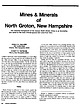
| Mines & Minerals of North Groton, New Hampshire The historical background of the famous North Groton...Candia Road Chester, New Hampshire 03036 R O B E R T W. WHITMORE Weare, New Hampshire 03281 N O R T H G... a large percentage of the popula tion of New Hampshire would not recognize the name, let alone be able...owner of the Palermo mines in North Groton, New Hampshire. WENTWORTH X McGinnis Mine X Wheat Mine ... X Belden Mine Atwood Mine, F. Davis .XMine DORCHESTER X RUMNEY (118 Penna Coal x Mine Diamond Minex |
 | | Report (volume) |
| River which flows northeast across the area to Dorchester Bay. The northwest corner is drained by streams...briefly in the summers of 1957, 1958, and 1960 for new exposures. Work for this report was done in cooperation...quadrangle is in the Seaboard Lowland section of the New England physiographic province and is characterized...several hundred feet along the main line of the New York, New Haven, and Hartford Railroad a few hundred feet...Salem Gabbro-Diorit© was named for Salem in Essex County, Mass., where it is widely distributed and typically |
 | | Report (volume) |
| .................................... Worcester County, Mass....................................... Westboro..................................... Westboro ("Grafton") quartzite............................. Marlboro...conglomerate member........................... Dorchester slate member................................................................... 150 Berkshire County.................................................. 195 Dikes cutting the Quincy granite in Essex County, Mass......... 196 Aplite..................... |
 | | Book |
| GEOLOGY OF SOUTHEASTERN NEW ENGLAND ^ ~- ., °'",....KILO>1ETFRS ^°ft o/ pCd o pCd pCd o o/ pCd D NEW ENGLAND INTERCOLLEGIATE GEOLOGICAL CONFERENCE *"|976...GROUP 3 MbDD DDMIS Tflbb GEOLOGY OF SOUTHEASTERN NEW ENGLAND A Guidebook for Field Trips to the Boston...Geology Boston University 68th Annual Meeting NEW ENGLAND INTERCOLLEGIATE GEOLOGICAL CONFERENCE October...Published by SCIENCE PRESS Princeton, New Jersey Univeroity of Nsv/ Hampshire Library- ©1976 by Barry W. |
 | | Report (volume) |
| -------------------------------General features of southeastern New England...___--_________-__ Historical sketch.__...Winthrop; B, Glacial gouge in bedrock, Mattapan, Dorchester district _-__--_____--__ 74 13. The Auburndale...________________ 2 2. Generalized geologic map of southeastern New England-_____ 3 3. Geomorphic subdivisions of Boston...__-___---__-----__ 8 4. Map of parts of New England, New York, and New Jersey, showing directions of movement...(see fig. 1) and includes nearly all of Suffolk County and parts of Middlesex, Essex, Norfolk, and Plymouth |
 | | Report (issue) |
| EPA REGION 1 Connecticut Maine Massachusetts New Hampshire Rhode Island Vermont OPEN-FILE REPORT 93-292-A...REGION 1 Connecticut, Maine, Massachusetts, New Hampshire, Rhode Island, and Vermont R. Randall Schumann...Preliminary Geologic Radon Potential Assessment of New Hampshire Linda C.S. Gundersen andR. Randall Schumann...directed to develop model standards and techniques for new building construction that would provide adequate...aerial radioactivity, and indoor radon data by county. Because of constraints on the scales of maps presented |
 | | Report (issue) |
| Vermont. The mineral industries of the state reached new levels of production during the war years, with a...prosperity. Her population and wealth were growing, new states were added to the Union, the balance of trade...American colonies down to the Revolution. In the new world The Boston Philosophical Society was founded...geology in 1816. Amos Eaton had surveyed Rensselaer County, N. Y., and the route of the Erie Canal; further...traveled many thousand miles on foot through New York and New England delivering short courses of lectures |
 | | Report (issue) |
| All who were involved in the preparation of the new bedrock map, particularly those responsible for the...understanding and portrayal of the geology. Although the new map is very different from Emerson's in many aspects...1984, Lithotectonic assemblages as portrayed on the new bedrock geologic map of Massachusetts: American Journal...Gneiss and schist near New Bedford (Zgs)................... Biotite gneiss near New Bedford (Zgn) ................. 40 Regional relations in southeastern New England .................... 42 Quartzitic assemblage |
 | | Report (issue) |
| diabase is mainly plagioclase laths (labradorite to oligoclase), pyroxene (diopside and augite) and a light...sizeable arch-shaped fold was also exposed in the new MBTA Red Line tunnel that was not seen in the nearby...between surface outcrops and bedrock mapping in the Dorchester Tunnel. Many shallow folds are visible in the...exposures can be found between Mt. Hope Cemetary and the new Mattapan School and in Milton on Blue Hill Avenue...east. A similar relationship was seen in the Dorchester Tunnel. Dark volcanics are limited in extent |
 | | Book (volume) |
| MODIFIED DRIFT By WARREN ae OF GLACIAL IN NEW HAMPSHIRE. UPHAM, DRIFT. APPENDIX II. TO PARTS ...INTRODUCTION, . . . . .. THE MINERALOGY OF NEW HAMPSHIRE, LITHOLOGY, INDEX TO PART IV, APPENDIX, Part...Rockingham, Vt., 3 : 18, Section in Bridgewater and New Hampton, 19, Section in Concord, Fig. 20, Section...of IN THE 14-16 ATLAS. New Hampshire—/ac-szmle, reduced. New Hampshire—/ac-simzle, half size. Two...the topography, contour lines, and geology of New Hampshire, with portions of that of the adjoining territory |
 | | Book (edition) |
| Shropshire, while rhyolite .is obtained in the same county near Wellington. Porphyrite is quarried in the...steel works. The iron slags are classified under "New Blastfurnace" (from current blastfurnace operations)...Renfrewshire and one in East Lothian; in .the latter county the phonolite of Traprain Law Quarry has been in...slabs. QUARTZITE TRADE GROUP (Q) Only one quarry (county of Aberdeen) is recorded as working quartzite;...Fl. D. G. s. ABERDEENSHIRE la ABERDEEN C.C., County Road Surveyor and Engineer, 25 Union Terrace, Aberdeen |
 | | Report (volume) |
| General features____________________________ Coosa County _________ ____________________ Randolph County...Cherokee County_____________________________ 72 Elbert County _____________________________ 75 Hall County__...County_______________________________ 76 Hart County. ___ __ __________________ 77, Lumpkin and Union counti...___________ S3 Pickens County _______-______________________ 83 Rabun County-_____________________________...____________ 86 Troup County ________________________________ 86 Upson County _______________________________ |
 | | Report (volume) |
| in Bronx and Westchester Counties, southeastern New York, by Charles A. Baskervi1le....................3. Buddenhagen...........................Hi 1 3. New Paleozoic formations in the northern Kuskokwim Mountains..., and Wi 1 1 iam W. Patton, 3r...........H13 ^. New stratigraphic unit in the Wilcox Group (upper Paleocene-lower...Shride.....................H57 8. Mauzy Formation, a new stratigraphic unit of Permian age in western Kentucky...formations in the Hamilton Group (Middle Devonian) of New York, by William A. Oliver, 3r..................H91 |
 | | Report (volume) |
| Director Bulletin 738 THE COMMERCIAL GRANITES OF NEW ENGLAND BY T. NELSON DALE WASHINGTON GOVERNMENT...expansion____^_________________ Geographic distribution of New England granite quarries____ Descriptions of the...___ Groton____________________________ Oriinge County __________________________ Topsham___________________________..._ Randolph ___________________________ Orleans County- _______________________ Derby Barton _ _________...granite and finished product Continued. Washington County _____________________ 121 Barre and Williamstown________________ |
 | | Report (issue) |
| PauL C. LYons ARTHUR H. BROWNLOW £ Studies in New England Geology A Memoir in Honor of C. Wroe Wolfe...GEOLOGICAL OF AMERICA SOCIETY er x ne Studies in New England Geology Edited by Paut C. LYons ArTHUR H...students were introduced to the complexities of New England Geology. In 1974 Dr. Wolfe received the Neil...interest in the earth sciences. Wolfe is best known to New England geologists as an astute crystallographer...his expertise on the mineralogy of pegmatites of New England, and for his work on the geology of the Boston |
 | | Book (edition) |
| the closure of some of the sources, the opening of new sources and changes of ownership of existing sources...SOURCES OF AGG R EGA TE THE sources are given under county headings, with all the counties of England, Wales...Scotland in one alphabetical list. Within each county the crushed rock quarries, gravel pits and slagworks...basis of information supplied by the producers: New blastfurnace slag Old blastfurnace slag Copper slag...steel works. The iron slags are classified under "New Blastfurnace" (from current blastfurnace operations) |
 | | Report (volume) |
| Lexicon of New For mal Geologic Names of the United States 1976-1980 By GWENDOLYN W. LUTTRELL, MARILYN...GEOLOGICAL SURVEY BULLETIN 1564 A compilation of the new geologic names intmduced into the litrrature from...Luttrell, Gwendolyn Lewise Werth, 1927Lexicon of new formal geologic names of the United States, 1976-1980...Geological Survey bulletin ; 1564) "A compilation of the new geologic names introduced into the literature from...biostratigraphy, Stroudsburg, Pa.; Dowden, Hutchinson, & Ross New York ; exclusive distributor: Halstead Press, c. |
 | | Report (issue) |
| In this district the cl1ange-over from six-incJ1 County sheets to I'J"ational Grid sheets is proceeding...British Guiana, Jamaica, Sierra Leone and Ghana ; new geochemical prospecting techniques have been tested...results ; a11d assistance has been given to the New Zealand Geological Survey in evaluating the occur...a wide range of researches has been conducted on new techniques, on age determinations by the uranium-lead...methods, on the study of metamict minerals, and on new mineral species. Coffinite, the rare uranium silicate |
 | | Report (issue) |
| Coastal Plain of Virginia, Maryland, Delaware, New Jersey, and New York for which granitic sources in the basement...(1) portions of the Atlantic Coastal Plain from New York to North Carolina and including parts of Georgia...water wells by persons of unknown qualifications. New and revised petrographic analyses of selected basement...(Zietz and others, 1977), and Maryland, Delaware, and New Jersey (Zietz and others, 1980b). The latter map...convenience: Georgia to North Carolina and Virginia to New York. Plates 2 and 4 are interpretive maps of the |
 | | Journal (article/letter/editorial) |
| Area, New Hampshire and Maine Abstract: The Connecticut Lakes-Parmachenee area, in northernmost New Hampshire...map of Connecticut Lakes-Parmachenee area, New Hampshire and Maine Insert 2. Photographs of structures...report is located in Coos County, northeasternmost New Hampshire, and Oxford County, northwestern Maine; it...by township name (for example, Clarksville, New Hampshire) are occasionally given herein for convenience...that understanding of the relation between New Hampshire stratigraphy and that of the southeastern Eastern |
 | | Field Trip Notes |
| //' . GUIDEBOOK FOR FIELD IN ''fy,.'t:J TRIPS NEW ENGLAND NOVEMBER 10-12, 1952 Organized by the...Before visiting any of the sites described in the New England Intercollegiate Geological Conference guidebooks...Highlands of East-Central New York, Southern Vermont, and Southern New Hampshire Field Trip No. 2, Outstanding...Outstanding pegmatites of Maine and New Hampshire 73 Geology of the "Chelmsford Granite" 103 Field Trip...OF EAST-CENTRAL NEW YORK, SOUTHER Leaders: VERJ-IONT, AND SOUTHERN NEW HAMPSHIRE Marland P, Billings |
 | | Report (volume) |
| Prof. H. E. Gregory, Sheffield Scientific School, New Haven. Delaware.........Prof. B. L. Miller, Lehigh...Tangier Smith, Berkeley, Cal. New Jersey...... .Dr. H. B. Kummel, Trenton. New York.........Mr. D. H. Newland...See Bauxite and Hallpysite. Asbestos. Tallapoosa County, with corundum deposits near Dudleyville; not found...commercial quantity or quality. Asphalt. Colbert County, small quantity has been shipped from near Leighton;...following localities: Bibb County, Pratts Ferry; Calhoun County, near Tampa; Clay County, T. 20, Pv. 7 E.; Jefferson |
 | | Report (issue) |
| VARIEGATED MARBLE SOUTHEAST OF CALERA, SHELBY COUNTY, ALABAMA. By CHARLES BUTTS. About 3£ miles a little...is great, and it would not be easy to establish a new enterprise in that line on a paying basis except...in Bulletins 313, 404, 430, and 484, on the other New England granites. The following scale of shades and...chief commercial granites offMassachusetts, New Hampshire, and Rhode Island: Bull. U. S. Geol. Survey...the writer's work on the commercial granites of New England. It contains two petrographic determinations |


