 | | Journal (article/letter/editorial) |
| JERI L . JONES R.D. #9, Sitler Lane York, Pennsylvania 17402 THE TYPE LOCALITY F O R C E L E S T I T...T E IS B E L L W O O D , B L A I R County, Pennsylvania. It was col lected there by a German traveler...collecting celestite in Juniata County, Pennsylvania. Location The Susquehanna quarry of the Koppers Company...miles north-northwest of East Salem, Juniata County, Pennsylvania. The quarry can be reached by tak ing...traveling north through East Salem, and then turning west onto Pennsylvania R t . 325. Travel about 200 |
 | | Report (issue) |
| MILLERSTOWN QUADRANGLE, PERRY, JUNIATA, AND SNYDER COUNTIES, PENNSYLVANIA Rodger T. Faill Richard B. Wells...Wells COMMONWEALTH OF PENNSYLVANIA DEPARTMENT OF ENVIRONMENTAL RESOURCES BUREAU OF ~5 7. ► i+17 ~...MILLERSTOWN QUADRANGLE, PERRY, JUNIATA, AND SNYDER . COUNTIES, PENNSYLVANIA by Rodger T. Faill and Richard...Richard B. Wells Pennsylvania Geological Survey PENNSYLVANIA GEOLOGICAL SURVEY FOURTH SERIES HARRISBURG...of Pennsylvania Quotations from this book may be published if credit is given to the Pennsylvania Geological |
 | | Journal (article/letter/editorial) |
| drainage pH atmospheric deposition Chesapeake Bay Susquehanna Schuylkill ocean acidification a b s t r a c...sulfur budgets were explored using watersheds of Pennsylvania underlain by extensive coal deposits. Areas...currently. Fluxes of sulfate and magnesium from the Susquehanna River at Danville, the major tributary to the...derived sulfate to the 29,000 km2 portion of the Susquehanna River studied here was twice as large as the...from SOx deposition to the entire 71,000 km2 Susquehanna watershed. This is surprising, comparing the |
 | | Journal (article/letter/editorial) |
| ........................................... Susquehanna R iver.........................................called the Taconic revolution. In southern Pennsylvania the Juniata sandstone lies conformably on 1 Manuscript...Geological Survey, and the State Geologist of Pennsylvania. (6 2 9 ) X L I— B u l l . G eol. S oc. A m...sedimentation follows either the Martinsburg or the Juniata. A reconnaissance survey of the upper contact of...of the Mar tinsburg shale was made across Pennsylvania for the State Survey to determine the nature |
 | | Book |
| B. Roadside geology of Pennsylvania. HQQIUNI ROA DSIDE EOLOGY of Pennsylvania Bradford B. Van Diver ...Roadside p. cm. Includes Bradfor B. geology of Pennsylvania / Bradford B. Van Diver — (Roadside geology...0-87842-227-7 : $15.00 1. Geology—Pennsylvania—Guide-books. 2. Pennsylvania— Description and travel—1981—Guide-books...glance at the 1980 edition of the Geologic Map of Pennsylvania spread upon the wall gives reason enough for...geologic history. On the ground, that spectacular Pennsylvania story is told piecemeal, but in much greater |
 | Mathur, R., Jin, L., Prush, V., Paul, J., Ebersole, C., Fornadel, A., Williams, J.Z., Brantley, S. (2012) Cu isotopes and concentrations during weathering of black shale of the Marcellus Formation, Huntingdon County, Pennsylvania (USA) Chemical Geology, 304. 175-184 doi:10.1016/j.chemgeo.2012.02.015 | Journal (article/letter/editorial) |
| of the Marcellus Formation, Huntingdon County, Pennsylvania (USA) R. Mathur a,⁎, L. Jin b, c, V. Prush... S. Brantley b a b c Juniata College, Department of Geology The Pennsylvania State University, Earth...of the Susquehanna/Shale Hills Critical Zone Observatory located in Jackson Corner, Pennsylvania. This...carbonaceous shale that underlies much of New York, Pennsylvania, Ohio and West Virginia. In this paper, we focus...and isotope data of the soils are consistent with pyrite weathering and loss of Cu from the ridgetop, but |
 | | Report (issue) |
| LEAD OCCURRENCES IN PENNSYLVANIA Robert C. Smith, II COMMONWEALTH OF PENNSYLVANIA DEPARTMENT OF ENVIRONMENTAL...ZINC AND LEAD OCCURRENCES IN PENNSYLVANIA Robert C. Smith, II PENNSYLVANIA GEOLOGICAL SURVEY FOURTH SERIES...1977 Copyright 1977 by the Commonwealth of Pennsylvania Quotations from this book may be published...published if credit is given to the Pennsylvania Geological Survey COVER ILLUSTRATION: Photograph of 1852 lithograph...and "new" Perkiomen mines(left to right, from the east). Courtesy of Allen V. Heyl, U.S. Geological Survey |
 | | Report (edition) |
| PENNSYLVANIA STATE LIBRARY OF 0144 00141189 1 v < 2 £ m- c oi; c» tt*s“S S Si! at tss^s isl^j...1 ' s WJ= ~S 5! s „3 &«eq Sjg® . . PENNSYLVANIA 1 .8 ^2»SS 3 d 5-s &s z l|lt« 7* < OF ...GEOLOGY REPORT 1976 33 MINERAL COLLECTING IN PENNSYLVANIA by Alan R. Geyer Robert C. Smith, John H....Graphics by Albert E. VanOlden COMMONWEALTH OF PENNSYLVANIA DEPARTMENT OF ENVIRONMENTAL RESOURCES TOPOGRAPHIC...II Copyrighted 1976 by the Commonwealth of Pennsylvania Quotations from this book may be published if |
 | | Report (issue) |
| PENNSYLVANIA GEOLOGICAL SURVEY FOURTH SERIES BULLETIN M 15 BUILDING STONES OF PENNSYLVANIA By RALPH... COPYRIGHTED 1932 BY THE COMMONWEALTH OF PENNSYLVANIA ADDITIONAL COPIES OF THIS PUBLICATION BUREAU...Structure 3 •> 10 Strength 10 Geology of Pennsylvania Physiography Stratigraphy Appalachian Revolut...Adams County Allegheny County Armstrong County Beaver County 19 1" -<» -- 24 -7 Bedford County -'•'...-;"» SO Perks County ;>- Blair County Bradford County Pucks County Butler County 00 03 07 77 Cambria |
 | | Report (volume) |
| MINERAL RESOURCES OF THE BELLEFONTE QUADRANGLE, PENNSYLVANIA GEOLOGICAL SURVEY BULLETIN 855 UNITED STATES...MINEEAL BESOUECES OF THE BELLEFONTE QUADRANGLE, PENNSYLVANIA BY CHARLES BUTTS AND ELWOOD S. MOORE UNITED...sandstone.____________________________________ Juniata formation____________________:_______________....character________________________________________ Quarry rock._____________________________________________...group. _____________________________ 34 A, Old quarry just southwest of active limestone mine in western |
 | | Journal (issue) |
| COMMONWEALTH OF PENNSYLVANIA Dick Thornburgh, Governor DEPARTMENT OF ENVIRONMENTAL RESOURCES Nicholas..... . ....... . ..... . Geologic research in Pennsylvania -1984 .............. . Areal Geology .........question. Photo cou rt esy of Geary Sarno. PENNSYLVANIA GEOLOGY is published bimonthy by the Topographic...Geologic Survey, Pennsylvania Dept. ef Environmental Resources, Harrisburg, Pennsylvania, 17120. Editor...and assistance, the Pennsylvania Geological Survey and the citizens of Pennsylvania owe a great debt of |
 | | Book |
| limestone. PENNSYLVANIA 40 I 60 50 Ml I 80 KM 76° -, I II --,--~ SUSQUEHANNA 42 ° I \ ...l0000unse THE GEOLOGY OF PENNSYLVANIA COMMONWEALTH OF PENNSYLVANIA Mark Schweiker, Governor DEPARTMENT...Geology Slippery Rock University Published by PENNSYLVANIA GEOLOGICAL SURVEY PITTSBURGH GEOLOGICAL SOCIETY...from Hyner View, Hyner Run Slate Park, Clinton County, showing accordant ridges in the Appalachian Plateaus...Plateaus province. The West Branch Susquehanna River flows 1,300 feet below the overlook. Photograph by |
 | | Report (volume) |
| Quadrangle Lackawanna, Luzerne, and Wyoming Counties Pennsylvania By THOMAS M. KEHN, ERNEST E. GLICK, and WILLIAM...Series_____________________________________ Susquehanna Group___________________________________ Trimmers... LACKAWANNA, LUZERNE, AND WYOMING COUNTIES, PENNSYLVANIA By THOMAS M. l{EHN, ERNEST E. GLICK, and...downward from the Catskill Formation of the Susquehanna Group to the Kalkberg Limestone of the Helderberg...Mississippian, and Pennsylvanian rock in northeastern Pennsylvania. The Lower Devonian consists of marine limestones |
 | | Report (volume) |
| Uranium Occurrences in Sedimentary Rocks of Pennsylvania GEOLOGICAL SURVEY BULLETIN Prepared on behalf... Uranium Occurrences in Sedimentary Rocks of Pennsylvania By HARRY KLEMIC CONTRIBUTIONS TO THE GEOLOGY...ILLUSTRATIONS PLATE 2. FIGURE 30. 31. Map of Pennsylvania showing localities where uranium is known to...areas______________________________ 246 Map of Pennsylvania showing Stratigraphic positions of uranium occurrences...of uraniferous and nonuraniferous rock from Pennsylvania, New Jersey, West Virginia, and Tennessee, with |
 | | Journal (article/letter/editorial) |
| A PENNSYLVANIA STATE MINERAL By RICHMOND E. MYERS Moravian College, Bethlehem, Pennsylvania Downloaded...August 2017 Reprinted from Proceedings of the Pennsylvania Academy of Science, pages 140-146. Vol. XXXIV...XXXIV, 1960 At the spring meeting of the Pennsylvania Academy of Science held at Schwenksville in 1959...ardent Pennsylvania rockhounds. The question was raised, "What is the state mineral of Pennsylvania ?" We...other states would be justified far more than Pennsylvania in adopting any one of them. Lansfordite and |
 | | Report (issue) |
| GEOLOGY AND MINERAL RESOURCES OF YORK COUNTY PENNSYLVANIA By GEORGE W. STOSE of the U. S. Geo1ogical...Geo1ogical Survey and ANNA I .•JONAS of the Pennsylvania Topographic and Geologic Survey Published with the...In COPYRIGHTED 1939 BY THE COMMONWEALTH OF PENNSYLVANIA Additional copies of this publication may be.... . . . . . . . . . . . . . . . . . . . . 5 Susquehanna drainage . . . . . . . . . . . . . . . . . .... . . . . . . . . . . . . . . . . . . . 9 A, Susquehanna River near P<>qua; 8, Dry <·lwnnel of riYer b |
 | | Journal (issue) |
| VOL. 33, NO. 1 GEOLOGY COMMONWEALTH OF PENNSYLVANIA Edward G. Rendell, Governor DEPARTMENT OF CONSERVATION...us/topogeo DCNR web site: www.dcnr.state.pa.us Pennsylvania home page: www.state.pa.us CONTENTS Many ideas...celestine, a mineral that was first described from Pennsylvania specimens. Celestine, which is composed of strontium...mineral of Pennsylvania (see article on page 14). Photograph by John H. Barnes. PENNSYLVANIA GEOLOGY PENNSYLVANIA...PENNSYLVANIA GEOLOGY is published quarterly by the Bureau of Topographic and Geologic Survey, Pennsylvania |
 | | Report (issue) |
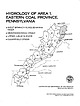
| NEW YORK WEST BRANCH SUSQUEHANNA RIVER SINNEMAHONING CREEK UPPER JUNIATA RIVER CLEARFIELD CREEK TENNESSEE... HYDROLOGY OF AREA 1, EASTERN COAL PROVINCE, PENNSYLVANIA BY WILLIAM J. HERB, DEBORAH E. BROWN, LEWIS...INVESTIGATIONS OPEN FILE REPORT 82-223 HARRISBURG, PENNSYLVANIA SEPTEMBER, 1983 UNITED STATES DEPARTMENT OF...P.O. Box 1107 228 Walnut Street Harrisburg, Pennsylvania 17108 CONTENTS Page Abstract ............... HYDROLOGY OF AREA I, EASTERN COAL PROVINCE, PENNSYLVANIA BY WILLIAM J. HERB, DEBORAH E. BROWN, LEWIS |
 | | Journal (issue) |
| � ... ��: ;... �. .. .' ·COMMONWEALTH OF PENNSYLVANIA · Robert P. Casey, Governor 1 DEPARTMENT...viewer. Thus geologic art is doubly valued. Pennsylvania is not represented in The Art of Geology. Yet...International Geological Con gress, 49 images of Pennsylvania geology were one of the main focuses of a large...the 1989 meeting of the Field Con ference of Pennsylvania Geologists and the 1990 meeting of the Northeastern...site near Allen town. At many localities in Pennsylvania, holes have been drilled into rocks to extract |
 | | Report (issue) |
| PENNSYLVANIA GEOLOGICAL SURVEY FOURTH SERIES BULLETIN M3 THE SILICA REFRACTORIES of PENNSYLVANIA $y...Forests and Waters for the Commonwealth of Pennsylvania IT LEGEND ,.;#';: Tuscarora Formation ^\... Clearfield o 41' FIGURE J Map of central Pennsylvania showing location of Tuscarora (Medina) and Chickies... _^_ _ _ \ x _ • 76° Map of southeast Pennsylvania showing location of Tuscarora (Medina) and Chickies...illustrations describing the Silica Refractories of Pennsylvania. This report is by Professor E. S. Moore, formerly |
 | | Report (issue) |
| INTERIOR GEOLOGY OF THE HANOVER-YORK DISTRICT PENNSYLVANIA GEOLOGICAL SURVEY PROFESSIONAL PAPER 204 CONTENTS...Triassic sedimentary racks in western New Jersey, Pennsylvania, and Maryland, showing diabase sills, crosscutting...____________________ FIGURE 1. Index map of southern Pennsylvania and adjacent part of Maryland, showing location..._____ 6. Sketch of section of Chiekies slate on east side of Mill Creek, south of Plank Road__________________________...________ 7. Sketch of section of Chickies slate east of Codorus Creek near York Country Club____________-_-__-_-__-___ |
 | | Journal (article/letter/editorial) |
| 26 August 2017 Kline's Quarry looking easterly from upper level. Susquehanna River visible in middle...Wrightsville, Pennsylvania 17358 and 1780 Prescott Road York, Pennsylvania Kline's quarry, Wrightsville...Wrightsville, York County, Penn- basis to go mineral collecting, weather permitting. slyvania is located on the...the west bank of the Susque Kline's quarry, being very close to our regular meet hanna River, approximately...Creek and the Susquehanna River. One Saturday morning some years ago after Kline's quarry is an active |
 | | Journal (issue) |
| 11 When Mexico shook, Pennsylvania jumped ...... .... .. . 15 PENNSYLVANIA GEOLOGY is published blmonthy... of E vlronl'[lental Resources, Harrisburg, Pennsylvania, 17120. . , Editor, Arthur A. Socblow; Associate...should not be measured only in dollars. And Pennsylvania, with its large resources of coal that is the...Plateaus physiographic province in southern Somerset County. Here, Negro Mountain Anticline brings Mississippian...crushed stone and agricultural limestone for Pennsylvania, Maryland, and West Virginia. The ancestral |
 | | Journal (issue) |
| VOL. 33, NO. 4 GEOLOGY COMMONWEALTH OF PENNSYLVANIA DEPARTMENT OF CONSERVATION AND NATURAL RESOURCES...us/topogeo DCNR web site: www.dcnr.state.pa.us Pennsylvania home page: www.state.pa.us BUREAU STAFF AND................... 1 Lead and zinc in central Pennsylvania ..............................................Berkheiser, Jr., P.G. Shaded-relief image of Blair County and surrounding area. The V-shaped Brush Mountain...northeastern part of the county and the Little Juniata River along the county boundary form the borders |


