 | | Journal (volume) |
| botryoidal varieties), from Bohill quarry, Dundrod, County Antrim, Northern Ireland, collected in 1978. The...2007 PAPERS Zoned oxidation deposits in Tynebottom Mine, Garrigil1, Cumbria Trevo r F. Bridges and David...Copper·bearing silica gel from the walls of the Tankardstown mine, Co. Waterford, Treland Stephen Moreton 10-17 ...vein minerals at the Conlig-Whitespots Lead Mines, County Down, Northern Ireland Norman R. Moles 40-46 ...and 1. Ike Wilson 52-54 Powellite from Benallt mine, Lleyn Peninsula, Gwynedd: a first Welsh occurrence |
 | | Report (issue) |
| Reports 10 11 Geophysical surveys around Talnotry mine, Kirkcudbrightshire, Scotland A study of the space...for the Institute of Geological Sciences by Four Point Printing I I I I I I I I I I I I I I I I I I...investigations 3 7 Other areas where sulphides or baryte were identified in drainage samples Other anomalous...groups: (a) copper, (b) copper (lead, zinc) and (c) baryte (lead). Economically, group (b) is the most important...and mineralogical observations indicated that all high Sn and Sb levels were related to contamination and |
 | | Journal (issue) |
| evening speakers was giving a talk on the Golconda Mine in Derbyshire, and I'd like to know what I missed...South-West Branch will be hosting the 1998 AGM. The County Museum at Truro will be the main 'base'and various...crizzled, and typically have compositions that are high in alkali (soda and/ or potash) and low in alkaline...strontium (Sr) from strontianite and barium (Ba) from baryte. Some minerals had been named after the elements...industry and road salt; and potash from the Boulby Mine of the Upper Permian of North Yorkshire (now reputed |
 | | Journal (issue) |
| Diamond Point for Quartz (Nathan Scholten) leader. • September 29th to Anderson Uranium Mine for Carnotite...COMPETITIONS THUMBNAIL SELF COLLECTED DIOPTASE, Sanda Mine, Mindouli Region, West of Brazzaville, Central African...Whitney-Smith. WULFENITE, Red Cloud Mine, Trigo Mts., La Paz County, Arizona, USA; © Chris Whitney-Smith. Page...Harvard Collection it is called the Electric Meatball Mine. At least mineral collectors have a good imagination...at for lapidary material. One is the Burro Barite Mine south of Bouse with veins of pink to white barite |
 | | Journal (issue) |
| above small caves exposed in the open pit fluorspar mine in Carboniferous Limestone adjacent to Dirtlow Rake...alabaster memorial to Bishop Ridding remains unverified. High in the North Transept, the pilgrim sculpture was...Havasupai and Toroweep. It has been built on Eagle Point, in the Hualapai native reservation. Significantly...convincingly demonstrated, but all the signs now point to some sort of microbial life commencing very soon...coal-bearing Westphalian A and B north of the Wales-Brabant High. Geological Society of London Special Publication |
 | | Report (volume) |
| Registered Charity No. 233199 Front Cover: Odin Mine and Mam Tor "'Tfar (w Geologists' Association...GEOMORPHOLOGY OF THE CASTLETON AREA 30 ITINERARIES 1. Odin Mine, Mam Tor. Windy Knoll & Treak Cliff 53 2. Cowlow...hydrocarbons at Windy Knoll. 21. Worked-out vein in Odin Mine. 22. Open-cut section, Dirtlow Rake. 23. Blue John...Classic vadose canyon of Peak Cavem. 35. Speedwell Mine and Cavem plan. 36. Speedwell Cavern's Main Canal...Itinerary 1. 46. Ore crushing circle and wheel, Odin Mine. 47. View along reef belt. 48. Windy Knoll quarry |
 | | Report (volume) |
| MISSOURI GEOLOGICAL SURVEY VOLUME VI. LEAD AND ZINC DEPOSITS ( SECTION l) By ARTHUR W INSL OW ASSISTED...EXCELLENCY, DR. J. HON. WM. ,J. STONE, GOVERNOR OF MISSOURI, JEFFERSON CITY, ex officio President of the Board... CARTER, SECRETARY , LETTER OF TRANSMITTAL. MISSOURI GEOLOGIC.AL SURVEY,} JEFFERSON CITY, JULY 1,...of the Report on the Lead and Zinc Deposits of Missouri, by Mr. Arthur Winslow, assisted by Mr. James...with the idea of gathering a complete series of mine descriptions to form part of the report. Not until |
 | | Book |
| older mining pictures from the collections of the County Museum, Truro. ln supplying material fro1n the...to innumerable questions, the curators. of the County Mu~eu1n. Leslie Douch and Roger Penhallurick, have...DartEdwards, 1985. The region is peninsular, with no point much further moor is the highest, averaging some...strong maritime level, with a maximum of 2039 ft at High Willhays. Brown Willy, at 13 7 5 ft on Bodmin Moor...Moor, is the highest hill in Cornwall; and the high point of the Isles of Scilly, Fig. 2 Geological map |
 | | Journal (issue) |
| allowed. Editor: Phyllis B. George 22407 Park Point Drive Katy, TX 77450-5852 Phone: (281) 395-3087...intermountain lakes. I only know of one, but you get my point—it was easy to recognize these geologic features...slate, but they still have at least one active coal mine. Most of Ireland’s electricity and its heating for...great deal of mineral eye candy. He will share some high-end pieces photographed recently and will talk about...Mexico is famous for its mineral riches. From Kelly Mine smithsonite and Blanchard fluorite to San Pedro |
 | | Journal (issue) |
| History, Productivity and Mineralogy of Snelston Mine, Ashbourne, Derbyshire. Philip S. Jackman 19 ...Willies, John Wilmot, and Tony Wood 42 Millclose Mine Strikes - Postscript Lynn Willies 46 John Gell...mineable thickness of coal would be the later-named High Main at about 550 feet (up to about four feet thick...explain the pioneering use of electricity at the mine. J. T. Barber may either be linked to the prominent...least suitable, being up-dip of the bulk of the mine take and at a position where the upper "barren red |
 | | Report (issue) |
| http://www.archive.org/details/cu31924005064260 MISSOURI GEOLOGICAL SURVEY VOLUME VIII ANNUAL REPORT...PRINTING COMPANY, STATE PRINTERS AND BINDERS 1S9d MISSOURI GEOLOGICAL SURVEY VOLUME VIII ANNUAL REPORT... — law under which the Geological Survey of Missouri was organ- have the honor to submit to you a...Charles RoUln Keyes ' 11 Crystalline Kocks of Missouri; by Erasmus Haworth UifTioxARY OF ALTITUDES by...OzARK MOUNTAINS; by Charles COAL Measures OF Missouri; by Garland M)Ex C. 81 Marbut Broadhead |
 | | Book |
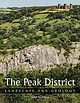
| you and great credit go to the late Paul Deakin, mine surveyor, caver and photographer who lived in the...Reef limestone forming the great white cliff of High Tor, seen from Masson Hill across the Derwent Gorge...front of the grit moors of Kinder Scout that stand high in the distance. Even within the national park...during the seasonal bloom of purple heather. The high ground of the Pennines and the Peak District, between...hill north of Monyash with the confusing name of High Low. Black Rock’s grit crags overlook Dene Quarry |
 | | Journal (volume) |
| and yellow zoning from the find at Rodderup Fell Mine in the early 1930’s Photo G. Scovil WANTED! We...Pyromorphite on plumbogummite from Roughton Gill Mine, Caldbeck Fells, Cumbria. Photo: David Green. The...------ 9 -------------------------- Rogerley Mine Jesse Fisher • Lindsay Greenbank MARKETING Peter...Geological Survey. Don Edwards communicated the dealer’s point of view, while Brian Jackson of the National Museum...cially-attached scheelite crystal from the Carrock Mine (to give an example of a Bryce Wright “specimen” |
 | | Book |
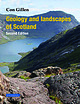
| marked contrasts, between high rugged mountains in the northwest, flat, high table lands in the northeast...1200–1300°C and therefore contain minerals with high melting points. On the other hand, acidic rocks...lavas are conspicuous at Stonehaven and Downan Point, Ballantrae, near Girvan; other examples include... The minerals in igneous rocks, which formed at high temperature, are unstable at the surface and will...that transported loose material across the surface. High-energy environments, such as fast-flowing mountain |
 | Au, Pek-Ing, Du, Mingyong, Liu, Jishan, Haq, Md. Bashirul, Leong, Yee-Kwong (2019) Surface chemistry, rheology and microstructure of as-received SHCa-1 hectorite gels. Clay Minerals, 54 (3) 269-275 doi:10.1180/clm.2019.37 | Journal (article/letter/editorial) |
| was sourced from The Clay Minerals Society (CMS), USA. Composite suspensions such as drilling fluids involving...Mountain (andesite formation), San Bernardino, CA, USA. The clay consists of ∼50% smectite, 43% calcite...gel. This yield stress represents the starting point in the ageing experiment. No shearing of the sample...potentiometric titration was conducted in the direction of high to low pH. The conductivity of the suspension increased...this pH. The dissolved Ca2+ ions contributed to the high conductivity. The zeta potential–pH characterization |
 | | Book |
| 7:">3} \,ith .the now flooded Park Sop haematite mine in the foreground. (L2258). (Photographer: KE Thon11...Low Scales Nlern ber 45 Kirkley Bank Formation 45 High Haume Tuff Fo rmatio n 47 Broughton Moor Fonnation...access to quarries and geological data; Cun1bria County Council :Highways and Transportalion Department...irreHigh H aume Tuff Formation marks the final pulse of volcanistn...such as Alston, Askrigg and the Manx- Lake District High were underpinned by the isostatically buoyant, early |
 | | Journal (issue) |
| common on the western side of the Apennines. The high Apennines are mainly formed of limestones of Jurassic...units have been exhumed and uplifted forming the high Alps. The GA Map library The GA map library is...and thrusts that characterise these belts is by high fluid pressures and that once these structures have...September 2016.qxp_mag41.qxd 13/09/2016 07:02 Page 19 high wave energy in a tropical sea. At the eastern end...were notable for their white blobs of the mineral baryte. Within St Mary’s Church grounds were a number |
 | | Book |
| to the Isle of Man (Bott 1974 and Chapter 3). The high poin t of the batholith are now exposed as the Skiddaw...formed as coalescing fans descended from surrounding high ground, rather like some alluvial fans in parts...formed as coalescing fans descended from surrounding high ground, rather like some alluvial fans in parts...local Ordovician geomagnetic field and obtaining a point on the apparent polar wander path for Britain, comparing...In this study many flows in both the Binsey and High Ireby Formations were sampled in detail at Binsey |
 | | Report (issue) |
| along the borders of a granite body in Halifax 18 County. 19 and Vanoe Counties. 20- Tungsten minerals...occur with sulfides in vein|j deposits in Cabarrus County. 21 22 23 24 25- U. S. GOVERNMENT PRINTING OFFICE:...deposits. 21 This belt passes through Gaston County. Tin veins in pegmatite and placer deposits derived...Halifax County. Tungsten occurs in North Carolina in two principal localities, in Cabarrus County associated...with copper-gold mineralization, and in 5- Vance County in mineralized quartz veins. Rare-earths occur |
 | | Book |
| mined at different places. It is difficult to pin-point any This very sketchy outline may to introduce...mining at Trewellard, at the Geevor mine, and the old Levant mine which has recently been reopened. Another...portance. r f i Here there is another working mine, at South Crofty. extracting tin ore. although copper...Wheel Mary Ann (O.S. map 186 288638), an old lead mine, good fluor ite crystals and other minerals are...another cluster of mines will be seen. Old Gunnislake mine (O.S. map 187,430720) has long been famous for its |
 | | Journal (volume) |
| Metallurgy of Copper in 1905. Bell, Robert N. State Mine Inspector, Idaho. Lead in Idaho. Gold and Silver...Mexico. Pyrites Mining and Milling, St. Law¬ rence County, N. Y. Talc in Northern New York. Brown, A. Selwyn-...Editor, Engineering Journal. Lead in Southeastern Missouri. Wilkinson, W. Fischer. Consulting Mining Engineer...Duluth, Minn. Formerly Superintendent, Cabin Branch Mine, Virginia. and Mining Petroleum. Paul, James...Quicksilver Industry in Brewster County, Texas. Rice, Claude T. W. Chief Mine Inspector, Charleston, W. Va |
 | | Report (issue) |
| equivalent of the southeast 3 INTRODUCTION Missouri district can be expected to turn up in the future...the mid-1950's on the west side of the Southeast Missouri district resulted in the discovery of the large...mines were operating, and the reserves of lead in Missouri alone had increased to 30 million tons. (See the...the phoenixlike rejuvenation of the Southeast Missouri district, the Viburnum Trend becomes the perfect...cannot be expected to continue in the future. To point the direction to potential resources and to attempt |
 | | Report (issue) |
| highest-lying diamond pipe. Commissioning Letseng mine at 10 500 feet during the last two years has called...COAL (CANADA) GYPSUM (USA) Whatever you're mining, wherever you're mining, mine it on Bridgestones Bridgestones...Operating conditions differ enormously from mine to mine. Not only are there variations in the kind of...Whatever you’re mining, wherever you’re mining, mine it on Bridgestones. iaaseinn Money — BRIDGE STONE...reversed in the next period of market shortage and high prices, it by no means follows that new investment |
 | | Journal (issue) |
| Nick Catford Back page upper: Rock Cemetery Sand Mine, Nottingham: The SubBrit group, unconcerned by the...killed in a mine blast in the northwestern Ningxia region. According to China’s National Coal Mine Safety...tunnel. More than 300 people were working inside the mine at the time of the rock burst, and most were successfully...safety. More than 700 rescuers were sent down the mine and they spent nine days searching for survivors...the body of the last miner was lifted out of the mine. Deadly mining accidents are common in China, where |
 | | Book |
| Drift 1927, (;overnmentBookshops 1:25 000 49 High Holborn, London WC 1V 6HB t 3a Castle Street, Edinburgh...132 Main structural features of the Rhyl and Den high district 136 Sketch-map showing details of the principal...rocks. The district lies largely in the former county of Denbighshire, with part of Flintshire in the...falls within Gwynedd, it now forms part of the new county of Clwyd. The main centres of population are on...half of the district. The Denbigh Moors consist of high dissected ground generally between 300 m (1000 ft) |


