 | | Report (issue) |
| for weights-ofevidence analysis in northeast Washington —2. Mineral databases by D.E. Boleneus1 Open-File...INTERIOR U.S. GEOLOGICAL SURVEY 1 Spokane, Washington Contents ABSTRACT............................carbonate-hosted lead-zinc model ..................................................................5 Small lead-zinc...11 Table 3. Training sites for carbonate-hosted lead-zinc. ......................................................................16 Table 4. Small lead-zinc mines and prospects. ......................... |
 | | Report (volume) |
| NORTHEASTERN WASHINGTON BY HOWLAND BANCROFT INCLUDING A SECTION ON THE REPUBLIC MINING DISTRICT BY WALDEMAR...WALDEMAR LINDGREN AND HOWLAND BANCROFT WASHINGTON GOVERNMENT PRINTING OFFICE 1914 I CONTENTS. Page............. ^................................ 1 Area examined.............................................. History of mining activity.............................................. Mining and metallurgy....................................... Methods of mining............................................... |
 | | Report (Issue volume) |
| State of Washington ARTHUR B. LANGLIE, Governor Department of Conservation and Development W. A. GALBRAITH...GLOVER, Supervisor Bulletin No. 37 INVENTORY OF WASHINGTON MINERALS PART II METALLIC MINERALS By MARSHALL...Volume 2 - MAPS STATE PRINTING PLANT. OLYMPIA, WASHINGTON lll!UI For sale by Department of Conservation...volumes-text and maps) $4.50. INVENTORY OF WASHINGTON MINERALS PART II METALLIC MINERALS Volume 1...Bulletin 33, "Nonmetallic Mineral Resources of Washington," published in 1936. Since then the catalogue |
 | | Report (issue) |
| Windfall Mining Company. The formations as exposed on the ' The ]iinerai Resources of Stevens Cotinty...ropo1-ted from the ore. u. s. COPPEn-oor_,n_ This mine is situated in sec. 17, T. 32 N., R. 41 E. TJiere...offices in Chewelah. The formations exposed in this area c011si.st of intcrbedded quartzite, silicified argillite...Bulletin, No. 20, Washington Geological SU-rvey CHEWELAH CONSOLIDATED. This mine is situated in the...of the north fork of Chewelah Creek and on the divide with Bear Creek. 1t is apprOA"lmately 12 miles |
 | | Report (issue) |
| BULLETIN N o. 20 Tl1e Mineral Resol1rccs of Stevens County Ry ('HARLES E. WEAVR]{ 01,YMP!A FRANJ, "M...a r eport entitled "The Mineral R csotu'ces of Stevens ounty,,, by Charles E. Weaver, with the recommendatio1...•• • ••. • . • • •• • •• • • • •. Location and area of the region. . . . . . . . . . . . . . . . . .... . . . . . . Relation of the mountains in Stevens County to the subdivisions of the Cordillera. . ..... . . . . . . . . . . . . . . . . . . . . . . Stevens Series.. . . . . . . . . . . . . . . . . . . . |
 | | Book |
| Bart Cannon 1975 CORD ILLERAN Mercer Island, Washington Lilli liliiiLt' 111? KLi-KlLLLIlrVlIlI Copyright...Cordilleran 18 Holly Hill Drive Mercer Island, Washington 98040 COVER ILLUSTRATION: Amethyst scepter heads...upon milky quartz stems. Denny Mountain area of King County. Specimen from the collection of Cary A....publications dealing with the various aspects of Washington State's diverse mineral wealth exist, but none..."Minerals of Washington" represents an attempt to begin such a cata logue. "Minerals of Washington" shall |
| | Report (issue) |
| evidence analysis in northeast Washington—4. Mineral industry activity in Washington, 1985-1997. by D.E. Boleneus1...Report 00-014 A Prepared in cooperation with Washington Department of Natural Resources, Division of...1 2 Spokane, Washington Washington Department of Natural Resources, Spokane, Washington Contents Abstract...Appendix II--Table of mineral industry activity in Washington, 1985 to 1997..................................showing location of 339 exploration or mining sites in Washington. ................................... |
 | | Report (issue) |
| WASHINGTON . GEOLOGICAL SURVEY. HENRY LANDES, STA TE GEOLOGIST. VOLUME I. ANNUAL REPORT FOR 1901... . . . . . . . . . . . . . . . . . . . . . Stevens County..................... ... . . . . . . . . .... . . . . . . . . . . . . . . . . Northport District. .... . ........ . .. ... . . . .. . . . ............... . Myers Fa.Us District . . . . . . . . . . . . . . . . . . . . . . . . . . . . . . . . . . . .... . . . Fla.t C1·eek District . . . . . . . . . . . . . . . . . . . . . . . . . . . . . . . . . . . . |
 | | Report (issue) |
| GEOLOGY AND ORE DEPOSITS OF THE OCEUR D'ALENE DISTRICT, IDAHO BY RANSO~IE FREDERICK LESLIE AND FRANK...: : .: :·· • • •• ••••• ,--4.. . U() I WASHINGTON GOVER~MENT / PRINTING 1908 OFFICE ·.~ ...________________________________ _ Location and area of the district_ ______________________________...northern Idaho and adjacent parts of Montana and Washington __ _ Introduction _____________________ ____.... ..... . . 65 Structural subdivisions of the district. . ................................•.. .. ... |
 | | Report (volume) |
| AND SAMUEL SANFORD A revision of Bulletin 585 WASHINGTON GOVERNMENT FEINTING OFFICE 1917 CONTENTS........................................... 102 District of Columbia ................................................................................ Washington................................................to refer to Geological Survey Bulletin 507, "The mining districts of the western United States," and to...abundant it may have been completely exhausted by mining or quarrying. Deposits of minerals that are widely |
 | | Report (issue) |
| 1 COUNTY REPORT HYSICAL >ci 8 PHYSICAL •CI. .Lib. IES TN 24 C3 1ERAL RESOURCES OF A34 1 IPINE...IPINE COUNTY, CA! IA -*ci?2®^?^a£~Vfes^A^Gw^i I ver Mou nta i nV-*- Digitized by the Internet...ALPINE COUNTY, CALIFORNIA by WILLIAM B.CLARK With sections on the Zaca gold-silver mine and the...the Leviathan COUNTY REPORT sulfur mine by James R. Evans 8 1977 CALIFORNIA DIVISION OF MINES AND...2 i DOCS. -US Frontispiece. Typical Alpine County scenery. View looking southeast across Twin Lakes |
 | | Report (issue) |
| . . . . . . . . . . . . . . . . . 1 Chapter I. Mining Districts of Counties and the State of Utah. .... . . . . . . . . . . . . . . . . . . . . . . 1 County Listings. . . . . . . . . . . . . . . . . . . ... . . . . . . . . . . . . . . . . 1 Chapter II. Mining Districts of Utah . . . . . . . . . . . . . . .... . . . . . . . 4 Mineral Localities Listed by County . . . . . . . . . . . . . . . . . . . . . . . .... . . . . . . . . . . . . . . . . . . 7 Beaver County . . . . . . . . . . . . . . . . . . . . . . . |
 | | Report (volume) |
| COMPILED BY SAMUEL SANFORD AND RALPH W. STONE WASHINGTON GOVERNMENT PRINTING OFFICE 1914 USEFUL MINERALS...it helpful to refer to Survey Bulletin 507, "The mining districts of the western United States," and to...abundant, it may have been completely exhausted by mining or quarrying. Deposits of minerals of wide distribution...because they occur in sufficient quantity to warrant mining for their usual products but because they furnish...STATES. Tennessee........Mr. George H. Ashley, Washington, D. C. Texas............Dr. William B. Phillips |
 | | Report (volume) |
| Reconnaissance for Radioactive Minerals in Washington, Idaho, and Western Montana 1952-1955 By PAULL...Commission UNITED STATES GOVERNMENT PRINTING OFFICE, WASHINGTON : 1958 ,- '• UNITED STATES DEPARTMENT OF...1922Reconnaissance for radioactive minerals in Washington,. Idaho, and western Montana, 1952-1955, by Paul...Weis, Frank C. Armstrong, and Samuel Rosenblum. Washington, U. S. Govt. Print. Off., 1958. iv, 7-48 p. plate...Documents, U. S. Gonrnme'b.t Prlnt'lna Office Washington 25, D. C. - Price 35 cents (paper cover) CONTENTS |
 | | Report (volume) |
| DEPOSITS OF SHOSHONE COUNTY, IDAHO BY JOSEPH B. UMPLEBY AND E. L. JONES, JR. WASHINGTON -GOVERNMENT PRINTING...SUPERINTENDENT OF DOCUMENTS GOVERNMENT PRINTING OFFICE WASHINGTON, D. C. AT 40 CENTS PER COPY PURCHASER AGREES...Osburn fault____________________________ Placer Creek fault___________________________ Other faults__...Replacement deposits along fissures and fracture zones 41 Lead-silver deposits 42 Importance _ ' 42 Distribution...deposits along fissures and fracture zones Con. Lead-silver deposits Continued. ° Page. Paragenesis of |
 | | Book (edition) |
| annual report upon the Mines and Minerals of Washington. Yours very truly, GEO. A... BETHUNE, ~ First...and House of Rep1·esentatives of the State of Washington: G~NTLEMEN- Herewitb find my annual report, as...as the first ~tate geologist of the State of Washington. In submitting this report for your consideration...the Barlow-Catlin, or Washington block, in the city of T acoma, P ierce county. I forthwith prepared...inspected, and now report upon every mining district, every mine of promise 01· prospective worth, every |
 | | Report (issue) |
| Deposits of the Metaline Zinc-Lead District Pend Oreille County Washington By MCCLELLAND G. DINGS and DONALD...%inc-lead district in the State of Washington UNITED STATES GOVERNMENT PRINTING OFFICE, WASHINGTON :...deposits of the Metaline zinc-lead district, Pend Oreille County, Washington, by McClelland G. Dings and...and Donald H. Whitebread. Washington, U.S. Govt. Print. Off., 1964. v, 109 p. illus., maps, diagrs., tables...Metaline zinc-lead district, Pend Oreille County, Washington. 1964. (Card 2) 1. Geology Washington (State) |
 | | Report (issue) |
| | oe Forty-second Annual Report of the Mining Industry of Idaho For the Year 1940 ous Ceapetioicusee...weaaw as ¥ RO yoEGOND ANNUALS REPORT OF THE Mining Industry of Idaho FOR THE YEAR 40 ARTHUR Inspector...Bottolfsen_...... New Developments and Equipment in Metal Mining, by Robert S. Lewis..... Role of Minerals in-the...Safety ss Sn ee Silicosis in the Coeur d’Alene Mining District, by Dr. Max T. Smith... PATa CO Um yaa Se cece...ace re ee a et Bear Lake County Benewah ‘County seo wen ce ee eT Bingham County ....... es ees ot ae ROR |
 | | Journal (issue) |
| Editorial Board written content: Pete J. Dunn Washington, DC Peter G. Embrey British Museum (N.H.) London...R. Kampf Natural History Museum of Los Angeles County George Robinson National Museums of Canada Arthur...the “famous locality” series: the Home Sweet Home mine and Mount Antero. A fine mineralogical study of...plus a sort of collector’s guide to the Pikes Peak area and a historical look at a fascinating occurrence:...future Col orado issues. Cripple Creek, for instance, and the Gilman area, Creede, Breckenridge, the American |
 | | Report (issue) |
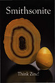
| Smithsonite slice and egg, 5.8 and 2.7 cm tall Masua Mine, Carbonia-lglesias, Sardinia, Italy Cal and Kerith...cm wide 400 Foot Level, Kelly Mine, Magdalena District Socorro County, New Mexico Steve Neely collection...Denver, Colorado, USA Design and Layout Gloria Staebler Gunther Neumeier Nancy Stevens © 2010 by Lithographie...Lithographie, LLC P.O. Box 11613 • Denver, C O 80211 • USA Phone 1.303.495.5521 • Fax 1.303.482.1238 www.lithographie...1867. ·thsonian Smithsonite First Oxide Zone, Tsu Mine, Tsumeb, Nami 10cm tall Brent Lockhart coll Joe |
 | | Book |
| Excavation begins on No. i shaft of Rossland's California Mine. Courtesy National Archives of Canada, C-?86i 20...Underground workers in Rossland's City of Spokane Mine. Courtesy Albertype Company/ National Archives of...C-J&59 41 Photo collage of 'Residences of Spokane Mining Men' in July 1899 issue of the SpokesmanReview...Premier Turner paying a visit to the Centre Star Mine in 1896. Courtesy Rossland Historical Museum, catalogue...sketch of a working mine prepared by Bernard MacDonald, manager of Rossland's Le Roi Mine, in 1903. Courtesy |
 | | Journal (volume) |
| Resumption of Activities at the Howell Mine BY WILL C. HIGGINS The Howell Mining Company, of Salt Lake City, is...property in the South Fork The property of the Howell Mining Com of Big Cottonwood canyon, about twentyfive...the great Cardiff mine, its near to the discovery of the property of the Howell Mining Company, of the...-roots. The discovery of the Howell reads al district has been not most like a romance . ed for its...ment and operation , the richest portion of and mining activities were inaugurated in Utah the Big a |
 | | Report (issue) |
| MINING INDUSTRY OF IDAHO eo Cen ee for 1952 BSA7, FC. TLS S4¥ th 1952 GEORGE VIOLET A. McDOWELL...Inspector of Mines - Secretary 954th Annual MINING OF Report INDUSTRY IDAHO for 1952 GEORGE VIOLET... 11-37 Rock Bolting in the Coeur d’Alene Mining District, by Ted Bush, Deputyclnspector OLE ViINGS ts...at the Sunshine Mine, Kellogg, Idaho, by William B. Foster, Engineer, Sunshine Mining Company ..........ean of Law Covering Mining ee eee —...... 45-52 Pretended Location of Mining Claims for Purpose of |
 | | Journal (issue) |
| of Victoria Melbourne, Australia Pete J. Dunn Washington, DC Peter G. Embrey London, England Richard C...Famous mineral localities: The Rush Creek District, Marion County, Arkansas ............................CHALCOPYRITE on TETRAHEDRITE, 15 cm, from the Herodsfoot mine, Liskeard, Cornwall, England. Collection of the...geologizing in a trackless wilderness or desert area, when at last you discover a fabulous vein o f minerals...automatically supply updated weather forecasts for your area every 4 -6 minutes. Now, if they will only miniaturize |


