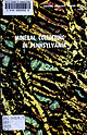
 | | Report (edition) | | STATE LIBRARY OF PENNSYLVANIA 1 1 II II II nil 3 014 4 00050005 «k. 1 ’^^jklTL% i ^IH ^ 1 k...of a thin slice of serpentinite from Lancaster County showing olivine (blue-green and red), serpentine...(icologist G BULLETIN 33 Mineral Collecting Pennsylvania in by Davis M. Lapham Mineralogist Alan ...Environmental Geologist JiU-ateJ VanOiden PENNSYLVANIA GEOLOGICAL SURVEY FOURTH SERIES HARRISBURG...Commonweath of Pennsylvania book may be pubished if credit this is given to the Pennsylvania Geological | 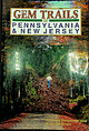 | | Book (edition) | | PENNSYLVAN1 A & NEW JERSEY «s m •p ■* ; sms •v ■1 mm D 'A ©F PENNSYLVANIA AND NEW JERSEY By Scott...due to man or nature, Gem Trails of Pennsylvania and New Jersey, its publisher and all other persons...Physiographic Map of Pennsylvania and New Jersey 5 6 7 9 10 12 PENNSYLVANIA SITE NO. PAGE NO. 1...Haven Ripple Marks............ Jersey Shore Calcite & Quartz.... Antes Creek Fossils.......................Fossil Pit....................... Eastern Industries Quarry.......... Carbondale Fossil Ferns............. |  | | Report (edition) | | PENNSYLVANIA STATE LIBRARY OF 0144 00141189 1 v < 2 £ m- c oi; c» tt*s“S S Si! at tss^s isl^j...1 ' s WJ= ~S 5! s „3 &«eq Sjg® . . PENNSYLVANIA 1 .8 ^2»SS 3 d 5-s &s z l|lt« 7* < OF ...GEOLOGY REPORT 1976 33 MINERAL COLLECTING IN PENNSYLVANIA by Alan R. Geyer Robert C. Smith, John H....Graphics by Albert E. VanOlden COMMONWEALTH OF PENNSYLVANIA DEPARTMENT OF ENVIRONMENTAL RESOURCES TOPOGRAPHIC...II Copyrighted 1976 by the Commonwealth of Pennsylvania Quotations from this book may be published if |  | Deasy, G. F., Griess, P. R., Balazik, R. F., Burtnett, J. W. (1967) Atlas of Pennsylvania’s Mineral Resources - Supplement, Limestones and dolomites of Pennsylvania, in Atlas of Pennsylvania's Mineral Resources. Mineral Resource Report M50-1S, Pennsylvania Geological Survey. | Report (Issue volume) | | Part 1, Supplement, Limestones and Dolomites of Pennsylvania · by George F. Deasy, Phyllis R. Griess, Ronald...Earth a.nd Mineral Sciences The Pennsylvania State University PENNSYLVANIA GEOLOGICAL SURVEY FOURTH SERIES...of Pennsylvania Quotations from this book may be published if credit is given to the Pennsylvania Geological...STATE BOOK STORE, P.O. BOX 1365, HARRISBURG, PENNSYLVANIA 17125 Bulletin MSO, Part 1, Supplement, Sheet...active mines, 1962 .. 2. Types of active mines (quarry andjor underground) 3. Number of months that mines |  | | Report (issue) | | LEAD OCCURRENCES IN PENNSYLVANIA Robert C. Smith, II COMMONWEALTH OF PENNSYLVANIA DEPARTMENT OF ENVIRONMENTAL...ZINC AND LEAD OCCURRENCES IN PENNSYLVANIA Robert C. Smith, II PENNSYLVANIA GEOLOGICAL SURVEY FOURTH SERIES...1977 Copyright 1977 by the Commonwealth of Pennsylvania Quotations from this book may be published...published if credit is given to the Pennsylvania Geological Survey COVER ILLUSTRATION: Photograph of 1852 lithograph...STATE BOOK STORE, P. O. BOX 1365 HARRISBURG, PENNSYLVANIA 17125 PREFACE The purpose of this report is |  | | Report (Issue volume) | | Earth and Mineral Sciences The Pennsylvania State University PENNSYLVANIA GEOLOGICAL SURVEY FOURTH SERIES...of Pennsylvania Quotations from this book may be published if credit is given to the Pennsylvania Geological... ROOM 54, MAIN CAPITOL BUILDING HARRISBURG, PENNSYLVANIA 17125 Bulletin M50, Part 2-8, Sheet 1 Page...of the mines of clay and shale companies in Pennsylvania supplying data for use in Part 2-B, of this...concerning 106 clay and shale mines operating in Pennsylvania during 1965 are given on 79 maps of the State |  | | Report (issue) | | PENNSYLVANIA GEOLOGICAL SURVEY FOURTH SERIES BULLETIN M 15 BUILDING STONES OF PENNSYLVANIA By RALPH... COPYRIGHTED 1932 BY THE COMMONWEALTH OF PENNSYLVANIA ADDITIONAL COPIES OF THIS PUBLICATION BUREAU...Structure 3 •> 10 Strength 10 Geology of Pennsylvania Physiography Stratigraphy Appalachian Revolut...Adams County Allegheny County Armstrong County Beaver County 19 1" -<» -- 24 -7 Bedford County -'•'...-;"» SO Perks County ;>- Blair County Bradford County Pucks County Butler County 00 03 07 77 Cambria |  | | Journal (issue) | | >·-.·i:;/;·~.--':;'~-:: _. 'COMMONWEALTH OF PENNSYLVANIA'·:.~<"~:> :·. - ,~ __..,_.:: ..- ·Milton J....tinued on page 30) GEOLOGICAL RESEARCH IN PENNSYLVANIA 1974 IN TRODUCTiON This publication is the seventeenth...report on Geological Research and Publications in Pennsylvania. Because of the extensive response and large...Department of Environmental Resources, Harrisburg, Pennsylvania 17120. RESEARC IIIN PROGRESS AREAL GEOLOGY...the Montoursville South and Muncy 7%' Quads., Lycoming Co., Pa. ACD: 1974. G. W. FISHER, M. W. HIGGINS |  | | Book | | Red and gray sandstone shale, and limestone. PENNSYLVANIA 40 I 60 50 Ml I 80 KM 76° -, I II --...l0000unse THE GEOLOGY OF PENNSYLVANIA COMMONWEALTH OF PENNSYLVANIA Mark Schweiker, Governor DEPARTMENT...Geology Slippery Rock University Published by PENNSYLVANIA GEOLOGICAL SURVEY PITTSBURGH GEOLOGICAL SOCIETY...from Hyner View, Hyner Run Slate Park, Clinton County, showing accordant ridges in the Appalachian Plateaus...of the Ridge and Valley province in Huntingdon County. Flooded meanders of Raystown Lake on the Raystown |  | | Report (volume) | | ................................ 190 201 New Jersey............................................................................................. Pennsylvania...............................................that are widely distributed, such as quartz and calcite, have been omitted, except those that by reason...value. Some minerals, such as the copper ores of Pennsylvania, are included in the list not because they occur...and Ehrenfeld, Frederick, Minerals of Pennsylvania: Pennsylvania Top. and Geol. Survey Comm. Kept. No |  | | Report (volume) | | minerals of wide distribution, such as quartz and calcite, have been omitted, except those that by some unusual...value. Some minerals, such as the copper ores of Pennsylvania, are included in the list not because they occur......Dr. W. S. Tangier Smith, Berkeley, Cal. New Jersey...... .Dr. H. B. Kummel, Trenton. New York.......Oregon............Prof. A. J. Collier, Eugene. Pennsylvania.... .Mr. R. R. Hice, Beaver. Prof. Florence...See Bauxite and Hallpysite. Asbestos. Tallapoosa County, with corundum deposits near Dudleyville; not found |  | | Report (issue) | | Surficial Geology and Geomorphology of Potter County ., Pennsylvania GEOLOGICAL SURVEY PROFESSIONAL PAPER... Surficial Geology and Geomorphology of Potter County· Pennsylvania By CHARLES S. DENNY GEOLOGICAL SURVEY...General features ___________________________ _ Potter County _____________________________ _ 1 2 2 4 4 4 4...Origin of paleosoL _____________________ _ Lycoming County, Penny Hill, Milton quadrangle ___________...Pre-Wisconsin glacial deposits ___________________ _ Potter County _____________________________ _ Salamanca reentrant |  | | Book | | 1 Gem Hunting In The Appalachians CHAPTER 2 New Jersey ........... _ . _ 1 _ CHAPTER 3 Pennsylvania___...Alabama Rivers. N e w Jersey: L a k e Hopatcong, Greenwood L a k e Pennsylvania: S c h u y l k i l l R...dollars at the noted locality of Cowee Valley, Macon County, North Carolina. An enthusiastic family found and...visited the well known old Rutherford mine in Amelia County, Virginia, and found bright spessartine garnets...Excited collectors took home from old quarries in Pennsylvania and Maryland, pieces of apple green precious |  | | Book (edition) | | "scratched" scratch was Many which is area, Wet is calcite, a pocket knife blade tests, make sure that...NORTH CAROLINA weight plac« date Brindletown Creek, Burke Co. 1843 2 stones Twitty gold placer,...Mecklenberg Co. Portis mine, Franklin Co. Muddy Creek headwaters, McDowell Co. Dysortville, of fine water...yellow Cleveland Co. GEORGIA Branch of Muddy Creek, 1843 Williams' Ferry, Hall Co. Horshaw mine...mine, Racooche Valley, White Co. 1866 Vs White County Daniel Light form, % mi. NE Less than 1887 Opaque |  | | Journal (article/letter/editorial) | | OCCURRENCE OF POLYMORPHOUS WURTZITE IN WESTERN PENNSYLVANIA AND EASTERN OHIO* Davru M. Soaua'N, Haraaril...the Brush creek limestone Two of them' wurtzConemaugh Formation near Etna, Allegheny County, Pennsylvania'...to the Brush Creek Iimestone horizon, one half mile northwest of Shelocta, Indiana county, Pennsylvania'alongU...had not previously been reported from western Pennsylvania' Additional first polymorph proved to be wurtzite-6H...polymorph at the Wittmer locality near Etna, pennsylvania, of rhombohedral (trigonal) crystalrization |  | | Report (Issue volume) | | Part 4 Copyright 1976 by the ·Commonwealth of Pennsylvania THE DISTRIBUTION OF LIMESTONES CONTAINING AT...AT LEAST 90 PERCENT CaC0 3 IN PENNSYLVANIA by Bernard J. O'Neill, Jr. 1976 The Bureau of Topographic...Topographic and Geologic Survey within the Pennsylvania Department of Environmental Resources has been following...resources. The distribution of geologic units in Pennsylvania that have the best potentials to be economic...table includes information concerning location by county, geologic unit involved, stratigraphic thickness |  | | Book (edition) | | thickness; mmed at Broken Arrow aud Trout creek, in Sc. Clair county. The strata in this field are more faulted...south prong of Canoe creek, in St. Clair county, to Ha\sop creek, in Bibb county, a distance of 60 miles...miles. Down to Helena, in Shelby county, the field has an average width of 5 or 6 miles. Below that point...miles being in the latitud" of Blocton, in Bibb county. The south ern end of this field has a greater...Jefferson county; Helena, Montevallo, and Brierfield, Shelby county; and at Blocion. Bibb county. The Warrior |  | | Book | | knowledge and enjoyment of this great owners, mine and quarry operators and science by collecting. Thanks too...these states. The cool summer spots are the north shore of Lake Superior in Minnesota, and the Keweenaw...standard prospector's pick. If the hunt is in a quarry for fossils which must be worked out of thick limestone...forested recreation areas. Except for the north shore of Lake Superior and the iron ranges, most of the...through Itasca and St. Louis Counties into Lake County. Hibbing is about the center of this historic area |  | | Book (edition) | | describes sites under of the nearest town and county. and the many maps included book contain such...skimmed over the water as you walked along a lake shore were some from which beautiful gems could be cut...beryl belong here, as well as the variations that calcite plays on the basic form. The orthorhombic system...especially in Maine, New Hampshire, Connecticut, New Jersey, Virginia, and North Carolina. In the West, the...hazards as well. Rocks can fall from a shattered quarry wall, a cliff, or an overhang. Someone on a rocky |  | | Journal (article/letter/editorial) | | University] at 01:02 21 December 2014 79 Mine, Gila County, Arizona E veryone likes blue minerals. Most...Brooksville, Hancock County, and the Lubec lead mine and prospects at Pembroke, Washington County. It has also...at the old lead mines at Middletown, Middlesex County, Connecticut; as good micromount material at the...Easthampton, Hampshire County, Massachusetts; the old Gorham (Mascot mine), Coos County, New Hampshire; as...as pale blue rosettes of pearly plates in calcite veins cutting trap rock at Moore, the long-abandoned |  | | Journal (issue) | | States and the highest and lowest elevations in Pennsylvania, but how many people know how these elevations...surveyor can say a monument near Millerstown, Pennsylvania, is located precisely at latitude 40°37 '04...National Center, Reston, Virginia 22092. The Pennsylvania Geological Survey maintains a collection of...uVklJ /}+~') L:t~) ~-::t=, During the past year new county topographic maps have been published by the U.S...political boundaries for county, township and boroughs outlined in orange. These county maps are of widespread |  | | Book (edition) | | MARIN COUNTY FREE LIBRARY 3 1111 00289 4184 \ I s Fifth Revised Edition A complete, state-by-state...the vicinity of Paris? Have you heard, Mr. New Jersey, of your famous pearls?" citing other notable collecting...Orthoclase feldspar 2. Gypsum 7. Quartz 3. Calcite 8. Topaz 4. Fluorite 9. Corundum 5. Apatite...gypsum, and a copper coin is just about as hard as calcite. A pocketknife blade will scratch apatite easily...belong here, as well as the many variations that calcite plays on the basic form. The orthorhombic system |  | | Book | | ADULARIA Adu Iaria from the Howard-Montgomery quarry, Howard County, Maryland (by J. S. White) 25:53-54 AFGHANISTAN...Iron-manganese phosphates of the Williams pegmatites, Coosa County, Alabama (by P. B. Leavens & T. A. Simpson) 6:66-73...nepheline, biotite and albite-antiperthite crystals in calcite-cored vein-dikes (by L. Moyd) 21:235-248 ALICE...ALICE GLORY HOLE The Alice glory hole, Clear Creek County, Colorado (by T. A. Hanson & W. B. Craft) 18:185187...AJlactite from Franklin and Sterling Hill, New Jersey (by P. J. Dunn) 14:251-252 ALLCHAR Famous mineral |  | | Journal (article/letter/editorial) | | epidote. Creek sand from Elbert and Lincoln Counties, Colo. In Colorado, U.S. 24 crosses Big Sand Creek which...center of the bridge is a county line—Lincoln County to the north and Elbert County to the south. About 450...450 feet north of the county line, U.S. 24 joins U.S. 40 and U.S. 287. On June 24, 1952, when the conductor...sand sample—two in fac't ' (one from each county). The creek w£.s absolutely dry and full of sand from...from one bank to the other. The sand from Elbert County was coarse grained and of a brownish-gray color |  | | Report (volume) | | Highway 49 (Skyway Road) near town of Abel, Cleburne County. Absaroka Supergroup/Volcanic Supergroup U ABRK03...m 8. Washburn Group, Sunlight Group, Thorofare Creek Group g. Unconformably underlies Junction Butte...volcanic field, Yellowstone National Park, Park County, Wyo. Academy Church Shale Member (Springer Formation)...W1/2NW1/4NE1/4SE1/4 sec. 1, T. 3 s., R. 2 E., Carter County. Adams Formation ADMS01 1. Holocene 2. Alaska (SE)...gradationally underlies Berg Formation 10. Type section: SE shore of Adams Inlet, lat 58°53' N., long 135°47'54" W |
|
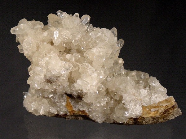


Pine Creek Quarry, Jersey Shore, Lycoming County, Pennsylvania, USA