 | | Report (issue) | | Formation, Coastal Santa Maria Province, Central California Geophysical section offshore Santa Maria basin...basin Geologic section onshore Santa Maria basin U.S. GEOLOGICAL SURVEY BULLETIN 1995-L AVAILABILITY OF...to Superintendent of Documents.) MENLO PARK, California Bldg. 3, Rm. 3128, 345 Middlefield Rd. RESTON...the Monterey Formation, Coastal Santa Maria Province, Central California By KENNETH L. FINGER U.S. GEOLOGICAL...the Monterey Formation, coastal Santa Maria Province, central California / by Kenneth L. Finger. p. cm |  | | Report (issue) | | Geophysical section offshore Santa Maria basin Geologic section onshore Santa Maria basin AVAILABILITY...to Superintendent of Documents.) MENLO PARK, California Bldg. 3, Rm. 3128, 345 Middlefield Rd. RESTON...the Lospe Formation (Lower Miocene), Santa Maria Basin, California By SAMUEL Y. JOHNSON and RICHARD G....the Lower Miocene Lospe Formation Near Point Sal, California By HUGH MCLEAN and RICHARD G. STANLEY Chapters...the Lospe Formation (Lower Miocene), Santa Maria Basin, California / by Samuel Y. Johnson and Richard G |  | | Report (issue) | | Lithotectonic Elements in the Basement of the Santa Maria Basin, California U.S. GEOLOGICAL SURVEY BULLETIN 1995-B...LOS ANGELES, California-Federal Bldg., Rm. 7638.300 N. Los Angeles St. MENLO PARK, California-Bldg. 3 (Stop... Rm. 8105,125 South State St. SAN FRANCISCO, California-Customhouse. Rm. 504.555 Battery St. SPOKANE...Lithotectonic Elements in the Basement of the Santa Maria Basin, California By HUGH McLEAN U.S. GEOLOGICAL SURVEY...SURVEY BULLETIN 1995 EVOLUTION OF SEDIMENTARY BASINS SANTA MARIA PROVINCE U.S. DEPARTMENT OF THE INTERIOR |  | Isaacs, C.M., Taggart, J.E., Jackson, L.L., Scott, Norman (1989) Analytical reproducibility and abundances of major elements and sedimentary components in cores from the Sisquoc, Monterey, and Point Sal Formations, Union Newlove 51 well, Orcutt oil field, onshore Santa Maria Basin, California. Open-File Report Vol. 1989 (89-459) US Geological Survey doi:10.3133/ofr89459 | Report (issue) | | MONTEREY, AND POINT SAL FORMATIONS, UNION NEWLOVE 51 WELL, ORCUTT OIL FIELD, ONSHORE SANTA MARIA BASIN...BASIN, CALIFORNIA by Caroline M. Isaacs Joseph E. Taggart, Jr. Larry L. Jackson Norman Scott, III 1 Open-File...Geological Survey 345 Middlefield Road Menlo Park, California 2 U.S. Geological Survey Federal Center, Box...as follows: Formation Sisquoc Fm Monterey Fm Point Sal Fm Detritus Silica Carbonate minerals 68 46...Organic matter 1 7 4 In both the Monterey and Point Sal Formations, fine-grained detritus in the Union |  | | Report (issue) | | ·Geology and Paleontology of the Santa Maria District California By W. P. WOODRING and M. N. BRAMLETTE...Miocene series _________________________________ _ Point Sal formation _________________________. Stratigraphy...Environment suggested by fossils ________________ _ Point Sal formation and Monterey shale ______ _ Sisquoc...Lospe formation ___________________________ _ Point Sal formation ________________________ _ Monterey..._ Foxen Canyon-Sisquoc River area ___________ _ Santa Maria Valley ________________________ _ Physiography |  | | Report (volume) | | OIL RESOURCES OF THE SANTA MARIA OIL DISTRICT SANTA BARBARA COUNTY CALIFORNIA BY RALPH ARNOLD AND................. Santa Ynez Mountains............................................ Santa Maria Valley........................................ Santa Ynez Valley and Santa Rita Hills............................................. 71 Accumulation of oil in the Santa Maria district......................... 72 Indications...future development.................. 79 Region of Santa Ynez Mountains................................. |  | | Report (issue) | | Formation (Early Miocene) and Origin of the Santa Maria Basin, California Petroleum Source Potential and Thermal...Miocene) near Point Sal, Onshore Santa Maria Basin, California Obispo Formation, California: Remobilized...Geophysical section offshore Santa Maria basin Geologic section oiibhore Santa Maria basin U.S. GEOLOGICAL...Superintendent of Documents.) Maps MENLO PARK, California-Bldg. 3, Rm. 3128, 345 Middlefield Rd. RESTON...Formation (Early Miocene) and Origin of the Santa Maria Basin, California By RICHARD G. STANLEY, SAMUEL Y. JOHNSON |  | Stanley, Richard G., Pawlewicz, M.J., Vork, D.R., Johnson, S.Y., Valin, Z.C. (1995) Preliminary report on petroleum source potential and thermal maturity of the Lospe Formation (lower Miocene) near Point Sal, onshore Santa Maria Basin, California. Open-File Report Vol. 1995 (95-530) US Geological Survey doi:10.3133/ofr95530 | Report (issue) | | Formation (lower Miocene) near Point Sal, onshore Santa Maria basin, California by Richard G. Stanley1, Mark...Government. 1U.S. Geological Survey, Menlo Park, California 94025 2U.S. Geological Survey, Denver, Colorado...Formation (lower Miocene) near Point Sal, onshore Santa Maria basin, California By Richard G. Stanley, Mark...the base of the onshore Neogene Santa Maria basin of central California. Eighteen outcrop samples (14 from...4 from bathyal marine shales of the overlying Point Sal Formation) were collected from a measured stratigraphic |  | | Report (issue) | | ORGANIC GEOCHEMISTRY STUDY, SANTA MARIA AND SANTA BARBARA-VENTURA BASINS, CALIFORNIA by Caroline M. Isaacs...Survey 345 Middlefield Road, MS 999 Menlo Park, California 94025 1992 CONTENTS Introduction..............! Comparison of the Monterey Formation with California strata as a whole...................... 1 Comparison...Comparison of the Monterey Formation in Santa Maria-Santa Barbara with................... the Monterey Formation....! Comparison of the Monterey Formation in Santa Barbara with modern sediments.......2 Regional paleogeographic |  | Isaacs, C.M., Medrano, M.D., Siems, D.F., Mee, J.S. (1993) Abundances of major elements and sedimentary components in cuttings from the Foxen, Sisquoc, Monterey, and Point Sal formations, OCS P-0315-1 well, Point Arguello oil field, offshore Santa Maria basin, Southern California. Open-File Report Vol. 1993 (93-382) US Geological Survey doi:10.3133/ofr93382 | Report (issue) | | MONTEREY, AND POINT SAL FORMATIONS, OCS P-0315-1 WELL, POINT ARGUELLO OIL FIELD, OFFSHORE SANTA MARIA BASIN...BASIN, SOUTHERN CALIFORNIA by Caroline M. Isaacs1 Marjorie D. Medrano1 David F. Siems2 J. Steven Mee2...Survey 345 Middlefield Road, MS 999 Menlo Park, California 94025 2 U.S. Geological Survey Federal Center......27 6. Silica/(silica+carbonates), calcite+dolomite, calcite, and dolomite vs. depth .........29 Tables...Formation in the offshore Santa Maria basin and Santa Barbara Channel of southern California (Figure 1) has received |  | | Report (issue) | | of the Monterey Formation, Santa Barbara and Santa Maria areas, California Caroline M. Isaacs1 Open-File...nomenclature. U.S. Geological Survey Menlo Park, California 94025 CONTENTS PART I: DEPOSITION AND DIAGENESIS...DIAGENESIS OF THE MONTEREY FORMATION, SANTA BARBARA COASTAL AREA Introduction............................southwestern Santa Barbara County...... Tectonic Map of southwestern Santa Barbara County................ Physiographic diagram of southwestern Santa Barbara County.... Map showing field trip sections of the |  | | Report (issue) | | Minerals of California By ARTHUR S. EAKLE, MARCH, Ph.D. 1914 Issued by California State Mining...Hon Hiram W. Johnson, Governor of the State of California. Sir: I have the honor to transmit Bureau...of herewith Bulletin 67 of the State Mining California. This work was made possible at this date through...Bureau. and Mineralogy of the University of California, with this Eakle has given freely of his time...Minerals Distribution by Counties Bibliography on California Minerals Index to Minerals — 197 204 210 220 |  | | Journal (article/letter/editorial) | | GEOCHEMISTRY OF METABASALTS FROM THE POINT SAL OPHIOLITE, CALIFORNIA MARTIN MENZIES * Department o f Geology...o f California, Davis, Calif. 95616 (USA) DOUGLAS BLANCHARD NASA-JSC, Houston, Texas 77058 {USA) and...Texas 77058 (USA) Received May 27, 1977 Revised version received August 8, 1977 The Point Sal ophiolite...ophiolite, California, contains a volcanic pile of pillowed and massive basalts and keratophyres that exhibit...semiquantitative verification of an origin for the Point Sal lavas by low-pressure fractionation of multiple |  | Menzies, Martin, Blanchard, Douglas, Brannon, Joyce, Korotev, Randy (1977) Rare earth and trace element geochemistry of a fragment of jurassic seafloor, Point Sal, California. Geochimica et Cosmochimica Acta, 41 (10) 1419-1430 doi:10.1016/0016-7037(77)90248-4 | Journal (article/letter/editorial) | | seafloor, Point Sal, California MARTIN MENZIES* Department of Geology, University of California, Davis,...Abstract-A suite of rocks from the Point Sal ophiolite, California, were analyzed for rare earth elements...suite of ophiolitic rocks in Santa Barbara County, California: The Point Sal ophiolite. By determining the...lavas. POINT SAL OPHIOLITE The Point Sal ophiolite is exposed at Point Sal, Santa Barbara County, California...radiolarian chert (recrystal1419 120’40’ 0, 0 Point - Sal Area OCEAN PA CINC I MILE 2 KM --- --- |  | | Report (issue) | | Geological Survey Volcanic Rocks of the Santa Maria Province, California Age and Tectonic Inferences from a...Area, Santa Barbara County, California Bulletin 1995-R, S Geophysical section offshore Santa Maria basin...basin Geologic section onshore Santa Maria basin USGS science fora changing world AVAILABILITY OF...Colorado-Federal Center, Bldg. 810 MENLO PARK, California-Bldg. 3, Rm. 3128, 345 Middlefield Rd. RESTON...Mississippi-Bldg. 3101 Volcanic Rocks of the Santa Maria Province, California By RONALD B. COLE and RICHARD G. STANLEY |  | | Journal (article/letter/editorial) | | migration in the Miocene Monterey Formation, California, USA: constraints from fluid-inclusion studies ROBERT...Institute and State University, Blacksburg, VA 24061, USA Abstract The Miocene Monterey Formation constitutes...Many fractures are filled with carbonate (mostly calcite and dolomite), quartz, baryte and anhydrite. These...sample from the Lion's Head area consists of early calcite and late quartz, both of which contain aqueous...temperatures than those in calcite. These data are consistent with calcite deposition during an early |  | | Report (issue) | | The Thermal Regime of Santa Maria Province, California Phosphorus Geochemistry, Diagenesis, and Mass...Beach, California Geophysical section offshore Santa Maria basin Geologic section onshore Santa Maria...Federal Center Denver, CO 80225 MENLO PARK, California Bldg. 3, Rm. 3128, 345 Middlefield Rd. Subscriptions...Bldg. 3101 The Thermal Regime of Santa Maria Province, California By COLIN F. WILLIAMS, S. PETER GALANIS...the Miocene Monterey Formation at Shell Beach, California By GABRIEL M. FILIPPELLI and MARGARET L. DELANEY |  | | Report (issue) | | Formation along the Santa Ynez Fault Implications for the Geologic History of the Eastern Santa Maria Basin Area...Area, California Reconnaissance Bulk-Rock and Clay Mineralogies of Argillaceous Great Valley and Franciscan...Franciscan Strata, Santa Maria Basin Province, California Geophysical section offshore Santa Maria basin ... Geologic section onshore Santa Maria basin U.S. GEOLOGICAL SURVEY BULLETIN 1995-HJ AVAILABILITY OF...to Superintendent of Documents.) MENLO PARK, California Bldg. 3, Rm. 3128, 345 Middlefield Rd. RESTON |  | | Report (issue) | | across the Onshore Santa Maria Basin and in Surface Sections along the Santa Barbara-Ventura Coast, Southern...Southern California by Caroline M. Isaacs Janice H. Tomson Open-File Report 89-108 This report is preliminary...Survey 345 Middlefield Road, MS 999 Menlo Park, California 94025 1990 CONTENTS Abstract......................... Map and cross-section of the onshore Santa Maria basin. ........ showing well locations .....localities and silica diagenetic grade along the Santa.. Barbara-Ventura coast. ........................... |  | | Report (issue) | | ORGANIC GEOCHEMISTRY STUDY, SANTA MARIA AND SANTA BARBARA-VENTURA BASINS, CALIFORNIA by Caroline M. Isaacs*...Survey 345 Middlefield Road, MS 999 Menlo Park, California 94025 1992 CONTENTS i>m*oDucnoN....................................................... 10 Calcite............................................................................................ 26 Calcite diagenesis.......................................organic geochemists, the Monterey Formation of California is widely known as an excellent petroleum source |  | Dickinson, William R., Ducea, Mihai, Rosenberg, Lewis I., Greene, H. Gary, Graham, Stephan A., Clark, Joseph C., Weber, Gerald E., Kidder, Steven, Ernst, W. Gary, Brabb, Earl E. (2005) Net Dextral Slip, Neogene San Gregorio-Hosgri Fault Zone, Coastal California: Geologic Evidence and Tectonic Implications. GSA Special Paper 391. Geological Society of America doi:10.1130/0-8137-2391-4 | Report (issue) | | Neogene San Gregorio–Hosgri Fault Zone, Coastal California: Geologic Evidence and Tectonic Implications...Neogene San Gregorio–Hosgri Fault Zone, Coastal California: Geologic Evidence and Tectonic Implications...Neogene San Gregorio–Hosgri fault zone, coastal California: Geologic evidence and tectonic implications...Arizona Tucson, Arizona, USA Mihai Ducea University of Arizona Tucson, Arizona, USA Lewis I. Rosenberg Tijeras... New Mexico, USA H. Gary Greene Moss Landing Marine Labs Moss Landing, California, USA Stephan A. Graham | 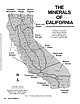 | | Journal (article/letter/editorial) | | Library] at 07:06 06 January 2015 Even though California is known as the “Golden State, ” it could also...the Tourmaline State, or the Colemanite State. California is, in fact, one of the world’s greatest sources...localities, the reader is encouraged to consult the “California Locality Index” (Kampf et al. 1989). The bibliography...great deal from the many publications of the California Division of Mines and Geology. The most valuable...tool for finding information on older mines in California is the Consolidated Index of Publications, Division |  | | Report (issue) | | MINERALS OF CALIFORNIA BULLETIN No STATE ; . .. : DlViSIi BUILDIN 113 COLLEGE OF AGRICULTURE...AGRICULTURE DAVIS, CALIFORNIA STATE OF CAUFORNIA DEPABTMENT OF NATURAL RESOURCES GEORGE D. NORDENHOLT, Director...MINERALS OF CALIFORNIA By ADOLF PABST Associate Professor of Mineralogy University of California BERKELEY...BERKELEY CALIFORNIA STATE PRINTING OFFICE GEORGE H. MOORE. State Printer SACRAMENTO. 51440 1938 TABLE...Letter of Transmittal 5 Map 6 Outline o['. California Preface 7 Introduction 11 Native Elements |  | | Report (issue) | | M^iajKaMVMtrVMMIMMVW^- 'Vv s > MINERALS Of CALIFORNIA BULl,ETIN N«, 91 issei0 BY rr: ^ ;wIFORNIA...BULLETIN [November, 1922 No. 91 Minerals of California $ BY ARTHUR S. EAKLE, Ph. D. Professor...Mineralogy, University of California COMPLIMENTS OF ^^^foyd Sc, c/iosty GIST CALIFORNIA STATE PRINTING OFFICE...Stephens, Governor of the State of California, Sacramento, California Sir: I have the honor to transmit...upon the minerals of California. This bulletin records our knowledge of California minerals to date, |  | | Report (volume) | | A RECONNAISSANCE OF THE GYPSUM DEPOSITS OF CALIFORNIA BY FRANK L. HESS WITH A NOTE ON ERRORS IN THE......... 9 9 11 11 Deposits near Dudley, Kings County .......................... 12 Lost Hills.......Deposits near McKittrick, Kern County ........................... California Gypsum and Mineral Company's................°...... .............. San Benito County ........................................... 17............................................. Santa Barbara Creek...................................... |
|


Point Sal, Guadalupe, Santa Barbara County, California, USA