| Locality type: | Mine |
| Classification |
|---|
|
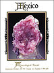
| Species: | 'Biotite' (not an IMA approved species) |
| Formula: | K(Fe2+/Mg)2(Al/Fe3+/Mg/Ti)([Si/Al/Fe]2Si2O10)(OH/F)2 |
| Confirmation |
|---|
|
| Validity: | Believed Valid |
| Data |
|---|
|
| Mineral Data: | Click here to view Biotite data |
| Locality Data: | Click here to view Dulce Nombre mine, Natividad, Natividad Municipality, Oaxaca, Mexico |
| Data Identifiers |
|---|
|
| Mindat Occurrence Record ID: | 1616697 |
| Long-form Identifier: | 1:3:1616697:2 |
| GUID (UUID V4): | 5043da16-b8e0-412a-ae0f-694ac959fc15 |
| Nearest other occurrences of Biotite |
|---|
|
|
| 49.8km (31.0 miles) | ⓘMuerto Mine, San Francisco Telixtlahuaca, San Francisco Telixtlahuaca Municipality, Oaxaca, Mexico |
| 49.8km (31.0 miles) | ⓘSanta Ana Mine, San Francisco Telixtlahuaca, la San Francisco Telixtlahuaca Municipality, Oaxaca, Mexico |
| 49.8km (31.0 miles) | ⓘSanta Cruz Mine, San Francisco Telixtlahuaca, San Francisco Telixtlahuaca Municipality, Oaxaca, Mexico |
| References |
|---|
|
|
| Reference Search (possible matching items) |
|---|
 | | Journal (issue) | | Trucco mining district, Taxco de Alarcon, Guerrero, Mexico .................................... .401 by J...mineral localities: The Refugio mine, Municipio de Choix, Sinaloa, Mexico ................................mineral localities: Cerro de Mercado, Durango, Mexico .................................................Ferry ~alace of Jlline_s The Palace of Mines in Mexico City .................................... .497...Smithsonite, 4 cm wide, from the Refugio mine, Choix, Sinaloa, Mexico. William Dameron collection; Jesse Fisher |  | | Report (issue) | | areally widespread flow also contains abundant biotite. The matrix is very fine grained, and both matrix...that is, fine sand, silt, and clay sizes. Near Dulce Nombre, stream deposits from the Toyogres and Barquero |  | | Report (issue) | | which a mine first produced. YEAR OF LAST PRODUCTION Year in which an inactive producing mine last operated...(PRESENT/LAST) Person or corporation which owns the mine or mining claims. The most recent owner is listed...OPERATOR Person or corporation which operates the mine. This may be a subsidiary or a lessee. TOTAL INVESTMENT...S. dollars in exploration and development of the mine at the site. MILL CAPACITY PER YR. (THOUS. UNITS)...BELOW SURFACE Maximum depth in meters (M) reached by mine workings. LENGTH OF WORKINGS Cumulative length, |  | | Report (volume) | | technical assistance to private mine operators about mineral exploration, mine development and operation,...trained to provide technical assistance to private mine operators, as well as to conduct reconnaissance...personnel were to supply guidance to small private mine operators on management and bookkeeping, service...1959, when the program ceased to grant loans to mine operators, the small staff consisted of one geologist...that extends from the Corocoro mine southeast to the Chacarilla mine. The second project mapped a belt-like |
|


