 | | Report (volume) |
| Mineral Belts in Western Sierra C:ourlty, New Mexico, Suggested by Mining Distri.cts, Ceologyt and c... Mineral Belts in Western Sierra County, New Mexico, Suggested by Mining Districts, Geology, and Geochemical...on mineral belts in western Sierra County, New Mexico, indicates many new areas favorable for mineral...mineral deposit exploration U.S. GEOLOGICAL SURVEY BULLETIN 1876 DEPARTMENT OF THE INTERIOR MANUEL LUJAN...LUJAN, JR., Secretary U.S. GEOLOGICAL SURVEY Dallas L. Peck, Director Any use of trade, product, or firm |
 | | Journal (article/letter/editorial) |
| leaf gold, smoky quark, and turquoise specimens, New Mexico boasts an array of mineral species. RAMON S....Albuquerque, New Mexico 87110 THE PURPOSE OF THIS INDEX is to provide a comprehensive listing of New Mexico...Particular attention was directed toward incorporating new information on discoveries and occurrences, although...to compile all of the mineral occurrences in New Mexico-a venture of that magnitude is beyond the scope...Minerals of New Mexico is the basic reference for locations. Abstracts from the New Mexico mineral symposia |
 | | Journal (article/letter/editorial) |
| Elsevier Science Ltd Pergamon Printed in the USA. All rights reserved 0016-7037/94$6.00 + .OO N2-Ar-He...MUSGRAVE’ ‘Department of Geoscience, New Mexico Tech, Socorro, NM 87801, USA *INC-9, MS J5 14, Los Alamos National...National Laboratory, Los Alamos, NM 87545, USA (Received January 8, 1992; accepted in revised form May...Pacific Rim active geothermal systems, specifically New Zealand, and (3) whether different deposit types...UCLA Conference Center, Lake Arrowhead, California, USA. 1119 D. I. NORMAN and J. A. M~JSGRAVE I 120 |
 | | Journal (issue) |
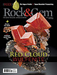
| JEWELRY 0 7 ROCK & GEM 0 74470 02033 2 July 2018 • U.S. $5.99 Vol 48 • No. 07 Issue code: 2018-07 Display...8 RED CLOUD MINE WULFENITE Rockhounds enjoy the products of this amazing Arizona mine. By Bob Jones...FIRE AGATE 34 CHLORIDE SAWTOOTH QUARTZ 40 ROCK & GEM KIDS 46 THE BRISTOL COPPER MINE 50 COOL SUMMER... Find jagged quartz crystals at the Wall Street mine. By Robert Beard Regular Columns Field Notes ....Wulfenite from the Red Cloud (photo credit)mine (La Paz County), Arizona, is world famous. (3.9 cm high) |
 | | Map |
| resource map 24 Mining Districts and Prospect Areas in New Mexico by Virginia T. McLemore edited by...Shari Kelley New Mexico Bureau of Geology and Mineral Resources A division of New Mexico Institute of...of Mining and Technology Socorro, New Mexico 2017 Mining Districts and Prospect Areas of New Mexico by...McLemore Shari A. Kelley (editor) Copyright © 2017 New Mexico Bureau of Geology and Mineral Resources Nelia...Director and State Geologist Mining Districts and Prospect Areas in New Mexico by Virginia T. McLemore edited |
 | | Journal (article/letter/editorial) |
| mined in 1868-69 on Treasure Hill in White Pine County, Nevada. Downward continuationsof the rich oreswere...east-centralNevadabetweenEureka and Ely, the S. Larsh (1909), a mining engineerat Hamilton, White Pine miningdistrictcontains11...pure cerar- cant ore bodies have been found. The district went gyrite at and near the surface. The first...million ouncesof silver, was named the Hidden Treasure mine, but the most but since1885 Hamiltonand TreasureCity...TreasureCity haverespectacularwas at the Eberhardt mine where R. W. mainedmostlyin the custodyof their ghosts |
 | | Journal (article/letter/editorial) |
| Alteration and Mineralization in the Comstock District, Nevada DONALD M. HUDSON† 1540 Van Petten Street...metal deposits of the world-renowned Comstock district of western Nevada constitute one of several superimposed...superimposed Miocene hydrothermal systems. In the district, Mesozoic metasedimentary and igneous rocks are...kaolinite alteration exposed at the periphery of the district may be linked to preore alteration near the paleowater...higher-temperature parts of the lodes. Adularia and rare bladed calcite indicate boiling during deep low-sulfidation hydrothermal |
 | | Report (issue) |
| OR PROFE SIONAL PAPER 68 THE ORE DEPOSITS OF NEW MEXI.CO BY WALDEMAR LINDGREN, LOUIS C. GRATON AND...PRQ)tESSIONAL PAPER 68 T·H E ORE DEPOSITS O.F NEW MEXICO.. . . ., .,· ;,.: BY WALDEMAR LINpGREN,........ . J,5 Historical sketch of mining and smelting in New Mexico....... . . . . . . . . . . . . . ....... : . .............. - ........ .. . . T~os County, by L. C. Graton and W ..Lindgren ..... ................. . . , ... -.. . Rio Hondo. (Twining) district . . . . . . . . . . . . . ................... |
 | | Report (volume) |
| Mountains Wilderness Study Area, Inyo County, California U.S. GEOLOGICAL SURVEY BULLETIN-1708-A -<...the Inyo Mountains Wilderness Study Area, Inyo County, California By EDWIN H. McKEE, JAMES E. KILBURN...RICHARD J. BLAKELY U.S. Geological Survey TERRY J. CLOSE U.S. Bureau of Mines U.S. GEOLOGICAL SURVEY... DEPARTMENT OF THE INTERIOR DONALD PAUL MODEL, Secretary U.S. GEOLOGICAL SURVEY Dallas L. Peck, Director UNITED...by the Distribution Branch, Text Products Section U.S. Geological Survey 604 South Pickett St. Alexandria |
 | | Report (issue) |
| 87 New Mexico Bureau of Mines & Mineral Resources A DIVISION OF NEW MEXICO INSTITUTE OF MINING & TECHNOLOGY...and Water Resources of New Mexico I'repared by U.S. Geological Survey for the U.S. Senate Committee on...with: New Mexico Bureau of Mines and Mineral Resources New Mexico Oil Conservation Commission New Mexico...Mexico State Engineer U.S. Bureau of Mines SOCORRO1977 NEW MEXICO INSTITUTE OF MINING & TECHNOLOGY Cibutus...Cibutus R. HOLMES. Acting President NEW MEXICO BUREAU OF MIXES & MINERAL FRANK F.. KOTTIOWSKI, Director |
 | | Journal (article/letter/editorial) |
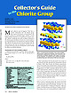
| forms dark green pleochroic rims on colloform calcite veins; individual crystallites are generally fibrous...black crystals are found at the Atlantic City iron mine, Wyoming. The obsolete varietal names thuringite...intended to be exhaustive. Green crystals with calcite and chondrodite are known from the Tilly Figure...chamosite on colorless quartz with white tabular calcite crystals from Yaogangxian, China. Specimen is about...groundwater (Rule and Radke 1988). Near Rodito in Sierra Norte de Cordoba, Argentina, baileychlore is found |
 | | Journal (article/letter/editorial) |
| Comstock Lode, Virginia City, Nevada BYRON R. BERGER,† U.S. Geological Survey, Federal Center, MS 964, Denver...Reno, Reno, Nevada 89557 AND LAWRENCE J. DREW U.S. Geological Survey, National Center, MS 954, Reston...vein district world class. In the world-class silver- and gold-producing Comstock mining district, Nevada...intrusive activity in this part of the stepover led to a new episode of hydrothermal activity and formation of...Comstock lode, Virginia City, Nevada is such a district. For the period 1859 through 1996, the Comstock |
 | | Report (volume) |
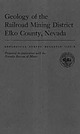
| Geology of the Railroad Mining District Elko County, Nevada GEOLOGICAL SURVEY BULLETIN Prepared in...Mines 1162-B Geology of the Railroad Mining District Elko County, Nevada By KEITH B. KETNER and J. FRED..._____________ Geologic setting of the Railroad mining district______________________ Geologic history...prospecting._________________________________________ Mine descriptions____________________________________________...column____________________--___-_---_-----Map of patented mining claims_---_-----__---_-_---------- m Page B2 |
 | | Journal (article/letter/editorial) |
| The first time was in 1879 when it partnered with New York fin'incier August Belmont in setting up the...following the Silver Panic of 1893, h c . I I.S. Treasury faced a rapidly dwindling gold reserve. I'residen...house. Photo hy Uycrs, CB.1904. courtcs\ Ouraj County Historical Society. Volume 75, November/December...decades between the Rothschilds’s two deals with the U.S. government. The fury reached the first of several...certainly aware that these deals would benefit the U.S. Treasury and stave off great financial hardship, they |
 | | Report (issue) |
| description of the geology, mining history, and production of the major gold-mining districts in 21 States...68-341 For sale by the Superintendent of Documents, U.S. Government Printing Office Wl\shington, D.C. 20402...relations ---------------------------History of gold mining and trends in production_ J\labama -----------...--------------Cleburne County ----------~----------------- Tallapoosa County --------------------------Alaska...------------------Cochise County -----------------------------Gila County --------------------------------Greenlee |
 | Keith, S.B., Schnabel, Lorraine, DeWitt, Ed, Gest, D.E., Wilt, Jan (1983) Map, description and bibliography of the mineralized areas of the Basin and Range Province in Arizona. Open-File Report Vol. 1983 (84-86) US Geological Survey doi:10.3133/ofr8486 | Report (issue) |
| preliminary and has not been reviewed for conformity with U.S. Geological survey editorial standards and stratigraphic...produced ore (Keith and others, 1983), (2) have mine workings to suggest past production, (3) are described...unpub. data), or (5) have been investigated by mining companies who have documented the presence of mineralized...Area may not be the same as the conventional Mining District name from older literature for the same geographical...geographical area. If an existing Mining District contained deposits of a specific age and type (for example |
 | | Report (volume) |
| 8 n 51 Z' O w d< w w Z w w X 8 JK RANGE, NEW MEXICO GEOLOGICAL SURVEY BULLETIN 1319-E Mineral...Range Primitive Area, Grant, Sierra, and , Catron Counties, New Mexico By GEORGE E. ERICKSEN, HELMUTH...JR., and GORDON P. EATON, U.S. GEOLOGICAL SURVEY, and by GEORGE R. LELAND, U.S. BUREAU OF MINES STUDIES...Director For sale by the Superintendent of Documents, U.S. Government Printing Office Washington, D.C. 20402...Senate bill 4, 88th Congress, the U.S. Geological Survey and the U.S. Bureau of Mines are making mineral |
 | | Journal (issue) |
| Mexico ineralogical Record September-October 2003 ❖ Volume 34 Number 5 ❖ $20 Wayne & Dona Leicht,...Van Pelt, Los Angles Mexico Special Issue II The Ojuela Mine Preface to Mexico-II1....................................................... 24 Mapimí District Geology ........................................Hardcover Copies $50 plus $2 shipping U.S. ($4 shipping outside U.S.) While supply lasts Subscription price...price for one year is $55 [in the U.S.], $59 [outside the U.S.] for individuals, and $175 for libraries |
 | Hayes, T. S., Landis, G. P., Whelan, J. F., Rye, R. O., Moscati, R. J. (2012) The Spar Lake Strata-Bound Cu-Ag Deposit Formed Across a Mixing Zone Between Trapped Natural Gas and Metals-Bearing Brine. Economic Geology, 107 (6) 1223-1249 doi:10.2113/econgeo.107.6.1223 | Journal (article/letter/editorial) |
| WHELAN,2 ROBERT O. RYE,2 AND RICHARD J. MOSCATI2 1 U.S. 2 U.S. Geological Survey, 520 N. Park Ave., Ste. 355...remains uncertain. Abundant ore-stage Fe and Mn calcite cements from the reduced fringe have δ13C values...organic carbon from the natural gas. The zone of calcite cements with very low δ13C values approximately...operated by Revett Minerals, Inc., as their Troy Mine. Measured and indicated resources together with...for this study. The Snowstorm Mine in the eastern Coeur d’Alene district was a deposit of this type mined |
 | | Report (volume) |
| ----------------Introduction History of placer mining in Arizona ----------~-------'----------------Purpose...- -------- - --- ----------------------Cochise County ____ __ ___ l. Dos Cabezas and Tevis1ton districts...Courtland-Gleeson district (Turquoise district) --------------------3. Bisbee-Warren district (Gold Gulch placer)...-----------------------4. Huachuca placers (Hereford or Hartford district) -----------------Other d~tricb -------------...5. California district ---------------------------------------------6. Pearce district ------------- |
 | | Report (issue) |
| Director For sale by the Superintendent of Documents, U.S. Government Printin~ Office Washin~ton 25, D.C. ..._ _ __ __ _ ___ __ __ ____ __ ___________ _____ Sierra ~adre district_______________________________________...___________ ____ __ ________ ____ Silver Islet district ___________________ ~_____________________ Cache..._______________________________ American Fork district (Alta area)___________________________ Alpine...______ Redmond district __________________________________ _:________ Millard County _______________ |
 | | Report (issue) |
| UNITED STATES DEPARTMENT OF THE INTERIOR U.S. GEOLOGICAL SURVEY A listing and map showing molybdenum...Theodore U.S. Geological Survey Open-File Report 84-830 1984 [1985] Prepared in part under U.S. Geological...preliminary and has not been reviewed for conformity with U.S. Geological Survey editorial standards and stratigraphic...address: MAGMACHEM Exploration Inc., Phoenix, AZ 85044 U.S. Geological Survey, Menlo Park, CA 94025 A listing...Mineral Technology under a contract issued by the U.S. Geological Survey. Each entry in the included |
 | | Report (issue) |
| U.S. DEPARTMENT OF THE INTERIOR U.S. GEOLOGICAL SURVEY Preliminary geologic map of the Howardsville...preliminary and has not been reviewed for conformity with U.S. Geological Survey editorial standards. Any use of...only and does not constitute endorsement by the U.S. Government. HJSGS, Reston, VA 2Deceased Contents...people (Ayers, 1951), most of whom were engaged in mining and related industries. The earliest areal geologic...southwestern Colorado. All published geologic maps by the U.S. Geological Survey. 37° 30' SAN r_l MIGUEL X*" |
 | | Report (issue) |
| 119 . 3 :1857-G Gold in Placer Deposits U.S. GEOLOGICAL SURVEY BULLETIN 1857-G 90-181 p GEORGIA TECH...AND MAPS OF THE U.S. GEOLOGICAL SURVEY Instructions on ordering publications of the U.S. Geological Survey...monthly catalog "New Publications of the U.S. Geological Survey." Prices of available U.S. Geological Sur...Availability List." Publications that are listed in various U.S. Geological Survey catalogs (see back inside cover)...released to the open files are given in the listing "U.S. Geological Survey Open-File Reports," updated month |
 | | Report (issue) |
| Bibliography 97 ll,LUSTRATIONS Fig 1 Former silver mining areas and silver occurrences in the United Kingdom...Fig 8 United Kingdom production of silver, by county: 1861-1870 85 Table l World primary silver resources...resources 16 Table 2 Selected EEC mining operations with silver-bearing base metal concentrate production...silver-containing batteries 80 Table 10 United Kingdom mine production of silver: 1851-1982 83 Table 11 United...86 Table 13 World mine production of silver: 1821-1981 87 Table 14 World mine production of silver |


