| Locality type: | Mountain |
| Classification |
|---|
|
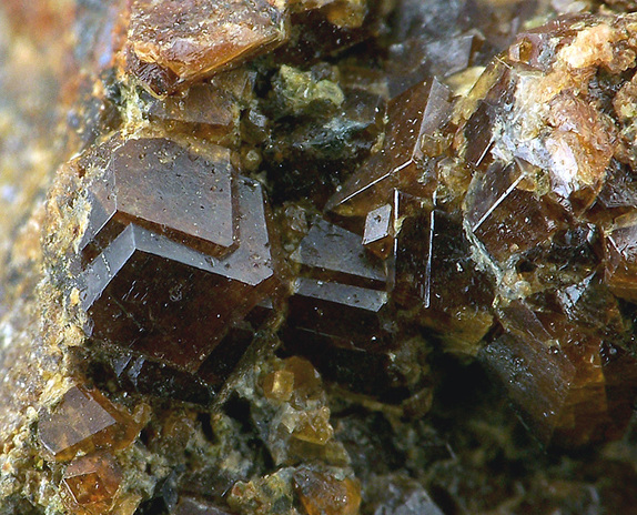
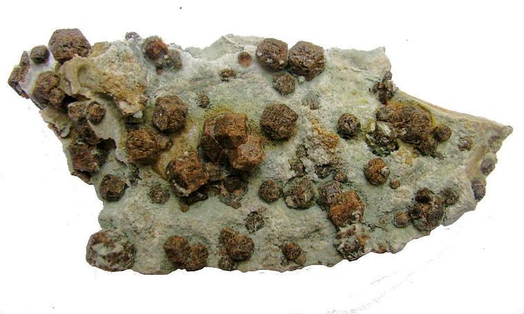
| Species: | Grossular |
| Formula: | Ca3Al2(SiO4)3 |
| Confirmation |
|---|
|
| Validity: | Believed Valid |
| Data |
|---|
|
| Mineral Data: | Click here to view Grossular data |
| Locality Data: | Click here to view L'Arbizon, Aulon, Bagnères-de-Bigorre, Hautes-Pyrénées, Occitanie, France |
| Photo Gallery | View Gallery (3 photos) |
| Data Identifiers |
|---|
|
| Mindat Occurrence Record ID: | 309930 |
| Long-form Identifier: | 1:3:309930:8 |
| GUID (UUID V4): | 6a208d9e-3fad-4e86-adf6-45a567a3272e |
| Localities for Grossular in this Region |
|---|
|
| Paloume pass, L'Arbizon, Aulon, Bagnères-de-Bigorre, Hautes-Pyrénées, Occitanie, France |
| Nearest other occurrences of Grossular |
|---|
|
|
| 1.8km (1.1 miles) | ⓘPaloume pass, L'Arbizon, Aulon, Bagnères-de-Bigorre, Hautes-Pyrénées, Occitanie, France |
| 28.5km (17.7 miles) | ⓘPosets Peak South Crest (Espalda del Posets), Eriste valley, Sahún, Huesca, Aragon, Spain |
| 35.8km (22.3 miles) | ⓘAlba Lower Ibón, Benasque, Huesca, Aragon, Spain |
| 36.3km (22.6 miles) | ⓘEriasa Quarry, Bossòst (Bossost), Aran Valley, Lleida, Catalonia, Spain |
| 46.1km (28.7 miles) | ⓘRespumoso Reservoir (Respomuso Reservoir), Sallent de Gállego, Huesca, Aragon, Spain |
| 49.2km (30.6 miles) | ⓘArrieles ravine, Sallent de Gállego, Huesca, Aragon, Spain |
| 49.3km (30.7 miles) | ⓘLac d'Artouste, Ossau valley, Pyrénées-Atlantiques, Nouvelle-Aquitaine, France |
| 71.6km (44.5 miles) | ⓘAnglade Mine, Salau, Seix, Saint-Girons, Ariège, Occitanie, France |
| 76.2km (47.4 miles) | ⓘLa Fourque granodiorite outcrop, Salau, Seix, Saint-Girons, Ariège, Occitanie, France |
| References |
|---|
|
|


L'Arbizon, Aulon, Bagnères-de-Bigorre, Hautes-Pyrénées, Occitanie, France