| Locality type: | Mine |
| Classification |
|---|
|
| Species: | Childrenite |
| Formula: | Fe2+Al(PO4)(OH)2 · H2O |
| Confirmation |
|---|
|
| Validity: | Believed Valid |
| Data |
|---|
|
| Mineral Data: | Click here to view Childrenite data |
| Locality Data: | Click here to view Okel Tor Mine, Harewood, Calstock, Cornwall, England, UK |
| Data Identifiers |
|---|
|
| Mindat Occurrence Record ID: | 3524 |
| Long-form Identifier: | 1:3:3524:8 |
| GUID (UUID V4): | 85e394d5-6287-44bf-b5a9-8fea31a4507c |
| Nearest other occurrences of Childrenite |
|---|
|
|
| 0.7km (0.4 miles) | ⓘGawton Mine, Gulworthy, West Devon, Devon, England, UK |
| 1.3km (0.8 miles) | ⓘGeorge and Charlotte Mine, Devon and Cornwall United Mines, Gulworthy, West Devon, Devon, England, UK |
| 2.0km (1.3 miles) | ⓘEast Wheal Russell, Gulworthy, West Devon, Devon, England, UK |
| 2.1km (1.3 miles) | ⓘWilliam and Mary Mine, Devon and Cornwall United Mines, Gulworthy, West Devon, Devon, England, UK |
| 2.3km (1.4 miles) | ⓘRussell United Mine (incl. Wheal Russell), Gulworthy, West Devon, Devon, England, UK |
| 2.3km (1.4 miles) | ⓘBroadwell Wood Railway Cutting (2), Gulworthy, West Devon, Devon, England, UK |
| 2.6km (1.6 miles) | ⓘBroadwell Wood Railway Cutting (1), Gulworthy, West Devon, Devon, England, UK |
| 2.6km (1.6 miles) | ⓘBlackmoorham Wood Railway Cutting, Gulworthy, West Devon, Devon, England, UK |
| 2.6km (1.6 miles) | ⓘLittle Duke Mine (North Tavy Mine), Gulworthy, West Devon, Devon, England, UK |
| 2.7km (1.7 miles) | ⓘDrakewalls Mine, Drakewalls, Calstock, Cornwall, England, UK |
| References |
|---|
|
|
| Reference Search (possible matching items) |
|---|
 | | Report (issue) | | responsible for tl1e mineral lodes taken £1..om olcl mine-planR, l)11t where p<}ssible tl1e Olttcrops were...supplied at the cost of drawing and colouring. CORNWALL. 15. NE., by H. Dewey; SE., by G. Barrow and H...-Pillow-Iava, 1 mile WSW. of Brent Tor . . . 53 .... • •• ••• ••• .•• , , 9.-Brent Tor from the west . . . • • •...Phrenix 1\lines . . • 84 ..• ••• ..• ... ,, 12.-Brent Tor from the no·rth-east .•• . .. ... 92 ..• ... ,, 13...14.-Wheal .Arthur. Sections ..• 93 ••• , , 15.-Cornwall Great Consols. Longitudinal Section .•• • • • |  | | Book | | Transactions of the Royal Geological Society of Cornwall. Quarterly Journals of the Geological Society...Genus 2. HYDROUS PHOSPHATES. 41. Wavellite. 42. Childrenite. Genus 3. HYDRO - SILICATES. Group 1. ALUMINOUS...ad petett inte tro con . LOCALITIES. — Evand. Cornwall ; near Tuckingmill, Cam borse, and is a gre quarry...on Kergiliack estate near Pen a. Coberard ; at a mine near the head of Borrowdale, near Lometer, rearis...in the Isle of Man. Scotland . At Craigman coal -mine, near New Cumnock in Ayrshire, massive and columnar | 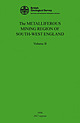 | | Book (volume) | | COUNCIL The METALLIFEROUS MINING GION OF SOUTH-WEST ENGLAND Volume II 1956 2017 reprint BRITISH GEOLOGICALSURVEY...The metalliferous mining region of south-west England VOLUME II H G Dines, ARSM, AMICE with petrographical...metalliferous mining region of the south-west England. Economic Environmental Science Centre Keyworth...London SW7 5BD Tel: +44 (0)20 7589 4090 www.bgs.ac. uk www. geologyshop. corn ... 111 CONTENTS PAGE...CHAPTER V-DETAILS iv V OF THE MINES IN EAST CORNWALL, DEVON AND WEST SOMERSET ................... |  | | Book | | PO Box 315. Harpenden. Hertfordshire AL5 2ZD. England Telephone: +44 (0)1582 762413 Fax: +44 (0)870 055...the production of e0pper. the mining areas of Cornwall and Devon became important producers of b th tin...Oxford University Museum of Natural History; Royal Cornwall Museum, Truro; Sedgwick Museum, University of...1\llaga::i11e, on minerals from localities in Cornwall. Devon. Cumbria and Yorkshire. He was renowned...theLakeDistrictandCornwall (izoklakeite}" WhealCock,StJust,Cornwall SouthTerrasmine,StStephen•in-Brannel. Comwa!I | 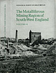 | | Book (volume) | | The Metalliferous Mining Region of South-West England 0 iz 0 1-rj VOLUME II Assistant Director's...GREAT BRITAIN ENGLAND AND WALES The Metalliferous Mining Region of South-West England Volume II By ...published 1956 Second impression 1969 Printed in England for Her Majesty's Stationery Office by Unwin Brothers...PLATES V CHAPTER V.-DETAILS OF THE MINES IN EAST CORNWALL, DEVON AND WEST SOMERSET 509 8. St. Austell... 623 Kit Hill (p. 624); Gunnislake (p. 636.); Calstock (p. 644); Luckett, Latchley and Devon Great Consols· |  | | Book (volume) | | IE METALLIFEROUS MINING REGION OF UTH -WEST ENGLAND Volume II LONDON HER MAJESTY ' S STATIONERY OFFICE...GREAT BRITAIN ENGLAND AND WALES The Metalliferous Mining Region of South -West England Volume II By H...iv CHAPTER V . — Details OF THE MINES IN EAST CORNWALL, DEVON AND WEST SOMERSET 8. St. Austell district...623 Kit Hill (p . 624); Gunnislake (p . 636 ) ; Calstock (p . 644 ); Luckett, Latchley and Devon Great...Wolfram Lode .. . FIG . 35. — Castle-an -Dinas Wolfram Mine; longitudinal section .. .. FIG . 36 . — The |
|


