 | | Report (issue) |
| COLORADO STATE GEOLOGICAL SURVEY BOULDER R. D. GEORGE, State Geologist BULLETIN 9 GEOLOGY AND ORE DEPOSITS...OF THE BONANZA DISTRICT SAGUACHE COUNTY COLORADO By HORACE B. PATTON 1915 DENVER,COLORADO EAMES BROTHERS...DOI: https://doi.org/10.58783/cgs.b09.vtso7767 Colorado State Geological Survey. Bulletin No. 9, Plate...rnor of Colorado LIVINGSTON FARRAND ______________________ President University of Colorado HowARD C...TRANS:\IITTAL ST.I.TE GEOLOGICAL SuRVEY, UNIVERSITY OF CoLORADO, December 2, 1916. Governor George A. Carlson |
 | | Report (issue) |
| GEOLOGY AND ORE DEPOSITS OF THE BONANZA MINING DISTRICT, COLORADO BY W. S. BURBANK WITH A SECTION ON...HENDERSON Prepared in cooperation with the COLORADO METAL MINING FUND UNITED STATES GOVERNMENT PRINTING...Geography _ ______________ ___-__-__ Situation of the district _ _ _________________ Topographic features. ....Previous geologic and topographic work in the district. ____ ___________._-__-______--__. Field work..._____ Pennsylvanian sedimentary rocks. _______ Kerber formation __________________ Thickness and stratigraphy |
 | | Book |
| MINES AND MINERALS OF THE GREAT AMERICAN RIFT (COLORADO-NEW MEXICO) Sine —_—< ¢ te om At _SHT 40...MINES AND MINERALS OF THE GREAT AMERICAN RIFT (COLORADO-NEW MEXICO) Richard Walker Holmes and Marrianna...Mines and minerals of the Great American Rift (Colorado-New Mexico). Bibliography: p. Includes index...index. 1. Mines and mineral resources—Colorado. 2. Mines and mineral resources—New Mexico. I. Kennedy, Marrianna...enter must be obtained to prevent trespass. Old mine workings are dangerous and entering underground |
 | | Report (issue) |
| Smith. Director Professional Paper 138 MINING IN COLORADO A HISTORY OF DISCOVERY, DEVELOPMENT AND PRODUCTJON...location, area, and organization of the mining counties of Colorado _________________________ _ Adams County_-..._____________________ _ Alamosa County __________________________ _ Arapahoe County _________________________...Archuleta County _________________________ _ Baca CountY-----------------------------Boulder CountY------...CountY----------------------~----Chaffee County _____________________·______ _ Clear Creek County _______________________ |
 | | Report (issue) |
| Geology of the Murray Area Shoshone County Idaho By. JOHN W. HOSTERMAN A CONTRIBUTION TO ECONOMIC GEOLOGY...-_.___ Jack Waite mine.__.-_-._--_--____-_-_-_---_-___.__----.______ Crystal Lead mine. ______________...___ Monarch mine..__-__-__-____-___--______--__-___.__--____-__, Black Horse and Paragon mines____-__-_...mines._______________ ______________ Silver Strike mine.__--_-____---_---_-_.-_-______--_-_-.______. Giant...Shoshone County, Idaho. 58. Geologic map of workings of the Jack Waite mine, Shoshone County, Idaho, and |
 | | Journal (issue) |
| 199~ Weird The Mineral and Wonderful from Quartz Alberta's Collector's Newsletter in Septarian...(though a little skeptical) to learn of a nearby quartz collecting locality. It is a three-hour drive northeast...locomotive cxursions. My first collecting specialty was quartz, for which I've retained a soft spot, and I was...produced a wide variety of interesting and unusual quartz crystals. These are found in abundant ironstone...nodules that weather out of Fig. 1 Partial, hollow quartz crystal 11/4 inches (3 cm) across, with multiple |
 | | Book (edition) |
| sOO0Ofoss Colorado LITHO BY WALSWORTH PUB. CO., INC., MARCELINE, MO. Colorado GOLD AND FARMS...Denver, of all other McMahon, unpublished Mining District, in reproduction. map Colo. places Albuquerque...Albuquerque, NM of Leadville a map of Territorial Colorado c. 1876, and a woodcut engraving Bird’s Eye View...scock G. York, Includes indexes. 1. Colorado. 2. Colorado. is Waele. Mines and mineral resources--...DressOne. MEXIC ies 35 Publisher’s Preface Colorado! The very name (which means “‘colored red’’) conjures |
 | | Journal (issue) |
| GoodspringsMining District,ClarkCounty,Nevada JackKepper P.O. Box314 Cave Creek, Arizona 85327 E-mail:...netcom.com The Milford Mine is located in the Goodsprings (Yellow Pine) Mining District, about 30 miles south...south of Las Vegas, in Clark County, Nevada. Production in the district ( 1856 to 1962) was dominated...zones of oxidation. The detailed mineralogy of the district has been published in the U.S. Geological Survey...reported the presence of wulfenite in 13 mines in the district. The better material comes from the Mobile, Shenandoah |
 | | Journal (issue) |
| Newsletter $2.00 LuminescentPhantom Quartz From Hudson,St. Croix County,Wisconsin William S. Cordua Dept...November-December, 1997 near Hudson, St. Croix County, Wisconsin has revealed some unexpectedly interesting...reached from Interstate 94. One takes Exit 2, marked County F and Carmichael Road, then turns south on Cannichael...Although Continued on page 4 ..;.. Fig. 1 Phantom in quartz, new roadcut near Hudson, Wisconsin, the central...83816-2043 Montgomery at the "Little Green Monster" Mine Fairfield, Utah 1937 A 96 page treatise based upon |
 | | Report (volume) |
| Bulletin 732 GEOLOGY AND ORE DEPOSITS OF SHOSHONE COUNTY, IDAHO BY JOSEPH B. UMPLEBY AND E. L. JONES...Osburn fault____________________________ Placer Creek fault___________________________ Other faults__...Pottsville_________________ 87 Slate Creek _______________________ Placer Creek ______________________ Wallace...Interstate-Callahan mine_________________ Success mine __________________________ Rex mine____________________________..._______ Morning lode __________________....______ Paragon groups .-._______ Murray Hill mine_ ____ __ ____________ |
 | | Journal (issue) |
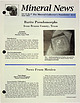
| Collector's Newsletter $2.00 Pseudomorphs from Brazos County, Texas Art Smith 9118 Concho Houston, Texas 77036...age occur along Turkey Creek in the BryanCol!~ge Stallon area of Brazos County, Texas. Thin, elongate...the log contain secondary bubbly chalcedony and quartz pseudomorphs after barite crystals. Originally...setting fire to he shaft and filling the entire mine with smoke. They also incurred the wrath of the...Fig. 1 Quartz pseudomorph of barite, from petrified wood, Turkey Creek, Bryan, Brazos County, Texas, |
 | | Report (volume) |
| ........................ 5 5 Distribution of mining districts..................................................................................... Colorado......................................................................... PART II. Catalogue of mining districts, by J. M. Hill..................................................... Classification of mining districts........................................counties....................................... Colorado.............................................. |
 | | Journal (issue) |
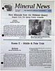
| Mineralsfrom the MidstateQuarry Magnet Cove, Hot Spring County, Arkansas Art Smith 9118 Concho Houston, Texas...mmlong, Midstate Quarry, Magnet Cove, Hot Spring County, Arkansas, photo by the author. Middle& PolarUrals...Russian • __., helicopter to fly further north to the mining village of Neroika. We spent our next 11 days in...the 1930s as the hub of operations in the Dodo quartz deposits, and extended further north to Patak and...produces some of the purest quartz in the world. At the height of mining, it employed some 240 workers |
 | | Report (issue) |
| and Grade-Tonnage Information on Low-Sulfide Au-Quartz Veins by James D. Bliss and Gail M. Jones Open-File...mineralogy of deposits classifed as lowsulfide Au-quartz veins were compiled for deposits found throughout...deposit. Table 4, part B, gives an alphabetic list of mine and properties followed by the deposit name. CHARACTERISTICS...tabulation have characteristics of low-sulfide Au-quartz veins as described in Berger (1986). These deposits...in detail. Alteration minerals associated with quartz in these deposits include carbonates (ankerite |
 | | Journal (issue) |
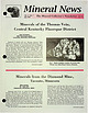
| the Thomas Vein, Central l(entuclry Fluorspar District Alan Goldstein 1607 Washington Blvd. Louisville...of the more famous Illinois-Kentucky lluorspar district. (Despite the editor-produced title in Goldstein...mineral name.) The Central Kentucky lluorspar district is certainly less wellknown, having been sporadically...northern end of district. For a review of the ,eneral geology of history of the district, see Anderson...produced very fine specimens of amethyst and clear quartz not much else is commonly reported from these mines |
 | | Journal (issue) |
| by Vandall King. from Orchard Dome, Fort Bend County, Texas Art Smith 9118 Concho Houston, Texas 77036...77036 • In I 969 and 1970 Duval's Frasch sulfur mining operations at Orchard Dome were being geared down...Fort Bend County, Texas, photo by the author. ,/" 2 Minero! News The Lost Gem Tourmaline Mine: the Royal...Royal Gorge No. 1 Mine, Eight Mile Park, Fremont Co., Colorado Mark Jacobson 112 N. Lemans St. Lafayette...in Mineral News about the gem tourmaline mine of the Colorado miner, C. A Beghtol. This long lost pegmatite |
 | | Journal (issue) |
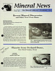
| and TwinnedFornacite from the Singer Mine, Goodsprings, Clark County, Nevada Paul M. Adams 126 S. Helberta...Beach, CA 90277 • The Singer Mine is located on the south end of Bonanza Hill, in Section I 8, T25S, R38E...7 miles (11 km) southwest of Goodsprings, Clark County, Nevada. Goodsprings is located 7 miles west of...Ersknie Ross of Los Angeles and J. H. Polk. The mine operated from 19I 3 to I 920, during which time...of radiating sprays of willemite crystals, Singer Mine, Goodsprings, Nevada. Recent Collecting Activities |
 | | Report (issue) |
| Mountain _________ _ Porphyry of Galena Creek ___________ _ Snow Creek(?) Porphyry ____________ _ Chemistry..._ Intermediate rocks --------------------------Quartz monzonite of Hughesville _______ _ Barker Porphyry...deposits --------------------------------Barker mining district -----------------------Fissure veins in the...ation -----------------------------San Miguel district -------------------------Ore potential ------...___ Map showing the Annie E dike intruding the quartz monzonite of Hughesville ________________________ |
 | | Journal (issue) |
| Rosasite, light blue, field of view 12 mm, Hecia District, Melrose, Montana, photo by L. R. Ream. A Si...quite yet. The main features listed for Grand County, Colorado, for example, are gravel pits and coal mines...won't appear (the Green Ridge Pegmatite in Grand County, described in Stephen Voynick's book is not listed....... I usually start by entering the State and County. A "Commodity" field allows one to search by element...collect. There are limitations to the search function. Mine names, for example, are literal; "Big Indian" returned |
 | | Report (issue) |
| org/details/reportofstatemin15cali CALIFORNIA STATE MINING BUREAU FERRY BUILDING, SAN FRANCISCO ^LETCHER...Statement xxiii Participation of the California State Mining Bureau in the Panama-Pacific International Exposition...Production General Features I. Alpine County. 5 6 6 , Mining Districts The Mogul and Monitor Districts...Hercules Company 14 23 Silver Mountain District Silver King District Mineral Water Grover's Hot Springs...27 27 27 , , Bibliography Chapter II, Inyo County. Introduction and Acknowledgments Location and |
 | | Report (issue) |
| ...... ·- ......... . J,5 Historical sketch of mining and smelting in New Mexico....... . . . . . . ....... : . .............. - ........ .. . . T~os County, by L. C. Graton and W ..Lindgren ..... ................. . . , ... -.. . Rio Hondo. (Twining) district . . . . . . . . . . . . . ......................::.:::.::: ::: :::: :: ':::: :: ::::. Red River district. ..................•......... -~ . . ...........·::-; : : :. ::.·.i?:5.•.:...,. .... Black.Copper mine ........ ............. ~ ... .. . .... ·....... |
 | | Journal (volume) |
| Logan, District Mining Engineer McK. Laizure, District W. Burling Tucker, Reid J. Mining Engineer...Engineer District Sampson, Assistant Mining Engineer District Engineer Chas. V. Averill, District Mining...Statistician and Curator Herbert A. Franke, Junior Mining Engineer (Librarian) — Sacramento San Francisco...REPORTS OF DISTRICT MINING ENGINEERS 7 Redding Field District 7 Sacramento Field District 7 Gold...Mines of Placer County 7 San Francisco Field District 07 Los Angeles Field District 97 GEOLOGIC BRANCH |
 | | Report (issue) |
| BULLETIN No, 92 ISSUIDBYTfSE CALIFORNIA STATE MINING BUREAU FERRY BUILDING - SAN FRANCISCO wummmKraBtaaaaaaeu...archive.org/details/bulletin92cali CALIFORNIA STATK MINING BUREAU FERRY BUILDING, SAN FRANCISCO LLOYD L...points proved in same. Chapter I. Control of Mining Debris History of problem and efforts to solve...valleys. Future benefits to be derived. II. Placer Mining Methods Methods of liandling- and commercial exploitation...I'ortage Creek, on the Iwttle Delta, Alaska Panning- on Portage Creek Dredge on Hunker Creek, Klondike |
 | | Report (issue) |
| an overall guide been written on gold and gold mining of publications have no single report or to...longer district Hulin, respectively. the principal features of each gold-bearing district are described...publications were written on various phases of gold mining. The reports of John Trosk, the first State Geologist...Commissioner of Mineral prepared reports of mine production and gold-mining Bureau, and later now the California...The California Mining in 1880, gold-mining operations; the and Geology and the County a number of |
 | | Report (issue) |
| 21 Gabbro 23 23 intrusive 21 Granodiorite Quartz veins Lamprophyres Keratophyre 24 24 24 24 24...bedding Tailings stacked along banks of Indian Creek ____ Tailings from dredging, Horse-shoe Bar Gleeson...Within its boundaries are the famous gold placer-mining many districts of Iowa Hill, Foresthill Divide...feet in thickness anywhere in the map area. Vein quartz and metachert debris predominate over other bedrock...north, and the merilies It principally in Placer County, California; and extends northwestward and southeastward |


