 | | Report (issue) | | digital geologic map for Badlands National Park in South Dakota, which the Geologic Resources Division produced...encompasses 242,755.94 acres in southwestern South Dakota and is home to striking erosional formations...topography was first recognized and described in South Dakota and the White River Badlands are the type locality...highest known rates of erosion occur in the South Dakota badlands. Ridges and pinnacles have collapsed...Badlands National Park is located in southwestern South Dakota about 80 km (50 mi) east of the Black Hills |  | | Journal (article/letter/editorial) | | [University of Connecticut] at 20:42 14 January 2015 South Dakota is perhaps best known for its pegmatites, which...Hills are responsible for the accessibility of South Dakota’s itbundant and diverse mineral locations...to be made. The most complete mineralogy of South Dakota and the Black Hills is found in Roberts and...965). Some uncited mineral species are from the South Dakota School of Mines Museum of Geology. Noteworthy...FiridofGt~rnSphultirite ut IIIP Bulinut Zinc Mine, St. Luwrence County, tditor of NPW b r k ” unrl iipptwwl in the No~~er |  | | Book | | 1320 East 10th Street Bloomington, Indiana 47405 USA iupress.indiana.edu © 2015 by Indiana University...and preservation – South Dakota – White River Region. 2. Paleontology – South Dakota – White River Region...dedicate this book to the Jones Family of Quinn, South Dakota. For over 26 years, Kelly, Mary, and Doug provided...170 176 188 P.1. Map of the Big Badlands of South Dakota showing locations of specific places and features...viii Preface Makosica (mah-KOH SHEE-jah) is the Lakota word for “badlands,” or the barren and rough country | 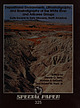 | | Report (issue) | | Clearance Center, 222 Rosewood Drive, Danvers, MA 01923, USA, phone (978) 750-8400, http://www.copyright.com...of the lower part of the White River Group: South Dakota to Nebraska ........06 006. DRO milerty it 3...sequence, Eocene-Oligocene White River Group, South Dakota ETON CDF USK A EPP ac Hace J. E. Evans and L...Chadron, Brule, and Arikaree Formations in North Dakota. .........00 00 cc ccc cece J. W. Hoganson, E....River—Arikaree rocks occur primarily in Nebraska, South and North Dakota, Wyoming, Montana, and Colorado. They have |  | | Book (volume) | | Guide for Rock Hounds in the United States SOUTH DAKOTA This northwestern Great Plains state varies...rising granite mass intruded the famed Cretaceous Dakota sandstone, which underlies most of the Great Plains...continental seas were advancing from the south, the Dakota sandstone represents topset beds, wave reworked...the fascination of these pegmatites. 437 South Dakota The commercial production of minerals, principally...beds, excavations, etc.Selenite roses. BRULE COUNTY AREA: in the Oacoma zone of the Pierre Fm. On Elm |  | | Report (issue) | | STATE OF SOUTH DAKOTA Nils Boe, Governor MINERALOGY OF THE BLACK HILLS by WILLARD LINCOLN ROBERTS...Associate in Mineralogy Museum of Geology, South Dakota School of Mines and Technology and GEORGE RAPP...Department of Geology and Geological Engineering, South Dakota School of Mines and Technology With the Editorial...Mineralogy South Dakota School of Mines and Technology BULLETIN NUMBER 18 of the South Dakota School of...of Mines and Technology Rapid City, South Dakota PUBLICATIONS STAFF F. L. Partlo J. T. Thomas President |  | | Book (volume) | | that is mostly a mixture of chert, translucent chalcedony, jasp-agate and common opal, rivaling in beauty...ASHTABULA COUNTY CONNEAUT, area pits, quarries, rd. cuts, etc.⎯cone-in-cone Calcite. CLERMONT COUNTY MILFORD...CLINTON COUNTY WILMINGTON, area of Todd’s Ford, a mineral deposit⎯Hematite. COSHOCTON COUNTY AREA, townships...CUYAHOGA COUNTY CHAGRIN FALLS (on Geauga Co. line), area quarries⎯oilstone. DELAWARE COUNTY DELAWARE...nodules⎯Pyrite (crystals sharply cubic). FRANKLIN COUNTY COLUMBUS, area countywide exposures of blue clay |  | | Book (volume) | | that is mostly a mixture of chert, translucent chalcedony, jasp-agate and common opal, rivaling in beauty...ASHTABULA COUNTY CONNEAUT, area pits, quarries, rd. cuts, etc.⎯cone-in-cone Calcite. CLERMONT COUNTY MILFORD...CLINTON COUNTY WILMINGTON, area of Todd’s Ford, a mineral deposit⎯Hematite. COSHOCTON COUNTY AREA, townships...CUYAHOGA COUNTY CHAGRIN FALLS (on Geauga Co. line), area quarries⎯oilstone. DELAWARE COUNTY DELAWARE...nodules⎯Pyrite (crystals sharply cubic). FRANKLIN COUNTY COLUMBUS, area countywide exposures of blue clay |  | | Book (edition) | | from the Tourmaline Q ueen .1ine, Pala, San Diego County, California. From a pen-and-ink drawing by W. E...of tourmaline crystal forms 38. Map of San Diego County, California gem sources 3 9. Stewart Lithia· and...View of Clear Creek, San Benito County, California 55. Monterey County jade-producing shoreline, California...San Benito County, Calfornia E. L. Gray Opencut wall, Dallas Gem mine, San Benito County, California...Digging for natrolite, Clear Creek, San Benito County, California Fluorite crystals from Illinois Views |  | | Book | | Carolina North Dakota Ohio Oklahoma Oregon Pennsylvania Rhode Island South Carolina South Dakota Tennessee...pyrite, quartz family minerals ( agate, carnelian, chalcedony, chert, flint, jasp-agate, jasper, quartzite...especially valuing the deep red carnelian variety of chalcedony. Although the Sumerians used almost all the common...color; assigned to Gad), agate (perhaps green · chalcedony or "chrysoprase"; Foreword xvi i assigned...[agate-jasper, i.e., our "jasp-agate"], cerachates [chalcedony], smaragdachates [green agate], haemachates [red |  | | Book | | and spires of Big Badlands National Park in South Dakota. The first part of the book summarizes the latest... Morris F. Skinner in the Big Badlands of South Dakota during the 1950s. (Photo courtesy Marie Skinner)...stratigraphically zoned collections from the Big Badlands of South Dakota. In the 1950s and 1960s, he made some of the...River outcrops in Wyoming, Nebraska, and North Dakota as well. Unlike many collectors, however, Morris...unpublished. Only his brief summary of the North Dakota sequence (Skinner, 1951) was published in his lifetime |  | | Book (edition) | | listed below: Philip Bjork, Museum of Geology, South Dakota School of Mines and Technology Robert S. Carmichael...National Park, South Dakota Theodore Rooseveit National Park, North ND AW OANDA Dakota Grand Canyon...feet) averages some 1,200 feet higher than the South Rim (6,900 feet). Two hundred eighty miles of the...black body, black stomach, and white tail. On the South Rim, vegetation that is lighter in color and typical...differences in life zones on the North Rim and South Rim became pronounced, the new species developed |  | | Journal (volume) | | indicate that the family had arisen in western South America and migrated into Brazil. ferior ovary ...Diaphoranthema of Tillandsia seems to have invaded from the south, while a few species of the subgenus Tillandsia...the most important host in Trinidad, found as far south as Baia, while Vriesm gigantea and Hohenbergia augusta...Probably the only danger there is the remote in the south, where I possibility of artificially stimulating...(IAN). Also: Central America, Trinidad, Northern South America. ; ; Pires 1937 23. Tillandsia linearis |  | | Report (volume) | | H1ldebrand, Fred A, Havens, R G Thalemte from Teller County, Colorado, zn Geolog1cal Survey Research 1962 U...Mcintosh Counties, North Dakota North Dakota Water Conserv Comm North Dakota Ground-Water Study 38, 22...and Steele Counties, North Dakota North Dakota Water Conserv Comm North Dakota GroundWater Study 39, 22... Allen F, Sevon, Wilham D Ogallala Group 10 South Dakota [abs] Geol Soc Amenca Spec Paper 68, p 126,...Merhn J, Steece, Fred V South Dakota's ground water needs and supphes South Dakota Geol Survey M1sc Inv |  | | Book (edition) | | Baker, University of Iowa; Robert F. Biek, North Dakota Geological Survey; Robert R. Churchill, Middlebury...National Park, Utah 9 Badlands National Park, South Dakota 3. Bryce Canyon National Park, Utah 10 Theodore...Theodore Roosevelt National Park, North Dakota 4 Capitol Reef National Park, Utah 11. Kobuk Valley...Badlands National Park (South Dakota) and Theodore Roosevelt National Park (North Dakota). The next national...stabilized dunefields. Great Sand Dunes is located in south central Colorado, while Cuyahoga Valley is found |  | | Book | | and Geophysics University of Adelaide Adelaide, South Australia 5001 Australia William A. Berggren Department...and Geophysics University of Adelaide Adelaide, South Australia 5001 Australia Michael L. McKinney Department...and Geophysics University of Adelaide Adelaide, South Australia 5001 Australia LIST OF CONTRIBUTORS...Penrose Conference on this subject in Rapid City, South Dakota. During that meeting, paleontologists and stratigraphers...Dr. Philip R. Bjork of the Museum of Geology, South Dakota School of Mines and Technology, was the local |  | | Report (volume) | | use of hgmte-Bureau of Mmes-Umversity of North Dakota SymposiUm, Grand Forks, N Oak, 1961, Proc US Bur...sectwn of Paleozotc rocks from Butler County to Stafford County, Kansas Kansas Geol Survey Otl and Gas...wells on a cross section from Barber County, Kansas, to Caddo County, Oklahoma Oklahoma Geol Survey Gutdebook...Garnette Geology of the M1ss1on quadrangle, South Dakota South Dakota Geol Survey [Geol Map], scale 1 62,500...deposits of East Shasta copper-z10c dtstnct, Shasta County, Cahforma U S Geol Survey Prof Paper 338, 107 p |  | | Report (volume) | | Bull. 1060-D, p. 193, 252-253, pl. 7. In Nemaha County, Kans., member is basal unit of Howard limestone...Aarde farm, sec. 4, T. 26 S., R. 11 E., Greenwood County. Aaron Slatet Precambrian or Paleozoic: Central...Central Railroad, sees. 5-7, T. 11 S., R. 5 E., Pope County. Named for Abbott Station. Abbyville Gabbrol Precambrian...map. Occurs in vicinity of Abbyville, Mecklenburg County. Abercrombie Formationl Middle Cambrian: Western...Underlies and named for Abercrombie Peak, on ridge south of Dry Canyon, in Gold Hill district. Aberdeen Sandstone |  | | Report (issue) | | A293-A298 of this chapter. Numerous Federal, State, county, and local agencies and other organizations and... North Carolina ............................ . South Carolina ......................•...... Georgia ...Montana ....................•...•......... North Dakota ............................. . Oklahoma ........resources-Continued Rocky Mountain region-continued South Dakota •..•...•......•....•.•........ Utah .•.•...•...cooperators ............................. . State, county, and local cooperators ................. . Other |  | | Report (issue) | | 1966 1967 1968 1969 1970 Numerous Federal, State, county, and local agencies and other organizations and.... North Carolina ....•...••...•••.•.•....•.... South Carolina •••...•.•••..•.•.......••...• Georgia ...North Dakota .•••••••••••••••••••••••.•••.• Oklahoma •.•.•••••...•.••••.•••..•.•.•..•• South Dakota •••...cooperators .............................. . State, county, and local cooperators ................. . Other...raw materials in nature, Tintic district, Utah County, Utah, has confirmed the existto the development |  | | Report (issue) | | Savannah River . . . . . . . . . . . 105-106 Wells south of the belt of outcrop . 106-108 Correlation . .... . . . . . . 192-200 Detailed sections (wells south of the belt of outcrop) . . . 200-204 CONTENTS...Richmond and Burke counties Savannah River, Burke County Shell Bluff . . . Demeries Ferry . Hancock Landing...Richmond County . Hephzibah . . . . Jefferson County .. Louisville . . . . Washington County Sandersville...Twiggs County . Dry Branch .. Gallemore . . . Area west of Ocmulgee River Perry, Houston County Flint |  | | Report (volume) | | North America..,__.._____________.___ Rivers of South America___._____________________ Waters of western..._____________________..___ :______ Central and South America______________________ '._____ Caspian Sea...it emerges'from the mountains, and second at Rockyford, nearly 100 miles below.0 The analyses are as.............................................. Rockyford. 37.55 14. 62 3.77 20.24 5.13 9.57 .60 8.19 ...For the rivers and lakes of the Atlantic slope south of the St. Lawrence the data are rather scanty. |  | | Report (volume) | | .................................... Rivers of South America...........................................................................J. Central and South America...........................................references to literature. See also E. H. L. Schwarz, South African Jour. Sci., April, 1910. Schwarz advocates...it emerges from the mountains, and second at Rockyford, nearly 100 miles below.1 The analyses are as.............................................. Rockyford. 37.55 14.62 3.77 20.24 5.13 9.57 .60 8.19 .33 |  | | Report (volume) | | ................................... Rivers of. South America.....................................:................................... 161 Central and South America...........................................references to literature. See also E. H. L. Schwarz, South African Jour. Sci., April, 1910. Schwarz advocates...it emerges from the mountains, and second at Rockyford, nearly 100 miles below.1 The analyses are as...77 20.24 5.13 9.57 .60 8.19 .33 100. 00 148 Rockyford. 2.65 60.69 4.89 12.78 3.76 14.50 .28 .45 100 |  | | Report (volume) | | .................................... Rivers of South America......................................................................... 163 Central and South America..............................;............and the West Indian Elands. 1,709 analyses. B. South America. 138 analyses. C. Europe, including British...areas are inadequately covered. The figures for South America, Asia, and Australia are, however, in close...references to literature. See also E. H. L. Schwarz, South African Jour. Sci., April, 1910. Schwarz advocates |
|


