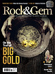
 | | Journal (issue) | | GOLD ON STEVENS TRAIL 10 California’s American River still holds riches. By Marc Davis THE WORLD’S FINEST...GOLDEN HISTORY OF BRECKENRIDGE 36 This legendary Colorado gold camp is full of attractions. By Steve Voynick...large pieces, could be found on the North Fork of the American River, in Northern California. (Getty Images)...Consulting Editor LYNN VARON Managing Editor JIM BRACE-THOMPSON MARC DAVIS RUSS KANIUTH BOB RUSH HELEN SERRAS-HERMAN...8 www.rockngem.com 7 California’s American River Still Holds Riches Story and Photos by Marc Davis |  | | Book (volume) | | ...........................................59 Colorado ...........................................................................................346 North Carolina ....................................................................................356 North Dakota ..........................................................548 Table of Maps Page Alabama County Map ...................................................................................4 Alaska County and Stream Map ............................... |  | | Book (volume) | | ...........................................47 Colorado ...........................................................................................295 North Carolina ....................................................................................302 North Dakota ...........................................rights, so remember you were told. If in doubt, a county map will tell you who the legal owner is. Good...gemmy qualities for cutting and polishing. AUTAUGA COUNTY PRATTVILLE, N. 6 mi., and just E of the Birmingham |  | | Book (volume) | | ...........................................47 Colorado ...........................................................................................295 North Carolina ....................................................................................302 North Dakota ...........................................rights, so remember you were told. If in doubt, a county map will tell you who the legal owner is. Good...gemmy qualities for cutting and polishing. AUTAUGA COUNTY PRATTVILLE, N. 6 mi., and just E of the Birmingham |  | | Report (volume) | | A. F. Rogers, Stanford University, Palo Alto. Colorado.........Prof. R. D. George, Boulder. Connecticut...State Museum, Albany. North Carolina.. .Dr. Joseph Hyde Pratt, Chapel Hill. North Dakota... .Dr. A. G....See Bauxite and Hallpysite. Asbestos. Tallapoosa County, with corundum deposits near Dudleyville; not found...commercial quantity or quality. Asphalt. Colbert County, small quantity has been shipped from near Leighton;...following localities: Bibb County, Pratts Ferry; Calhoun County, near Tampa; Clay County, T. 20, Pv. 7 E.; Jefferson |  | | Book (edition) | | plains have been buried deep under debris brought north by glaciers or washed down down from have been...when planning A a trip. desert, such Green River country of Utah or the far southern part of California...Diamonds have been found in the United way from North Carolina to California and from Wisconsin. Some...Some are found in the rock in which spare North America. States, all the Georgia to they were created...Locations place Table North Carolina and Georgia Diamond Locations E: NORTH CAROLINA weight plac« |  | | Report (volume) | | have been found are: Smith River, Del Norte County; Trinity River, Trinity County; Spanish Creek and Gopher...Gopher Hill, Plumas County; Placerville and Webber Hill, El Dorado County; Cherokee Flats, Yankee Hill,and...Oroville, Butte County; French Corral, Nevada County; Indian Gulch and Volcano, Amador County; and Alpine... Tulare County. Other western localities are: Diamond Basin, Ada County, Idaho; Curry County, Oreg.;...; and Nelson Hill, near Glacier County, Mont. The Great Lakes diamond region is essentially the terminal |  | | Report (volume) | | ............................................. Colorado.......................................................... North Carolina. .......................................................... North Dakota......especially from those of Arkansas, California, Colorado, New Mexico, Oregon, South Dakota, Tennessee,...1888. Branner, J. C., The zinc and lead region of north Arkansas: Arkansas Geol. Survey Ann. Kept, for 1892...minerals and rocks, their occurrence and uses: Colorado State Geol. Survey Bull. 6, 1913. 8 USEFUL |  | | Report (volume) | | Minerals of Colorado: A 100- Year Record By EDWIN B. ECKEL GEOLOGICAL SURVEY BULLETIN 1 1 14 A...knowledge____________________________________ Future of Colorado mineralogy______________________________________...mineral localities and metallic mineral deposits of Colorado ________________________________ In pocket III...mineral localities and metallic mineral deposits of Colorado, has not been included in this reprint. Many of...especially Fischer and others, 1946). MINERALS OF COLORADO: A 100-YEAR RECORD By EDWIN B. EcKEL ABSTRACT |  | | Book (volume) | | cuts, breaks, river banks, stream beds, excavations, etc.Selenite roses. BRULE COUNTY AREA: in the Oacoma...Fm. On Elm Cr. Near its jct. with the Missouri River (about 15 mi. S of Chamberlain) gray Barite rosette...rosette up to 5 or 6 inches. CAMPBELL COUNTY MOUND CITY, W to the Missouri R., regional hillsides, ridges...gravels, etc.petrified wood, wood opal. CORSON COUNTY LITTLE EAGLE: area ridges, slopes, stream beds...Guide for Rock Hounds in the United States CUSTER COUNTY AREA: The November Mine, 1.2 mi. SE of the Needles |  | | Journal (article/letter/editorial) | | October 2014 Mineral Index by Counties Alfalfa County Carmen, 2 mi. NE of Carmen, 1 .1 mi. W of Highway...Permian-age Crisfield Sandstone: malachite. Adair County Bunch, near Bunch, secs.l.5, 16, T.14N, R.24E:...fluorescent and phosphorescent) (Gilmore 1963). Beckham County Malachite localities, SW1/4 SE1/4 sec.36 and SE1/4...at Great Salt Plains, Alfalfa County. Joe Lobell photo. Blaine County Southard, quarries of the U.S...Gypsum, variety selenite, Great Salt Plains, Alfalfa County. Left, 12 cm high; center, 17.6 cm high; right |  | | Journal (article/letter/editorial) | | across, on blue thomsonite. Lucky Peak Dam, Ada County; Lanny Ream specimen and photo. Figure 3 (below)...cut near Pinehurst, Adams County; Lanny Ream specimen and photo. Ada County Lucky Peak Dam, on east side...PHILLIPSITE, and THOMSONITE. Adams County Alaska mine, Seven Devils district: azurite, grossular, malachite, powellite...Jacket claim, Seven Devils district, about 4 miles north-northeast of Cuprum: chabazite, heulandite, and...Seven Devils district, in the mountains 6 miles north-northeast of Cuprum: POWELLITE was first described |  | | Book (volume) | | Alabama, Florida, Georgia, Kentucky, Mississippi, North Carolina, South Carolina, Tennessee, Virginia, and...Kansas, Minnesota, Missouri, Montana, Nebraska, North Dakota, Oregon, South Dakota, Washington, and Wyoming...SOUTHWESTERN QUADRANT Arizona, Arkansas, California, Colorado, Louisiana, Nevada, New Mexico, Oklahoma, Texas...Backwaters The King Snake Blue Jacket The Owls of North America The Conquerors Savage Journey The Court-Martial...to Empire A Time of Terror The Wading Birds of North America The Great Auk The Wand The HAB Theory |  | | Book (volume) | | ASHTABULA COUNTY CONNEAUT, area pits, quarries, rd. cuts, etc.⎯cone-in-cone Calcite. CLERMONT COUNTY MILFORD...CLINTON COUNTY WILMINGTON, area of Todd’s Ford, a mineral deposit⎯Hematite. COSHOCTON COUNTY AREA, townships...CUYAHOGA COUNTY CHAGRIN FALLS (on Geauga Co. line), area quarries⎯oilstone. DELAWARE COUNTY DELAWARE...nodules⎯Pyrite (crystals sharply cubic). FRANKLIN COUNTY COLUMBUS, area countywide exposures of blue clay...HIGHLAND COUNTY SINKING SPRING, area ore deposit (most important in Ohio) ⎯Hematite. HOCKING COUNTY AREA |  | | Book (volume) | | ASHTABULA COUNTY CONNEAUT, area pits, quarries, rd. cuts, etc.⎯cone-in-cone Calcite. CLERMONT COUNTY MILFORD...CLINTON COUNTY WILMINGTON, area of Todd’s Ford, a mineral deposit⎯Hematite. COSHOCTON COUNTY AREA, townships...CUYAHOGA COUNTY CHAGRIN FALLS (on Geauga Co. line), area quarries⎯oilstone. DELAWARE COUNTY DELAWARE...nodules⎯Pyrite (crystals sharply cubic). FRANKLIN COUNTY COLUMBUS, area countywide exposures of blue clay...HIGHLAND COUNTY SINKING SPRING, area ore deposit (most important in Ohio) ⎯Hematite. HOCKING COUNTY AREA |  | | Journal (article/letter/editorial) | | the state. In line with a project begun by the Colorado Friends of Mineralogy in 1976, the list is intended...world-wide locality index. The localities are listed by county, followed by a listing of the most prominent minerals...Alleghany County. Howard Freeland specimen and photo. Rutherford pegmatite in Amelia County and the Lynch...Station locality (turquoise crystals) in Campbell County, are now closed to collectors. However, landowners...(c) = currently closed to collecting Albemarle County Alberene soapstone quarry—Alberene amphiboie asbestos |  | | Book | | commercial ores and secondary minerals by state, county, township, and geologic range. For easy identification...cities, and many of today’s prosperous western county seats began as mining-boom camps. trating sand...Whether you such as those listed alphabetically by county, township, and range in Part II of this book. Where...gem Jersey, show pegmatites of New England North Carolina, the Black this type of mineralization...regional offices include: Federal Center, Denver 25, Colorado; 345 Middlefield Road, Menlo Park, California; |  | | Journal (issue) | | the State. In line with a project begun by the Colorado Friends of Mineralogy in 1976, the list is intended...world-wide locality index The localities are listed by county, followed by a listing of the most prominent minerals...pegmatite in Amelia County and the Lynch Station locality (turquoise crystals) in Campbell County, are now closed...(c) = currently closed to collecting ALBEMARLE COUNTY Alberene soapstone quarry-Alberene actinolite-tremolite...erythrite, galena, ilmenite, magnetite, talc Briar Fork-near Schuyler (excavation on Rt. 6) goethite pseudomorphs |  | | Book (volume) | | corner of Kimball Co. where it overlooks both Colorado and Wyoming. The subsurface rock strata of the...vertebrate remains. The breaks of the White River north of Crawford in Dawes Co. and the rather extensive...Valentine in Cherry Co., extending along the Niobrara River eastward into Brown Co. The Sandhills Museum in...area around the confluence of the Loup River with the Platte River in Platte Co. is well known for its agates...chalcedony, jasper and gem petrified wood. BUFFALO COUNTY KEARNEY, area gravel bars and pits along the Platte |  | | Book | | cracks and fissures appear. As they wash down to the river beds and sea, the minerals that are the heaviest...action of a million years is readily apparent. The river deposited the minerals IN THE BEGINNING 9 Chart...perfectly obvious that the garnets had washed into the river valley from the hills about, and that the flatland...famous was the single beryl stone found in Oxford County in Maine that weighed 18 tons and was 18 feet in...blue sapphires, blue diamonds, blue topza, blue azurite, blue quartz; so that, in general, color does not |  | | Journal (article/letter/editorial) | | The large variety of minerals and gemstones in North Carolina annually attracts thousands of collectors...over the world. Some Mineral Collecting Sites in North Carolina T H E C O L L E C T I N G L O C A L I T...McKenzie's publication Mineral Collecting Sites in North Carolina: Information Circular 24 (1978). For a...locations on county road maps, refer to this publication, which can be ordered from the North Carolina Department...27687, Raleigh, North Carolina 27611. The price is $5.00 plus 4% sales tax. Individual county road maps can |  | | Report (issue) | | NORTH CAROLINA DEPARTMENT OF CONSERVATION WILLIAM DIVISION JASPER P. OF L. SAUNDERS, MINERAL...RESOURCES GEOLOGIST Circular 16 LOCALITIES NORTH OF CAROLINA BY JAMES F. CONLEY Doc NC DENR.......... ACKNOWLEDGEMENTS MINERAL COLLECTING IN NORTH CAROLINA , . . . . # . WHERE TO COLLECT f ... f...THE MINERAL LOCALITIES OF NORTH CAROLINA BY COUNTIES . . ALAMANCE COUNTY 5 5 Pyrophyllite ......... f .......... 5 ALEXANDER COUNTY ................. 7 Emerald, Hiddenite and Associated Minerals |  | | Book (edition) | | mmed at Broken Arrow aud Trout creek, in Sc. Clair county. The strata in this field are more faulted und...prong of Canoe creek, in St. Clair county, to Ha\sop creek, in Bibb county, a distance of 60 miles. Down to...to Helena, in Shelby county, the field has an average width of 5 or 6 miles. Below that point the width...miles being in the latitud" of Blocton, in Bibb county. The south ern end of this field has a greater...Jefferson county; Helena, Montevallo, and Brierfield, Shelby county; and at Blocion. Bibb county. The Warrior |  | | Report (issue) | | Geological Survey editorial standards or with the North American Stratigraphic Code. Any use of trade, product...National Forest, Idaho ILLUSTRATIONS Plate 1. North Fork Ranger District mines and prospects 2. Salmon...east-central Idaho. Most of the Forest is in Lemhi County; only a small portion falls within Idaho and Valley...Approximately 426,114 acres of the Frank Church-River of No Return Wilderness extends into the western...restricted. Because of its location within the Salmon River drainage, the Forest also is subject to numerous |  | | Book | | Petrified Forest Trails Arizona Gem Trails and the Colorado Desert of California High Tension (A Biography)...\merica Alabama Alaska Arkansas Arizona California Colorado Connecticut Delaware Florida Georgia Hawaii Idaho...Hampshire New Jersey New Mexico New York North Carolina North Dakota Ohio Oklahoma Oregon Pennsylvania...scrabbling for agates amor1g the gravel bars of the river Achates (now called Drillo), which flows through...stating that they were first found in Sicily near the river Achates, hence the name "agate." Pliny wrote: "It |
|


