 | | Report (issue) | | Quadrangle, Chaffee County, Colorado GEOLOGICAL SURVEY Work done in cooperation with the Colorado State Mining...Deposits of the Poncha Springs SE Quadrangle, Chaffee County, Colorado By RALPH E. VAN ALSTINE GEOLOGICAL SURVEY...PROFESSIONAL PAPER 829 Work done in cooperation with the Colorado State Mining Industrial Development Board Description...ash-flow tuff _. Rhyodacite flow and tuff _______ Upper rhyolitic ash-flow tuff ___ Page 1 1 1 3 3 3 3...Springs SE quadrangle, Colorado Page .In pocket Index map of south-central Colorado ______ __ ____ Photographs |  | | Report (volume) | | Minerals of Colorado: A 100- Year Record By EDWIN B. ECKEL GEOLOGICAL SURVEY BULLETIN 1 1 14 A...knowledge____________________________________ Future of Colorado mineralogy______________________________________...mineral localities and metallic mineral deposits of Colorado ________________________________ In pocket III...mineral localities and metallic mineral deposits of Colorado, has not been included in this reprint. Many of...especially Fischer and others, 1946). MINERALS OF COLORADO: A 100-YEAR RECORD By EDWIN B. EcKEL ABSTRACT |  | | Report (volume) | | Beryllium Deposits of the Mount Antero Region, Chaffee County, Colorado By JOHN W. ADAMS A CONTRIBUTION TO ECONOMIC..._---_---The beryllium-bearing vein at the California mine.-___-_-----_-._-Location and history...___...95 95 98 98 98 100 101 101 101 103 103 The California vein_______________.______---------__--.---_...119 ILLUSTKATIONS Page FIGURE 26. Index map of Colorado showing location of Mount Antero area________...---------27. Part of the Garfield quadrangle, Colorado and contiguous unmapped area_______--__--__-- |  | | Journal (issue) | | p a c if ic COAST HIGHWAY Gold-Nevado Co. California Hours: Tues-Sar. 10-5 Sunday 12-5 [evenings by...Julius Weber Mamaroneck, New York COLORADO ISSUE #2 Articles Colorado locality index.............................. 323 by B. L. Muntyan What’s new in Colorado minerals? ...................................... Famous mineral localities: the Home Sweet Home mine ..................................................339 by M. I. Jacobson The San Juan Mountains of Colorado ..................................349 by J. A |  | | Book (edition) | | MILEAGE L OGS. REVISED EDITION Revised Edition, COLORADO GEM TRAILS AND MINERAL GUIDE HICllAHD :--1. PEARL...an extensive ¥em and mineral collecting tour 01 Colorado, revealing the interesting places where Nature...Swallow, Publisher) 2679 South York Street Denver, Colorado 80210 - , =· - ·, BOOKS BY RICHARD M. PEARL...PEARL Exploring Rocks, Minerals, Fossils in Colorado America's Mountain: Pikes Peak and the Pikes Peak...Atlas of Colorado American Gem Trails Nature As Sculptor: A Geologic Interpretation of Colorado . Scenery |  | | Book (edition) | | — _ ; COLORADO GEM TRAILS AND MINERAL GUIDE ! ■ : ' BOOKS BY RICHARD M. PEARL Colorado Gem Trails...Trails and Mineral Guide Colorado Rocks, Minerals, Fossils America’s Mountain: Pikes Peak and the Pikes...Nature As Sculptor: A Geologic Interpretation of Colorado Scenery Guide to Geologic Literature Popular Gemology...Gemology Mineral Collectors Handbook Colorado Gem Trails The Art of Gem Cutting (With Dr. H. C. Dake)...Dake) * RICHARD M. PEARL ★ COLORADO GEM TRAILS AND MINERAL GUIDE ★ SKETCH MAPS BY MIGNON WARDELL PEARL |  | | Report (volume) | | localities in California where diamonds have been found are: Smith River, Del Norte County; Trinity River...River, Trinity County; Spanish Creek and Gopher Hill, Plumas County; Placerville and Webber Hill, El Dorado...Dorado County; Cherokee Flats, Yankee Hill,and Oroville, Butte County; French Corral, Nevada County; Indian...Indian Gulch and Volcano, Amador County; and Alpine Creek, Tulare County. Other western localities are:...Diamond Basin, Ada County, Idaho; Curry County, Oreg.; and Nelson Hill, near Glacier County, Mont. The Great |  | | Book | | Pumice 5. 3. II. 6. 7. 8. 9. 10. 11. Rhyolite Colorado Mass. Felsite (Aporhyolite) Quartz-Felsite Porphyry...Porphyry South Dakota Rhyolite Porphyry (Nevadite) Colorado Pumiceous Rhyolite 13. 14. 15. 16. 17. 18...Granite Mass. Binary Granite N. H. Binary Granite Colorado Biotite-Granite R. I. Biotite-Granite Vermont...Sanidine-Trachyte Colorado Trachyte Porphyry S. Dakota 23. Bostonite 27. 28. 29. Phonolite Colorado Leucite-Syenite...Monzonite Colorado Phonolite-Nephelite-Syenite Series: IV. V. Perlite Colorado Vitrophyre Colorado Rhyolite-Granite |  | | Book | | MINES AND MINERALS OF THE GREAT AMERICAN RIFT (COLORADO-NEW MEXICO) Sine —_—< ¢ te om At _SHT 40...MINES AND MINERALS OF THE GREAT AMERICAN RIFT (COLORADO-NEW MEXICO) Richard Walker Holmes and Marrianna...Mines and minerals of the Great American Rift (Colorado-New Mexico). Bibliography: p. Includes index...index. 1. Mines and mineral resources—Colorado. 2. Mines and mineral resources—New Mexico. I. Kennedy, Marrianna...enter must be obtained to prevent trespass. Old mine workings are dangerous and entering underground |  | | Report (issue) | | Quadrangle, Colorado GEOLOGICAL SURVEY PROFESSIONAL Prepared in cooperation with the Colorado State Geological...Geological Survey Board and the Colorado Metal Mining Fund PAPER 289 Geology and Ore Deposits of...of the Garfield Quadrangle, Colorado By McCLELLAND G. DINGS and CHARLES S. ROBINSON GEOLOGICAL SURVEY...in cooperation with the Colorado State Geological Survey Board and the Colorado Metal Mitting Fund. A...the geol- ogy, ore deposits, andJttines itt an area ofthe Sa watch Range UNITED STATES GOVERNMENT PRINTING |  | | Book (volume) | | ..........................................49 California ..........................................................................................59 Colorado ...............................................................548 Table of Maps Page Alabama County Map ...................................................................................4 Alaska County and Stream Map ......................................................................22 Arizona County Map .......................................... |  | Collins, Donley S., Cobban, Robert R., Foord, Eugene E., Murphy, Jack A. (1989) Bibliography for update and revision of U.S.G.S. Bulletin 1114, Minerals of Colorado -- a 100 year record, by Edwin B. Eckel, Part A - Paper copy --Bibliography data file disks. Open-File Report Vol. 1989 (89-206) US Geological Survey doi:10.3133/ofr89206a | Report (issue) | | Survey Denver, Colorado Department of Geology, Denver Museum of Natural History Denver, Colorado NOTE FOR...revision of U.S.G.S. Bulletin 1114, Minerals of Colorado A 100 year record, by Edwin B. Eckel By Donley...Prepared in cooperation with Friends of Mineralogy - Colorado Chaptar, and the Denver Museum of Natural History...references dealing with the mineralogy of the state of Colorado. It is part of a more than 10 year effort to update...and revise U.S.G.S. Bulletin 1114, Minerals of Colorado: A 100 year record, by Edwin B. Eckel (1961). |  | | Report (volume) | | San Isabel National Forest, South-Ce tral Colorado COLORADO An Assessment of the Mineral Resource...the San Isabel National Forest, South-Central Colorado By Richard B. Taylor, Rebecca j. Stoneman, and...the San Isabel National Forest, south-central Colorado Mineral resource potential map of the San Isabel...Isabel National Forest, south-central Colorado FIGURES 1. 2. 3. 4. 5. 6. 7. 8. 9. 10. 11. 12. 13. 14....the San Isabel National Forest, South-Central Colorado By Richard B. Taylor, Rebecca j. Stoneman, and |  | | Book (volume) | | SOUTHWESTERN QUADRANT Arizona, Arkansas, California, Colorado, Louisiana, Nevada, New Mexico, Oklahoma...Southwestern Quadrant Arizoni, Arkansas, California, Colorado, Louisicna, Nevada, New Mexico, Oklahoma...Mineral Location Numbers Arizona Arkansas California Colorado 258 Louis B30 ana HOW TO USE THIS...volumes, through very precise directions and accurate county maps, to get you to the best and most accessible...for the county in which it is located. This site number also appears under the given county in the text | 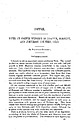 | | Report (issue) | | IN CHAFFEE, FREMONT, AND JEFFERSON COUNTIES, COIO. By WALDEMAR LINDGREN. INTRODUCTION. Colorado is not...Juan County slightly exceeded 1,500,000 pounds. The copper ores, properly so called, of Colorado comprised...from San Juan County. It may be said that Colorado does not contain a single copper mine of prominence...prominence. Of the counties mentioned in the title Chaffee produced 349,466 pounds of cop'per from 6,249 tons...Nearly all the gold- and silver-bearing deposits of Colorado, and the copper deposits as well, occur in close |  | | Book (volume) | | ..........................................39 California ..........................................................................................47 Colorado ................................................rights, so remember you were told. If in doubt, a county map will tell you who the legal owner is. Good...pegmatites and ore-bearing veins. Prior to the California gold rush of 1849, this portion of Alabama experienced...gemmy qualities for cutting and polishing. AUTAUGA COUNTY PRATTVILLE, N. 6 mi., and just E of the Birmingham |  | | Book (volume) | | ..........................................39 California ..........................................................................................47 Colorado ................................................rights, so remember you were told. If in doubt, a county map will tell you who the legal owner is. Good...pegmatites and ore-bearing veins. Prior to the California gold rush of 1849, this portion of Alabama experienced...gemmy qualities for cutting and polishing. AUTAUGA COUNTY PRATTVILLE, N. 6 mi., and just E of the Birmingham |  | | Report (issue) | | ......................... Leadville district, Colorado ........................................ Tintic...(Red Cliff) district, Colorado ...................... Aspen district, Colorado ............................................. Southern Seward Peninsula area ...................... Salmon River district ............................................ Cameron area ..................................................Northern Arkansas zinc-lead district .............. California ............................................ |  | | Report (issue) | | Series 30 Bibliography and Index of Colorado Geology, 1984-1989 Colorado Geological Survey Department of...Resources Denver, Colorado 1990 Information Series 30 Bibliography and Index of Colorado Geology, 1984-1989...Institute under contract to the Colorado Geological Survey Colorado Geological Survey Department of...of Natural Resources Denver, Colorado 1990 ii FOREWORD In recognition of the need to more effectively...published literature on the state's geology, the Colorado Geological Survey is pleased to release Information |  | | Report (volume) | | the Mount Aetna Volcanic Center, Chaffee and Gunnison Counties, Colorado By PRIESTLEY TOULMIN Ill and JANE...the Mount Aetna volcanic center, Chaffee and Gunnison counties, Colorado. · (U.S. Geological Survey bulletin...tuff, etc. -Colorado-Chaffee County. 2. Volcanic ash, tuff, etc.-Colorado-Gunnison County. 3. Volcanism-Colorado-Chaffee...Volcanism-Colorado-Chaffee County. 4. Volcanism-Colorado-Gunnison County. 5. GeologyColorado-Chaffee County. 6...6. Geology-Colorado-Gunnison County. I. Hammarstrom, Jane Marie. II. Title. Ill. Series. QE75.B9 no. |  | | Report (issue) | | JURASSIC MAGMATIC ARC OF WESTERN NEVADA AND EASTERN CALIFORNIA by Jeff L. Doebrich 1 , Larry J. Garside2, and...Survey, Retired, 8920 West 2nd Ave., Lakewood, Colorado 80226 CONTENTS ABSTRACT .......................................................... Adularia-Sericite Epithermal Gold-Silver Veins ...................Jurassic magmatic arc of western Nevada and eastern California were conducted to characterize mineral deposits...economic concentration of minerals in the study area. Middle Jurassic arc-related hydrothermal mineral | 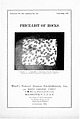 | | Catalog/List | | Albemarle Counly, Virginia ... Custer County, Colorado . Albemarle County, Virginia . Near Mesaba, l\linnesola...York . San Juan County, Colorado Delta, Shasta County, California . Boulder County, Colorado .. .... Newlon...Newlon, Massachusetts Mt. Shasta, California " Lyon County, Nevada Hillsborough, New Brnnswick Keeseville...Essex County, New York Rochester, New York Split Rock, Minnesota Iron Mountain, near Cripple Creek, Colorado...Rhenish-Prus ia J:asalt. fine-gTained Chaffee County, Colorado Hornblende Basalt. coarse " J-lornblenclc |  | | Journal (article/letter/editorial) | | A-K-F plots I can characterizepotassic, quartz-sericite, argillic,andsilicicalterationassemblages andleadto...convection-aided thermogravitational diffusionin the upper part of a batholithicmagmachamber;transferof the...developchemicalfingerprintsto the pluton(Thompson Creek),marginalannularbodrecognizedifferent alterationassemblages...model for molybdenitedepositsasso- (Little Boulder Creek and Cannivan). Granodiorite ciatedwith graniticsourcerocks...tectonicsettingat the time and Mount Emmons-Redwell Basin, Colorado, are of formation,orebodygeometry,and trace element |  | | Catalog/List | | enlarged photograph of a piece of Obsidian, from Lake County, Oregon, which shows a Conchoidal fracture. t...magnesium and iron) Actinolite Xline, fibrous; California or Vermont ............ .30 Radiated on rock;...\lassive; California ......... ... . .... ........ .... . .50 .75 Chiastolite XI; California or South...... 1 x 2" .26 2.00 1.00 XI, partly altered; California ....... ..... ...... .. 1.00 .60 XI, sections...ANORTHITE (calcium aluminum silicate) Xline in rock; California ........................... .60 .60 .30 |  | | Report (issue) | | --------------Cleburne County ----------~----------------- Tallapoosa County --------------------------Alaska...------------------Cochise County -----------------------------Gila County --------------------------------Greenlee...ee County ----------------------------R[aricopa County ----------------------------R[ohave County --...-----------------------------Pima County -------------------------------Pinal County -------------------------------Santa...-------Santa Cruz County --------------------------'ravapai County -----------------------------'ruma |
|


