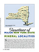
 | | Journal (article/letter/editorial) | | 2014 Figure 1. County map of New York State, prepared by William Besse. MAJOR NEW YORK STATE M I N E...E R A L LOC A L I T I E S N ew York State is rich in minerals of interest to collectors. A number of...Dana 1877, 1892). Herbert P. Whitlock published a New York State list in 1903. The most recent comprehensive...localities in the state is the book Minerals of New York State by David Jensen, published in 1978. Our...Mode of Occurrence Most mineral localities in New York can be categorized into three groups based on |  | | Journal (issue) | | com Calcite comes in diverse crystal shapes. One interesting variety is the barrel-shaped calcite. In...In Keokuk, Iowa area geodes the barrel calcite does not seem to be a dominate crystal shape. One seems...of the calcites found in Keok.'Ukarea geodes: "Calcite, CaCO 3 , is common as white, brown, and rarely...Rhombohedra are the predominant form. Much of the calcite has a green fluorescence, but it is not as strong...recent construction along Missouri highway 61 in Lewis County Missouri or at fee collecting sites around the |  | | Report (issue) | | preparation of new geologic maps which are planned for the State. Basically, the papers suggest new approaches...Sequatchie Formation in the valley of West Chickamauga Creek, and conformably by the Inman Formation in Lookout...surface in the region-the McLemore Cove, Wills Creek, and Lookout Valley anticlines. The Pigeon Mountain...Mountain syncline separates the McLemore, Wills Creek, and Lookout Valley anticlines (fig. 1). The oldest...the Knox Group, are exposed in the core of Wills Creek and McLemore Cove anticlines, where they underlie |  | | Journal (article/letter/editorial) | | the Middle Ordovician. The term St. Paul group (new), proposed as a substitute for the erroneously applied...formations, a lower, Row Park limestone (new), and the overlying New Market limestone. The Row Park limestone...dove vaughanites on the south, east, and north. The New Market limestone was traced from Virginia, through...the same direction as the Row Park limestone. The New Market is primarily dove vaughanite in southern areas...with the Chazy limestone of New York. Corals dominate the fauna of the New Market; this fauna suggests |  | | Report (issue) | | with attendant construction of new roads and highways, as well as new railroad right-ofways after 1895...passage of time, were noted in culture, such as new roads constructed since 1936 and relocation of some...northwestern part of Murray County, the northern half of \¥hitfield County, and a very small strip of...of the northeastern corner ·of Catoosa County. The quadrangle extends into Tennessee for a distance of...of southeastern Hamilton County, a narrow strip of southern Bradley County, as well as a very small part |  | | Journal (article/letter/editorial) | | com Figure 1 (top left). Calcite, 5.5 cm high, Elmwood mine, Smith County. Terry Huizing specimen, Jeff...(above). Fluorite, 13.1 cm wide, Elmwood mine, Smith County. Francis Benjamin specimen, Jeff Scovil photo....Smith County. Terry Huizing specimen and photo. Figure 4 (right). Cumberland mine, Smith County. Travis...and other nearby orebodies were discovered by the New Jersey Zinc Company when it was exploring for zinc...earths to make saltpeter, at Nicojack Cave in Marion County, then nitromagnesite at the same location (Shepard |  | | Report (issue) | | Middle and Upper Ordovician Series _____ _ Hanson Creek Formation ___________ _ flilurian System ______...features ____ ____ -- -------- - Indian Creek valley, Mount Lewis quadrangle _____________________________...rocks _________ --- --- -- -- - - Mill Creek-Harry Creek-Cooks Creek area_ Sedimentary rocks _________________...____ 79 Dacite plug on southeast spur of Mount Lewis ___ ------------ - _- ______ --- __ - _ 79 Rhyolite...Goat window__________ __ ___________________ 98 Mill Creek window__________________________ 104 Horse Mountain |  | | Journal (issue) | | Collector's Newsletter $2.00 from the Mill Creeli. Quarry Polk County, Oregon John Cornish 40 Cedar Glen...localities. The Mill Creek quarry is one of these. The Mill Creek quarry is located in Polk County, off of Highway...Highway 22 tum onto the well-marked Mill Creek road which parallels Mill Creek. Approximately two miles from...from the highway one passes the county-maintained Mill Creek Picnic Area. Just beyond the picnic area the...is usually open. Proed onward, crossing over Mill Creek twice. In approximately 8 miles a left-hand, |  | | Report (issue) | | ............................................. Lowville-Moccasin limestone ...................................................................... Dade County ....................................................................................... Catoosa County ........................................................................................ Walker County ..................................................................................... Chattooga County .............................................. |  | | Report (issue) | | 4, A1 2 O 3 26.8, Na 2 O 16.3, Lenni, Delaware County. Crystals. Eyerman, 1911, 11. Composition: Analysis:...Sp.gr LOCALITIES: Berks County: Birdsboro, and Gickerville; Delaware County: Leiperville, Lenni (druses...Felton's farm (Chester), and Ward's quarry; Montgomery County: Sumneytown, and Perkiomenville ; Philadelphia:...Birdsboro), Berks County. White, Smith, 1910, 540. silky mass of radiating needles, with calcite. Colorless...42 9.86 4.77 13.60 100.69 2.277 LOCALITY: Berks County: Birdsboro. MESOLITE m Na Al Si3Oio.2H O 2 2 |  | | Book (edition) | | channels of trade, transportation and consumption, new utilizations, and recent discoveries, have, to a...most part, have been progressive. In addition to new finds of valuable deposits, many of the occurrences...has therefore seemed advisable to pre sent such new information as may bring the whole subject more nearly...gas fields occur in almost every State except in New England and a few Southern States, but the discoveries...thickness; mmed at Broken Arrow aud Trout creek, in Sc. Clair county. The strata in this field are more faulted |  | | Report (issue) | | -------------Mill Creek Strike Belt Sections __________________ , _______ --------------1. New Hope Church...------------------------------ --------------·-------------4. Mill Creek ........................... ·······-························...----------- ------------------------6. Furnace Creek ---------- --------------------------------- --...--- --------------------------· 4. Chickamauga Creek ----------- _ -------------------------- ----------------------5...Railroad ------------------··---·--··--·-----5. Voiles Creek ______ -----------------------------------·---- |  | | Book (edition) | | with the former “appendix,” so as to include much new materials. And in addition to the general synopsis...of the subject up to date. Since that time much new material has been added to the state collection...opportunity to examine, except in occasional instances, new species and the range of occurrence of many known...yielding them have been greatly extended all these new data have been embodied. Sevfor the investigation...development of the state, and the addition of many new* species to the list of its known minerals, some |  | | Journal (article/letter/editorial) | | Mineral Occurrences ITEMS ON NEW FINDS ARE DESIRED £ _ . PLEASE SEND THEM I N . Abbreviations: xl—crystal...mineral has been mined quite extensively in Clay County, Alabama, from one end to the other. It is quite...ARKANSAS—Brown jasper pebbles have been found in a creek bed near Benton, Saline Co., Ark. ROCKS AND MINERALS...xline—crystalline CALIFORNIA-G.H. Haldén, 270 Lewis Ave., Millbrae, Calif., sent in an interesting item...south of Antimony Peak, near Hollister, San Benito County, California. While it might sound like exaggeration |  | | Book | | C. Kr( Fniin II . I'm lUHvn.i.i: MOlUIAX’S MILL i.. lo nnini;]'AVA'n-.i! :.ioiiw uir nk.sii...REPORT OF PROGRESS c^ TTTE GEOLOGY PHILADELPHIA COUNTY AND OF THE SOUTHERN PARTS OF MONTGOMERY AND By...regions : 1881. address Pleasantville, Venango county, Pa. Sutton VVall, to report on the coal and...and Fulton counties address Uniontown, Fayette county. Pa. W. G. Platt, geologist for Centre and Clearfield...Walnut street, Philadelphia. H. ; H. Carvill Lewis, volunteer geologist for the stud}’' of the surface |  | | Journal (article/letter/editorial) | | postmineralization extension and tilting, but here we present new data that suggest major post-Eocene extension along...interpreted as subvertical breccia pipes (intrusions), but new field data indicate that these “pipes” consist of...ash flow tuff (informally named the tuff of Mount Lewis) interbedded with sandstones and coarse volcaniclastic...foliation in breccia pipes. The southern belt along Mill Creek, previously mapped as undivided welded tuff,...in the central Shoshone Range (<5 km south of Mill Creek), but further mapping is necessary to trace the |  | | Report (issue) | | Madison Valley (where it is termed the North Meadow Creek fault). Continuing southeastward, the zone of weakness...fault; intersected by minor northwest faults; E-W Mill Creek fault system extends into area from east. Within...2 N., R. 5 W. Jackson La Duke Lolo Medicine New Biltmore Norris Pipestone Location Hunters Spring...faulted anticlinal axis intersected by N. 70° W. calcite vein-fault system. Structure Geologic setting...Star Sleeping Child Warm White Sulphur Wolf Creek 46 73 50 44 NE% sec. 1, T. 8 S., R. 5 W. Puller |  | | Book (edition) | | to include And in addition to the general much new materials. synopsis, he has, by request, thrown...that time latest complete exposition of the much new material has been to the State collection, which...occasional instances, for the investigation of species, new species; and the range of occurrence of many known...and the number of greatly extended; all these new data have been embodied. Sev- GEOLOGY OF NORTH...development of the State, and the addi- to many new tion of species to the list of its known minerals |  | | Report (volume) | | Quartzite__ __-___-_-_--_-__-_---_---___-_-_____ Hanson Creek Formation___-_---____--_----_-_---___-_Silurian...--_----_--l_---_----_---__-_-__._.___-. Quartz monzonite of the Mill Canyon stock___--___-__-_____ Quartz porphyry and...Cortez Silver Mines Co___________________________ Mill Creek mines.-----------.--------------------------------Cbpper...Photomicrograph of biotite-quartz monzonite from the Mill Canyon stock_______..__._.__._____.________ 12....Photomicrograph of hornblende-biotite granodiorite from the Mill Canyon stock.___.__._____.._--...__,______ 13. Map |  | | Report (volume) | | Lamellibranchiata of the Raritan Clays and Greensand Marls of New Jersey, by Robert P. "Whitfleld. 1885. 4°. xx, 338pp...Fishes and Fossil Plants of the Triassic Rocks of New Jersey and the Connecticut Valley, by John S. Nbwberry...Cephalopoda of the Raritan Clays and Greensand Marls of New Jersey, by Robert P. Whittteld. The Penokee Iron-Bearing...Mollusca and Crustacea of the Miocene Formations of New Jersey, by R. P. Whitfleld. Geology of the Eureka...meridian of 76° 30', from Tompkins County, New York, to Bradford County, Pennsylvania, by Henry S. "Williams |  | | Report (issue) | | Methods at an Abandoned Mine Land Site in Pike County, Indiana Tracy D. Branam, Denver Harper, Ronald...the Water Quality of Augusta Lake and Mill Creek, Pike County, Indiana John B. Comer, Ronald T. Smith...mine site, which straddles the Sullivan and Greene County line near Dugger, Indiana, is described by Harper...Reclamation at the Midwestern abandoned mine site in Pike County, the first in Indiana using coal combustion byproducts...located near the South Fork Patoka River in Pike County. The constructions include a long drainageway that |  | | Journal (issue) | | of luck!) but out of fear of missing the joy of new experiences and the chance to see and learn. Mineralientage...Weber by the Natural History Museum of Los Angeles County (see February 2005 Mineral News - Ed.). Between...noted for the mounted specimens acquired by the LA County Museum, the collection provides a solid reference...specimens and must recommend Johann Zenz' (2005a, 2005b) new book Agates (Achate in the German version). This...about field collecting, descriptive mineralogy and new mineral finds. This year, why not consider giving |  | | Journal (issue) | | the President Mine, Bohemia mining district. Lone County, p. 123 • Late Cenozoic tectonics and paleogeography...Grants Pass in 1990. Cover photo Fon Rock in Lake County, is a lpectacular example of the many volcatlic...cinders, and geothennal resources: worked on numerous county studies including Lake, K1 amath, Des· chutes,...the President Mine, Bohemia mining district, Lane County, Oregon by Robert E. Streiff, Geologist, Echo Bay...southern edge of the Bohemia mining district, Lane County, Oregon (Figure 1). Although claims are located |  | | Report (issue) | | __ Northern facies _______________________ Lee Creek Member of Nicoll and Rexroad (1968) ___________...belt and those used by Butts (1915) in Jefferson County, Ky ___ ____________ Photographs of the Brassfield...calcium, and magnesium; calculated percentages of calcite and dolomite; and calculated Ca/Mg ratios for 18...Silurian rocks is also shown in greater detail on the new "Geologic Map of Ken tucky" (McDowell, Grabowski...Cravens, Leb anon Junction, St. Catharine, Loretto, New Haven, and Nelsonville quadrangles and in other quad |  | | Journal (issue) | | visitation of American Indians to Frederick and Augusta county sites. Thomas Jefferson (1825) wrote an account...and cascade series on Falling Springs Creek, Alleghany County, Virginia. Note man standing in center...An extensive marl deposit located in Frederick County, Virginia. Stream, in foreground, has incised and...calcium carbonate in Mill Creek, Page County, Virginia. . TRAVERTINE-MARL DEPOSIT X COUNTY WlTH ABANDONED...ABANDONED WORKINGS COUNTY WITH ACTIVE WORKINGS Figure 4. Travertine-marl deposits found in Alleghany, Augusta |
|


