| Locality type: | Quarter |
| Classification |
|---|
|
| Species: | Calcite |
| Formula: | CaCO3 |
| Confirmation |
|---|
|
| Validity: | Believed Valid |
| Associated Minerals Based on Photo Data: |
|---|
|
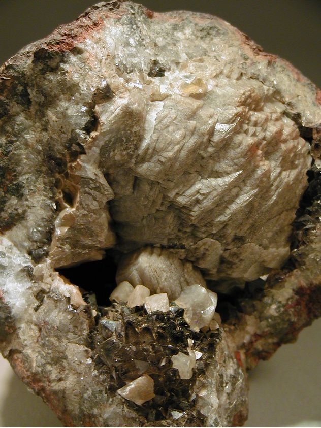
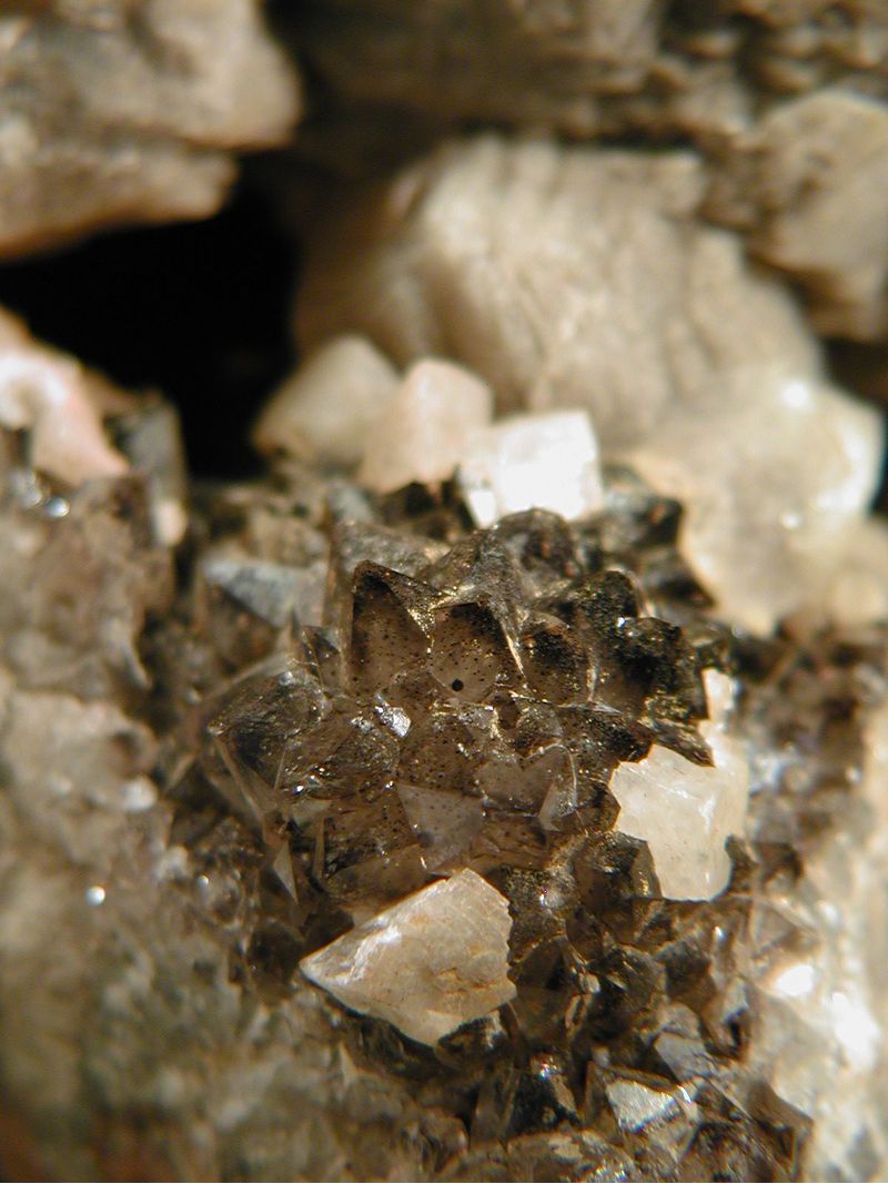
| Smoky Quartz | ⓘ5 photos of Calcite associated with Smoky Quartz at this locality. |
| Amethyst | ⓘ1 photo of Calcite associated with Amethyst at this locality. |
| Data |
|---|
|
| Mineral Data: | Click here to view Calcite data |
| Locality Data: | Click here to view Oberhohndorf, Zwickau, Zwickau District, Saxony, Germany |
| Data Identifiers |
|---|
|
| Mindat Occurrence Record ID: | 529172 |
| Long-form Identifier: | 1:3:529172:4 |
| GUID (UUID V4): | f19f7014-54b8-4dba-9e7a-0c590777a445 |
| Nearest other occurrences of Calcite |
|---|
|
|
| 2.0km (1.3 miles) | ⓘPlanitz, Zwickau, Zwickau District, Saxony, Germany |
| 12.0km (7.4 miles) | ⓘDiabase quarries, Neumark, Vogtlandkreis, Saxony, Germany |
| 14.1km (8.8 miles) | ⓘWolframite mine, Pechtelsgrün, Lengenfeld, Vogtlandkreis, Saxony, Germany |
| 14.9km (9.2 miles) | ⓘShaft 371, Hartenstein, Zwickau District, Saxony, Germany |
| 14.9km (9.3 miles) | ⓘShaft 309, Niederschlema, Bad Schlema, Aue-Bad Schlema, Erzgebirgskreis, Saxony, Germany |
| 15.7km (9.7 miles) | ⓘShaft 38, Niederschlema, Bad Schlema, Aue-Bad Schlema, Erzgebirgskreis, Saxony, Germany |
| 15.8km (9.8 miles) | ⓘRosenkranz Mine, Neustädtel, Schneeberg, Erzgebirgskreis, Saxony, Germany |
| 15.8km (9.8 miles) | ⓘWeißer Hirsch Mine (shaft 3), Neustädtel, Schneeberg, Erzgebirgskreis, Saxony, Germany |
| 15.8km (9.8 miles) | ⓘDaniel Mine (St. Daniel Mine), Neustädtel, Schneeberg, Erzgebirgskreis, Saxony, Germany |
| 15.9km (9.9 miles) | ⓘNeujahr Mine, Neustädtel, Schneeberg, Erzgebirgskreis, Saxony, Germany |
| References |
|---|
|
|
| Reference Search (possible matching items) |
|---|
 | | Book | | Petrology Brennhausgasse 14, D-09596 Freiberg, Germany (e-mail, thomas.seifert@mineral.tu-freiberg.de)...mica-lamprophyre). Arme Leute Bergfreude mine, Marienberg district. small picture top right: Stringer zone W-As-Sn...ore-type. Ober Neuhaus Sachsen mine, Pobershau district. small picture on the bottom left: Zoned phlogopite-phenocryst...late-Variscan ore mineralization in the Erzgebirge (Germany and Czech Republic). Located at the northwestern...Saxonian Erzgebirge in the south-eastern part of East-Germany (this study) and the Bohemian Krušné hory located |  | | Book (volume) | | in-plane (ν1) and out-of-plane (ν2) vibrations of calcite- and dolomite-group carbonates (Ca,Mn,Mg,Fe) (CO3)...CaCO3. The figures correspond to the areas of calcite (1), rhodochrosite (2), siderite (3), magnesite...distribution densities for samples of Fe-bearing calcite with the formulae (a) Ca0.92Fe0.08(CO3) and (b)...(Specord 75 IR or Specord M80, Carl Zeiss, Jena, Germany), Perkin Elmer 1600 Series FT IR spectrometer or...FT IR spectrometer (Bruker Optics, Ettlingen, Germany). IR spectrum of a pure KBr disc was subtracted |
|


Oberhohndorf, Zwickau, Zwickau District, Saxony, Germany