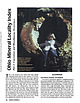
 | | Journal (article/letter/editorial) | | that bring together important locality data for Ohio minerals. It is a contri bution to the national...the Findlay Arch (northwestern Ohio) and Serpent Mound (southwestern Ohio) districts (Carlson 1990); thisvone...some world-class localities, such as gypsum crystals from Ellsworth and flint from Flint Ridge (Silliman...at mouth of Silver Creek near Edinburg, Portage County. Figure 1 (left). Rosanna Carlson sitting in dolostone...septarium, Copperas Mountain near Spargursville, Ross County. Ernest Carlson photo. Figure 3. Map showing mineral |  | | Journal (issue) | | Elwell ............270 Selenite Crystals at Ellsworth, Ohio. By Gerald U. Greene ........ 272 A Utah...who owned the land; fairfieldite after Fairfield County in which is Branchville; and reddingite after the...ROCKS and MINERALS R - SELENITE CRYSTALS AT ELLSWORTH , OHIO t} By GERALD U. GREENE u A locality renowned...renowned for selenite crystals is Ellsworth, Mahoning County, Ohio. Dana mentions the locality in his...had however but not of the quality which made Ellsworth famous. The writer came to Cleveland in the spring |  | | Journal (article/letter/editorial) | | This perfect gypsum crystal from Meander Creek, near Ellsworth, Mahoning County, Ohio, represents the... no attachments, a complete “floater.” Similar gypsum crystals from many localities are readily available |  | | Report (edition) | | GEOLOGICAL SURVEY 2045 MORSE RD., BLDG. C- 1 COLUMBUS, OHIO 43229-6693 (614) 265-6576 (614) 447-1918 (FAX)...L. Fox, MS, Seismologist Michael C. Hansen, PhD, Ohio Seismic Nelwork (OhioSeis) Coordinator An Equal... Minerals of Ohio by Ernest H. Carlson Bulletin 69 Second Edition STATE OF OHIO DEPARTMENT OF NATURAL...(formerly Stoneco, Inc.}, near Junction, Pau lding County, Ohio. Specimen is 3.8 x 2.4 cm with the largest crystal...citation: Carlson, E.H., 2015, Mineral s of Ohio (2d ed.): Columbus, Ohio Department of Natural Resources, Division |  | | Book (edition) | | mmed at Broken Arrow aud Trout creek, in Sc. Clair county. The strata in this field are more faulted und...prong of Canoe creek, in St. Clair county, to Ha\sop creek, in Bibb county, a distance of 60 miles. Down to...to Helena, in Shelby county, the field has an average width of 5 or 6 miles. Below that point the width...miles being in the latitud" of Blocton, in Bibb county. The south ern end of this field has a greater...Jefferson county; Helena, Montevallo, and Brierfield, Shelby county; and at Blocion. Bibb county. The Warrior |  | | Report (issue) | | Section showing relation of Antrim Shale and Ellsworth Shale in western Michigan to Antrim Shale, Bedford...Michigan------------ 9. 27 Isopach map of Antrim-Ellsworth-Sunbury sequence and structure map on base of...include the Ohio Shale of Devonian age in northern Ohio and the DevonianMississippian Ellsworth Shale, and...Pennsylvanian Des Moines Series DevonianMississippian Ellsworth Sh. * Mississippian Coldwater Sh. * Age and stratigraphic...--South- central New York 43. --Northeastern Ohio Devonian Ohio Sh. * possibility of ground water contamination |  | | Report (issue) | | Gypsum Resources of Indiana BULLETIN 42-A STATE OF INDIANA DEPARTMENT OF NATURAL RESOURCES GEOLOGICAL...Head DONNA C. SCHULTZ, Sales and Records Clerk Gypsum Resources of Indiana By ROBERT R. FRENCH and LAWRENCE... Contents Introduction / I Acknowledgments / 3 Gypsum deposits in southwestern Indiana / 3 Previous work...Commercial deposits / 7 Mining / 11 Conclusions / 15 Gypsum deposits in northern Indiana / 15 Previous work...Figure 1 Map of Indiana showing distribution of gypsum and anhydrite / 2 2 Map of southwestern Indiana |  | | Journal (article/letter/editorial) | | discuss gypsum, a mineral that some unlucky people may literally become wrapped up in. Gypsum When gypsum...term referring to the calcined or burned mineral. Gypsum is the commonest of the sulfate minerals being...associated with limestone, sandstone, clay, etc. Gypsum is a soft mineral—number 2 on Moh's scale of hardness...streak is white. There are three main varieties of gypsum—crystallized or Selenite, fibrous or Satin Spar...Lake and Wayne County, both in Utah. Nice transparent crystals are found in clay at Ellsworth and other localities |  | | Report (volume) | | results. During the succeeding years nearly every county lost population, and the entire State, as is shown...Kansas, 9 per cent in Illinois, 7.5 per cent in Ohio, and smaller proportions in other States, as is......................................... Ill, 945 Ohio...... ............................................production of the State one-half came from Crawford County. Lead and zinc are mined in the southeastern portion...civil townships, the number of townships in each county ranging from 5 in Wyandotte to 30 in Eeno and Sumner |  | | Report (issue) | | place, locality, or civil division (city, village, county, township, crossroad, and railroad siding) named...and the Virgin Islands: County (4th column) — This is the name of the county in which the listed entity...place, feature, or area lies in more than one county, the county listed is the one in which the center of...found; or in the case of a stream or valley, the county listed is the one in which the feature's mouth...ELLINWOOD NW ELLINWOOD SW ELLIOTT (OK) ELLIS ELLIS SE ELLSWORTH ELMDALE ELMER ELMO ELMONT ELSMORE EMMETT EMPORIA |  | | Report (issue) | | A CONTRIBUTION TO LAND USE PLANNING IN LA PORTE COUNTY, INDIANA Special Report 14 sinking stream State...a Contribution to Land Use Planning in LaPorte County, Indiana By JOHN R. HILL, DONALD D. CARR, EDWIN... . . . . . . Peat and marl . . . . . . . . . . Gypsum and anhydrite . . . . Limestone . . .... . .. ...... . .. Appendix: Auger hole data for LaPorte County . . ... .. . . . . . . . . . . . . . 17 . . ....potential, LaPorte County, Indiana Figure 1 Physiographic map of LaPorte County .1 2 Glacial lobes |  | | Journal (issue) | | website, csms-web.org In Memoriam WANDA J. WULFF ELLSWORTH November 27, 1939 - April 26, 2016 We regret...passing of our long-time member, Wanda Wulff Ellsworth. Wanda is the daughter of one of CSMS's founders...annual home rock sale, 9 a.m. – 3 p.m., 15339 West Ellsworth Drive, Golden, CO 80401 (ph: 303-279-5504). “Help...(McIntyre Circle) and right at the next street (Ellsworth Drive). We are about midway down the street on...expanding Lake would reach. It seems that the city and county building “experts” were trying to “fool mother |  | | Report (issue) | | 7. 24 38 Hydrographs of selected wells in Ellsworth and Rice Counties ---------------------- 42 ...rocks crop out from Washington County on the north to Comanche County on- the south. The rocks dip from...of calcium sulfate water result from solution of gypsum in the Kiowa Formation, and areas of sodium chloride...Washington County to central Rice County, as shown in figure 1. (near here) From central Rice County to southeastern...Cenozoic deposits. In the area west of Comanche County, Lower Cretaceous rocks commonly are buried by |  | | Report (volume) | | North Dakota... .Dr. A. G. Leonard, Grand Forks. Ohio.............Prof. John A. Bownocker, Columbus. Prof...See Bauxite and Hallpysite. Asbestos. Tallapoosa County, with corundum deposits near Dudleyville; not found...commercial quantity or quality. Asphalt. Colbert County, small quantity has been shipped from near Leighton;...following localities: Bibb County, Pratts Ferry; Calhoun County, near Tampa; Clay County, T. 20, Pv. 7 E.; Jefferson...Jefferson County, at Elyton; Lee County, at Chewacla lime works; St. Clair County, at Gfeensport; Shelby |  | | Journal (issue) | | well, which was drilled along Oil Creek in Venango County, Pennsylvania, about two miles south of Titusville...the Marcellus play was discovered in Washington County, Pennsylvania in 2003 by Range Resources-Appalachia...One company that falls into the latter category is Ohio-based FirstEnergy Corporation, which operates the...Bruce Mansfield Power Plant at Shippingport, Beaver County in western Pennsylvania (Figure 1). Bruce Mansfield...plant and the National Gypsum Company (NGC) plant in Shippingport, Beaver County, PA. Page 6 of 34 Pennsylvania |  | | Journal (article/letter/editorial) | | of the outcrop of the Red P.eds below the first gypsum beds; the Red Hills upland, to the west of the...Oklahoma prairie, and separated from it by the Gypsum Hills escarpment : and the High Plains, to the...the Oklahoma Prairies by the Gypsum Hills Escarpment (the Blaine Gypsum of O k l a h o m a ) , rear the...formation Blaine formation Shimer gypsum Jenkins clay Medicine Lodge gypsum Glass Mountain formation: Flower-pot...three, gypsum beds belong to this horizon, the Solomon and Greeley gypsum beds of Dickinson County being |  | | Report (volume) | | Selected Annotated Bibliography of Gypsum and Anhydrite in the United States and Puerto Rico By CHARLES...geographic occurrences, origin, technology, and uses of gypsum and anhydrite UNIT.ED STATES GOVERNMENT PRINTING...Francis, 1920comp. Selected annotated bibliography of gypsum and anhydrite in the United States and Puerto Rico...S. Geological Survey. Bulletin 1105) 1. Gypsum-Bibl. 2. Gypsum-U.S. 3. Anhydrite--Bib!. 4. Anhydrite-U...______________________________________________ Gypsum and anhydrite_____________________________________________ |  | | Book (volume) | | Dahlonega Co. and Rabum Co., and the McDuffie County Belt extending through portions of McDuffie, Warren...Sphalerite. BALDWIN COUNTY MILLEDGEVILLE, at state farmjasper. BANKS COUNTY COMMERCE, along Hwy. 59...along adjoining Co. linerock crystal. BARROW COUNTY WINDER, along rd. to Jefferson and 1½ mi. inside...Guide for Rock Hounds in the United States BARTOW COUNTY AREA, Saltpeter Cave, as floatjasper. CARTERSVILLE:...agate, (banded, various colors), jasper. BIBB COUNTY MACON: at Holton Quarry, 7½ mi. NWagate; N |  | | Catalog/List | | from New Mexico. Selenite Crystals Japanese from Ohio. Twinned Chiastolite from Meteorites — Quartz...lead have with bases, hexagonal prisms and gypsum From thousand the this number these phantom...FROM these in now lot we acute one on one OHIO. sharp, transparent stock, including with notches...cut indifference subsequently result the The gypsum. and a the fortunate- The examination cuts...Marble, Mexico. 21. Gypsum, 22. 23. Co., Pa. Eng. Co., 17. Rock Salt, Ellsworth Co., Kan. 6. Berks |  | | Journal (article/letter/editorial) | | detailed geological investigations (1979-80) in the Ellsworth Mountains of west Antarctica have established...boundary of the Lower and Middle Cambrian, the Ellsworth Mountains' forms represented Irregularian Archaeocyatha...optical microscopy and X-ray analysis as twinned gypsum crystals which had been replaced by calcite. These...Antarctica 293 Wilberns Formation, McCulloch County, Texas (U.S.A.). According to the original description...the Minaret Formation of the Heritage Range, Ellsworth Mountains, central west Antarctica (Fig. 2). The |  | | Report (issue) | | trace , in sol . trace, total 99 . 77 (H . V . Ellsworth , 1916 : Ont . Bur . Mines Ann . Rept. , vol....llage ofActinolite in Elzevir Township, Hastings County . 31 F /1 5 Chemi cal analysis of a light greenish...actino l ite from Westmeath Township , Renfrew County: Si0 2 56 . 70 , Al 0 3 1. 62 , Fe o 3 . 06 , FeO...Township of St . Francis (Beauceville ) , Beauce County : Si0 52 . 30 , Al 2 o 1 . 30 , FeO 6 . 75, 2 3...syenites near Montreal in H oche laga County, and Beloeil in Rouville County (G. C . Hoffmann, 1 888 - 9 : Geol |  | | Report (volume) | | Devoman black shale and related rocks m New York, Ohio, and other areas Almost 100 years (yr) elapsed before...northwestern Pennsylvama and reached northeastern OhiO m the 1870's (Stout and others, 1935, p 905) From...century, development spread to central and southern Ohio, southern Indiana, and western Kentucky In the southeastA2...North Amenca em part of the IllinOis basm m Medde County, western Kentucky, gas was discovered m the Devoman...Kentucky, and, m 1920, gas was recovered from a Boyd County black shale well (Hunter, 1935) By 1926, the Devoman |  | | Report (volume) | | ............................................... Ohio...................................................See Bauxite and Halloysite. Asbestos. Tallapoosa County, with corundum deposits near Dudleyville; not found...commercial quantity or quality. Asphalt. Colbert County, small quantity has been shipped from near Leighton;...following localities : Bibb County, Pratts Ferry; Calhoun County, near Tampa; Clay County, T. 20 S., R. 7 E.;...; Jefferson County, at Ely ton; Lee County, at Chewacla lime works"; St. Clair County, at Greensport; |  | | Book | | * isometric * iron sulfide Fort Scott, Bourbon County, Kansas This book published simultaneously in the...minerals are quartz, diamond, graphite, talc, and gypsum. Each has a distinctive composition and arrangement...Pyrite * isometric ° iron sulfide Butte, Silver Bow County, Montana The intergrown crystals of this specimen...* isometric ° zinc iron oxide Franklin, Sussex County, New Jersey : This crystal also shows a dominant...inclined; one axis inclined), typified by the mineral gypsum (9). When 5. Leucite * isometric * potassium aluminum |  | | Report (issue) | | rock above the Springfield Coal Member in Sullivan County, Ind. Logan's term was modified to "Alum Cave Limestone"...site of the former town of Alum Cave, Sullivan County, Ind., in the NW¼NE¼ sec. 25, T. 9 N., R. 8 W....Sullivan County and Vigo County and cannot be identified in outcrop in northern Vigo County and Vermillion...Vermillion County. South of Sullivan County the limestone is thin and nodular. It can be traced as gray to...faulted blocks in the Kentland structure in Newton County, Ind. (Gutschick, 1983). ROCK-UNIT NAMES Correlation: |
|


Ellsworth, Mahoning County, Ohio, USA