| Locality type: | Mine |
| Classification |
|---|
|
| Species: | Chrysocolla |
| Formula: | Cu2-xAlx(H2-xSi2O5)(OH)4 · nH2O, x < 1 |
| Confirmation |
|---|
|
| Validity: | Believed Valid |
| Data |
|---|
|
| Mineral Data: | Click here to view Chrysocolla data |
| Locality Data: | Click here to view Iron Chest Mine, Chaffee County, Colorado, USA |
| Data Identifiers |
|---|
|
| Mindat Occurrence Record ID: | 663494 |
| Long-form Identifier: | 1:3:663494:0 |
| GUID (UUID V4): | bd62f472-0d5b-47d6-8ecf-f90d8f2b8086 |
| Nearest other occurrences of Chrysocolla |
|---|
|
|
| 21.9km (13.6 miles) | ⓘGaro Deposit (Shirley May Mine; Duvall Discovery), Garo Area, Park County, Colorado, USA |
| 23.8km (14.8 miles) | ⓘTamarack Occurrence, Buena Vista Area, Free Gold Mining District, Chaffee County, Colorado, USA |
| 31.0km (19.3 miles) | ⓘAce High - Jackpot Prospect, Turret Mining District, Chaffee County, Colorado, USA |
| 34.4km (21.4 miles) | ⓘSedalia Mine (Sedalia Copper Mine), Sedalia Mining District, Chaffee County, Colorado, USA |
| 39.4km (24.5 miles) | ⓘSherman Mine (Sherman tunnel; Leadville Corporation Mine; Day Mines; Hilltop Mine), Upper Iowa Gulch, Lake County, Colorado, USA |
| 41.9km (26.0 miles) | ⓘGreat Western Mine, Wilkerson Pass Area, Park County, Colorado, USA |
| 42.3km (26.3 miles) | ⓘMary Murphy Mine, Chalk Creek District, Chaffee County, Colorado, USA |
| 43.4km (27.0 miles) | ⓘIbex Mine, Breece Hill, Leadville, Lake County, Colorado, USA |
| 44.0km (27.3 miles) | ⓘHighland Chief Mine, Yankee Hill, Leadville, Lake County, Colorado, USA |
| 44.1km (27.4 miles) | ⓘStockton Mine (Gertrude Vein), Cleora Mining District, Chaffee County, Colorado, USA |
| References |
|---|
|
|
| Reference Search (possible matching items) |
|---|
 | | Report (issue) | | Quadrangle, Colorado GEOLOGICAL SURVEY PROFESSIONAL Prepared in cooperation with the Colorado State Geological...Geological Survey Board and the Colorado Metal Mining Fund PAPER 289 Geology and Ore Deposits of...of the Garfield Quadrangle, Colorado By McCLELLAND G. DINGS and CHARLES S. ROBINSON GEOLOGICAL SURVEY...in cooperation with the Colorado State Geological Survey Board and the Colorado Metal Mitting Fund. A..._ Fremont dolomite _________________________ _ Chaffee formation __________________________ _ Leadville |  | | Book | | MINES AND MINERALS OF THE GREAT AMERICAN RIFT (COLORADO-NEW MEXICO) Sine —_—< ¢ te om At _SHT 40...MINES AND MINERALS OF THE GREAT AMERICAN RIFT (COLORADO-NEW MEXICO) Richard Walker Holmes and Marrianna...Mines and minerals of the Great American Rift (Colorado-New Mexico). Bibliography: p. Includes index...index. 1. Mines and mineral resources—Colorado. 2. Mines and mineral resources—New Mexico. I. Kennedy, Marrianna...enter must be obtained to prevent trespass. Old mine workings are dangerous and entering underground |  | | Report (issue) | | Oxidized Zinc Deposits of the United States Part 3. Colorado By ALLEN V. HEYL GEOLOGICAL SURVEY BULLETIN...deposits and the resources of oxidized zin.c ores in Colorado UNITED STATES· GOVERNMENT PRINTING OFFICE, WASHINGTON...19180xidized zinc deposits of the United States. Part 3. Colorado. Washington, U.S. Govt. Print. Off., 1964. vi...Bibliography : p. 88-91. 1. Zinc ores-Colorado. 2. Zinc mines and mining-Colorado. I. Title. (Series) For sale...(~arble) district_______________________________ Chaffee County_______________________________________________ | 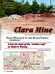 | | Journal (article/letter/editorial) | | info@wendel-minerals.com Clara Mine The Figure 1. Dumps of the Clara mine where collecting is allowed...mirror told them that the calf would stand on an iron chest. They dug a tunnel and reached the calf. One...to be told even now (List 1969). Today, the Clara mine uses the latest technology and is one of the most...the best quality. Location and History The Clara mine lies in the upper Rankach Valley, about 5 kilometers...north; and Zurich, Switzerland, in the south. The mine gained fame because of the numerous minerals that |  | | Journal (issue) | | Epidote Croft Magnetite Mine. 6 miles N. of Peekskill, Westchester County, N. Y. Tourmaline Strickland...Collins Hill, 2½ miles N . E. of Portland, Middlesex County, Conn. Allanite N. W. Slope of the ( " Bald") Friar...Amherst County, Va. Uraninite Edwin Feldspar Co~p. Mine. Headwaters Crabtree Creek, Yancey County, N. C...engineer. Montgome ry Mine In the vicinity of the above site the Montgomery Mine was started about 1875...about $8,000 worth of gold was taken out of the mine. and that many fine nuggets, weighing up to 3 or |  | | Book (volume) | | College, Woolwich. A Treatise on the Metallurgy of Iron. H. C. H. Rev. Horace Carter Hovey, Author of...(in part), Childrenite; Chlorite; Chromite; Chrysocolla; Clintonite; Cobaltite; Colemanite; Columbite...Code. Coke, Sir Edward. Collier, Jeremy. Colony. Colorado. Colours, Military. Commerce. Common Order, Book...incorporated town and port of entry in Northumberland county, New Brunswick, Canada, on the Miramichi river...entry of Ontario, Canada, and the capital of Kent county, situated 64 m. S.W. of London, and 11 m. N. of |  | | Book (volume) | | the seat of a bishop; and chief town of the ami (county) of its name, on the south bank of the Limf jord...connected with Aalborg by a pontoon and also by an iron railway bridge, one of the finest engineering works...ribbon looms and tanneries in the town, and large iron works in the neighbourhood. There are several schools...AALESUND, a seaport of Norway, in Romsdal ami (county), 145 m. N. by E. from Bergen. Pop. (1900) 11,672...(Mellingen, Muri, Villmergen, and Bremgarten), with the county of Baden, were ruled as " subject lands" by all |
|


