 | | Report (issue) |
| Med bidrag af Dr. Tellef Dahll O. A. Corneliussen og Bergmester Direktør vedVigsnæs kobbergrube udgivet...Bestyrer af Norges geologiske undersøgelse Mcd profiler og Dahlls Geologi3k kart over det nordlige Horge" samt...d. Side T. Dahll. Om fj eldbygningen i Finmarken og guldets forekomst sammesteds Hans Reusch. lagttagelser...Finmarken Varangerhalvøen og nærliggende strøg Porsangerfj orden Grundfjeldet paa Kvaløen og paa sydsiden af Kvalsund...amtet Hans Reusch. Almenfattelig forklaring at kartet og at endel i det foregaaende anvendte geologiske udtryk |
 | | Journal (article/letter/editorial) |
| worked metal ~ were discovered in Siberia, at a gold-mine on the River Shargant, in about lat. 59 ~ 30' N...composed of ycllow sand, pebbles, small fragments of quartz, with other pulverized or decomposed rocks. Imbedded...matter, containing pieces (but not of large size) of quartz, granite, and porphyritic rocks. Overlying this...found in the presence of one of the officers of the mine, and secured by him, or they would probably have...the latter river ultimately joins the u This gold-mine is about 150 miles from the town of Yenissey. Remains |
 | | Report (issue) |
| stratigraphic and structural framework studies in The Cedars quadrangle, southern Shoshone Range Thomas E. Moore...ARBM, Alligator Ridge-Bald Mountain; G, Getchell Mine; JC, Jerritt Canyon Mining District; M, Midas; RM...studies in the southern Battle Mountain trend, The Cedars area, Shoshone Range, in Tosdal, R.M., ed., Contributions...characteristic of igneous bodies. Exposures of Cretaceous quartz monzonite near MT station 18, Tertiary granodiorite...disconformably above the Hanson Creek Formation, is a quartz silt, dolomitic, lime mudstone to packstone, and |
 | | Journal (article/letter/editorial) |
| Manuel Mine, San Manuel, Arizona. Tourmaline: Mass of black tourmaline xls in massive milky quartz. From...projection on the wall of a tunnel in the Stayton Mine, Lone Tree, two miles south of Antimony Peak, near...its original shape. The Stayton Mine is principally a quicksilver mine, yielding cinnabar and native mercury...Colo. On the side of Anvil Mt. is the Coming Wonder Mine, on a contact of the Sultan Mt. monzonite stock...huebnerite, a somewhat rare tungsten mineral; clear quartz xls; and sphalerite xls. "Sometimes a small vug |
 | | Journal (article/letter/editorial) |
| the Ionian Islands, Brazil, Russia, Sweden and Norway, Austria, and the Zollverein. The proceedings commenced...on the north side of the River Mawddach contains quartz-lodes which contain, besides other minerals, gold...which was found in that country: it is from the mine of Cwmheisian, thrown out by some miners; the taker...taker of the bargain to excavate the level in the mine was by name William Owen: this was 2 B 280 in...fire-assays of ores and stones from the Cwmheisian Mine, near the Falls of Rhaider Mawddach and Pisyll Cain; |
 | | Journal (article/letter/editorial) |
| gold mine 1s at Lyman. The principal The vein is fourteen feet wide composed chiefi;r of quartz, containing...recently discov ered several extensive groves of cedars in Lebanon. Of these there are three of great...alluded to by several corres CAN. .. _ .. The Cedars serves iron exposed to the atmosphere infinitely |
 | | Report (volume) |
| A, Palisade coal in Thompson Canyon; B, Farrer mine, Coal Canyon _-_________-_--___---___-_--_----_-_-_---___-_5...-_-_---___-_5. A, Tipple of Chesterfield mine, Sego; B, Neslen strata northwest of Thompson-._____________---...is 500,000,000 tons. The area has but 1 shipping mine and 2 local mines. INTRODUCTION LOCATION AND GENERAL...areas the gravel benches are dotted with scrubby cedars and some 8 BOOK CLIFFS COAL FIELD IN UTAH pinons...supports in most places a moderate growth of gnarled cedars, sagebrush, and coarse grass. The slopes of the |
 | | Journal (article/letter/editorial) |
| substanee: witl! mica,slag, and glassy grains, and quartz with large, fluidal inclosures, looking like a...forms not to be distinguisbed from tbose of the old mine. Mr. Hyde bas shown me lately in New York a large...alternately at each end of the are growing large cedars and pines, tbe age of wbich-judg· stroke. Tbe connecting...ham for_our first detailed notice of this ancient mine, mers, some to be held in tbe hand and otbers swung |
 | | Report (issue) |
| lichen, mosses, then grasses, shrubs, gnarled cedars and finally other trees. PROCEED on foot downhill...xenoliths; fractures lined with grasses and gnarled cedars; large sedum-lichen-moss communities; raised rims...processing plant using phyllite from the Haile gold mine area. 0.6 OBLIQUE RIGHT (S) on County Road 60...Introduction). This particular granite tends to show quartz phenocrysts on weathered boulder surfaces, whereas...At this locality the rock is pink and distinctly quartz-porphyritic. At the town of Liberty Hill, the rock |
 | | Report (volume) |
| Sandy Ridge anticline, which are separated by The Cedars syncline. In addition, the eastern tip of the Powell...Chestnut Ridge and Sandy Ridge uplands is named The Cedars lowland, and the northern lowland is named the...in the cultivated areas. Extensive areas in The Cedars lowland and Powell River lowland have been left...Ridge anticline and also along the axis of The Cedars syncline. The latter area narrows northeastward...slopes of the Chestnut Ridge upland and because The Cedars syncline and Sandy Ridge anticline produce pronounced |
 | | Journal (issue) |
| County Sees. 11, 12 T. 38 S., R. 10 W. Chrome King Mine King and Hansen Mining Co. Selma, Ore. Josephine...Josephine County Sec. 28 T. 37 S., R. 9 W • Deep Gorge Mine Grisson and Inman Selma, Ore. Josephine County...County Sec. 32 T. 37 S., R. 9 W • Mohawk Chrome Mine Carl Stevens Selma, Ore. Joseph ine County Sec. 29 T...Curry County Sec. 10 T. 39 S., R. 11 W . Nigger Mine Louis A. Robertson Galice, Ore. Josephine County...Sec. 24 T,. 36 S.l·~ R.," 9W • Haggard and New Mine J. J. Kinsella John Day, Ore. Grant County Sec |
 | | Journal (issue) |
| this area and predominantly from the Oregon Chrome mine (No. 31, see map on following page). Geography....just north of the Chrome King mine (No. 44) and the one west of the Crown mine (No.5) are prominent topographic...Approximate projection of zone 0 MILES Crown chrome mine (zone A) High View chromite (zone E) Geologic... Zone C twin Ced~per & lower) Old Casey Youngs Mine {Neme unknown} Millers Dream ,.........-----.....chromite ore have been found in the Oregon Chrome mine (No.31). The bodies are lens-shaped and somewhat |
 | | Journal (issue) |
| by 1943 the list of operating installations of quartz lamp solariums read like a 'Who's Who' of the British...group which received ultravio!et irradiation with quartz mercury lamps had only sixty-six days of absence...the Missouri Ozarks, supports a dense growth of cedars. These trees appear darker than the surrounding...most photographs, therefore, anything so large as a mine dump stands out like the proverbial sore thumb....Many likely place.~ for good collecting, such as mine dumps, quarries, and road cuts, can usually be detected |
 | | Journal (issue) |
| Chro.e Kines (cont.) Gold Placers (cant.) '!'wln Cedars R. E. 1I0Caleb Selll&, Oregon Josephlne County...County Soos. 10, 15 T. 17 5., R. 19 E. Platner Mine (Meroury) Laverne Taylor Portland, Oregon Crook...(Manganese) Paul .ho BOise, Idaho Baker County. Standard Mine (Copper, Cobalt) RaT Su.mers John Day, Oregon Grant...xpo~re and espe01ally along a 2-1nch band in the quartz vein. Ro soheellte was ob8erved in the "Little...IlIKERAL IHDUST.RIES 22 vol.15, no." adequate; quartz orystals, 100 percent, adequate; natural rubbar |
 | | Journal (article/letter/editorial) |
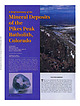
| Dianne Kile specimen. Figure 9. Astrophyllite on quartz from the Saint Peters Dome area, El Paso County...of the melt, each eventually being emplaced as quartz syenite, fayalite granite, and riebeckite granite...known us “rysonite”),fluorite, goethite, goethitd quartz intergrowths ( “onegite”), hematite (some ufter...microcline (some as variety amazonite), phenakite, quartz (varieties colorless and smoky), schorl, topaz...wild raspberries and strawberries and collecting quartz crystals. Cross and Hillebrand reported topaz from |
 | | Report (issue) |
| dinary trace-element accumulations in roadside cedars near Centerville, Mo., by J. J. Connor, H. T. Shacklette...abund·ant. It commonly consists of 50-65 percent quartz, 4-11 percent feldspar, mica flakes, rock fragments...in places it contains a few well-rounded white quartz pebbles. Well-sorted finegrained quartzose sandstone...weathering to yellowish gray, very fine grained; mostly quartz but about 10 percent dark grains of other minerals...southern California: California Dept. Nat. Res., Div. Mine& Bull.170, p. ~1. B512 PALEONTOLOGY AND STRATIGRAPHY |
 | | Journal (article/letter/editorial) |
| of the Zamies, are found large drusy geodes of quartz, and sometimes of chalcedony. Among the other fossils...numbers a little above Tripoli, on the way to the Cedars, and about thirty miles north of Beyroot. None |
 | | Report (issue) |
| -Preflood and postflood photographs at: 5. The Cedars looking north-northeast.______________________..._________--__--_---_--------------6. The Cedars looking north-northwest.____________________________...and intrusive rocks. A northeast-trending belt of quartz-mica schist and hornblende schist of possible Precambrian...foundations around 5:00 p.m. The main house at The Cedars (mile 5.0), where 18 people had gathered because...approximately same position looking north-northeast at The Cedars (mile 5.0 to 5.1). Cabin (4) is the same in both |
 | | Journal (article/letter/editorial) |
| years. Standing as sentinels, living pines and cedars spread welcome shade over the petrified logs lying...the background. ROCKS AND MINERALS 51» as tiny quartz crystals began to grow, giving them a sparkling |
 | | Report (issue) |
| gold 79 Epithermal gold, quartz-adularia type 82 Epithermal gold, quartz-alunite type 90 Nickel laterite-oxide...Name Country Ace of Spades Adobe Canyon Gp. Alice Mine Allan (Johnson) Alta Hill Althouse Alyce and Blue...Chrome, etc. Buttercup Chrome Camden Mine Camptonvilie area Castro Mine Cattle Springs Cavyell Horse C (continued...Cleopatra Clover Leaf Codd Prospect Coggins Col lard Mine Commander Coon Mt. Nos. 1-3 Copper Creek (Low Divide)...Fourth of July French Hill Friday Gallagher Gardner Mine Gas Canyon Geach Bibsonville Glory Ho Griffin Chromite |
 | | Journal (article/letter/editorial) |
| Humboldt. .. _ .. ered several extensive groves of cedars in Lebanon. sphere were but increased thirteen...Hampshire gold mine 1s at Lyman. The vein is fourteen feet wide composed chiefi;r of quartz, containing...increased power of retaining the warmth CAN. The Cedars oC Lebanon. Mr. Jessup, an She says that And |
 | | Journal (issue) |
| "Gathering lemonade in a pushcart's no fun. Gather mine in m'hat, m'gloves or m' pockets—if they're mended...1O Desert Magazine / July, 1966 Hank Brandt's mine and tailings. HIS IS AN answer to a DESERT Magazine...we'd talked of searching for the Hank Brandt lost mine and had informed ourselves of the basic facts concerning...Ocotillo Wells and followed the road around the Gypsum mine railroad track to the northern end of T Fish Mountains... This, we recalled, was a clue to Hank Brandt's mine. Now we hurried faster, anxious to see where the |
 | | Journal (issue) |
| . . . . . . . . . . 276 BIBLIOGRAPHICAL NOTES: Quartz Family Minerals 277 Mineral Tables . . . . ....and by doubly terminated clear crystals of quartz . The quartz crystals varied in ROCKS and MINERALS ...thick, much silicified in usually associated with quartz and the spots. It is more or less impregnated concave...parts the granules are scattered ( Locality 25. ) quartz with small pieces of light yellow sparingly through...miner, I was also told, made a fortune out of his mine but had died without revealing where he hid his |
 | | Journal (article/letter/editorial) |
| of these hillocks are sometimes ornamented with cedars, but more frequently they are quite bare, or covered...Alabamacontain little quartz from which pebbles could be made, the abundant waterworn quartz pebbles show that |


