| Locality type: | Quarry |
| Classification |
|---|
|
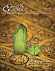
| Species: | Tremolite |
| Formula: | ◻Ca2Mg5(Si8O22)(OH)2 |
| Confirmation |
|---|
|
| Validity: | Confirmed |
| Confirmation Methods: | Dealer/Collection Label |
| Data |
|---|
|
| Mineral Data: | Click here to view Tremolite data |
| Locality Data: | Click here to view Zechner quarry, Pöllau am Greim, Sankt Peter am Kammersberg, Murau District, Styria, Austria |
| Data Identifiers |
|---|
|
| Mindat Occurrence Record ID: | 855280 |
| Long-form Identifier: | 1:3:855280:8 |
| GUID (UUID V4): | 73eecabb-ef31-4718-9d45-4257adde0859 |
| Nearest other occurrences of Tremolite |
|---|
|
|
| 12.8km (8.0 miles) | ⓘHansen Alp mines, Sölk, Liezen District, Styria, Austria |
| 24.7km (15.4 miles) | ⓘBodenmoosgraben talc mine, Lessach, Tamsweg District, Salzburg, Austria |
| 30.5km (19.0 miles) | ⓘMn deposit, Dürnstein, Neumarkt in der Steiermark, Murau District, Styria, Austria |
| 32.1km (19.9 miles) | ⓘStegsdorf, Sankt Salvator, Friesach, Sankt Veit an der Glan District, Carinthia, Austria |
| 38.4km (23.9 miles) | ⓘSerpentinite quarry, Griesserhof (Gulitzen; Gullitzen), Hirt, Micheldorf, Sankt Veit an der Glan District, Carinthia, Austria |
| 43.9km (27.3 miles) | ⓘAlbert adit, Hüttenberger Erzberg, Hüttenberg, Sankt Veit an der Glan District, Carinthia, Austria |
| 45.0km (28.0 miles) | ⓘPlankogel, Knappenberg, Hüttenberger Erzberg, Hüttenberg, Sankt Veit an der Glan District, Carinthia, Austria |
| 46.3km (28.8 miles) | ⓘFuchs Alp - Fuchs lake area, Tweng, Tamsweg District, Salzburg, Austria |
| 51.9km (32.3 miles) | ⓘMischlinggraben, Reichenfels, Wolfsberg District, Carinthia, Austria |
| 55.4km (34.4 miles) | ⓘSchurfspitze (Egydi adit; Ochsenleiten), Lanisch, Pölla valley, Rennweg am Katschberg, Spittal an der Drau District, Carinthia, Austria |
| References |
|---|
|
|
| Reference Search (possible matching items) |
|---|
 | | Journal (issue) | | and a History of Emerald Mining in Habachtal, Austria Duncan Pay FEATURE ARTICLES p. 300 292 Blue...of Emerald Mining in the Habachtal Deposit of Austria, Part I p. 347 Karl Schmetzer Contributes to...Carlsbad, California Leiden, The Netherlands Peter Heaney Benjamin Rondeau University Park, Pennsylvania...and a History of Emerald Mining in Habachtal, Austria Welcome to the Winter 2021 issue of Gems & Gemology...description of the mines of precious stones in the district of Kyatpyin, in the Kingdom of Ava. Journal of |  | | Report (issue) | | Waves: Synthesis and New Directions Kazue Takahashi, Peter J. Chi, Richard E. Denton, and Robert L. Lysal (Eds...Seismic Potential of Alaska Jeffrey T. Freymueller, Peter J. Haeussler, Robert L. Wesson, and Göran Ekström...Hydrothermal Systems on Slow Spreading Ocean Ridges Peter A. Rona Colin W. Devey Jérôme Dyment Bramley J....hydrothermal systems on slow spreading ocean ridges / Peter A. Rona ... [et al.], editors. p. cm. -- (Geophysical...Chemical oceanography. 4. Hydrothermal vents. I. Rona, Peter A. QE511.7.D58 2010 551.2'309162--dc22 2010023962 |
|


Zechner quarry, Pöllau am Greim, Sankt Peter am Kammersberg, Murau District, Styria, Austria