| Locality type: | Mountain |
| Classification |
|---|
|
| Species: | 'Garnet Group' (not an IMA approved species) |
| Formula: | X3Z2(SiO4)3 |
| Confirmation |
|---|
|
| Validity: | Confirmed |
| Confirmation Methods: | Visually Identified |
| Associated Minerals Based on Photo Data: |
|---|
|
| Kyanite | ⓘ2 photos of Garnet Group associated with Kyanite at this locality. |
| Data |
|---|
|
| Mineral Data: | Click here to view Garnet Group data |
| Locality Data: | Click here to view Taine Mountain, Burlington, Hartford County, Connecticut, USA |
| Photo Gallery | View Gallery (2 photos) |
| Data Identifiers |
|---|
|
| Mindat Occurrence Record ID: | 858176 |
| Long-form Identifier: | 1:3:858176:1 |
| GUID (UUID V4): | 68034ed1-7ad4-47be-9b4e-089416f34082 |
| Nearest other occurrences of Garnet Group |
|---|
|
|
| 10.4km (6.5 miles) | ⓘSatan's Kingdom talc deposits, New Hartford, Litchfield County, Connecticut, USA |
| 11.3km (7.0 miles) | ⓘRock Brook, Harwinton, Litchfield County, Connecticut, USA |
| 12.7km (7.9 miles) | ⓘLead Mine Brook, Harwinton, Litchfield County, Connecticut, USA |
| 13.9km (8.6 miles) | ⓘRatlum Mountain, Canton, Hartford County, Connecticut, USA |
| 14.5km (9.0 miles) | ⓘRobin Drive, Ratlum Mountain, Canton, Hartford County, Connecticut, USA |
| 15.0km (9.3 miles) | ⓘNorth Canton, Canton, Hartford County, Connecticut, USA |
| 16.6km (10.3 miles) | ⓘState Routes 8 and 118 interchange, Harwinton, Litchfield County, Connecticut, USA |
| 22.9km (14.2 miles) | ⓘPine Mountain, Barkhamsted, Litchfield County, Connecticut, USA |
| 24.5km (15.2 miles) | ⓘWatertown, Litchfield County, Connecticut, USA |
| 24.7km (15.3 miles) | ⓘEast Main Street construction site, Waterbury, New Haven County, Connecticut, USA |
| References |
|---|
|
|

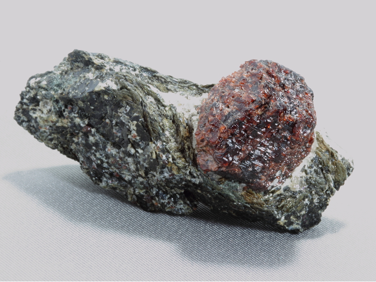

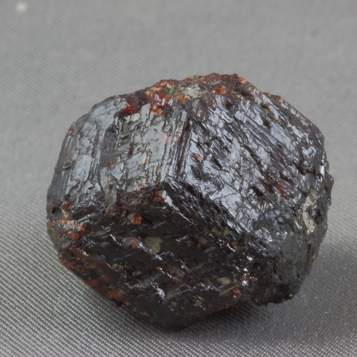


Taine Mountain, Burlington, Hartford County, Connecticut, USA