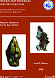
 | | Report (issue) | | COLLECTOR Geological Survey of Canada Miscellaneous Report 32 Kingston, Ontario to Lac St-Jean, Quebec Ann...Collection specimen (No. 36384). National Museum of Canada photo. Right: Serandite with analcime and mangan-neptunite...Collection specimen (No. 37124). National Museum of Canada photo. Miscellaneous Report 32 ROCKS AND MINERALS...MINERALS FOR THE COLLECTOR Kingston, Ontario to Lac St-Jean, Quebec Ann P. Sabina Originally published... © Minister of Supply and Services Canada 1983 A vailable in Canada through authorized bookstore agents | | | Report (issue) | | BR THE COLLECTOR ie AnnP. Sabina \ Kingston, Ontario to - . Lac St-Jean, Quebec, Digitized by the...ROCKS AND MINERALS FOR THE COLLECTOR Kingston, Ontario to Lac St-Jean, Quebec Ann P. Sabina Originally... © Minister of Supply and Services Canada 1983 Available in Canada through authorized bookstore agents...and Services Canada Hull, Québec, Canada K1A 0S9 and from Geological Survey of Canada 601 Booth Street...Street Ottawa, Canada K1A 0E8 A deposit copy of this publication is also available for reference in public |  | | Report (issue) | | SURVEY OF CANADA CANADA PAPER 67-51 ROCKS AND MINERALS FOR THE COLLECTOR Kingston, Ontario to Lac St-Jean...Queen's Printer, Ottawa, from Geological Survey of Canada, 601 Booth St., Ottawa, and at the followin$ Canadian...Queen's Printer and Controller of Stationery Ottawa, Canada 1968 - iii - Plate I. Mont St-Hilaire quarry...Section 1: Kingston - Island of Montreal Kingston township quarry . . . . . . . . . . . . . . . . . . . .... . . . . . . . . . . . . . . . . Freebern mica mine . . . . . . . . . . . . . . . . . . . . . . . . |  | | Journal (article/letter/editorial) | | Bernardino County. Piedmontite is reddish-brown banded with smoky quartz. San Bernardino County is in S/E...consists of drusy, dark reddish calcite crystals on whitish calcite. Loveland, in S/E Larimer Co., is...1965, comes from Ed Schwab, Rt. 2, c/o Big Beryl Mine, La Grange, Ga.: "Just received "Old Faithful" R&M...process of milky quartz production at our "Big Beryl" mine, on # 2 1 9 , south of La Grange, this week we recovered...quartz is scattered all over the quarry. "The old mine spoil dumps are still open to rockhounds and free |  | | Journal (article/letter/editorial) | | for calcite- and dolomite-structure carbonates. An empirical model for thermometry with calcite-ferroan...ternary solvus byfittingan empirical equation to the calcite limb of the ternary solvus. This model appears... 390 CaCO 3 FeCO, FIG. 1. The three-phase (calcite-ankente-siderite) fields of by Rosenberg (1967)...(Haase, 1979; Klein & Gole, 1981; our data, Wawa, Ontario). Data are in mol per cent, and tie-lines connect...(1967), we may calculate its stability relative to Calcite,^ Siderite,, and a slightly more magnesian ankerite |  | | Report (issue) | | S",55-'I4 Compiled by L. B. Gilligan and J.G. Byrnes Manuscript dated January 1994 Published under...4 level stope in eastern lode, Mount Boppy gold mine. Quartz-filled net-vein fractures and brecciated...gold mine, Cobar (Cobar Collection negative 0083) Bibliographic reference GILLIGAN L.B. & BYRNES J.G....5 1. METALLOGENIC STUDY - L.B. Gilligan, J.G. Byrnes and R.A. Glen INTRODUCTION SUMMARY GEOLOGICAL SUMMARY...Girilambone - Hermidale area Girilambone copper mine . Hartman - Larsen group of workings .. Bonnie Dundee |  | | Report (issue) | | sandstone reservoirs of the Appalachian basin, U.S. and Canada showing oil and gas fields used in the report....and regional structural elements imprinted on the north- to northeast-striking structural trend of the Appalachian...field, Washington County, Ohio.... 47 Appendix B. Athens gas field, Crawford County, Pennsylvania....... 49 Appendix D. Carbon Hill oil field, Hocking County, Ohio............................... 50 Appendix...Guernsey County, Ohio................................. 51 Appendix F. Clayton oil field, Perry County, Ohio |  | | Book | | (Natural History), London; GSC — Geological Survey of Canada, Ottawa; FMNH PP, FMNH PE and FMNH UC - Department...(1962), Matthew H. Nitecki (1968a-1976c), John G. Byrnes (1968, 1979), Siegfried Rietschel (1969-1977),...Kesling and Graham (1962), Nitecki (1969a-1986), Byrnes (1968, 1979), Nitecki and Charles C. Dapples (1975)...(1974), osculum by Hinde (1884), basal foramen by Byrnes (1979), and /acuna by Fisher and Nitecki (1982a)...osculum (Billings 1865a); central or main axis (Byrnes 1968; Nitecki 1972b; Brummer 1979; see also Finney |  | | Journal (article/letter/editorial) | | and minor folds near major thrust faults, 412. Burgess, I. C , et al, Microfossils from the cleaved Skiddaw...Red Sandstone of N.E. Scotland [ R ] , 6 2 2 . Byrnes, J. G., & R. E. Wass, New genus of Polyzoa (Cryptostomata)...Basin, Venezuela, Post-burial sideritisation of calcite in, C. B. Phipps, 485. Erosion in Different Climates...and F.xploration [ R ] , 107. Geological Survey (Canada) : — Geological Maps and Reports, Guide for the...Researches, Heft 28 [ R ] , 502. Gneisses in the north-western part of Co. Mayo, Ireland, J. S. Sutton |  | | Report (chapter) | | vertical and lateral variability of dolomitization, calcite cementation, and anhydrite precipitation. Brine...modification of Devonian reservoirs in western Canada (Mountjoy et al. 1999); and modification of the...throughout Kansas (Watney 1980; Callewaert 1987; Byrnes et al. 2003; Raef et al. 2005). Geological setting...oscillations across this positive feature (Watney 1980; Byrnes et al. 2002) responding to glacioeustacy with durations...fluids. Additionally, strata in the studied area lie north of deep Pennsylvanian basins, the Arkoma and Anadarko |  | | Journal (article/letter/editorial) | | 281. PHIPPS, C. B. Post-burial sideritisation of calcite in Eocene beds from the Maracaibo Basin, Venezuela... J. S., & M. D. MAX Gneisses in the north-western part of County Mayo, Ireland, 3, 284. TORRENS, H. S...magma, 2,166. Contents vii WASS, R. E., & J. G. BYRNES A new genus of Polyzoa (Cryptostomata) from the...Umkwelane, Zululand, 2, 206. LISTER, T. R., I. C. BURGESS, & A. J. WADGE. Microfossils from the cleaved Skiddaw...Longvillian shelly faunas from the Dolwyddelan area, North Wales, 6, 603. viii Contents ROSE, W. C. C. |  | | Journal (article/letter/editorial) | | 281. PHIPPS, C. B. Post-burial sideritisation of calcite in Eocene beds from the Maracaibo Basin, Venezuela... J. S., & M. D. MAX Gneisses in the north-western part of County Mayo, Ireland, 3, 284. TORRENS, H. S...magma, 2,166. Contents vii WASS, R. E., & J. G. BYRNES A new genus of Polyzoa (Cryptostomata) from the...Umkwelane, Zululand, 2, 206. LISTER, T. R., I. C. BURGESS, & A. J. WADGE. Microfossils from the cleaved Skiddaw...Longvillian shelly faunas from the Dolwyddelan area, North Wales, 6, 603. viii Contents ROSE, W. C. C. |  | | Journal (article/letter/editorial) | | 281. PHIPPS, C. B. Post-burial sideritisation of calcite in Eocene beds from the Maracaibo Basin, Venezuela... J. S., & M. D. MAX Gneisses in the north-western part of County Mayo, Ireland, 3, 284. TORRENS, H. S...magma, 2,166. Contents vii WASS, R. E., & J. G. BYRNES A new genus of Polyzoa (Cryptostomata) from the...Umkwelane, Zululand, 2, 206. LISTER, T. R., I. C. BURGESS, & A. J. WADGE. Microfossils from the cleaved Skiddaw...Longvillian shelly faunas from the Dolwyddelan area, North Wales, 6, 603. viii Contents ROSE, W. C. C. |  | | Journal (article/letter/editorial) | | 281. PHIPPS, C. B. Post-burial sideritisation of calcite in Eocene beds from the Maracaibo Basin, Venezuela... J. S., & M. D. MAX Gneisses in the north-western part of County Mayo, Ireland, 3, 284. TORRENS, H. S...magma, 2,166. Contents vii WASS, R. E., & J. G. BYRNES A new genus of Polyzoa (Cryptostomata) from the...Umkwelane, Zululand, 2, 206. LISTER, T. R., I. C. BURGESS, & A. J. WADGE. Microfossils from the cleaved Skiddaw...Longvillian shelly faunas from the Dolwyddelan area, North Wales, 6, 603. viii Contents ROSE, W. C. C. |  | | Journal (article/letter/editorial) | | 281. PHIPPS, C. B. Post-burial sideritisation of calcite in Eocene beds from the Maracaibo Basin, Venezuela... J. S., & M. D. MAX Gneisses in the north-western part of County Mayo, Ireland, 3, 284. TORRENS, H. S...magma, 2,166. Contents vii WASS, R. E., & J. G. BYRNES A new genus of Polyzoa (Cryptostomata) from the...Umkwelane, Zululand, 2, 206. LISTER, T. R., I. C. BURGESS, & A. J. WADGE. Microfossils from the cleaved Skiddaw...Longvillian shelly faunas from the Dolwyddelan area, North Wales, 6, 603. viii Contents ROSE, W. C. C. |  | | Journal (article/letter/editorial) | | 281. PHIPPS, C. B. Post-burial sideritisation of calcite in Eocene beds from the Maracaibo Basin, Venezuela... J. S., & M. D. MAX Gneisses in the north-western part of County Mayo, Ireland, 3, 284. TORRENS, H. S...magma, 2,166. Contents vii WASS, R. E., & J. G. BYRNES A new genus of Polyzoa (Cryptostomata) from the...Umkwelane, Zululand, 2, 206. LISTER, T. R., I. C. BURGESS, & A. J. WADGE. Microfossils from the cleaved Skiddaw...Longvillian shelly faunas from the Dolwyddelan area, North Wales, 6, 603. viii Contents ROSE, W. C. C. |  | | Journal (article/letter/editorial) | | Figure 1. Postcard view of the Waukon iron mine, Allamakee County, cia. 1912. John Taylor collection. ARTHUR...Unfortunately. with today’s environmental laws and mine and quarry regulations. the prolific collecting...Iowa Geological Survey. Localities by County Allamakee County Lansing, Lansing lead mines = Captain...after 1900, adit, cuts, and shafts: anglesite, calcite, cerussite (crystals), dolomite, galena, goethite...Maquoketa Formations: barite (crystals), bitumen, calcite (crystals, some fluorescent), fluorite (small |  | | Journal (issue) | | Branch Chairmen: Midlands Branch: D. Morgan, F.G.A. North-West Branch: 1. Knight, F.G.A. South Yorkshire &...occupying only a small area in the Rabbit Basin north of Plush, seemed to be unique. As such, it would...feldspar constituent of pegmatites, as in Norway, Ontario and India. The Oregon sunstone is a very different..., 1983, XVIII, 6 FIG. 4. Sorting apparatus at mine location. (Photo by Laura J. Ramsey) The colour-distribution...produced some years ago by heating Brazil's Montezuma Mine stones. (We proposed the name 'peridine' for this |  | | Report (issue) | | LIME A)fD SAND L"'COUNTY . . . . . . . . • . . Hy G. E. Ladd, assistant...LIME AND SAND INDUSTRIES 0~' ST. LOUIS CITY AND COUNTY. BY G. E. LADD, assistant geologist. CONTENTS.... . . . . . . . . 42 The Quarries in St. Louis County...... . . . . . . . . . . . . . . . . . . . . .... . . . . . . . . . . . . . . Map of St. Louis County, Geological ......... o#,......................... . . View of Entrance to the Laclede Fire Clay Mine . . . . . . . . . . . . . . . . . . . . . . . . |  | | Report (chapter) | | chert-rich reservoir facies are documented throughout North America in the Permian Basin, Appalachian Basin...Devonian Wabamun Formation of British Columbia, Canada, retains most of the reservoir pore volume by ...Mississippian ramp margin location from NW Cherokee County, Kansas, USA (Fig. 1a, b) with the purpose of examining:...stain was used to distinguish between calcite, ferroan calcite, dolomite and ferroan dolomite (Dickson...is located in Cherokee County of SE Kansas, USA (Fig. 1a, b). Cherokee County is situated within the |  | | Report (volume) | | . . . . . . . . . . . . . . . . . Cotter Basin mine . . . . . . . . . . . . . . . . . . . . . . . ....Mines, prospects, and mineralized areas-Continued Byrnes Creek copper occurrence .........................addition showing the location of the Cotter Basin mine and Copper Camp prospects . . . . . . . . . . ..... . . . . . . . . . 14. Map of the Cotter Basin mine showing sample localities and resource blocks ..... . . . . 15. Map of the open pit, Cotter Basin mine . . . . . . . . . . . . . . . . . . . . . 16. Map |  | | Journal (article/letter/editorial) | | with dolomite and ankerite and in one rock with calcite. The magnesites, ferroan magnesites and some magnesian...appears to have crystallized in the two-phase calcite + siderite field in the subsolidus CaCO3-MgCO3-FeCO3...13 51.47 2.31 1.66 97.21 49.58 52.00 0.80 ec, calcite; dol, dolomite; ank, ankerite; mag, magnesite;...contains calcite, dolomite, ankerite and ferroan magnesite-magnesian siderite. The calcite and dolomite...relatively large amount of Mg dissolved in the calcite, suggests that these were the first, and highest |  | Coe, Nancy, le Roex, Anton, Gurney, John, Pearson, D. Graham, Nowell, Geoff (2008) Petrogenesis of the Swartruggens and Star Group II kimberlite dyke swarms, South Africa: constraints from whole rock geochemistry. Contributions to Mineralogy and Petrology, 156 (5) 627-652 doi:10.1007/s00410-008-0305-1 | Journal (article/letter/editorial) | | and Kopylova et al. (2007) on the Jericho pipe in Canada, le Roex et al. (2003) on Group I kimberlites from...kimberlite is located some 250 km further south, 10 km north of the town of Theunissen, and has an age of approximately...crosscutting Changehouse dyke; in addition, the North and South fissures are encountered in the eastern...the dyke swarm, in the Third Lease section of the mine. A fifth cross-cutting dyke, known as the barren...swarm consists of the Wynandsfontein, East Star, Byrnes, Micaceous or Barren, Clewer and South fissure |  | | Journal (article/letter/editorial) | | Atmospheric Sciences, University of Alberta, Edmonton, Canada ABSTRACT Multi-anvil experiments have been performed...materials consist of mixtures of pure synthetic calcite, natural virtually pure dolomite from Adamello...He-Ne-laser. All 4 different carbonate minerals, calcite, dolomite, aragonite, and magnesite could be distinguished...fractions of MgCO3 in the starting mixtures: C = Calcite, D = Dolomite, M = Magnesite. Product = Product...GPa, 1200 °C, x(MgCO3) = 0.333, starting from calcite + dolomite. Homogeneous grains of intermediate |  | | Report (volume) | | fluid inclusion temperatures in sphalerite and calcite..................................................fracture-controlled ore zones of the Thompson-Temperly mine and heat transfer to the adjacent rocks where biomarker...Upper Mississippi Valley zinc-lead district, just north of the Illinois Basin (fig. 1), provides unique...both for basinwide fluid flow and for a south to north flow direction includes development of a systematic...broadly coincide in time with these events (Cluff and Byrnes, 1991). Development or reactivation of many of |
|


