Bertram Mine (Bertram Siding Sulfate deposit; Bertram Sodium Sulphate deposits), Bertram siding, Bertram, Imperial County, California, USAi
| Regional Level Types | |
|---|---|
| Bertram Mine (Bertram Siding Sulfate deposit; Bertram Sodium Sulphate deposits) | Mine |
| Bertram siding | - not defined - |
| Bertram | - not defined - |
| Imperial County | County |
| California | State |
| USA | Country |
This page is currently not sponsored. Click here to sponsor this page.


Latitude & Longitude (WGS84):
33° 22' 55'' North , 115° 45' 34'' West
Latitude & Longitude (decimal):
Type:
Köppen climate type:
Nearest Settlements:
| Place | Population | Distance |
|---|---|---|
| Bombay Beach | 295 (2011) | 4.5km |
| Salton City | 3,763 (2011) | 20.5km |
| Mortmar | 211 (2011) | 22.5km |
| Salton Sea Beach | 422 (2011) | 23.4km |
| Desert Shores | 1,104 (2011) | 26.1km |
Mindat Locality ID:
25090
Long-form identifier:
mindat:1:2:25090:9
GUID (UUID V4):
82ddbd68-6458-41f9-a3e2-cebc5128cfae
A Na sulphate deposit/mine located in NE¼ sec. 19, T9S, R12E, SBM, 2.2 km (1.4 miles) E of Bertram and 1.5 miles (2.4 km) NE of the Bertram siding (a railroad siding, no buildings), Southern Pacific Railroad, near the E shore of the Salton Sea. MRDS database stated accuracy for this location is 500 meters.
Local rocks include Quaternary alluvium and marine deposits.
Workings include unspecified surface openings.
Select Mineral List Type
Standard Detailed Gallery Strunz Chemical ElementsDetailed Mineral List:
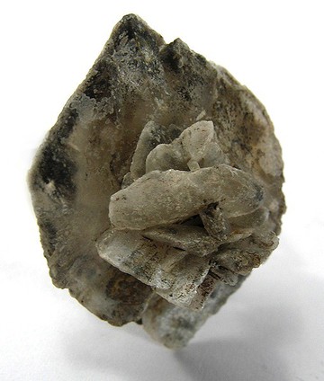
| ⓘ Blödite Formula: Na2Mg(SO4)2 · 4H2O Description: Occurs as a 6 to 12 inch (15.5 to 31 cm) thick layer interstratified with thenardite and clay. References: |
| ⓘ 'Clay minerals' |
| ⓘ Glauberite Formula: Na2Ca(SO4)2 Description: Occurs as good crystals in mud of a dry lake bed. |
| ⓘ Mirabilite Formula: Na2SO4 · 10H2O Description: Some is present. |
| ⓘ Thénardite Formula: Na2SO4 Description: Occurs interstratified with Bloedite and clay in layers from a few inches to 6 feet (2 meters) thick.Occurs as a large deposit. References: |
| ⓘ Vanthoffite Formula: Na6Mg(SO4)4 References: |
Gallery:

List of minerals arranged by Strunz 10th Edition classification
| Group 7 - Sulphates, Chromates, Molybdates and Tungstates | |||
|---|---|---|---|
| ⓘ | Vanthoffite | 7.AC.05 | Na6Mg(SO4)4 |
| ⓘ | Glauberite | 7.AD.25 | Na2Ca(SO4)2 |
| ⓘ | Thénardite | 7.AD.25 | Na2SO4 |
| ⓘ | Blödite | 7.CC.50 | Na2Mg(SO4)2 · 4H2O |
| ⓘ | Mirabilite | 7.CD.10 | Na2SO4 · 10H2O |
| Unclassified | |||
| ⓘ | 'Clay minerals' | - | |
List of minerals for each chemical element
| H | Hydrogen | |
|---|---|---|
| H | ⓘ Blödite | Na2Mg(SO4)2 · 4H2O |
| H | ⓘ Mirabilite | Na2SO4 · 10H2O |
| O | Oxygen | |
| O | ⓘ Blödite | Na2Mg(SO4)2 · 4H2O |
| O | ⓘ Glauberite | Na2Ca(SO4)2 |
| O | ⓘ Mirabilite | Na2SO4 · 10H2O |
| O | ⓘ Thénardite | Na2SO4 |
| O | ⓘ Vanthoffite | Na6Mg(SO4)4 |
| Na | Sodium | |
| Na | ⓘ Blödite | Na2Mg(SO4)2 · 4H2O |
| Na | ⓘ Glauberite | Na2Ca(SO4)2 |
| Na | ⓘ Mirabilite | Na2SO4 · 10H2O |
| Na | ⓘ Thénardite | Na2SO4 |
| Na | ⓘ Vanthoffite | Na6Mg(SO4)4 |
| Mg | Magnesium | |
| Mg | ⓘ Blödite | Na2Mg(SO4)2 · 4H2O |
| Mg | ⓘ Vanthoffite | Na6Mg(SO4)4 |
| S | Sulfur | |
| S | ⓘ Blödite | Na2Mg(SO4)2 · 4H2O |
| S | ⓘ Glauberite | Na2Ca(SO4)2 |
| S | ⓘ Mirabilite | Na2SO4 · 10H2O |
| S | ⓘ Thénardite | Na2SO4 |
| S | ⓘ Vanthoffite | Na6Mg(SO4)4 |
| Ca | Calcium | |
| Ca | ⓘ Glauberite | Na2Ca(SO4)2 |
Other Databases
| Link to USGS MRDS: | 10187720 |
|---|
Other Regions, Features and Areas containing this locality
North America
- Sonoran DesertDesert
North America Plate
- Basin and Range BasinsBasin
- Mojave DomainDomain
- Southern California Borderland BasinsBasin
Pacific PlateTectonic Plate
This page contains all mineral locality references listed on mindat.org. This does not claim to be a complete list. If you know of more minerals from this site, please register so you can add to our database. This locality information is for reference purposes only. You should never attempt to
visit any sites listed in mindat.org without first ensuring that you have the permission of the land and/or mineral rights holders
for access and that you are aware of all safety precautions necessary.
References


Bertram Mine, Bertram siding, Bertram, Imperial County, California, USA