Montpelier, Washington County, Vermont, USAi
| Regional Level Types | |
|---|---|
| Montpelier | - not defined - |
| Washington County | County |
| Vermont | State |
| USA | Country |
This page is currently not sponsored. Click here to sponsor this page.


Latitude & Longitude (WGS84):
44° 15' North , 72° 34' West
Latitude & Longitude (decimal):
Köppen climate type:
Nearest Settlements:
| Place | Population | Distance |
|---|---|---|
| Montpelier | 7,592 (2017) | 1.3km |
| Barre | 8,746 (2017) | 7.8km |
| South Barre | 1,219 (2017) | 9.5km |
| Plainfield | 401 (2017) | 11.6km |
| Graniteville | 784 (2017) | 12.5km |
Mindat Locality ID:
236726
Long-form identifier:
1:2:236726:5
GUID (UUID V4):
65356fc2-aeb5-4f21-bcbe-2773c51bf6bf
Montpelier is the capital city of the state of Vermont.
Select Mineral List Type
Standard Detailed Gallery Strunz Chemical ElementsMineral List
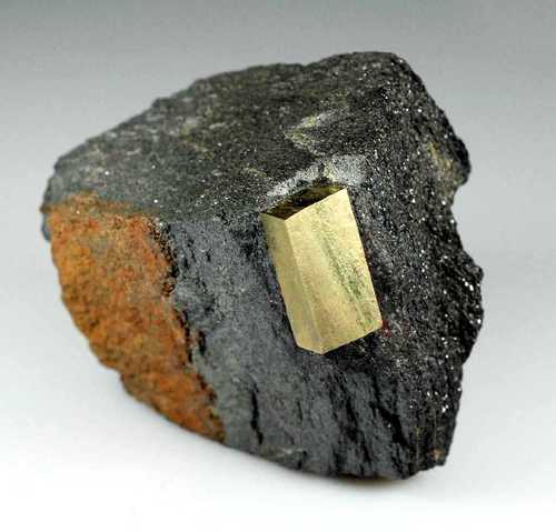
Mineral list contains entries from the region specified including sub-localities1 valid mineral.

List of minerals arranged by Strunz 10th Edition classification
| Group 2 - Sulphides and Sulfosalts | |||
|---|---|---|---|
| ⓘ | Pyrite | 2.EB.05a | FeS2 |
Localities in this Region
- Vermont
- Washington County
- Montpelier
- Washington County
Other Regions, Features and Areas containing this locality
North America PlateTectonic Plate
- Appalachian BasinBasin
- Piedmontia DomainDomain
This page contains all mineral locality references listed on mindat.org. This does not claim to be a complete list. If you know of more minerals from this site, please register so you can add to our database. This locality information is for reference purposes only. You should never attempt to
visit any sites listed in mindat.org without first ensuring that you have the permission of the land and/or mineral rights holders
for access and that you are aware of all safety precautions necessary.


Route I-89 road cut, Montpelier, Washington County, Vermont, USA