Greenvale area, Clutha District, Otago Region, South Island, New Zealandi
| Regional Level Types | |
|---|---|
| Greenvale area | Area |
| Clutha District | District |
| Otago Region | Region |
| South Island | Island |
| New Zealand | Country |
This page is currently not sponsored. Click here to sponsor this page.

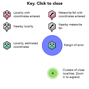
Key
Lock Map
Latitude & Longitude (WGS84):
45° 51' 59'' South , 169° 3' 0'' East
Latitude & Longitude (decimal):
Locality type:
Köppen climate type:
The Greenvale area straddles both the Clutha District, Otago Region and Gore District, Southland Region.
Care needs to be taken regarding assigning localities to this area.
(Henderson, 1922) 'A cinnabar bearing lode was recently discovered in the Waikaka valley, Section 6, Block X1, Greenvale survey district'. It goes on to say that cinnabar is found in silicified greywacke as small seams. impregnations, and grains throughout a band 10-24 inches wide. Three winzes had been sunk by the prospectors to depths of 50, 40 and 25 feet, with a 100 foot drive at the 25 foot level. The lode strikes north-west.
(Geological Survey Department, 1923) states it is Section 8, Block 11, Greenvale survey district 'a few miles north-east of Waikaka'. The site is on top of a round hill, as veins of cinnabar across an area 10-12 feet thick, the largest vein one foot thick, containing a continuous thin irregular sheet of cinnabar, in weathered greywacke. It stated two vertical shafts had been sunk to 25 and 50 feet, and an adit into the hill for 280 feet heading north. The veinlets are partly silicified in places, and also note pale pyrite. Testing of surface material came back at 0.88 mercury.
It is mentioned briefly again in 1926, when cinnabar ore was displayed at an exhibition.
This is a lost locality, at least until someone goes to the local titles office, and does an on the ground search.
Regions containing this locality
| Pacific Plate | Tectonic Plate |
Select Mineral List Type
Standard Detailed Strunz Dana Chemical ElementsDetailed Mineral List:
| ⓘ Cinnabar Formula: HgS Reference: Railton, G.T., Watters, W.A. (1990) Minerals of New Zealand. New Zealand Geological Survey Bulletin 104, 89 pages. |
List of minerals arranged by Strunz 10th Edition classification
| Group 2 - Sulphides and Sulfosalts | |||
|---|---|---|---|
| ⓘ | Cinnabar | 2.CD.15a | HgS |
List of minerals arranged by Dana 8th Edition classification
| Group 2 - SULFIDES | |||
|---|---|---|---|
| AmXp, with m:p = 1:1 | |||
| ⓘ | Cinnabar | 2.8.14.1 | HgS |
References
Sort by
Year (asc) Year (desc) Author (A-Z) Author (Z-A)Henderson, J. (1922) Cinnabar in New Zealand, New Zealand Geological Survey, 16th Annual Report, p15-16.
Mines Department (1923) C-02c Seventeenth Annual Report -subsection- Cinnabar in Greenvale survey district near Waikaka Southland (summary of report by J. Henderson), Mines Department Geological Survey Branch, p12, 01 January 1923.
Alexandra Herald and Central Otago Gazette newspaper (1926) Southland Minerals, issue 1526, 24 February 1926.
Railton, G.T., Watters, W.A. (1990) Minerals of New Zealand. New Zealand Geological Survey Bulletin 104, 89 pages.
This page contains all mineral locality references listed on mindat.org. This does not claim to be a complete list. If you know of more minerals from this site, please register so you can add to our database. This locality information is for reference purposes only. You should never attempt to
visit any sites listed in mindat.org without first ensuring that you have the permission of the land and/or mineral rights holders
for access and that you are aware of all safety precautions necessary.


