| Locality type: | Mine |
| Classification |
|---|
|
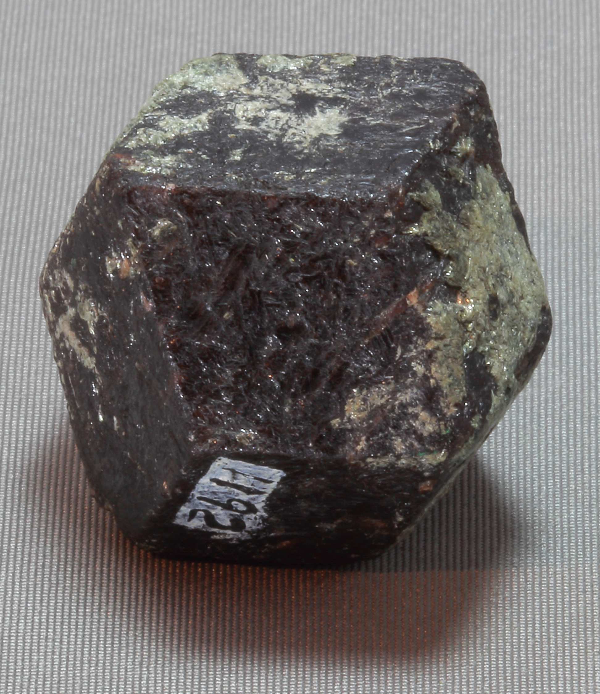
| Species: | Almandine |
| Formula: | Fe32+Al2(SiO4)3 |
| Confirmation |
|---|
|
| Validity: | Believed Valid |
| Associated Minerals Based on Photo Data: |
|---|
|
| Chamosite | ⓘ16 photos of Almandine associated with Chamosite at this locality. |
| Clinochlore | ⓘ1 photo of Almandine associated with Clinochlore at this locality. |
| Data |
|---|
|
| Mineral Data: | Click here to view Almandine data |
| Locality Data: | Click here to view Michigamme Mine (Mt Shasta mine), Michigamme, Marquette County, Michigan, USA |
| Photo Gallery | View Gallery (2 photos) |
| Data Identifiers |
|---|
|
| Mindat Occurrence Record ID: | 97617 |
| Long-form Identifier: | 1:3:97617:4 |
| GUID (UUID V4): | 9e63454a-d76e-4585-ba64-d0f8288b1a90 |
| Nearest other occurrences of Almandine |
|---|
|
|
| 2.8km (1.7 miles) | ⓘSpurr Mine, Imperial Heights, Baraga County, Michigan, USA |
| 9.0km (5.6 miles) | ⓘChampion Mine, Champion, Marquette County, Michigan, USA |
| 9.1km (5.7 miles) | ⓘMagnetic Mine, Republic, Marquette County, Michigan, USA |
| 15.1km (9.4 miles) | ⓘGertrude Mine, Marquette County, Michigan, USA |
| 15.6km (9.7 miles) | ⓘUnnamed outcrop (3), Humboldt Township, Marquette County, Michigan, USA |
| 15.9km (9.9 miles) | ⓘNew Humboldt Mine (Ampson; Washington; Baron; And; Humboldt Workings; New Humboldt Mine-Includes: Old S), Marquette County, Michigan, USA |
| 16.0km (10.0 miles) | ⓘM-95 bridge, Republic, Marquette County, Michigan, USA |
| 16.4km (10.2 miles) | ⓘHumboldt Mine (Edwards Mine), Humboldt Township, Marquette County, Michigan, USA |
| 17.4km (10.8 miles) | ⓘRepublic Mountain, Republic, Marquette County, Michigan, USA |
| 18.2km (11.3 miles) | ⓘSmith Mountain, Republic, Marquette County, Michigan, USA |
| References |
|---|
|
|
| Reference Search (possible matching items) |
|---|
 | | Book | | Mineralogy of Michigan by E. W. Heinrich updated and revised • by George W. Robinson M By E W~ Hellnr]ch...Museum Michigan Technological University Houghton, Michigan 49931 2004 © MINERALOGY OF MICHIGAN 3 FOREWORD...FOREWORD Michigan has a long and varied geologic history that includes repeated episodes of volcanism...before the first Europeans set foot here. When Michigan became a state in 1837, one of the first actions...and we continue to learn more about them today. Michigan minerals helped to build the state and nation |
|


Michigamme Mine, Michigamme, Marquette County, Michigan, USA