 | | Journal (article/letter/editorial) | | New Hampshire Mineral Locality Index Downloaded by [University of Newcastle, Australia] at 15:01 05...entrance and arch of the Palermo mine, North Groton, Grafton County. Rob Lawrence photo, courtesy Bob...Bob Whitmore. 242 ROCKS & MINERALS lthough New Hampshire, the Granite State, is one of our smaller states...reading Jackson (1844) on the mineralogy of New Hampshire that even at this early date there was already...activity produced new localities, renewed some old localities, and resulted in new minerals being discovered | 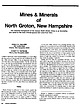 | | Journal (article/letter/editorial) | | Minerals of North Groton, New Hampshire The historical background of the famous North Groton mines is as fascinating...Candia Road Chester, New Hampshire 03036 R O B E R T W. WHITMORE Weare, New Hampshire 03281 N O R T H G...from local residents and collectors. History North Groton is unknown to many people outside the mineral fraternity... a large percentage of the popula tion of New Hampshire would not recognize the name, let alone be able...Forest. 350 ROCKS & MINERALS In the early 1800s, Groton was a thriving farming com munity with a population |  | | Journal (article/letter/editorial) | | A NEW BRAZILIANITE LOCALITY THE CHARLES DAVIS MINE, NO. GROTON, N. H. By PHILIP MORRILL To reach this...this mine go northwest from No. Groton village about one mile toward Cheever. After passing the cemetery...cemetery, a flat valley will be reached. The mine road turns south from the center of this flat and crosses...rerouted. The mine is about three hundred yards up hill from the town road. A Frank Davis Mine is located...located farther out nearer Cheever. This mine consists of a shaft forty feet deep in pegmatite. It was operated |  | | Book (volume) | | instance, a single Spodumene crystal from the Etta Mine near Keystone on the east side of the Mount Rushmore...beds, excavations, etc.Selenite roses. BRULE COUNTY AREA: in the Oacoma zone of the Pierre Fm. On Elm...gray Barite rosette up to 5 or 6 inches. CAMPBELL COUNTY MOUND CITY, W to the Missouri R., regional hillsides...gravels, etc.petrified wood, wood opal. CORSON COUNTY LITTLE EAGLE: area ridges, slopes, stream beds...Hounds in the United States CUSTER COUNTY AREA: The November Mine, 1.2 mi. SE of the Needles Eye Tunnel |  | | Book (volume) | | chalcedony, jasper and gem petrified wood. BUFFALO COUNTY KEARNEY, area gravel bars and pits along the Platte...townagate, chalcedony, jasper, petrified wood. CASS COUNTY WEEPING WATER, SE, on rd. to Nehawka, in the Snyderville...chalcedony, jasper, fossils. CHERRY COUNTY VALENTINE, in the Sandhills county along the Niobrara R. and Minnechaduza...gem qualityagatized and opalized wood. DAWES COUNTY CHADRON, in N part of Co. and as far W as Crawford...woods, etc. DAWSON COUNTY GOTHENBURG, in sand pitspetrified palm wood. DEUEL COUNTY CHAPPELL, all regional |  | | Book (volume) | | 600 to 800 feet thick in the north. ALEXANDER COUNTY FAYVILLE, area stream gravels⎯agate, jasper, rare...⎯agate, jasper; d RR siding of Clay⎯agate. CALHOUN COUNTY AREA, shores of the Mississippi R., in the Warsaw...crystals). CRAWFORD COUNTY PALESTINE, area deposits⎯Siderite. EDWARDS COUNTY AREA, T. 1 S, R. 10 E...deposits⎯Siderite. FULTON COUNTY FARMINGTON, W 6 mi. on Rte. 116 to the Rapatee No. 5 strip mine⎯pyritized gastropods...gastropods (Pennsylvanian age). GRUNDY COUNTY AREA: c Regional rd. and RR cuts and banks of Mason Cr.⎯fossils; |  | | Book (volume) | | 600 to 800 feet thick in the north. ALEXANDER COUNTY FAYVILLE, area stream gravels⎯agate, jasper, rare...⎯agate, jasper; d RR siding of Clay⎯agate. CALHOUN COUNTY AREA, shores of the Mississippi R., in the Warsaw...crystals). CRAWFORD COUNTY PALESTINE, area deposits⎯Siderite. EDWARDS COUNTY AREA, T. 1 S, R. 10 E...deposits⎯Siderite. FULTON COUNTY FARMINGTON, W 6 mi. on Rte. 116 to the Rapatee No. 5 strip mine⎯pyritized gastropods...gastropods (Pennsylvanian age). GRUNDY COUNTY AREA: c Regional rd. and RR cuts and banks of Mason Cr.⎯fossils; |  | | Journal (article/letter/editorial) | | the logs of mineral col leering in Maine and New Hampshire. (Several trips are omitted for political reason...now 90 years old. He described the Aaron's Ledge Mine where he once worked. Following his directions,...long way down the valley but could not find the mine. He told me on return that the trail turns a sharp...stone wall. This mine was op erated by Mr. Lamb and is also known as the Lamb Mine. After operating...found that as sayed one ounce of gold per ton. The mine is located at the foot of the ridge that marks the |  | | Report (volume) | | mines_______________________________________ Boulder CountY----------------------------------~-----------Jamestown...Generalfeatures--------------------------------------Blue Jay mine, by R. U. King__________________________ Fair Day...mine________________________________________ Nations Treasure mine, by R. U. King___________________ Victory group...Description of principal mines-Continued Boulder County-Continued Other areas __________________________...___________ Shirley mine _____________ ----- __ ------------__________ Sisk mine, by F. B. Moore____ |  | | Book (volume) | | Where & How to Djg, Pan and Mine Your Own Gen1s & Minerals Where & I-low to 1-Iunt for Treasure From...vacation stops at a roadside "dig your own" gem mine. Junior finds a sapphire the size of a p ach and...) Many an unsuspecting tourist has stopped at a mine to try his or her luck and become a rockhound for...Arizona California Colorado Hawaii Kansas Nevada New Mexico Oklahoma Texas Utah Alaska Idaho Iowa Minnesota...Indiana Maine Maryland Massachusetts Michigan New Hampshire New Jersey Nev,, York Ohio Pennsylvania Rhode |  | | Book (edition) | | describes sites under of the nearest town and county. and the many maps included book contain such...collector of gem minerals RUSSELL P. Thomas NEW YORK MACFALL Y. Crowell Company / ESTABLISHED...Shop and Herbert Grand Girard, both of Santa Fe, New Mexico, Ken Kyte of Covington, Louisiana, Merton...Indiana, George E. Lambert of Wappingers Falls. New York, and D. L. Hathaway of Cosmopolis, Washington...Such pegmatite dikes in Maine, Connecticut, New Hampshire, North Carolina, South Dakota, liquid in the |  | | Field Trip Notes | | //' . GUIDEBOOK FOR FIELD IN ''fy,.'t:J TRIPS NEW ENGLAND NOVEMBER 10-12, 1952 Organized by the...Before visiting any of the sites described in the New England Intercollegiate Geological Conference guidebooks...Highlands of East-Central New York, Southern Vermont, and Southern New Hampshire Field Trip No. 2, Outstanding...Outstanding pegmatites of Maine and New Hampshire 73 Geology of the "Chelmsford Granite" 103 Field Trip...OF EAST-CENTRAL NEW YORK, SOUTHER Leaders: VERJ-IONT, AND SOUTHERN NEW HAMPSHIRE Marland P, Billings |  | | Report (volume) | | volcanic rocks, in Faul, Henry, ed., Nuclear geology: New York, John Wiley & Sons Inc., p. 89-98. On the basis...for the following observation. At the W. Wilson mine, "a few secondary minerals, mainly metatorbernite...radioactivity of four Paleozoic magma series in New Hampshire: Geol. Soc. America Bull., v. 57, p. 797-828...series are recognized in western and central New Hampshire. This paper describes the rocks of these series...increase in the amount of zircon. The rocks of the New Hampshire magma series of Late Devonian (?) age range |  | | Book | | HfiRIN COUNTY FREE LIBRfiRY 311110G386652Q I V Russell P MacFal A COLOR TREASUF FOR COLLECTORS...it a veritable not just a picof informa- is mine tion, telling everything the collector needs to...to Hunting Locations ? i 9 GIVEN TO THE MARIN COUNTY LIBRARY BY MARI N L MTNF.RAT. SOCTETY DAVID...MINERALS AND GEMS Russell P. MacFall THOMAS Y. New CROWELL COMPANY York ! Established 1834 Copyright...Boscardin. published in Italy in 1973 by Fratelli New Fabbri Editori. material has been added for this |  | | Report (issue) | | Sugar Loaf and St. Kevin Mining Districts Lake County, Colorado By QUENTIN D. SINGEWALD A CONTRIBUTION...nearby mines___________________________________ Mine workings___________..___________________________Records...________________________________________ Tiger-Shields mine.______________________________________ Gertrude-Venture..._________ Griffin mine.____________________________________________ President mine._________________...___________ Amity mine..___________________________________________ Birdella mine.__________________ |  | | Report (issue) | | URANIUM-BEARING MINERALS IN THE ST. KEVIN DISTRICT LAKE COUNTY, COLORADO This report concerns work done on behalf...URANIUM-BEARING MINERALS IN THE ST. KEVIN DISTRICT, LAKE COUNTY, COLORADO By C. T. Pierson and Q. D. Singewald...URANIUM-BEARING MINERALS IN THE ST. KEVIN DISTRICT, LAKE COUNTY, COLORADO By C. T. Pierson and Q. D. Singewald...the uranium-bearing minerals been determined. Torbernite, associated with turquoise, malachite, and chrysocolla...May turquoise mine; metatorbernite is disseminated in granite at the Turquoise Chief mine. Commonly the |  | | Book | | tons of 0.27% U3D8 by mid-1957, of vvhich 70% is in New Mexico, 16% in Colorado, Utah, and Arizona, and 8%... . . . . .. . .... . . . . . . .... ....... . . New Zealand . ............ . . . . . .... .. ... . ....with many other cations and anions to form numerous new hosts. Thus thorium forn1s only six minerals of its...characteristics form two sb"Ucturally related groups, the torbernite and metatorbernite groups (1~able 1.11). Beintema...TABLE 1.11. Minerals of the torbernite and metatorbernite gro,ups Torbernite group I-I20 Autunite . |  | | Report (volume) | | ...... New Hampshire........................................................... 190 201 New Jersey.............. New Mexico............................................................. New York. .........F. C. Schrader: Besides giving several thousand new localities of mineral deposits and adding more than...especially from those of Arkansas, California, Colorado, New Mexico, Oregon, South Dakota, Tennessee, and Texas;...Franklin, Hampshire, and Hampden counties, Mass.: U. S. Geol. Survey Bull. 126, 1895. Jones, F. A., New Mexico |  | | Book (edition) | | MARIN COUNTY FREE LIBRARY 3 1111 00289 4184 \ I s Fifth Revised Edition A complete, state-by-state...Edition Russell P. MacFall Thomas Y. Crowell New York / Company Established 1834 Copyright ©...West, the broad plains and the verdant hills of New England hold inestimable treasures of living things...doorstep in the vicinity of Paris? Have you heard, Mr. New Jersey, of your famous pearls?" citing other notable...the developer's bulldozer obliterates other sites, new ones are discovered. Books and thetic and scientific |  | Birch, W. D., Mills, S. J., Maas, R., Hellstrom, J. C. (2011) A chronology for Late Quaternary weathering in the Murray Basin, southeastern Australia: evidence from230Th/U dating of secondary uranium phosphates in the Lake Boga and Wycheproof granites, Victoria. Australian Journal of Earth Sciences, 58 (7) 835-845 doi:10.1080/08120099.2011.594090 | Journal (article/letter/editorial) | | well-crystallised secondary uranyl phosphates, including torbernite, saléeite, metanatroautunite and ulrichite....phosphates, two of which (ulrichite and lakebogaite) are new species (Birch et al. 1988; Mills 2004; Mills et...yielding the new U species ulrichite and lakebogaite, the quarry is the type locality for two other new phosphates...crystals of lakebogaite could not be included). Torbernite is the most abundant, occurring as transparent...and crusts in small cavities. In some cavities, torbernite crystals sit on white kaolinite infillings or |  | | Report (issue) | | REYNOLDS AREA LAWSON-DUMONT DISTRICT CLEAR CREEK COUNTY COLORADO By J. E. Harrison and B. F. Leonard UNITED...REYNOLDS AREA LAWSON-DUMONT DISTRICT, CLEAR CREEK COUNTY, COLORADO By J. E. Harrison and B. F. Leonard ...REYNOLDS AREA LAWSON-DUMONT DISTRICT, CLEAR CREEK COUNTY, COLORADO CONTENTS Page Abstract ................... Purpose and scope of study ................ Mine workings .......................... Rock units..... In pocket Plan and section of the Jo Reynolds mine ............................................... |  | | Report (issue) | | several geologic guides are useful in prospecting for new deposits. They include (1) stratigraphic position...But the search for uranium has been made in every county west of Denver, and even in a few places in eastern...Adams and F. B. Moore (thorium deposits in Gunnison County); E. P. Beroni and F. A. McKeown (scattered deposits...(pitchblende in gold-telluride veins near Hessie, Boulder County); G. E. Manger (porosity and permeability of radon-... Huerfano County; the Skull Creek area, Moffat County; the Brush Creek area, Eagle County; the Prairie |  | | Book | | W. H. Smith Publishers Inc. 112 Madison Avenue New York City 10016 This edition first published in... H. Smith Publishers, Inc., 112 Madison Avenue, New York 10016 © 1990 Dragon’s World Ltd © 1990 Text...Smith Publishers, Inc., 112 Madison Avenue, New York, New York 10016. (212) 532-6600. Editor: Michael...museum quality but many minerals can be found on mine dumps or can be purchased or traded. After introducing...granite but with no quartz. Sandstone (South Dakota, USA) _9_ A darker rock than granite but with a similar |  | | Journal (issue) | | a recreational device, a sort of game—that was new.” (See also front cover.) A Trip TO LEAD PIPE SPRINGS...Edge Road must be abandoned 12 OLDEST MINE OPERATING IN NEW HAMPSHIRI by Mrs. Julian Wetherbee It has...of course, the “in betweens”’ v nary run-of-the-mine collections, consisting of a little of everything;...one was ever encountered who coul just where this mine had been, and careful search of the area never revealed...SCIENCE, December, 1949) ) > Linda Vista, Las Cruces, New Mexico, D cembet 1O, 1954 Thanks for sending me a |  | | Book (volume) | | Dahlonega Co. and Rabum Co., and the McDuffie County Belt extending through portions of McDuffie, Warren...Sphalerite. BALDWIN COUNTY MILLEDGEVILLE, at state farmjasper. BANKS COUNTY COMMERCE, along Hwy. 59...along adjoining Co. linerock crystal. BARROW COUNTY WINDER, along rd. to Jefferson and 1½ mi. inside...Guide for Rock Hounds in the United States BARTOW COUNTY AREA, Saltpeter Cave, as floatjasper. CARTERSVILLE:...agate, (banded, various colors), jasper. BIBB COUNTY MACON: at Holton Quarry, 7½ mi. NWagate; N |
|


Plume Mine, Groton, Grafton County, New Hampshire, USA