 | | Journal (article/letter/editorial) | | New Hampshire Mineral Locality Index Downloaded by [University of Newcastle, Australia] at 15:01 05...entrance and arch of the Palermo mine, North Groton, Grafton County. Rob Lawrence photo, courtesy Bob...Bob Whitmore. 242 ROCKS & MINERALS lthough New Hampshire, the Granite State, is one of our smaller states...reading Jackson (1844) on the mineralogy of New Hampshire that even at this early date there was already...activity produced new localities, renewed some old localities, and resulted in new minerals being discovered |  | | Report (volume) | | Mendenhall, Director Bulletin 931-P MICA-BEARING PEGMATITES OF NEW HAMPSHIRE A PRELIMINARY REPORT BY J. C................................................ Grafton district.........................................Alstead area, Keene district......................... Mica-bearing pegmatites................................Mineral zones and streaks............................ Mica................................................................ Sheet mica sizes and pric'es.......................... Punch mica..................... | 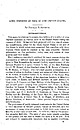 | | Report (issue) | | SOME DEPOSITS OF MICA IN "THE UNITED STATES. By DOUGLAS B. STERRETT. INTRODUCTION. This paper is intended...intended to present descriptions of a number .of mica deposits examined in various parts of the United...information on the production, value, uses, and nature of mica is given only very briefly. Much assistance was...given in New Hampshire by Samuel Cordick, superintendent of the General Electric Co.'s mine; Andrew T...T. Orr, of the Mica Products Co.; C. W. Bryant, of the Standard mine; L. R. Brown, of Canaan; G. N. Bicker |  | | Report (volume) | | (K)The Wild Horse quicksilver district, Lander County, Nevada, by C. H. Dane and C. P. Ross (published...August 1942)• 259 (L)Tin deposits of northern Lander County, Nevada, by Carl Fries, Jr. (published in March...(M)Manganese deposits in the Nevada district, White Pine County, Nevada, by R. J. Roberts (published ix June 1942)•...of the Opalite district, Malheur County, Oregon, and Humboldt County Nevada, by R. G. Yates (published...Boulder County, Colorxdo, by E. N. Goddard and T. S. Lovering (published in March 1942)• 349 (P) Mica-bearing |  | | Journal (article/letter/editorial) | | Mines & Minerals of North Groton, New Hampshire The historical background of the famous North Groton...Candia Road Chester, New Hampshire 03036 R O B E R T W. WHITMORE Weare, New Hampshire 03281 N O R T H G...1900s, it was an important mining dis trict with mica as the principal product. For the mineral col lector... a large percentage of the popula tion of New Hampshire would not recognize the name, let alone be able...It was during this period that the discovery of mica changed the character of this village for a brief |  | | Book | | THE PEGMATITE MINES KNOWN AS NORTH GROTON, NEW HAMPSHIRE eral I ederi Acknowledi:ments Dedicated...experience. As a kid growing up in Manchester, New Hampshire, I was always fascinated by minerals and tried...premier sandbox, but I could also make sure the mine would remain open to mineral enthusiasts for years...maintained the notoriety acquired by the Palermo No. I mine. Its impact on the nation, and in some respects...twenty-five year history. From one of the biggest mica producers in the United States immedi ately following |  | | Report (volume) | | (K) The Wild Horae quicksilver district, Lander County, Nevada, by C. H. Dane and C. P. Ross (published......... 259 (L) Tin deposits of northern Lander County, Nevada, by Carl Pries, Jr. (published in March...Manganese deposits in the Nevada district, White Pine County, Nevada, by R. J. Roberts (published in June 1942)...of the Opallte district, Malheur County, Oregon, and Humbdldt County. Nevada, by R. G. Yates (published...'319 (0) Nickel deposit near Gold Hill, Boulder County, Colo.rado, by E. N. Goddard and T 0 S. Lovering |  | | Report (issue) | | Pegmatite Investigations 1942-45 New England By EUGENE N. CAMERON and OTHERS GEOLOGICAL SURVEY PROFESSIONAL...History of pegmatite mining inN ew England _______ _ Mica mining ______________________________ _ Feldspar..._______ _ Geology of the pegmatite districts of New Hampshire_ Rock units ________________________________...pegmatites ___________________ _ Pegmatites of the Grafton and Keene districts __ _ Sources of pegmatites..._____________ _ Mica deposits ____ ·_________________________________ _ Kinds and characteristics of mica _________________ |  | | Report (volume) | | SURVEY GEORGE OTIS SMITH, Director Bulletin 740 MICA DEPOSITS OF THE UNITED STATES DOUGLAS B. STERRETT...Physical properties_____________________________ Mica mining__________________ ____ _ ________ . Hist...Methods_____________________:_____________ Preparation of mica for the market____________________ Uses________...General features____________________________ Coosa County _________ ____________________ Randolph County...Cherokee County_____________________________ 72 Elbert County _____________________________ 75 Hall County__ |  | | Report (volume) | | ........ The Grand Gulch mining region, Mohave County, Ariz., by J. M. Hill (published June 12; 1914).... ........... Some cerusite deposits in Custer County, Colo., by J. F. Hunter (published May 5, 1914)...MISCELLANEOUS: A new gypsum deposit in Iowa, by G. F. Kay (published June 12,1914).... Some deposits of mica in the...cerusite belt near Use, Custer County, Colo., at the open cut of the Terrible mine................................. 5. Plan of the Terrible mine, near Use, Custer County, Colo.......... 6. Sketch map showing location |  | | Report (issue) | | Precambrian rocks..................... ............. Mica schist and gneiss ............. ............. Mixed...quartz diorite, pegmatite, quartz monzonite, and mica schist and gneiss ........................... Biotite...through Triassic sequence of the Eagle Basin . Belden Formation ................................... Gothic....................... Photographs of outcrops of mica schist and gneiss ................................Diagram of proportions of quartz, feldspar, and mica and clay in Sawatch Quartzite ................. |  | | Report (issue) | | the current-year issues of the monthly catalog "New Publications of the U.S. Geological Survey." Prices...Alaska Distribution Section, U.S. Geological Survey, New Federal Building - Box 12 101 Twelfth Ave., Fairbanks...Distribution, Bldg. 810, Federal Center FAIRBANKS, Alaska-New Federal Bldg., 101 Twelfth Ave. Geology and Uranium...Saguache County. 2. Geology Colorado Gunnison County. 3. Uranium ores Colorado Saguache County. 4. Uranium...Uranium ores Colorado Gunnison County. I. Title, II. Series: Geological Survey professional paper ; 1457 |  | | Report (issue) | | Limestone (or Dolomite) ................ . Pre-Belden unconformity and Molas Formation ........ . Pennsylvanian...Pennsylvanian and Permian Systems ................. . Belden Formation ............................... . Minturn...5 Photographs: 3. Canyon of the Eagle River at Belden and Gilman . . . . . . . . . . . . . . . . . .............................. -........... 27 10. Belden Formation in roadcut on U.S. Highway 24 . . . .... . . . . . . 35 11. Channeled contact between Belden and Minturn Formations . . . . . . . . . . . . |  | | Book (volume) | | chalcedony, jasper and gem petrified wood. BUFFALO COUNTY KEARNEY, area gravel bars and pits along the Platte...townagate, chalcedony, jasper, petrified wood. CASS COUNTY WEEPING WATER, SE, on rd. to Nehawka, in the Snyderville...chalcedony, jasper, fossils. CHERRY COUNTY VALENTINE, in the Sandhills county along the Niobrara R. and Minnechaduza...gem qualityagatized and opalized wood. DAWES COUNTY CHADRON, in N part of Co. and as far W as Crawford...woods, etc. DAWSON COUNTY GOTHENBURG, in sand pitspetrified palm wood. DEUEL COUNTY CHAPPELL, all regional |  | | Book (edition) | | describes sites under of the nearest town and county. and the many maps included book contain such...collector of gem minerals RUSSELL P. Thomas NEW YORK MACFALL Y. Crowell Company / ESTABLISHED...Shop and Herbert Grand Girard, both of Santa Fe, New Mexico, Ken Kyte of Covington, Louisiana, Merton...Indiana, George E. Lambert of Wappingers Falls. New York, and D. L. Hathaway of Cosmopolis, Washington...Such pegmatite dikes in Maine, Connecticut, New Hampshire, North Carolina, South Dakota, liquid in the |  | | Report (volume) | | the current-year issues of the monthly catalog "New Publications of the U.S. Geological Survey." Prices...Alaska Distribution Section, U.S. Geological Survey, New Federal Building- Box 12 101 Twelfth Ave., Fairbanks...Alaska--New Federal Bldg., 101 Twelfth Ave. Geology and Geochemistry of the Pitch Uranium Mine Area,... Saguache County, Colorado By j. THOMAS NASH Description and interpretation of the geology and geochemistry...geochemistry of a new type of uranium deposit that occurs chiefly in brecciated dolomite U.S. GEOLOGICAL |  | | Report (issue) | | WHITEPINE AREA, TOMICHI MINING DISTRICT, GUNNISON COUNTY, COLORADO by Charles S. Robinson This report Is... ................... 29 .................. 36 Belden shale ...................... 42 Tertiary intrusive...of the ore depoait* ..............*...... 143 Mine* and prospect* ......................... 147 Akron............. 139 * May, Mazeppa, and W. and A. mine* ......... 191 Morning Star ....................the White pine area 3. Sketch of the Spar Copper mine 1. Geologic map and sections of the White pine |  | | Report (issue) | | Reconnaissance of the ore deposits in northern Yuma County, Ariz.: Bull. 451, 130 pp., 1911. 30c. -. The ore..., Mineral resources [of the Raritan quadrangle, New Jersey] exploited: Geol. Atlas U. S., folio 191,...geology and mining district'of Leadville, Lake County, Colo.: Second Ann. Rept, pp, 201-290, 1882. $2...pp., 1912. The Grand Gulch mining region, Mohave County, Ariz.: Bull. 580-D, pp. 39-58, 1914. Some mining...mineral notes: Bull. 20, pp. 89-99, 1885. Exhausted. New mineral species from Colorado: Bull. 20, pp. 100-109 |  | | Report (issue) | | _ Schists and gneisses ________________ _ Quartz-mica schist _____________ _ Quartz-hornblende schist...Leadville limestone ________________________ _ Belden shale and Minturn formation _________ _ Mesozoic...economic s.nd geologic features _____ -_- __ Gold Cup mine _______ ---------------------Other mines and prospects..._______ _ Maid of Athens mine _______________________ _ Silent Friend mine _________________________...features _________ _ Akron mine _______________________________ _ Erie mine _________________________________ | 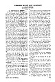 | | Journal (article/letter/editorial) | | Darry, N. H. 0 3 0 4 1 (PART 16 SPOTSYLVANIA COUNTY Bordered on the N by the Rappahan nock and Rapidan...number of gold operations r u n n i n g across the county from N to S. These are mainly placers and rather...Jackson's Trail, iy mi. S o f Brockroad. Old gold mine on Greene Farm near Brockroad. Marsden Gold M. A...gets up to 124 Dwt. Placer only. United States Gold Mine. Between Rte 620 and Rappahannock R. Nr. power line...Xing. Op. by Gov. Spotswood in 1717. Ashmead Gold Mine. Lead and zinc M. at Todd's Tavern. 100 Yds. in |  | | Book (edition) | | MARIN COUNTY FREE LIBRARY 3 1111 00289 4184 \ I s Fifth Revised Edition A complete, state-by-state...Edition Russell P. MacFall Thomas Y. Crowell New York / Company Established 1834 Copyright ©...West, the broad plains and the verdant hills of New England hold inestimable treasures of living things...doorstep in the vicinity of Paris? Have you heard, Mr. New Jersey, of your famous pearls?" citing other notable...the developer's bulldozer obliterates other sites, new ones are discovered. Books and thetic and scientific |  | | Thesis/Dissertation | | mineralogy................ 44 vii f. ABSTRACT A new technique is introduced to produce mineralogic maps...lead-silver ore and the Star Mine in 1878 (Garrett, 1950). The remoteness of the mine discouraged development...2711 lb (oz ?) Ag and 2 oz. Au (Roy, 1972). The mine is currently.being prospected by Dr, C. S. Livingstone...future. 4 The -Clara L. Mine, 300 m. south of the Star and the Stewart Mine in Stewart Basin were actively...initial flurry of activity in the forties, the lapis mine settled into dormancy that was to last until 1980 |  | | Book (volume) | | 600 to 800 feet thick in the north. ALEXANDER COUNTY FAYVILLE, area stream gravels⎯agate, jasper, rare...⎯agate, jasper; d RR siding of Clay⎯agate. CALHOUN COUNTY AREA, shores of the Mississippi R., in the Warsaw...crystals). CRAWFORD COUNTY PALESTINE, area deposits⎯Siderite. EDWARDS COUNTY AREA, T. 1 S, R. 10 E...deposits⎯Siderite. FULTON COUNTY FARMINGTON, W 6 mi. on Rte. 116 to the Rapatee No. 5 strip mine⎯pyritized gastropods...gastropods (Pennsylvanian age). GRUNDY COUNTY AREA: c Regional rd. and RR cuts and banks of Mason Cr.⎯fossils; |  | | Book (volume) | | 600 to 800 feet thick in the north. ALEXANDER COUNTY FAYVILLE, area stream gravels⎯agate, jasper, rare...⎯agate, jasper; d RR siding of Clay⎯agate. CALHOUN COUNTY AREA, shores of the Mississippi R., in the Warsaw...crystals). CRAWFORD COUNTY PALESTINE, area deposits⎯Siderite. EDWARDS COUNTY AREA, T. 1 S, R. 10 E...deposits⎯Siderite. FULTON COUNTY FARMINGTON, W 6 mi. on Rte. 116 to the Rapatee No. 5 strip mine⎯pyritized gastropods...gastropods (Pennsylvanian age). GRUNDY COUNTY AREA: c Regional rd. and RR cuts and banks of Mason Cr.⎯fossils; |  | | Report (issue) | | ..... . . ............ 10 Pike National Forest County of El Paso (Black Forest) Land Exchange Offer ...Fig. 39. Attachment S. MAS 0080510124: Fairview Mine ......... 80 Fig. 40. Attachment T. MRDS DC01244:...43. Attachment W. MAS 0080510096: Climax (Ender) Mine ... 85 Fig. 44. Attachment X. Geologic map of Italian... 48. Attachment BB. MAS 0080510265: Spar Copper Mine ..... Fig. 49. Attachment CC. MRDS DC01200: Morning...193 194 195 196 197 198 199 200 201 202 Fig. 14. Mine and claim location map for part of the Custer quadrangle |
|


