| Locality type: | Mine |
| Classification |
|---|
|
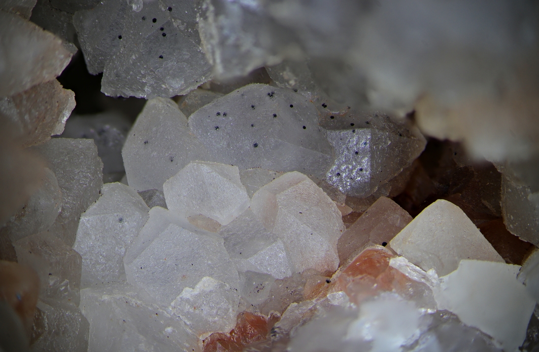
| Species: | Quartz |
| Formula: | SiO2 |
| Confirmation |
|---|
|
| Validity: | Confirmed |
| Confirmation Methods: | Visually Identified |
| Associated Minerals Based on Photo Data: |
|---|
|
| Hematite | ⓘ1 photo of Quartz associated with Hematite at this locality. |
| Data |
|---|
|
| Mineral Data: | Click here to view Quartz data |
| Locality Data: | Click here to view Section 30 Mine (The Nikaniss Company Congdon Trust et al), Vermilion Range, Lake County, Minnesota, USA |
| Data Identifiers |
|---|
|
| Mindat Occurrence Record ID: | 1297180 |
| Long-form Identifier: | 1:3:1297180:8 |
| GUID (UUID V4): | 629a99d8-7518-46c5-a9ce-cc59e9cc5529 |
| Nearest other occurrences of Quartz |
|---|
|
|
| 3.8km (2.4 miles) | ⓘZenith Mine (Whiteside office et al), Vermilion Range, St. Louis County, Minnesota, USA |
| 9.4km (5.8 miles) | ⓘRaspberry prospect (Ely prospect), Burntside, St. Louis County, Minnesota, USA |
| 12.2km (7.6 miles) | ⓘSpruce Road Prospect (Spruce Mine; INCO Prospect; INCO Mine; Ely Nickel Copper Deposit; Spruce Road Deposit), Ely-Hoyt Lakes Area, Lake County, Minnesota, USA |
| 19.7km (12.2 miles) | ⓘFoss Lake prospect, Vermilion River Mines, St. Louis County, Minnesota, USA |
| 29.3km (18.2 miles) | ⓘMurray shear, Vermilion River Mines, St. Louis County, Minnesota, USA |
| 29.8km (18.5 miles) | ⓘNorthshore Mine (Peter Mitchell Mine; Reserve Mine; Babbitt Mine), Babbitt, St. Louis County, Minnesota, USA |
| 30.6km (19.0 miles) | ⓘMurray prospect, Vermilion Range, St. Louis County, Minnesota, USA |
| 34.8km (21.6 miles) | ⓘSoudan Mine, Soudan, Vermilion Range, St. Louis County, Minnesota, USA |
| 38.2km (23.7 miles) | ⓘNorth American Mine, St. Louis County, Minnesota, USA |
| 48.1km (29.9 miles) | ⓘGold Island Prospect, St. Louis County, Minnesota, USA |
| References |
|---|
|
|


Section 30 Mine, Vermilion Range, Lake County, Minnesota, USA